$8,800
Total Monthly Price
12 Month Lease
52 Lane Park
Boston, MA 02135
Favorites
-
Bedrooms
6
-
Bathrooms
2.5
-
Square Feet
2,500 sq ft
52 Lane Park

Favorites
About This Home
12 Month Lease
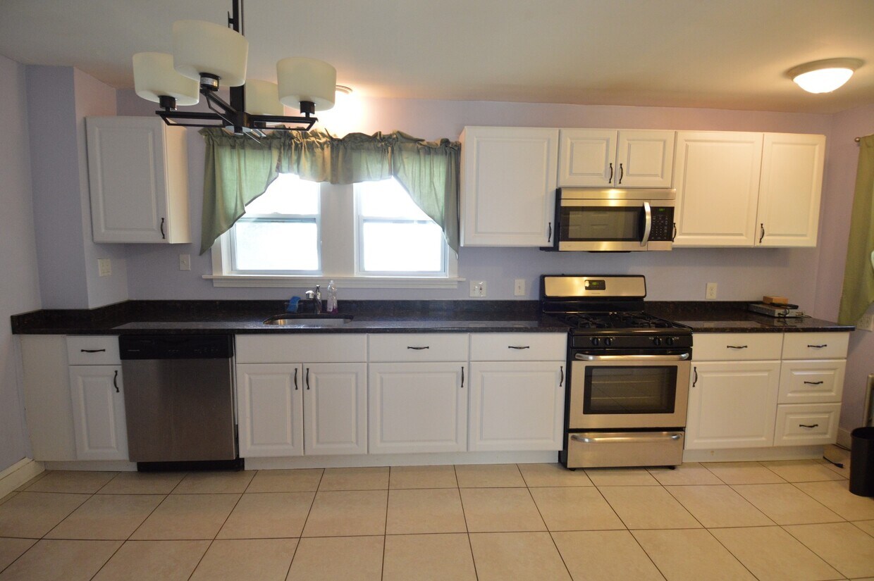
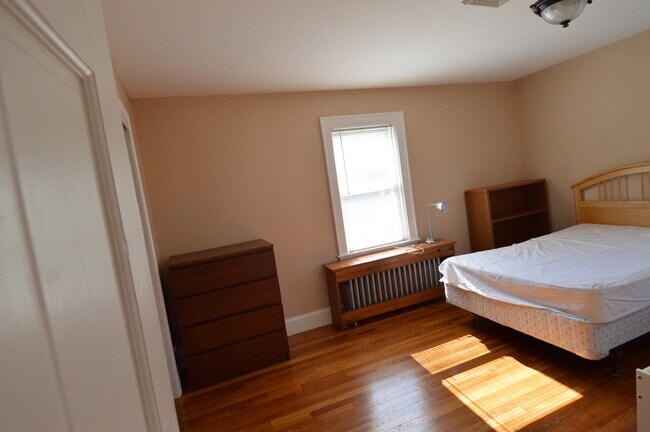
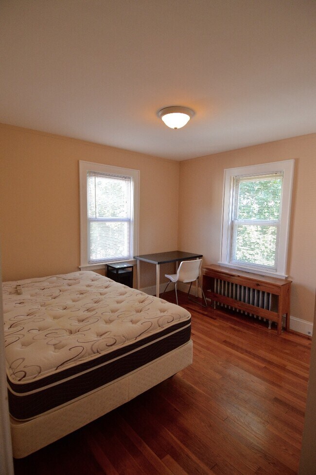
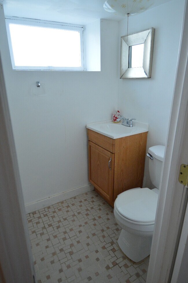
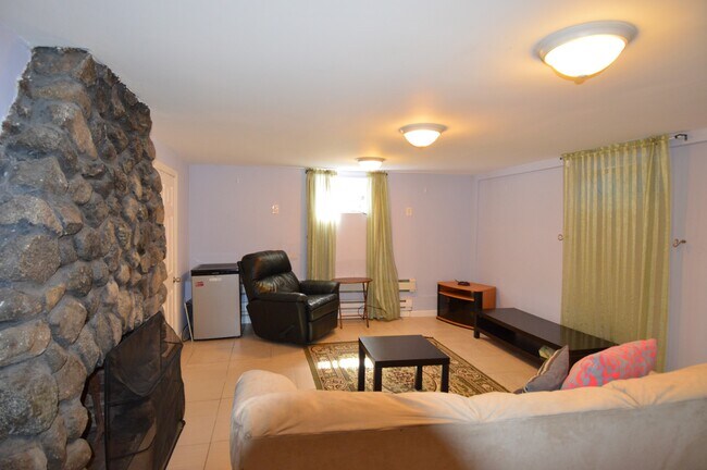
– Summary – Unit with 7 beds and 2.5 baths located in Brighton. If the price isn’t right or you don’t love the location, reach out to me anyways as I have many available units that will better suit your preferences.? – Transportation – Tram: B South Street (0.24 mi) Bus: 57 Washington St @ Lake St (0.42 mi) Bus: 86 Chestnut Hill Ave @ Embassy Rd (0.26 mi) Bus: 501 Winship St @ Union St (0.42 mi) Bus: 65 Washington St @ Shepard St (0.61 mi) --------- All information is from reliable sources but not guaranteed. Photos of the properties reflect conditions at the time the photos were obtained. We are pledged to the letter and spirit of U.S. policy for the achievement of equal housing opportunity throughout the Nation. We encourage and support an affirmative advertising and marketing program in which there are no barriers to obtaining housing because of race, color, religion, sex, handicap, familial status, or national origin.
52 Lane Park is a house located in Suffolk County and the 02135 ZIP Code. This area is served by the Boston Public Schools attendance zone.
* Price shown is total price based on community-supplied monthly required fees. Excludes user-selected optional fees and variable or usage-based fees and required charges due at or prior to move-in or at move-out. Price, availability, fees, and any applicable rent special are subject to change without notice.
* Square footage definitions vary. Displayed square footage is approximate.
Contact
Location
Get Directions
Saint Elizabeth’s is a Brighton neighborhood situated about 10 miles away from Boston. Thanks to Saint Elizabeth’s top border sitting on Highway 20, commuting in and out of Brighton is easy. Some residents travel by car, but buses and railways make commuting via public transportation a breeze.
The neighborhood’s best amenities are two world-renowned hospitals, Saint Elizabeth’s Medical Center and Franciscan Children’s, that sit on the edge of town. Other great amenities of Saint Elizabeth’s include many local parks like Ringer Playground and Chestnut Hill Reservoir, which has great trails and greenspace. This neighborhood is also equipped with cozy coffee shops, restaurants serving international and American classics, and shopping plazas with grocers and convenience stores.
Saint Elizabeth’s has several rental options ranging from apartments to single-family homes.
Learn more about living in St Elizabeth's
Education
| Colleges & Universities | Distance | ||
|---|---|---|---|
| Colleges & Universities | Distance | ||
| Walk: | 9 min | 0.5 mi | |
| Walk: | 15 min | 0.8 mi | |
| Drive: | 7 min | 3.3 mi | |
| Drive: | 9 min | 3.5 mi |
52 Lane Park is within 9 minutes or 0.5 mile from Boston College, Brighton. It is also near Boston College and Boston University.
Schools


Public Elementary School
Grades PK-5
349 Students
Attendance Zone
Public Elementary & Middle School
Grades PK-8
455 Students
Attendance Zone
Public Middle & High School
Grades 6-12
609 Students
Attendance Zone
Public Middle & High School
Grades 6-12
2,382 Students
Attendance Zone
Public Middle & High School
Grades 6-12
450 Students
Attendance Zone
Public High School
Grades 9-12
27 Students
Attendance Zone
Private Elementary & Middle School
Grades PK-8
408 Students
Nearby
Private Elementary School
Grades PK-5
103 Students
Nearby
Private High School
Grades 9-12
34 Students
Nearby
School data provided by
 The GreatSchools Rating helps parents compare schools within a state based on a variety of school quality indicators and provides a helpful picture of how effectively each school serves all of its students. Ratings are on a scale of 1 (below average) to 10 (above average) and can include test scores, college readiness, academic progress, advanced courses, equity, discipline and attendance data. We also advise parents to visit schools, consider other information on school performance and programs, and consider family needs as part of the school selection process.
View GreatSchools Rating Methodology
Data provided by GreatSchools.org © 2026. All rights reserved.
View GreatSchools Rating Methodology
Data provided by GreatSchools.org © 2026. All rights reserved.
Transportation options available in Boston include South Street Station, located 0.3 mile from 52 Lane Park. 52 Lane Park is near General Edward Lawrence Logan International, located 10.4 miles or 19 minutes away.
| Transit / Subway | Distance | ||
|---|---|---|---|
| Transit / Subway | Distance | ||
|
|
Walk: | 6 min | 0.3 mi |
|
|
Walk: | 10 min | 0.5 mi |
|
|
Walk: | 11 min | 0.6 mi |
|
|
Walk: | 11 min | 0.6 mi |
|
|
Walk: | 16 min | 0.9 mi |
| Commuter Rail | Distance | ||
|---|---|---|---|
| Commuter Rail | Distance | ||
|
|
Drive: | 8 min | 3.4 mi |
| Drive: | 9 min | 4.3 mi | |
|
|
Drive: | 9 min | 4.6 mi |
|
|
Drive: | 9 min | 4.6 mi |
|
|
Drive: | 12 min | 5.1 mi |
| Airports | Distance | ||
|---|---|---|---|
| Airports | Distance | ||
|
General Edward Lawrence Logan International
|
Drive: | 19 min | 10.4 mi |
Getting Around
 What do Walkability, Transit, Drivability, and Bikeability mean?
Walkability measures the walking distance to day-to-day needs.
Transit measures access to public transportation.
Drivability measures congestion, parking availability, and access to major roads.
Bikeability measures the suitability for cycling.
How It Works
What do Walkability, Transit, Drivability, and Bikeability mean?
Walkability measures the walking distance to day-to-day needs.
Transit measures access to public transportation.
Drivability measures congestion, parking availability, and access to major roads.
Bikeability measures the suitability for cycling.
How It Works
Moderately Walkable
Walkability
70
/ 100
Some Public Transit
Transit
50
/ 100
Moderately Drivable
Drivability
70
/ 100
Moderately Bikeable
Bikeability
60
/ 100
Scores provided by
-
Soundscore™
-
/ 100
Traffic
-Airport
-Businesses
-Scores provided by
HowLoud What is a Sound Score Rating? A Sound Score Rating aggregates noise caused by vehicle traffic, airplane traffic and local sources. How It WorksTime and distance from 52 Lane Park.
| Shopping Centers | Distance | ||
|---|---|---|---|
| Shopping Centers | Distance | ||
| Drive: | 3 min | 1.4 mi | |
| Drive: | 3 min | 1.6 mi | |
| Drive: | 5 min | 1.7 mi |
52 Lane Park has 3 shopping centers within 1.7 miles, which is about a 5-minute drive. The miles and minutes will be for the farthest away property.
| Parks and Recreation | Distance | ||
|---|---|---|---|
| Parks and Recreation | Distance | ||
|
Chestnut Hill Reservation
|
Walk: | 13 min | 0.7 mi |
|
Hammond Pond Reservation
|
Drive: | 4 min | 2.0 mi |
|
Frederick Law Olmsted National Historic Site
|
Drive: | 5 min | 2.4 mi |
|
John Fitzgerald Kennedy National Historic Site
|
Drive: | 6 min | 2.7 mi |
|
Coit Observatory
|
Drive: | 8 min | 3.8 mi |
52 Lane Park has 5 parks within 3.8 miles, including Chestnut Hill Reservation, Hammond Pond Reservation, and Frederick Law Olmsted National Historic Site.
| Hospitals | Distance | ||
|---|---|---|---|
| Hospitals | Distance | ||
| Drive: | 3 min | 1.2 mi | |
| Drive: | 4 min | 1.5 mi | |
| Drive: | 5 min | 2.8 mi |
52 Lane Park has 3 hospitals within 2.8 miles, the nearest is St. Elizabeth's Medical Center which is 1.2 miles away and a 3 minute drive.
| Military Bases | Distance | ||
|---|---|---|---|
| Military Bases | Distance | ||
| Drive: | 22 min | 12.7 mi | |
| Drive: | 27 min | 15.3 mi | |
| Drive: | 43 min | 24.2 mi |
52 Lane Park has 3 military bases within 24.2 miles, the nearest is US Military Reservation which is 12.7 miles away and a 22 minute drive.
52 Lane Park Photos
What Are Walk Score®, Transit Score®, and Bike Score® Ratings?
Walk Score® measures the walkability of any address. Transit Score® measures access to public transit. Bike Score® measures the bikeability of any address.
What is a Sound Score Rating?
A Sound Score Rating aggregates noise caused by vehicle traffic, airplane traffic and local sources.

52 Lane Park
Boston, MA 02135