$1,168 / Month
4909 Ayers Pl SE Unit 302
Washington, DC 20019
2 Weeks Ago
Favorites
4909 Ayers Pl SE Unit 302

Favorites
Check Back Soon for Upcoming Availability
| Beds | Baths | Average SF |
|---|---|---|
| 1 Bedroom 1 Bedroom 1 Br | 1 Bath 1 Bath 1 Ba | 650 SF |
Fees and Policies
The fees below are based on community-supplied data and may exclude additional fees and utilities.
- Parking
-
Street--
Details
Utilities Included
-
Gas
-
Water
-
Electricity
-
Heat
-
Trash Removal
-
Sewer
-
Air Conditioning
Property Information
-
13 units
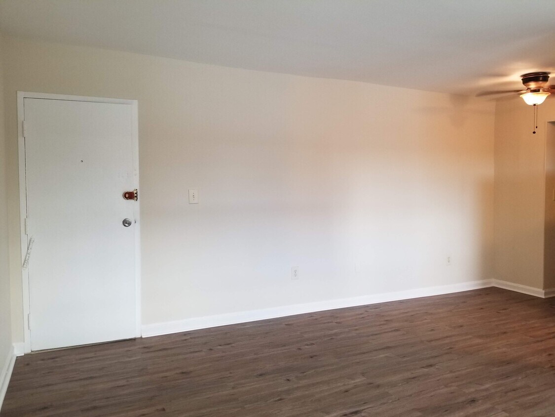
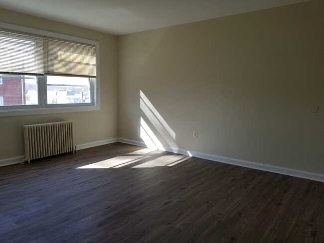
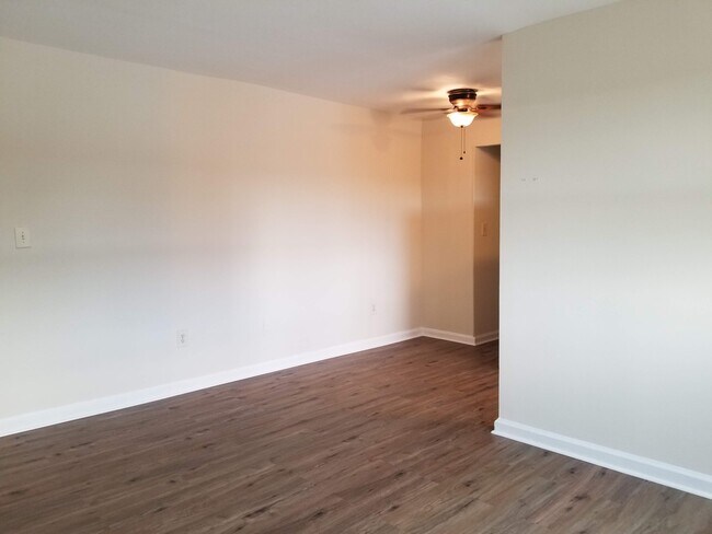
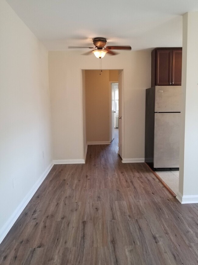
About This Property
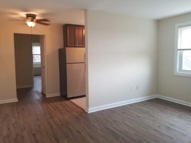
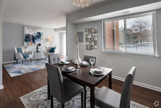
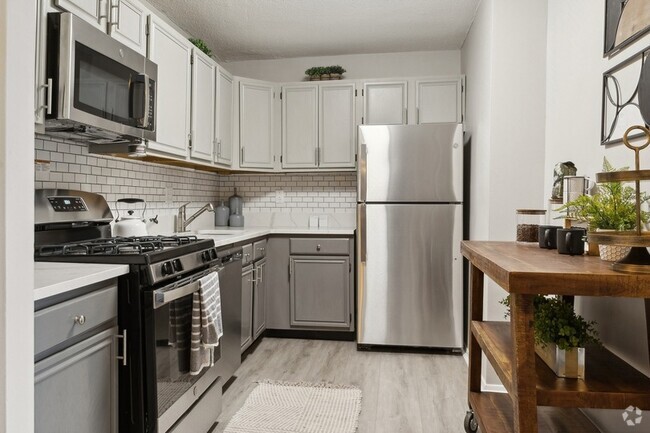
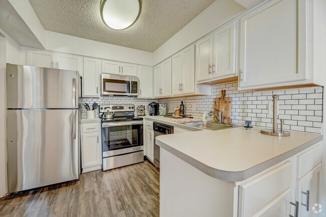
All utilities included in this spacious top floor apartment in a quiet building on quiet street. Close to Benning Road metro and on bus routes. Voucher holders welcome!
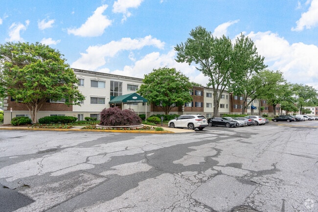
4909 Ayers Pl SE is an apartment community located in District of Columbia County and the 20019 ZIP Code.
Apartment Features
- Laundry Facilities
Location
Get Directions
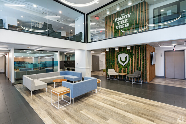
A triangular-shaped community wedged between Capitol View and Capitol Heights, Marshall Heights is roughly eight miles southeast of Downtown Washington, DC. Bordered by East Capitol Street on the north, Southern Avenue on the south, and Benning Road on the west, this neighborhood is part of DC's Seventh Ward. A walkable landscape means the few cafes and shops in the area can be reached in just minutes. With its proximity to downtown and fast commute times, apartments in Marshall Heights are ideal for those who want a suburban home while still enjoying easy access to DC.
Learn more about living in Marshall HeightsBelow are rent ranges for similar nearby apartments
Amenities
- Laundry Facilities
Expenses
Utilities Included
Gas, Water, Electricity, Heat, Trash Removal, Sewer, Air Conditioning
Included
Education
| Colleges & Universities | Distance | ||
|---|---|---|---|
| Colleges & Universities | Distance | ||
| Drive: | 8 min | 4.0 mi | |
| Drive: | 9 min | 5.0 mi | |
| Drive: | 9 min | 5.0 mi | |
| Drive: | 11 min | 6.0 mi |
4909 Ayers Pl SE Unit 302 is within 8 minutes or 4.0 miles from Gallaudet University. It is also near Georgetown and Georgetown Law.
Transportation options available in Washington include Benning Road, Blue/Silver Line Center Platform, located 0.5 mile from 4909 Ayers Pl SE Unit 302. 4909 Ayers Pl SE Unit 302 is near Ronald Reagan Washington Ntl, located 10.5 miles or 18 minutes away, and Baltimore/Washington International Thurgood Marshall, located 28.2 miles or 43 minutes away.
| Transit / Subway | Distance | ||
|---|---|---|---|
| Transit / Subway | Distance | ||
|
|
Walk: | 9 min | 0.5 mi |
|
Capitol Heights, Blue/Silver Line Center Platform
|
Drive: | 3 min | 1.4 mi |
|
|
Drive: | 4 min | 1.7 mi |
|
|
Drive: | 4 min | 1.7 mi |
|
|
Drive: | 4 min | 2.1 mi |
| Commuter Rail | Distance | ||
|---|---|---|---|
| Commuter Rail | Distance | ||
|
|
Drive: | 7 min | 4.3 mi |
|
|
Drive: | 8 min | 4.5 mi |
|
|
Drive: | 9 min | 4.6 mi |
|
|
Drive: | 11 min | 5.8 mi |
|
|
Drive: | 11 min | 5.8 mi |
| Airports | Distance | ||
|---|---|---|---|
| Airports | Distance | ||
|
Ronald Reagan Washington Ntl
|
Drive: | 18 min | 10.5 mi |
|
Baltimore/Washington International Thurgood Marshall
|
Drive: | 43 min | 28.2 mi |
Time and distance from 4909 Ayers Pl SE Unit 302.
| Shopping Centers | Distance | ||
|---|---|---|---|
| Shopping Centers | Distance | ||
| Walk: | 6 min | 0.4 mi | |
| Walk: | 8 min | 0.5 mi | |
| Walk: | 20 min | 1.0 mi |
4909 Ayers Pl SE Unit 302 has 3 shopping centers within 1.0 miles, which is about a 20-minute walk. The miles and minutes will be for the farthest away property.
| Parks and Recreation | Distance | ||
|---|---|---|---|
| Parks and Recreation | Distance | ||
|
Fort Dupont Park
|
Drive: | 5 min | 1.7 mi |
|
Kingman and Heritage Island Park
|
Drive: | 4 min | 2.2 mi |
|
Washington Youth Garden
|
Drive: | 6 min | 3.7 mi |
|
Frederick Douglass National Historic Site
|
Drive: | 10 min | 4.1 mi |
|
National Arboretum
|
Drive: | 10 min | 4.5 mi |
4909 Ayers Pl SE Unit 302 has 5 parks within 4.5 miles, including Fort Dupont Park, Kingman and Heritage Island Park, and Washington Youth Garden.
| Hospitals | Distance | ||
|---|---|---|---|
| Hospitals | Distance | ||
| Drive: | 8 min | 3.4 mi | |
| Drive: | 14 min | 5.4 mi | |
| Drive: | 14 min | 5.8 mi |
4909 Ayers Pl SE Unit 302 has 3 hospitals within 5.8 miles, the nearest is University of Maryland Prince George's Hospital Center which is 3.4 miles away and a 8 minute drive.
| Military Bases | Distance | ||
|---|---|---|---|
| Military Bases | Distance | ||
| Drive: | 10 min | 4.6 mi | |
| Drive: | 13 min | 6.8 mi |
4909 Ayers Pl SE Unit 302 is 4.6 miles from Washington Navy Yard, and is convenient to other military bases, including Anacostia Naval Station.
You May Also Like
Similar Rentals Nearby


What Are Walk Score®, Transit Score®, and Bike Score® Ratings?
Walk Score® measures the walkability of any address. Transit Score® measures access to public transit. Bike Score® measures the bikeability of any address.
What is a Sound Score Rating?
A Sound Score Rating aggregates noise caused by vehicle traffic, airplane traffic and local sources

4909 Ayers Pl SE
Washington, DC 20019