
LIA by Vermella
51 Lincoln Avenue,
Orange, NJ 07050
$1,950 - $4,100
Studio - 2 Beds

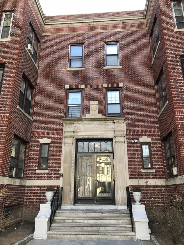
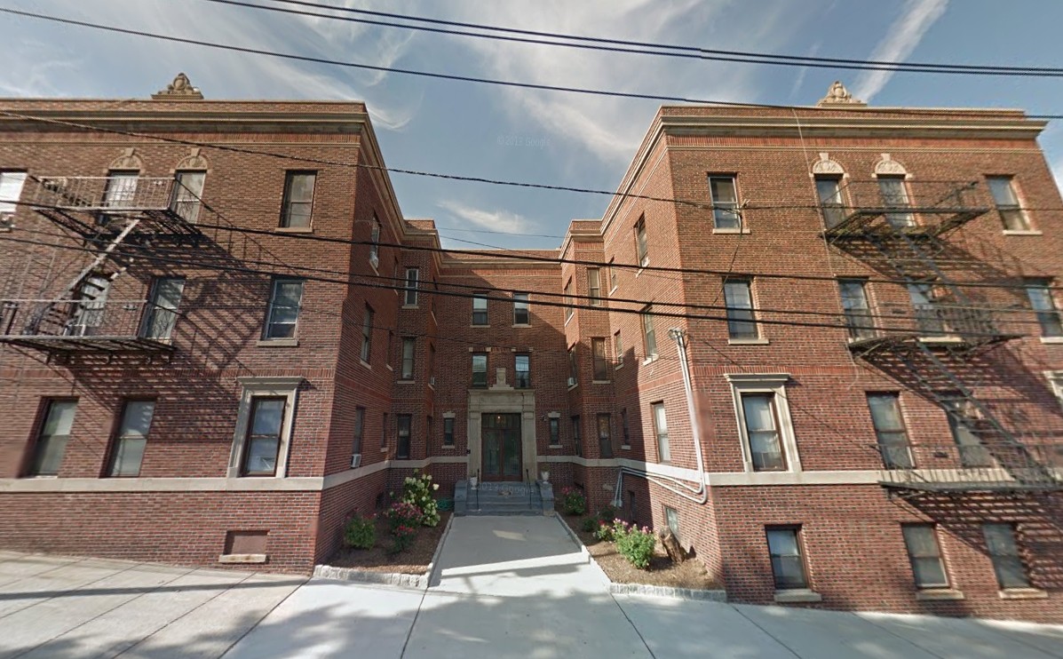
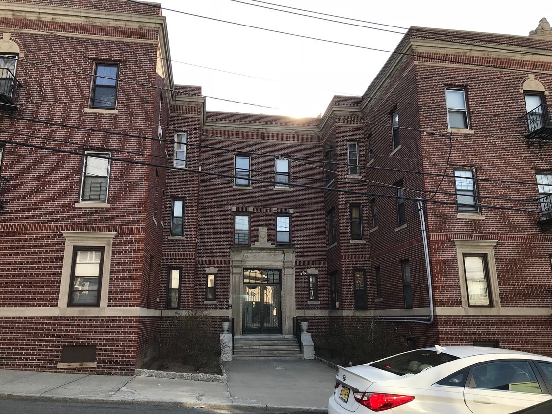
Thanks for visiting 490 Tremont Ave in Orange, NJ. You'll find this community in the 7050 area of Orange. The professional leasing staff is ready to show off our wonderful community. So get a head start on your move. Contact or stop by the 490 Tremont Ave leasing office to learn more about our community.
490 Tremont Ave is an apartment community located in Essex County and the 07050 ZIP Code. This area is served by the Orange Board Of Education attendance zone.
The City of Orange is a historic and largely residential community in the suburbs outside of Newark, roughly fifteen miles from Manhattan. The thriving Main Street district is packed with shops and restaurants of every kind, making life easy whether you’re running errands or just looking for a quick bite to eat.
With multiple NJ Transit stops in town, it’s easy to get around the area without a car—this combined with the abundance of affordable apartments and condos makes Orange a highly popular home base for New York-area commuters. While close to the big city, living in Orange will also allow you to take advantage of the huge nearby nature preserves, such as the South Mountain and Eagle Rock Reservations.
Learn more about living in Orange| Colleges & Universities | Distance | ||
|---|---|---|---|
| Colleges & Universities | Distance | ||
| Drive: | 5 min | 1.8 mi | |
| Drive: | 9 min | 4.4 mi | |
| Drive: | 10 min | 4.4 mi | |
| Drive: | 9 min | 4.6 mi |


Transportation options available in Orange include Norfolk Street, located 4.1 miles from 490 Tremont Ave. 490 Tremont Ave is near Newark Liberty International, located 9.5 miles or 16 minutes away, and LaGuardia, located 31.2 miles or 48 minutes away.
| Transit / Subway | Distance | ||
|---|---|---|---|
| Transit / Subway | Distance | ||
|
|
Drive: | 8 min | 4.1 mi |
|
|
Drive: | 8 min | 4.1 mi |
|
|
Drive: | 8 min | 4.4 mi |
|
|
Drive: | 10 min | 4.6 mi |
|
|
Drive: | 10 min | 5.2 mi |
| Commuter Rail | Distance | ||
|---|---|---|---|
| Commuter Rail | Distance | ||
|
|
Walk: | 9 min | 0.5 mi |
|
|
Walk: | 12 min | 0.7 mi |
|
|
Drive: | 3 min | 1.3 mi |
|
|
Drive: | 4 min | 1.4 mi |
|
|
Drive: | 4 min | 2.0 mi |
| Airports | Distance | ||
|---|---|---|---|
| Airports | Distance | ||
|
Newark Liberty International
|
Drive: | 16 min | 9.5 mi |
|
LaGuardia
|
Drive: | 48 min | 31.2 mi |
Time and distance from 490 Tremont Ave.
| Shopping Centers | Distance | ||
|---|---|---|---|
| Shopping Centers | Distance | ||
| Walk: | 11 min | 0.6 mi | |
| Drive: | 7 min | 2.1 mi | |
| Drive: | 5 min | 2.2 mi |
| Parks and Recreation | Distance | ||
|---|---|---|---|
| Parks and Recreation | Distance | ||
|
Edison National Historic Site
|
Drive: | 6 min | 2.3 mi |
|
Turtle Back Zoo
|
Drive: | 8 min | 2.5 mi |
|
Newark Museum and Dreyfuss Planetarium
|
Drive: | 9 min | 4.7 mi |
|
Greenwood Gardens
|
Drive: | 11 min | 5.0 mi |
|
Branch Brook Park
|
Drive: | 11 min | 5.6 mi |
| Hospitals | Distance | ||
|---|---|---|---|
| Hospitals | Distance | ||
| Drive: | 5 min | 2.3 mi | |
| Drive: | 7 min | 3.5 mi | |
| Drive: | 10 min | 4.9 mi |
| Military Bases | Distance | ||
|---|---|---|---|
| Military Bases | Distance | ||
| Drive: | 21 min | 13.4 mi | |
| Drive: | 27 min | 14.4 mi | |
| Drive: | 25 min | 14.8 mi |
What Are Walk Score®, Transit Score®, and Bike Score® Ratings?
Walk Score® measures the walkability of any address. Transit Score® measures access to public transit. Bike Score® measures the bikeability of any address.
What is a Sound Score Rating?
A Sound Score Rating aggregates noise caused by vehicle traffic, airplane traffic and local sources
490 Tremont Ave
Orange, NJ 07050


