
Williamsburg
200 W Galbraith Rd,
Cincinnati, OH 45215
$843 - $2,765
Studio - 3 Beds
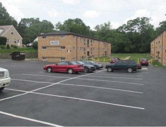

Wonderful garden apartments located in Delhi Hills. Oak Hills schools! Great location close to downtown, Amazon, DHL, and Delhi shopping. Newly updated, AC, large closets, outdoor space, off-street parking, laundry in the building and more! Pets considered for an additional fee. Apply today at KJLRentals.com.
463 Pedretti Ave is an apartment community located in Hamilton County and the 45238 ZIP Code. This area is served by the Oak Hills Local School District attendance zone.
Air Conditioning
Hardwood Floors
Refrigerator
Tub/Shower
Delhi Hills (pronounced DEL-high) located on the west side of Cincinnati in Delhi Township may be small in terms of geography, but it has much to offer in terms of community and easy access to area amenities. Situated on a bluff overlooking the Ohio River and Kentucky-Ohio border, this densely populated residential area lies just seven easy miles into Cincinnati's bustling city center. U.S. forms the area’s southern border with the river, making it easy to commute around this vibrant area. There’s a diverse mix of apartments ranging from the low-rise and affordable to mid-rise and more luxurious communities.
Learn more about living in Delhi HillsCompare neighborhood and city base rent averages by bedroom.
| Delhi Hills | Cincinnati, OH | |
|---|---|---|
| Studio | - | $1,073 |
| 1 Bedroom | $954 | $1,135 |
| 2 Bedrooms | $1,217 | $1,424 |
| 3 Bedrooms | $1,420 | $1,731 |
| Colleges & Universities | Distance | ||
|---|---|---|---|
| Colleges & Universities | Distance | ||
| Drive: | 6 min | 2.7 mi | |
| Drive: | 17 min | 7.1 mi | |
| Drive: | 19 min | 7.4 mi | |
| Drive: | 23 min | 12.7 mi |


Transportation options available in Cincinnati include 14Th & Elm Station, located 6.3 miles from 463 Pedretti Ave. 463 Pedretti Ave is near Cincinnati/Northern Kentucky International, located 18.8 miles or 34 minutes away.
| Transit / Subway | Distance | ||
|---|---|---|---|
| Transit / Subway | Distance | ||
| Drive: | 13 min | 6.3 mi | |
| Drive: | 13 min | 6.5 mi | |
| Drive: | 13 min | 6.5 mi | |
| Drive: | 14 min | 6.7 mi | |
| Drive: | 14 min | 6.8 mi |
| Commuter Rail | Distance | ||
|---|---|---|---|
| Commuter Rail | Distance | ||
|
|
Drive: | 13 min | 5.9 mi |
| Airports | Distance | ||
|---|---|---|---|
| Airports | Distance | ||
|
Cincinnati/Northern Kentucky International
|
Drive: | 34 min | 18.8 mi |
Scores provided by
Traffic
-Airport
-Businesses
-Scores provided by
HowLoud What is a Sound Score Rating? A Sound Score Rating aggregates noise caused by vehicle traffic, airplane traffic and local sources. How It WorksTime and distance from 463 Pedretti Ave.
| Shopping Centers | Distance | ||
|---|---|---|---|
| Shopping Centers | Distance | ||
| Walk: | 13 min | 0.7 mi | |
| Walk: | 16 min | 0.9 mi | |
| Drive: | 3 min | 1.2 mi |
| Parks and Recreation | Distance | ||
|---|---|---|---|
| Parks and Recreation | Distance | ||
|
Embshoff Woods
|
Drive: | 4 min | 1.2 mi |
|
Imago Earth Center
|
Drive: | 5 min | 2.3 mi |
|
Wilson Commons
|
Drive: | 7 min | 3.0 mi |
|
Museum of Natural History and Science
|
Drive: | 13 min | 5.9 mi |
|
Cincinnati History Museum
|
Drive: | 13 min | 5.9 mi |
| Hospitals | Distance | ||
|---|---|---|---|
| Hospitals | Distance | ||
| Drive: | 18 min | 6.8 mi | |
| Drive: | 16 min | 8.4 mi | |
| Drive: | 15 min | 8.7 mi |
| Military Bases | Distance | ||
|---|---|---|---|
| Military Bases | Distance | ||
| Drive: | 80 min | 59.6 mi | |
| Drive: | 86 min | 64.6 mi | |
| Drive: | 88 min | 67.9 mi |
What Are Walk Score®, Transit Score®, and Bike Score® Ratings?
Walk Score® measures the walkability of any address. Transit Score® measures access to public transit. Bike Score® measures the bikeability of any address.
What is a Sound Score Rating?
A Sound Score Rating aggregates noise caused by vehicle traffic, airplane traffic and local sources.

463 Pedretti Ave
Cincinnati, OH 45238


