
$3,950 / Month
45 Worcester Ln Unit 1
Waltham, MA 02451
Today
Favorites
339-222-0871
-
Bedrooms
3
-
Bathrooms
2
-
Square Feet
2,000 sq ft
-
Available
Available Sep 1
Highlight
- Pets Allowed
45 Worcester Ln Unit 1

Favorites
About This Home
$3,950 deposit,
Available Sep 1
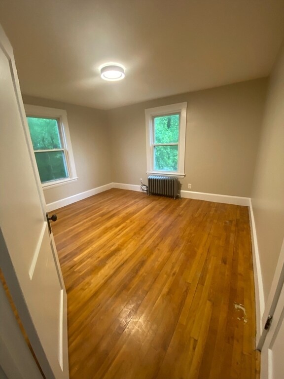
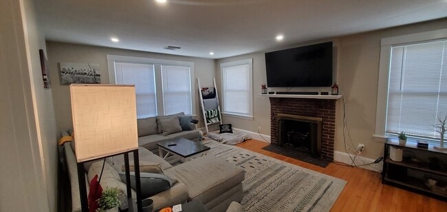
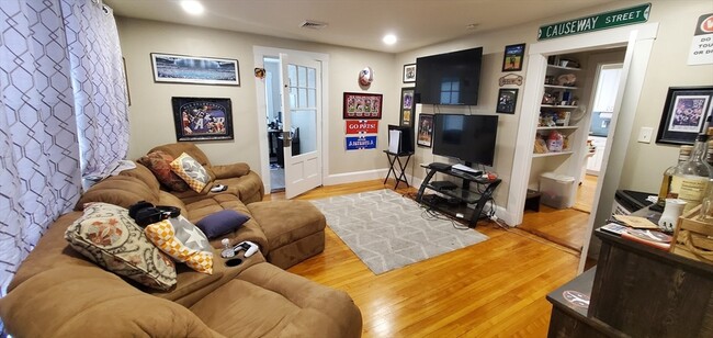
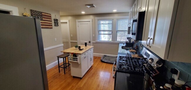
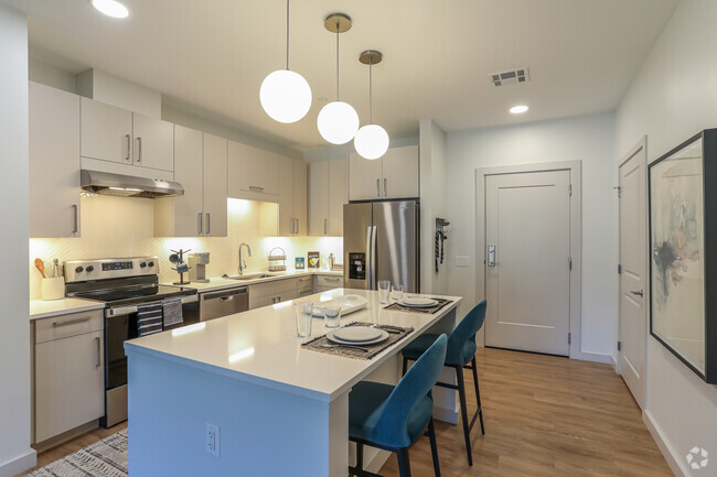
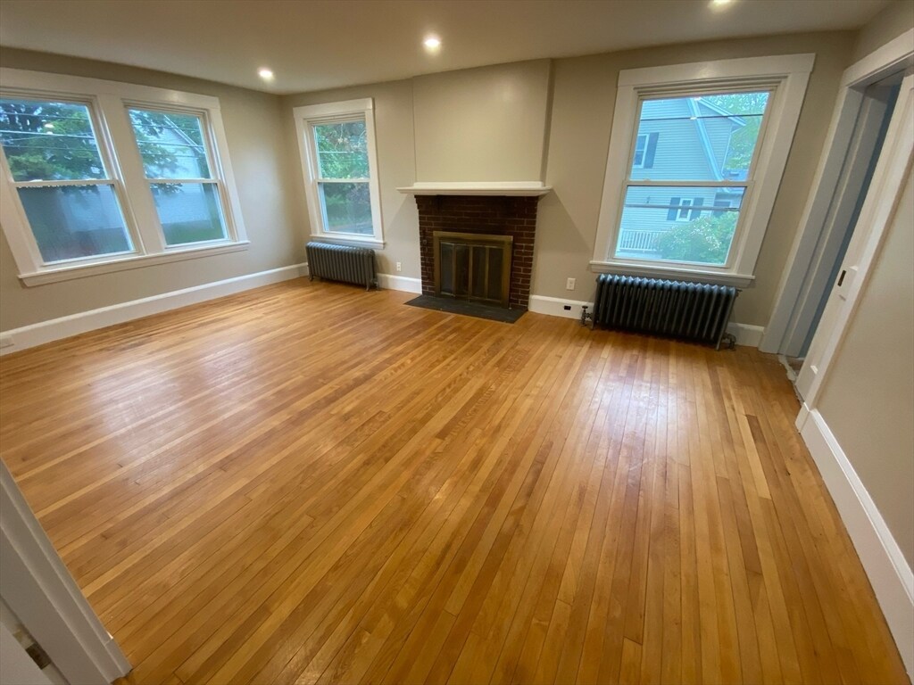
Are you looking to live in a charming residential neighborhood & still be close to everything you need? Welcome to 45 Worcester Lane,nestled between Totten Pond Road & Lexington Street,this neighborhood is also known as Piety Corner/The Lanes. The home is situated a stone throw from Prospect Hill Park,less than 1 mile from Rt 95,Rte. 2. Mass Pike. Short distance to shops and restaurants on vibrant Moody Street. Some of the new features include freshly painted walls & ceilings,gleaming hardwood floors,2 full bathrooms,3 bedrooms,living room,dining room,office and eat in kitchen. Apartment also includes a washer/dryer in the unit,recessed lighting,new kitchen cabinets and counters,new matching stainless-steel appliances,energy efficient central AC and gas heat. Short distance to the 60 and 71 bus lines.1 mile away from Main Street,2 miles away from Brandeis University,1.8 miles away from Bentley University &1.5 miles away from Moody Street. MLS# 73369601
45 Worcester Ln is an apartment community located in Middlesex County and the 02451 ZIP Code.
* Price shown is base rent and may not include non-optional fees and utilities.
Price, availability, fees, and any applicable rent special are subject to change without notice.
* Square footage definitions vary. Displayed square footage is approximate.
Features
Microwave
Refrigerator
Disposal
Range
- Disposal
- Microwave
- Range
- Refrigerator
Fees and Policies
The fees below are based on community-supplied data and may exclude additional fees and utilities.
- Dogs Allowed
-
Fees not specified
- Cats Allowed
-
Fees not specified
Contact
- Listed by The Varano Realty Group | Keller Williams Realty
- Phone Number
-
Source
 MLS Property Information Network
The property listing data and information set forth herein were provided to MLS Property Information Network, Inc. from third party sources, including sellers, lessors and public records, and were compiled by MLS Property Information Network, Inc. The property listing data and information are for the personal, non-commercial use of consumers having a good faith interest in purchasing or leasing listed properties of the type displayed to them and may not be used for any purpose other than to identify prospective properties which such consumers may have a good faith interest in purchasing or leasing. MLS Property Information Network, Inc. and its subscribers disclaim any and all representations and warranties as to the accuracy of the property listing data and information set forth herein. All properties are subject to prior sale, change or withdrawal. Copyright © 2025 MLS Property Information Network, Inc. All rights reserved.
Location
Get Directions
Amenities
- Disposal
- Microwave
- Range
- Refrigerator
As a historic city with roots in early American history and a hub for modern innovation, Waltham mixes the past and present. Waltham is home to two institutions of higher education, Brandeis University and Bentley University, and it’s the headquarters of Raytheon Technologies and Thermo Fisher Scientific. Lush parks like Lyman Park and Storer Conservation hide museums, historic landmarks, trails, and outdoor adventures. Main Street is lined with cafes, restaurants, venues, and businesses. The Charles River flows just south of Main Street, offering more outdoor adventures like kayaking and fishing. For commuters, Highway 20 and Interstate 95 provide easy access to Boston and beyond while also being the spot for retail centers, big-box stores, and hotels. The rest of Waltham is made up of residential areas with an abundance of rental choices. From students to professionals to families, everyone will find their ideal rental in Waltham.
Learn more about living in Waltham
Education
| Colleges & Universities | Distance | ||
|---|---|---|---|
| Colleges & Universities | Distance | ||
| Drive: | 4 min | 1.6 mi | |
| Drive: | 7 min | 2.7 mi | |
| Drive: | 16 min | 6.7 mi | |
| Drive: | 15 min | 7.1 mi |
45 Worcester Ln Unit 1 is within 4 minutes or 1.6 miles from Bentley University. It is also near Brandeis University and Boston College.
Transportation options available in Waltham include Riverside Station, located 4.1 miles from 45 Worcester Ln Unit 1. 45 Worcester Ln Unit 1 is near General Edward Lawrence Logan International, located 15.1 miles or 27 minutes away, and Worcester Regional, located 41.5 miles or 60 minutes away.
| Transit / Subway | Distance | ||
|---|---|---|---|
| Transit / Subway | Distance | ||
|
|
Drive: | 9 min | 4.1 mi |
|
|
Drive: | 10 min | 4.7 mi |
|
|
Drive: | 12 min | 5.4 mi |
|
|
Drive: | 13 min | 5.8 mi |
|
|
Drive: | 13 min | 6.0 mi |
| Commuter Rail | Distance | ||
|---|---|---|---|
| Commuter Rail | Distance | ||
|
|
Drive: | 3 min | 1.3 mi |
| Drive: | 3 min | 1.4 mi | |
|
|
Drive: | 5 min | 2.6 mi |
|
|
Drive: | 6 min | 3.2 mi |
|
|
Drive: | 6 min | 3.2 mi |
| Airports | Distance | ||
|---|---|---|---|
| Airports | Distance | ||
|
General Edward Lawrence Logan International
|
Drive: | 27 min | 15.1 mi |
|
Worcester Regional
|
Drive: | 60 min | 41.5 mi |
Time and distance from 45 Worcester Ln Unit 1.
| Shopping Centers | Distance | ||
|---|---|---|---|
| Shopping Centers | Distance | ||
| Walk: | 14 min | 0.8 mi | |
| Drive: | 3 min | 1.3 mi | |
| Drive: | 3 min | 1.6 mi |
45 Worcester Ln Unit 1 has 3 shopping centers within 1.6 miles, which is about a 3-minute walk. The miles and minutes will be for the farthest away property.
| Parks and Recreation | Distance | ||
|---|---|---|---|
| Parks and Recreation | Distance | ||
|
Beaver Brook Reservation
|
Drive: | 5 min | 2.7 mi |
|
Land's Sake Farm
|
Drive: | 8 min | 4.3 mi |
|
Mass Audubon's Habitat Education Center and Wildlife Sanctuary
|
Drive: | 10 min | 4.5 mi |
|
Mass Audubon's Drumlin Farm Wildlife Sanctuary
|
Drive: | 12 min | 6.7 mi |
|
Codman Community Farms
|
Drive: | 13 min | 6.9 mi |
45 Worcester Ln Unit 1 has 5 parks within 6.9 miles, including Beaver Brook Reservation, Mass Audubon's Habitat Education Center and Wildlife Sanctuary, and Land's Sake Farm.
| Hospitals | Distance | ||
|---|---|---|---|
| Hospitals | Distance | ||
| Drive: | 4 min | 1.8 mi | |
| Drive: | 6 min | 3.1 mi | |
| Drive: | 10 min | 4.7 mi |
45 Worcester Ln Unit 1 has 3 hospitals within 4.7 miles, the nearest is Walden Behavioral Care which is 1.8 miles away and a 4 minute drive.
| Military Bases | Distance | ||
|---|---|---|---|
| Military Bases | Distance | ||
| Drive: | 14 min | 6.7 mi | |
| Drive: | 21 min | 12.1 mi |
45 Worcester Ln Unit 1 is 6.7 miles from Hanscom Air Force Base, and is convenient to other military bases, including US Military Reservation.
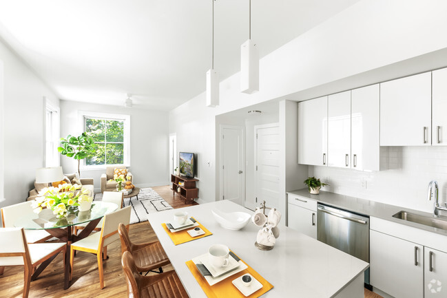
You May Also Like
Similar Rentals Nearby


What Are Walk Score®, Transit Score®, and Bike Score® Ratings?
Walk Score® measures the walkability of any address. Transit Score® measures access to public transit. Bike Score® measures the bikeability of any address.
What is a Sound Score Rating?
A Sound Score Rating aggregates noise caused by vehicle traffic, airplane traffic and local sources
45 Worcester Ln
Waltham, MA 02451