$1,995
/ Month
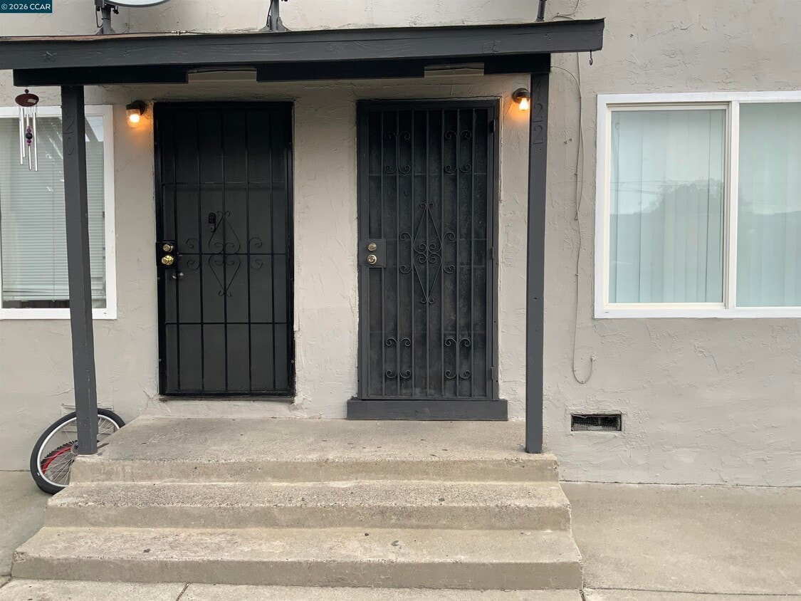
422 C St
Richmond, CA 94801
Today
|
Edit
Favorites
510-758-5636
-
Bedrooms
2
-
Bathrooms
1
-
Square Feet
1,000 sq ft
-
Available
Available Now
Highlights
- Carpet
- Wall Furnace
- 1-Story Property
422 C St

Favorites
About This Home
Available Now
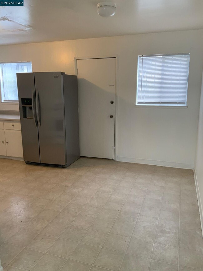
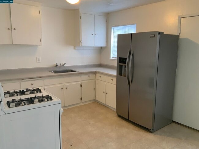
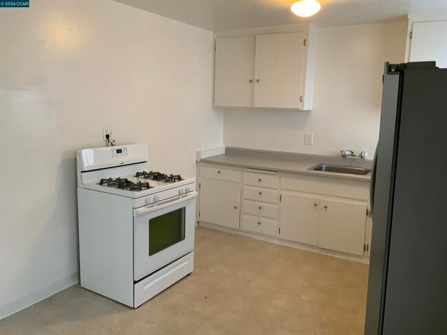
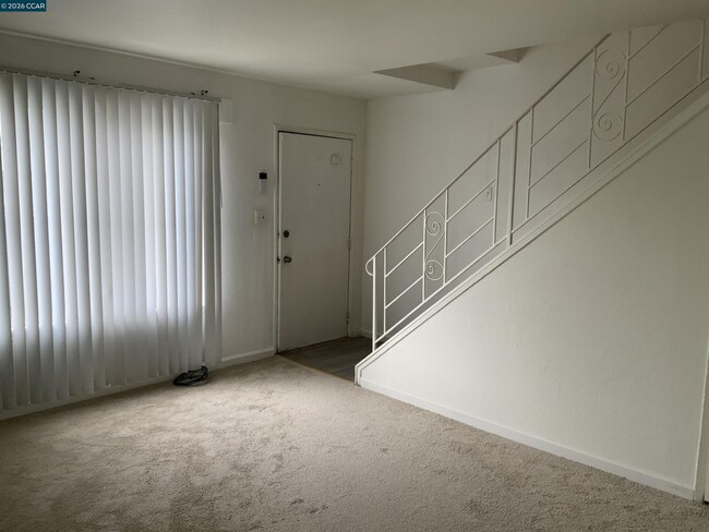
This spacious,cozy townhouse style apartment in a 4-unit building features two bedrooms and one bathroom,new paint and wall-to-wall carpets throughout,a dining area,a gas stove,a refrigerator,and ample cabinets making cooking a breeze,both bedrooms are upstairs. This unit is within walking distance to public transportation,shops,Ez freeway access to San Rafael Bridge and Oakland,one (1) car garage available,No pets,Street Parking,Garbage is included with the rent. $ 1995 Rent / $ 1995 Deposit / $ 3,990 Total Move-In Cost
422 C St is an apartment community located in Contra Costa County and the 94801 ZIP Code.
* Price shown is base rent. Excludes user-selected optional fees and variable or usage-based fees and required charges due at or prior to move-in or at move-out. Price, availability, fees, and any applicable rent special are subject to change without notice.
* Square footage definitions vary. Displayed square footage is approximate.
Home Details
Year Built
Built in 1950
Bedrooms and Bathrooms
1 Full Bathroom
2 Bedrooms
Home Design
Apartment
Stucco
Interior Spaces
Carpet
1-Story Property
Kitchen
Gas Range
Laundry
No Washer or Dryer Hookups
Parking
Carport
Utilities
Wall Furnace
Community Details
Overview
No Home Owners Association
North Richmond Subdivision
Contact
- Listed by Gene Smith | First Republic Real Estate
- Phone Number
- Contact
-
Source
 Contra Costa Association of REALTORS®
Copyright © 2026 Bay East, CCAR, bridgeMLS. Based on information from Bay East and Contra Costa Association of REALTORS® and bridgeMLS. All data, including all measurements and calculations of area, is obtained from various sources and has not been, and will not be, verified by broker or MLS. All information should be independently reviewed and verified for accuracy. If a floor plan is included, the floor plan is for illustrative purposes only, and the actual dimensions and layout of the home may differ from the floor plan. Buyer is urged to make a detailed inspection of the property, and if any aspect of a floor plan is critical to the buyer's decision to purchase, buyer must conduct their own measurements and inspection. Properties may or may not be listed by the office/agent presenting the information.
Location
Get Directions
The Iron Triangle neighborhood sits in the heart of Central Richmond, California. With the area being largely residential, most rentals reside in the upper part of the triangle and an easy three-mile commute north to Point Richmond, a major shipping and industrial area. To the south, Berkeley and Oakland lie roughly 10 miles away via Interstate 580.
Locals often head for the Miller/Knox Regional Shoreline for a bit of jogging or cycling, or to cast a line off the fishing pier. Wade into the waters of San Francisco Bay at Keller Beach on the northern end of the park, or enjoy a show at the Masquers Playhouse, also just outside the Iron Triangle's southern border. Most eateries sit along Interstate 580, including several fast food chains. The MacDonald 80 Shopping Center lies roughly three miles east of the neighborhood. Drive another three miles and find Wildcat Canyon Regional Park and the Tilden Nature Area.
Learn more about living in Iron Triangle
Education
| Colleges & Universities | Distance | ||
|---|---|---|---|
| Colleges & Universities | Distance | ||
| Drive: | 8 min | 3.8 mi | |
| Drive: | 17 min | 9.8 mi | |
| Drive: | 21 min | 10.9 mi | |
| Drive: | 19 min | 10.9 mi |
422 C St is within 8 minutes or 3.8 miles from Contra Costa College. It is also near Berkeley City College and UC Berkeley.
Transportation options available in Richmond include Richmond Station, located 1.4 miles from 422 C St. 422 C St is near Metro Oakland International, located 22.9 miles or 32 minutes away, and San Francisco International, located 30.5 miles or 45 minutes away.
| Transit / Subway | Distance | ||
|---|---|---|---|
| Transit / Subway | Distance | ||
|
|
Drive: | 3 min | 1.4 mi |
|
|
Drive: | 8 min | 3.6 mi |
|
|
Drive: | 11 min | 5.7 mi |
|
|
Drive: | 16 min | 9.2 mi |
|
|
Drive: | 18 min | 9.9 mi |
| Commuter Rail | Distance | ||
|---|---|---|---|
| Commuter Rail | Distance | ||
| Walk: | 18 min | 1.0 mi | |
|
|
Drive: | 11 min | 8.0 mi |
| Drive: | 16 min | 9.1 mi | |
| Drive: | 16 min | 10.1 mi | |
| Drive: | 15 min | 10.3 mi |
| Airports | Distance | ||
|---|---|---|---|
| Airports | Distance | ||
|
Metro Oakland International
|
Drive: | 32 min | 22.9 mi |
|
San Francisco International
|
Drive: | 45 min | 30.5 mi |
Time and distance from 422 C St.
| Shopping Centers | Distance | ||
|---|---|---|---|
| Shopping Centers | Distance | ||
| Walk: | 17 min | 0.9 mi | |
| Drive: | 5 min | 2.4 mi | |
| Drive: | 5 min | 2.6 mi |
422 C St has 3 shopping centers within 2.6 miles, which is about a 5-minute drive. The miles and minutes will be for the farthest away property.
| Parks and Recreation | Distance | ||
|---|---|---|---|
| Parks and Recreation | Distance | ||
|
Miller/Knox Regional Shoreline
|
Drive: | 5 min | 2.3 mi |
|
Rosie the Riveter WWII Home Front National Historical Park
|
Drive: | 6 min | 2.8 mi |
|
Marina Park & Green
|
Drive: | 7 min | 3.0 mi |
|
Shimada Friendship Park
|
Drive: | 8 min | 3.7 mi |
|
Brooks Island Regional Preserve
|
Drive: | 9 min | 3.9 mi |
422 C St has 5 parks within 3.9 miles, including Miller/Knox Regional Shoreline, Rosie the Riveter WWII Home Front National Historical Park, and Marina Park & Green.
| Hospitals | Distance | ||
|---|---|---|---|
| Hospitals | Distance | ||
| Drive: | 20 min | 11.4 mi | |
| Drive: | 17 min | 12.4 mi | |
| Drive: | 18 min | 12.4 mi |
422 C St has 3 hospitals within 12.4 miles, the nearest is Alta Bates Summit Medical Center - Alta Bates Campus which is 11.4 miles away and a 20 minute drive.
| Military Bases | Distance | ||
|---|---|---|---|
| Military Bases | Distance | ||
| Drive: | 8 min | 3.8 mi | |
| Drive: | 13 min | 6.3 mi | |
| Drive: | 26 min | 16.5 mi |
422 C St has 3 military bases within 16.5 miles, the nearest is Armory West Contra Costa which is 3.8 miles away and a 8 minute drive.
You May Also Like
Similar Rentals Nearby
-
-
2 Beds$3,355+Total Monthly PriceTotal Monthly Price NewPrices include base rent and required monthly fees of $5. Variable costs based on usage may apply.Base Rent:2 Beds$3,350+Specials
Pets Allowed Pool Business Center Tennis Court
-
2 Beds$3,703+Total Monthly PriceTotal Monthly Price NewPrices include base rent and required monthly fees of $7. Variable costs based on usage may apply.Base Rent:2 Beds$3,696+1 Month Free
Pets Allowed Fitness Center In Unit Washer & Dryer High-Speed Internet Controlled Access EV Charging Rooftop Deck
-
-
2 Beds$4,387+3 Beds$7,642Total Monthly PriceTotal Monthly Price NewPrices include base rent and required monthly fees of $7. Variable costs based on usage may apply.Base Rent:2 Beds$4,380+3 Beds$7,635Specials
Pets Allowed Fitness Center In Unit Washer & Dryer High-Speed Internet Controlled Access Concierge Rooftop Deck
-
-
-
-
-


What Are Walk Score®, Transit Score®, and Bike Score® Ratings?
Walk Score® measures the walkability of any address. Transit Score® measures access to public transit. Bike Score® measures the bikeability of any address.
What is a Sound Score Rating?
A Sound Score Rating aggregates noise caused by vehicle traffic, airplane traffic and local sources

422 C St
Richmond, CA 94801