$1,995
/ Month
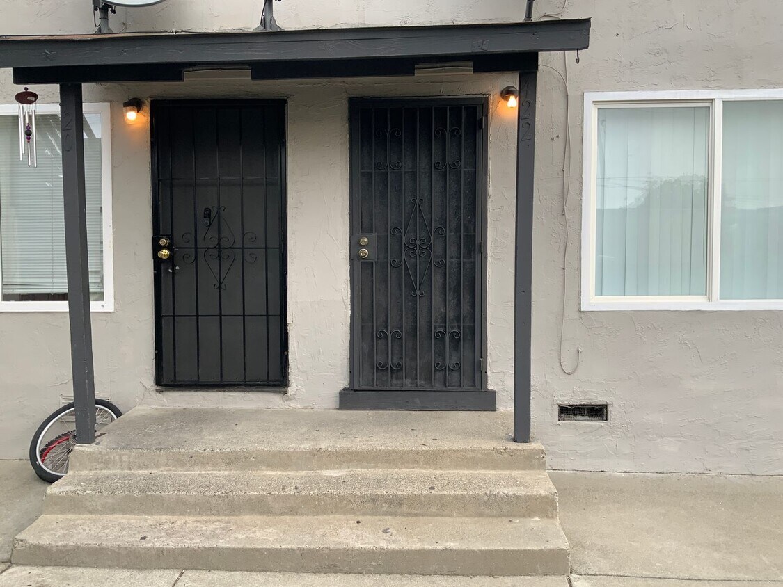
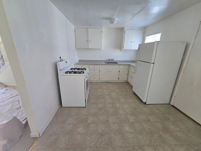
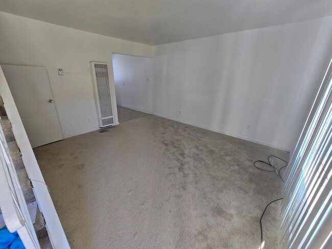
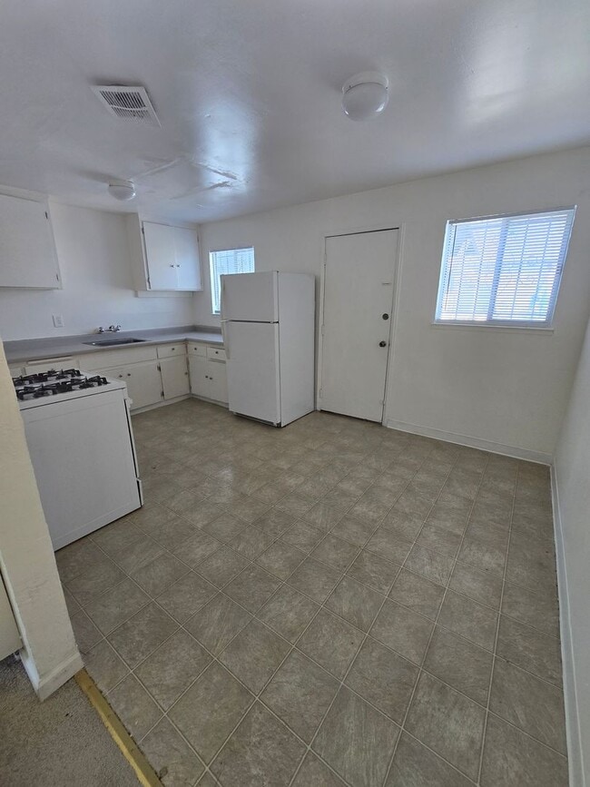
418 C St Unit 422 C Street
Richmond, CA 94801
Favorites
510-758-5636
-
Bedrooms
2
-
Bathrooms
1
-
Square Feet
--
-
Available
Available Now
418 C St Unit 422 C Street

Favorites
Fees and Policies
The fees listed below are community-provided and may exclude utilities or add-ons. All payments are made directly to the property and are non-refundable unless otherwise specified. Use the Cost Calculator to determine costs based on your needs.
-
One-Time Basics
-
Due at Move-In
-
Security Deposit - RefundableCharged per unit.$1,995
-
-
Due at Move-In
Property Fee Disclaimer: Based on community-supplied data and independent market research. Subject to change without notice. May exclude fees for mandatory or optional services and usage-based utilities.
Contact
- Listed by Professional Property Management | Professional Property Management
- Phone Number
- Contact
Location
Get Directions
The Iron Triangle neighborhood sits in the heart of Central Richmond, California. With the area being largely residential, most rentals reside in the upper part of the triangle and an easy three-mile commute north to Point Richmond, a major shipping and industrial area. To the south, Berkeley and Oakland lie roughly 10 miles away via Interstate 580.
Locals often head for the Miller/Knox Regional Shoreline for a bit of jogging or cycling, or to cast a line off the fishing pier. Wade into the waters of San Francisco Bay at Keller Beach on the northern end of the park, or enjoy a show at the Masquers Playhouse, also just outside the Iron Triangle's southern border. Most eateries sit along Interstate 580, including several fast food chains. The MacDonald 80 Shopping Center lies roughly three miles east of the neighborhood. Drive another three miles and find Wildcat Canyon Regional Park and the Tilden Nature Area.
Learn more about living in Iron Triangle
Education
| Colleges & Universities | Distance | ||
|---|---|---|---|
| Colleges & Universities | Distance | ||
| Drive: | 8 min | 3.8 mi | |
| Drive: | 17 min | 9.8 mi | |
| Drive: | 21 min | 10.9 mi | |
| Drive: | 19 min | 10.9 mi |
418 C St Unit 422 C Street is within 8 minutes or 3.8 miles from Contra Costa College. It is also near Berkeley City College and UC Berkeley.
Transportation options available in Richmond include Richmond Station, located 1.4 miles from 418 C St Unit 422 C Street. 418 C St Unit 422 C Street is near Metro Oakland International, located 22.9 miles or 32 minutes away, and San Francisco International, located 30.5 miles or 45 minutes away.
| Transit / Subway | Distance | ||
|---|---|---|---|
| Transit / Subway | Distance | ||
|
|
Drive: | 3 min | 1.4 mi |
|
|
Drive: | 8 min | 3.6 mi |
|
|
Drive: | 11 min | 5.7 mi |
|
|
Drive: | 16 min | 9.2 mi |
|
|
Drive: | 18 min | 9.9 mi |
| Commuter Rail | Distance | ||
|---|---|---|---|
| Commuter Rail | Distance | ||
| Walk: | 19 min | 1.0 mi | |
|
|
Drive: | 11 min | 8.0 mi |
| Drive: | 16 min | 9.1 mi | |
| Drive: | 16 min | 10.1 mi | |
| Drive: | 15 min | 10.3 mi |
| Airports | Distance | ||
|---|---|---|---|
| Airports | Distance | ||
|
Metro Oakland International
|
Drive: | 32 min | 22.9 mi |
|
San Francisco International
|
Drive: | 45 min | 30.5 mi |
Getting Around
 What do Walkability, Transit, Drivability, and Bikeability mean?
Walkability measures the walking distance to day-to-day needs.
Transit measures access to public transportation.
Drivability measures congestion, parking availability, and access to major roads.
Bikeability measures the suitability for cycling.
How It Works
What do Walkability, Transit, Drivability, and Bikeability mean?
Walkability measures the walking distance to day-to-day needs.
Transit measures access to public transportation.
Drivability measures congestion, parking availability, and access to major roads.
Bikeability measures the suitability for cycling.
How It Works
Fairly Walkable
Walkability
40
/ 100
Some Public Transit
Transit
40
/ 100
Exceptionally Drivable
Drivability
90
/ 100
Fairly Bikeable
Bikeability
50
/ 100
Scores provided by
Active
Soundscore™
69
/ 100
Traffic
BusyAirport
CalmBusinesses
ActiveScores provided by
HowLoud What is a Sound Score Rating? A Sound Score Rating aggregates noise caused by vehicle traffic, airplane traffic and local sources. How It WorksTime and distance from 418 C St Unit 422 C Street.
| Shopping Centers | Distance | ||
|---|---|---|---|
| Shopping Centers | Distance | ||
| Walk: | 16 min | 0.8 mi | |
| Drive: | 3 min | 1.6 mi | |
| Drive: | 4 min | 1.8 mi |
418 C St Unit 422 C Street has 3 shopping centers within 1.8 miles, which is about a 4-minute drive. The miles and minutes will be for the farthest away property.
| Parks and Recreation | Distance | ||
|---|---|---|---|
| Parks and Recreation | Distance | ||
|
Miller/Knox Regional Shoreline
|
Drive: | 5 min | 2.3 mi |
|
Rosie the Riveter WWII Home Front National Historical Park
|
Drive: | 6 min | 2.8 mi |
|
Marina Park & Green
|
Drive: | 7 min | 3.0 mi |
|
Shimada Friendship Park
|
Drive: | 8 min | 3.7 mi |
|
Brooks Island Regional Preserve
|
Drive: | 9 min | 3.9 mi |
418 C St Unit 422 C Street has 5 parks within 3.9 miles, including Miller/Knox Regional Shoreline, Rosie the Riveter WWII Home Front National Historical Park, and Marina Park & Green.
| Hospitals | Distance | ||
|---|---|---|---|
| Hospitals | Distance | ||
| Drive: | 20 min | 10.9 mi | |
| Drive: | 20 min | 11.4 mi | |
| Drive: | 18 min | 12.4 mi |
418 C St Unit 422 C Street has 3 hospitals within 12.4 miles, the nearest is MarinHealth Medical Center which is 10.9 miles away and a 20 minute drive.
| Military Bases | Distance | ||
|---|---|---|---|
| Military Bases | Distance | ||
| Drive: | 8 min | 3.9 mi | |
| Drive: | 13 min | 6.3 mi | |
| Drive: | 26 min | 16.5 mi |
418 C St Unit 422 C Street has 3 military bases within 16.5 miles, the nearest is Armory West Contra Costa which is 3.9 miles away and a 8 minute drive.
You May Also Like
Similar Rentals Nearby
-
-
-
2 Beds$5,0803 Beds$6,880Total Monthly Price12 Month LeaseTotal Monthly Price NewPrices include base rent and required monthly fees. Variable costs based on usage may apply.Specials
Pets Allowed Fitness Center In Unit Washer & Dryer Stainless Steel Appliances Business Center Package Service Elevator
-
-
-
-
-
-
-


418 C St
Richmond, CA 94801