
$1,050
/ Month
3903 Erby St
Houston, TX 77087
2 Weeks Ago
|
Edit
Favorites
3903 Erby St

Favorites
Check Back Soon for Upcoming Availability
| Beds | Baths | Average SF |
|---|---|---|
| 2 Bedrooms 2 Bedrooms 2 Br | 1 Bath 1 Bath 1 Ba | — |
Fees and Policies
The fees below are based on community-supplied data and may exclude additional fees and utilities.
- Dogs Allowed
-
Fees not specified
- Cats Allowed
-
Fees not specified
About This Property
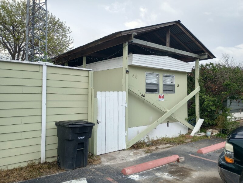
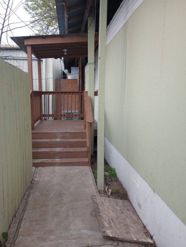
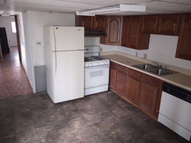
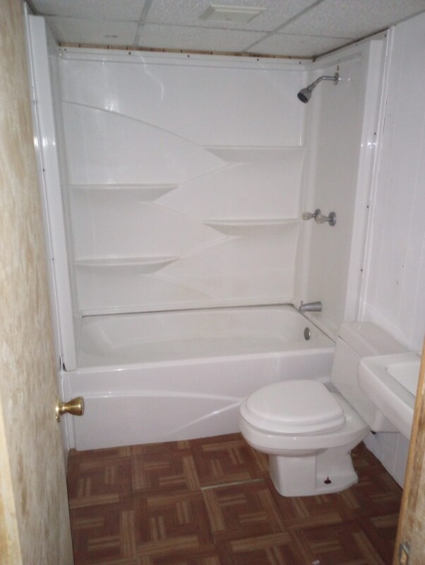
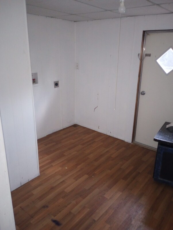
Property Id: 1159073 Great home of 2 bedroom and 1 bath, READY TO MOVE IN! Cozy mobile home in Houston. Nice and quiet neighborhood in a real central area. 16 minutes from downtown Houston.
3903 Erby St is a house located in Harris County and the 77087 ZIP Code. This area is served by the Houston Independent attendance zone.
House Features
- Oven
- Refrigerator
- Vinyl Flooring
Location
Get Directions
Just 10 minutes from Downtown Houston, Gulfgate-Pine Valley is a triangular-shaped neighborhood adjacent to the University of Houston. The neighborhood follows Gulf Freeway to the point where it meets I-610, then along the Alvin Freeway northward until it merges with the Freeway. The Brays Bayou and the Brays Bayou Greenway Trail passes through the neighborhood, and university students can use this paved trail to walk or bike to class.
Gulfgate-Pine Valley offers quiet, residential streets lined with bungalows interspersed with businesses, warehouses, parks, and restaurants. The largest park in the neighborhood, Fonde Park, provides a playground, green space, picnic tables, and a dog park. A large shopping area is located near the highway interchange. This is where you’ll find H-E-B, Best Buy, Lowe’s, and several chain restaurants. Another large shopping area is available off Wayside Drive and Telephone Road.
Learn more about living in Gulfgate-Pine ValleyBelow are rent ranges for similar nearby apartments
Amenities
- Oven
- Refrigerator
- Vinyl Flooring
Education
| Colleges & Universities | Distance | ||
|---|---|---|---|
| Colleges & Universities | Distance | ||
| Drive: | 7 min | 2.8 mi | |
| Drive: | 8 min | 3.9 mi | |
| Drive: | 12 min | 5.5 mi | |
| Drive: | 11 min | 5.7 mi |
3903 Erby St is within 7 minutes or 2.8 miles from University of Houston. It is also near Texas Southern University and Houston Community College.
Schools


Public Elementary School
Grades PK-5
732 Students
Attendance Zone
Public Middle School
Grades 6-8
904 Students
Attendance Zone
Public High School
Grades 9-12
1,421 Students
Attendance Zone
Private Elementary & Middle School
Grades PK-8
80 Students
Nearby
Private High School
Grades 9-12
211 Students
Nearby
School data provided by
 The GreatSchools Rating helps parents compare schools within a state based on a variety of school quality indicators and provides a helpful picture of how effectively each school serves all of its students. Ratings are on a scale of 1 (below average) to 10 (above average) and can include test scores, college readiness, academic progress, advanced courses, equity, discipline and attendance data. We also advise parents to visit schools, consider other information on school performance and programs, and consider family needs as part of the school selection process.
View GreatSchools Rating Methodology
Data provided by GreatSchools.org © 2025. All rights reserved.
View GreatSchools Rating Methodology
Data provided by GreatSchools.org © 2025. All rights reserved.
Transportation options available in Houston include Palm Center Transit Ctr Sb, located 2.0 miles from 3903 Erby St. 3903 Erby St is near William P Hobby, located 7.1 miles or 17 minutes away, and George Bush Intcntl/Houston, located 27.0 miles or 35 minutes away.
| Transit / Subway | Distance | ||
|---|---|---|---|
| Transit / Subway | Distance | ||
| Drive: | 4 min | 2.0 mi | |
| Drive: | 5 min | 2.3 mi | |
| Drive: | 5 min | 2.5 mi | |
| Drive: | 7 min | 3.4 mi | |
| Drive: | 7 min | 3.4 mi |
| Commuter Rail | Distance | ||
|---|---|---|---|
| Commuter Rail | Distance | ||
|
|
Drive: | 12 min | 7.2 mi |
| Airports | Distance | ||
|---|---|---|---|
| Airports | Distance | ||
|
William P Hobby
|
Drive: | 17 min | 7.1 mi |
|
George Bush Intcntl/Houston
|
Drive: | 35 min | 27.0 mi |
Time and distance from 3903 Erby St.
| Shopping Centers | Distance | ||
|---|---|---|---|
| Shopping Centers | Distance | ||
| Walk: | 14 min | 0.7 mi | |
| Walk: | 14 min | 0.8 mi | |
| Walk: | 18 min | 1.0 mi |
3903 Erby St has 3 shopping centers within 1.0 mile, which is about a 18-minute walk. The miles and minutes will be for the farthest away property.
| Parks and Recreation | Distance | ||
|---|---|---|---|
| Parks and Recreation | Distance | ||
|
Sims Bayou Urban Nature Center
|
Drive: | 6 min | 3.6 mi |
|
Children's Museum of Houston
|
Drive: | 11 min | 5.8 mi |
|
Hermann Park
|
Drive: | 11 min | 5.8 mi |
|
Discovery Green
|
Drive: | 11 min | 5.9 mi |
|
Cockrell Butterfly Center
|
Drive: | 12 min | 6.2 mi |
3903 Erby St has 5 parks within 6.2 miles, including Sims Bayou Urban Nature Center, Discovery Green, and Hermann Park.
| Hospitals | Distance | ||
|---|---|---|---|
| Hospitals | Distance | ||
| Drive: | 9 min | 4.8 mi | |
| Drive: | 9 min | 5.2 mi | |
| Drive: | 9 min | 5.5 mi |
3903 Erby St has 3 hospitals within 5.5 miles, the nearest is Harris Cty Psychiatric Center which is 4.8 miles away and a 9 minute drive.
| Military Bases | Distance | ||
|---|---|---|---|
| Military Bases | Distance | ||
| Drive: | 31 min | 21.0 mi | |
| Drive: | 59 min | 46.5 mi |
3903 Erby St is 21.0 miles from Lyndon B Johnson Space Center, and is convenient to other military bases, including Pelican Spit Military Reservation.
You May Also Like
Similar Rentals Nearby


What Are Walk Score®, Transit Score®, and Bike Score® Ratings?
Walk Score® measures the walkability of any address. Transit Score® measures access to public transit. Bike Score® measures the bikeability of any address.
What is a Sound Score Rating?
A Sound Score Rating aggregates noise caused by vehicle traffic, airplane traffic and local sources

3903 Erby St
Houston, TX 77087