
$6,000
Total Monthly Price
39 Woodstock Ave Unit 1
Brighton, MA 02135
2 Weeks Ago
Favorites
39 Woodstock Ave Unit 1

Favorites
Check Back Soon for Upcoming Availability
| Beds | Baths | Average SF |
|---|---|---|
| 7 Bedrooms 7 Bedrooms 7 Br | 2 Baths 2 Baths 2 Ba | 2,000 SF |
About This Property
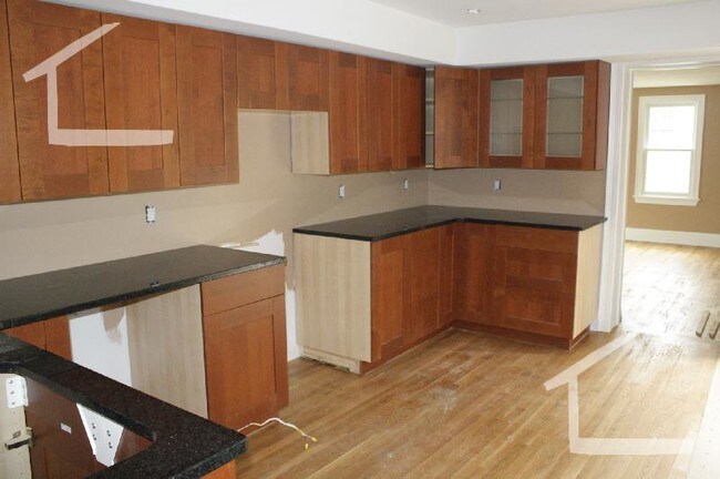
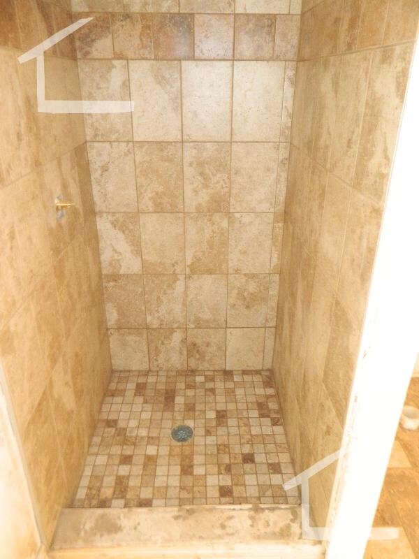
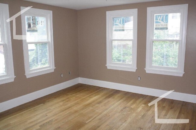
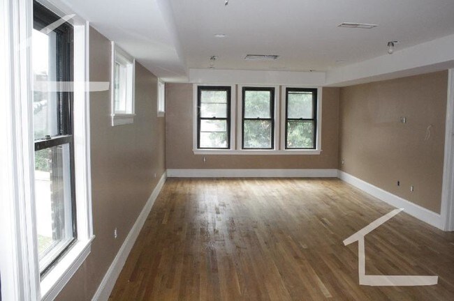
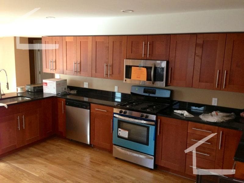
Video walk-through: https://www.youtube.com/watch?v=B3ghk-au9Fs Gut renovated duplex seven bed two bath, laundry in unit, Huge living room, Completely new in 2013, Tenants responsible for all utilities including the water and sewer. one half of the driveway is included.
39 Woodstock Ave is an apartment community located in Suffolk County and the 02135 ZIP Code.
Location
Get Directions
Situated about five miles west of Downtown Boston, Commonwealth boasts a vibrant atmosphere with charming brick buildings, local shops, delectable restaurants, numerous entertainment options, lush parks and playgrounds, and a diverse population. Commonwealth is convenient to several renowned attractions, including the John Fitzgerald Kennedy National Historic Site, Coolidge Corner Theatre, Brookline Booksmith, and Brighton Music Hall.
Commonwealth residents also enjoy quick access to Boston College, making the area especially popular among the institution’s students, faculty, and staff. A host of T stops strewn along Commonwealth Avenue provide easy commutes and travels to Greater Boston as well as convenience to an array of metropolitan amenities.
Learn more about living in CommonwealthBelow are rent ranges for similar nearby apartments
| Beds | Average Size | Lowest | Typical | Premium |
|---|---|---|---|---|
| Studio Studio Studio | 4448 Sq Ft | $900 | $2,215 | $9,380 |
| 1 Bed 1 Bed 1 Bed | 4131 Sq Ft | $850 | $2,604 | $13,291 |
| 2 Beds 2 Beds 2 Beds | 3990-3991 Sq Ft | $1,680 | $3,188 | $15,647 |
| 3 Beds 3 Beds 3 Beds | 3887-3889 Sq Ft | $1,000 | $4,107 | $10,053 |
| 4 Beds 4 Beds 4 Beds | 4075-4076 Sq Ft | $900 | $5,356 | $17,000 |
Education
| Colleges & Universities | Distance | ||
|---|---|---|---|
| Colleges & Universities | Distance | ||
| Drive: | 4 min | 1.7 mi | |
| Drive: | 5 min | 2.0 mi | |
| Drive: | 4 min | 2.1 mi | |
| Drive: | 6 min | 2.4 mi |
39 Woodstock Ave Unit 1 is within 4 minutes or 1.7 miles from Boston University. It is also near Boston College, Brighton and Boston College.
Transportation options available in Brighton include Allston Street Station, located 0.3 mile from 39 Woodstock Ave Unit 1. 39 Woodstock Ave Unit 1 is near General Edward Lawrence Logan International, located 8.8 miles or 16 minutes away.
| Transit / Subway | Distance | ||
|---|---|---|---|
| Transit / Subway | Distance | ||
|
|
Walk: | 5 min | 0.3 mi |
|
|
Walk: | 5 min | 0.3 mi |
|
|
Walk: | 7 min | 0.4 mi |
|
|
Walk: | 8 min | 0.4 mi |
|
|
Walk: | 10 min | 0.5 mi |
| Commuter Rail | Distance | ||
|---|---|---|---|
| Commuter Rail | Distance | ||
|
|
Drive: | 6 min | 2.9 mi |
|
|
Drive: | 7 min | 3.2 mi |
|
|
Drive: | 9 min | 3.9 mi |
|
|
Drive: | 12 min | 4.7 mi |
| Drive: | 10 min | 4.8 mi |
| Airports | Distance | ||
|---|---|---|---|
| Airports | Distance | ||
|
General Edward Lawrence Logan International
|
Drive: | 16 min | 8.8 mi |
Time and distance from 39 Woodstock Ave Unit 1.
| Shopping Centers | Distance | ||
|---|---|---|---|
| Shopping Centers | Distance | ||
| Walk: | 5 min | 0.3 mi | |
| Walk: | 12 min | 0.7 mi | |
| Drive: | 4 min | 1.1 mi |
39 Woodstock Ave Unit 1 has 3 shopping centers within 1.1 miles, which is about a 4-minute walk. The miles and minutes will be for the farthest away property.
| Parks and Recreation | Distance | ||
|---|---|---|---|
| Parks and Recreation | Distance | ||
|
John Fitzgerald Kennedy National Historic Site
|
Walk: | 16 min | 0.9 mi |
|
Chestnut Hill Reservation
|
Drive: | 3 min | 1.2 mi |
|
Frederick Law Olmsted National Historic Site
|
Drive: | 5 min | 2.0 mi |
|
Coit Observatory
|
Drive: | 5 min | 2.2 mi |
|
Charles River Reservation
|
Drive: | 7 min | 3.3 mi |
39 Woodstock Ave Unit 1 has 5 parks within 3.3 miles, including John Fitzgerald Kennedy National Historic Site, Chestnut Hill Reservation, and Coit Observatory.
| Hospitals | Distance | ||
|---|---|---|---|
| Hospitals | Distance | ||
| Walk: | 10 min | 0.5 mi | |
| Walk: | 14 min | 0.7 mi | |
| Drive: | 2 min | 1.1 mi |
39 Woodstock Ave Unit 1 has 3 hospitals within 1.1 miles, the nearest is Franciscan Children's Hospital & Rehab Center which is 0.5 mile away and a 10 minute walk.
| Military Bases | Distance | ||
|---|---|---|---|
| Military Bases | Distance | ||
| Drive: | 24 min | 13.9 mi | |
| Drive: | 27 min | 13.9 mi |
39 Woodstock Ave Unit 1 is 13.9 miles from US Military Reservation, and is convenient to other military bases, including Hanscom Air Force Base.
You May Also Like
Similar Rentals Nearby


What Are Walk Score®, Transit Score®, and Bike Score® Ratings?
Walk Score® measures the walkability of any address. Transit Score® measures access to public transit. Bike Score® measures the bikeability of any address.
What is a Sound Score Rating?
A Sound Score Rating aggregates noise caused by vehicle traffic, airplane traffic and local sources
39 Woodstock Ave
Brighton, MA 02135