
Envy by Gomes
58-84 Norfolk St,
Newark, NJ 07103
$2,000 - $2,815
1-2 Beds
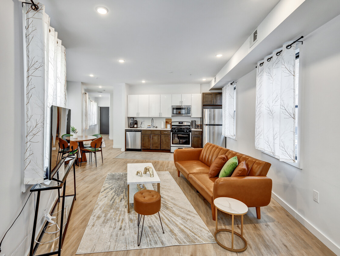

NUEVO 2021 construir. Todos los nuevos TODO. Amplios armarios Amanecer/atardecer vistas /Terraza en la azotea Gimnasio Varias disposiciones disponible Extra grandes ventanas que admiten la entrada de luz natural Electrodomésticos de acero inoxidable Lavadora y secadora en el apartamento Intercomunicador con video Google termostatos con Wi-Fi GIG-XERO a Internet Prueba de sonido y acolchado paredes del diseño de interior Con llave inteligente sistema de control con dedo Se admiten mascotas pequeñas
35 Mulberry St is an apartment community located in Essex County and the 07102 ZIP Code. This area is served by the The Newark Public attendance zone.
Lavadora/Secadora
Aire acondicionado
Lavavajillas
Acceso a Internet de alta velocidad
Vestidores
Nevera
Wifi
Bañera/Ducha
The largest city in New Jersey and the second biggest in the New York metro area, Newark has undergone an artistic and cultural renaissance in recent decades. A major international airport and shipping port, several institutions of higher learning, including two Rutgers campuses and the New Jersey Institute of Technology, and the headquarters of Prudential Financial, Panasonic, and PSEG all call Newark home, making it one of the busiest areas in the Garden State. With a melting pot of residents represented across the city's five distinct wards, Newark (which is Essex County's urban center) never fails to stimulate its residents with a diverse, urban landscape. Sitting just eight miles west of Manhattan, Newark allows its residents to easily commute to one of the world's most cosmopolitan destinations, which is just a short drive or train ride away.
Learn more about living in Downtown Newark| Colleges & Universities | Distance | ||
|---|---|---|---|
| Colleges & Universities | Distance | ||
| Walk: | 11 min | 0.6 mi | |
| Walk: | 16 min | 0.9 mi | |
| Walk: | 16 min | 0.9 mi | |
| Drive: | 10 min | 4.6 mi |


Transportation options available in Newark include Njpac/Center Street, located 0.2 mile from 35 Mulberry St. 35 Mulberry St is near Newark Liberty International, located 5.5 miles or 9 minutes away, and LaGuardia, located 27.2 miles or 41 minutes away.
| Transit / Subway | Distance | ||
|---|---|---|---|
| Transit / Subway | Distance | ||
|
|
Walk: | 4 min | 0.2 mi |
|
|
Walk: | 4 min | 0.2 mi |
|
|
Walk: | 8 min | 0.4 mi |
|
|
Walk: | 9 min | 0.5 mi |
|
|
Walk: | 10 min | 0.5 mi |
| Commuter Rail | Distance | ||
|---|---|---|---|
| Commuter Rail | Distance | ||
|
|
Walk: | 9 min | 0.5 mi |
|
|
Drive: | 3 min | 1.4 mi |
|
|
Drive: | 3 min | 1.6 mi |
|
|
Drive: | 5 min | 3.1 mi |
|
|
Drive: | 9 min | 3.8 mi |
| Airports | Distance | ||
|---|---|---|---|
| Airports | Distance | ||
|
Newark Liberty International
|
Drive: | 9 min | 5.5 mi |
|
LaGuardia
|
Drive: | 41 min | 27.2 mi |
Time and distance from 35 Mulberry St.
| Shopping Centers | Distance | ||
|---|---|---|---|
| Shopping Centers | Distance | ||
| Walk: | 6 min | 0.3 mi | |
| Drive: | 4 min | 1.6 mi |
| Parks and Recreation | Distance | ||
|---|---|---|---|
| Parks and Recreation | Distance | ||
|
Newark Museum and Dreyfuss Planetarium
|
Walk: | 9 min | 0.5 mi |
|
Branch Brook Park
|
Drive: | 5 min | 2.6 mi |
|
Kearny Marsh
|
Drive: | 8 min | 3.4 mi |
|
Richard W. DeKorte Park
|
Drive: | 12 min | 6.2 mi |
|
McDowell Observatory
|
Drive: | 21 min | 9.0 mi |
| Hospitals | Distance | ||
|---|---|---|---|
| Hospitals | Distance | ||
| Walk: | 12 min | 0.6 mi | |
| Drive: | 3 min | 1.7 mi | |
| Drive: | 5 min | 2.8 mi |
| Military Bases | Distance | ||
|---|---|---|---|
| Military Bases | Distance | ||
| Drive: | 14 min | 9.4 mi | |
| Drive: | 25 min | 12.5 mi | |
| Drive: | 30 min | 17.4 mi |
What Are Walk Score®, Transit Score®, and Bike Score® Ratings?
Walk Score® measures the walkability of any address. Transit Score® measures access to public transit. Bike Score® measures the bikeability of any address.
What is a Sound Score Rating?
A Sound Score Rating aggregates noise caused by vehicle traffic, airplane traffic and local sources

35 Mulberry St
Newark, NJ 07102


