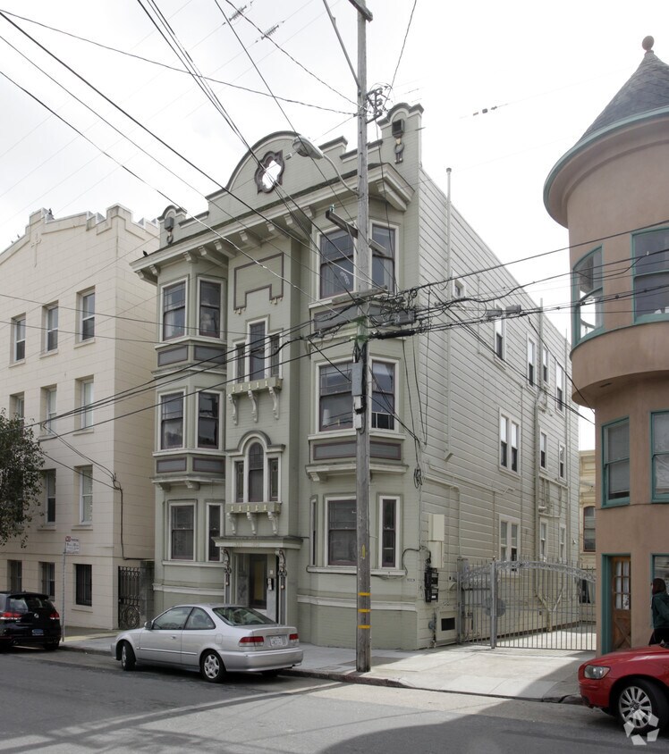
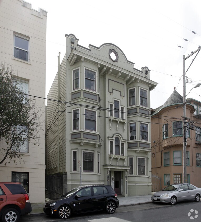
349-353 29th St
349-353 29th St,
San Francisco,
CA
94131
2 Weeks Ago
Favorites
349-353 29th St
Favorites
Check Back Soon for Upcoming Availability
| Beds | Baths | Average SF | Availability |
|---|---|---|---|
| 1 Bedroom 1 Bedroom 1 Br | 1 Bath 1 Bath 1 Ba | — | Not Available |
| 4 Bedrooms 4 Bedrooms 4 Br | 3 Baths 3 Baths 3 Ba | — | Not Available |
Fees and Policies
The fees below are based on community-supplied data and may exclude additional fees and utilities.
- Parking
-
Surface LotParking Available--
Details
Property Information
-
Built in 1912
-
7 units/3 stories
About 349-353 29th St San Francisco, CA 94131
Discover a new place to live at 349-353 29th St. The 94131 location has much to offer its residents. Here at this community, the community staff is excited to help you find your new apartment. Make sure you to check out the current floorplan options. Contact us or drop by the leasing office to find out the availability today and see 349-353 29th St.
349-353 29th St is an apartment community located in San Francisco County and the 94131 ZIP Code. This area is served by the San Francisco Unified attendance zone.
Location
Get Directions
Noe Valley is in central San Francisco, encompassed by modern comforts. Many renters choose Noe Valley apartments because of the convenient access to city transit. The SFMTA Light Rails pick up along Church Street, and BART 24th Street Mission Station is a short walk away.
Most of the neighborhood’s bars, eateries, and bakeries are found along 24th Street. A couple of green spaces are in Noe Valley, such as Upper Noe Recreation Center and Noe Valley Courts. Residents enjoy hiking along the trails at nearby Twin Peaks and perusing the luxury jewelry shops and boutiques in town3.
Learn more about living in Noe ValleyBelow are rent ranges for similar nearby apartments
Education
| Colleges & Universities | Distance | ||
|---|---|---|---|
| Colleges & Universities | Distance | ||
| Drive: | 6 min | 2.7 mi | |
| Drive: | 9 min | 3.2 mi | |
| Drive: | 10 min | 3.5 mi | |
| Drive: | 9 min | 5.7 mi |
349-353 29th St is within 6 minutes or 2.7 miles from City College of San Francisco. It is also near California College of the Arts and UC San Francisco, Mission Bay.
Schools


Public Elementary School
Grades K-5
Nearby
Public Elementary School
Grades K-5
308 Students
Attendance Zone
Public Elementary & Middle School
Grades K-8
536 Students
Nearby
Public Middle School
Grades 6-8
485 Students
Attendance Zone
Public High School
Grades 9-12
679 Students
Attendance Zone
Public High School
Grades 9-12
320 Students
Attendance Zone
Private Elementary & Middle School
Grades PK-8
476 Students
Nearby
Private Elementary & Middle School
Grades K-8
207 Students
Nearby
Private High School
Grades 9-12
364 Students
Nearby
School data provided by
 The GreatSchools Rating helps parents compare schools within a state based on a variety of school quality indicators and provides a helpful picture of how effectively each school serves all of its students. Ratings are on a scale of 1 (below average) to 10 (above average) and can include test scores, college readiness, academic progress, advanced courses, equity, discipline and attendance data. We also advise parents to visit schools, consider other information on school performance and programs, and consider family needs as part of the school selection process.
View GreatSchools Rating Methodology
Data provided by GreatSchools.org © 2025. All rights reserved.
View GreatSchools Rating Methodology
Data provided by GreatSchools.org © 2025. All rights reserved.
Transportation options available in San Francisco include Church And 29Th Street, located 0.1 mile from 349-353 29th St. 349-353 29th St is near San Francisco International, located 12.8 miles or 20 minutes away, and Metro Oakland International, located 23.0 miles or 37 minutes away.
| Transit / Subway | Distance | ||
|---|---|---|---|
| Transit / Subway | Distance | ||
|
|
Walk: | 1 min | 0.1 mi |
|
|
Walk: | 2 min | 0.1 mi |
| Walk: | 3 min | 0.2 mi | |
|
|
Walk: | 5 min | 0.3 mi |
|
|
Walk: | 5 min | 0.3 mi |
| Commuter Rail | Distance | ||
|---|---|---|---|
| Commuter Rail | Distance | ||
| Drive: | 10 min | 4.7 mi | |
| Drive: | 9 min | 4.9 mi | |
| Drive: | 9 min | 5.9 mi | |
| Drive: | 9 min | 6.0 mi | |
| Drive: | 10 min | 6.8 mi |
| Airports | Distance | ||
|---|---|---|---|
| Airports | Distance | ||
|
San Francisco International
|
Drive: | 20 min | 12.8 mi |
|
Metro Oakland International
|
Drive: | 37 min | 23.0 mi |
Time and distance from 349-353 29th St.
| Shopping Centers | Distance | ||
|---|---|---|---|
| Shopping Centers | Distance | ||
| Walk: | 13 min | 0.7 mi | |
| Walk: | 16 min | 0.8 mi | |
| Drive: | 6 min | 1.9 mi |
349-353 29th St has 3 shopping centers within 1.9 miles, which is about a 6-minute walk. The miles and minutes will be for the farthest away property.
| Parks and Recreation | Distance | ||
|---|---|---|---|
| Parks and Recreation | Distance | ||
|
Buena Vista Park
|
Drive: | 7 min | 2.3 mi |
|
Randall Museum
|
Drive: | 8 min | 2.6 mi |
|
Heron's Head Park
|
Drive: | 10 min | 3.5 mi |
|
Conservatory of Flowers
|
Drive: | 9 min | 3.7 mi |
|
California Academy of Sciences
|
Drive: | 12 min | 4.5 mi |
349-353 29th St has 5 parks within 4.5 miles, including Randall Museum, Buena Vista Park, and Heron's Head Park.
| Hospitals | Distance | ||
|---|---|---|---|
| Hospitals | Distance | ||
| Walk: | 12 min | 0.6 mi | |
| Drive: | 4 min | 1.7 mi | |
| Drive: | 6 min | 2.0 mi |
349-353 29th St has 3 hospitals within 2.0 miles, the nearest is California Pacific Medical Center - Mission Bernal which is 0.6 mile away and a 12 minute walk.
| Military Bases | Distance | ||
|---|---|---|---|
| Military Bases | Distance | ||
| Drive: | 18 min | 6.6 mi | |
| Drive: | 19 min | 7.2 mi |
349-353 29th St is 6.6 miles from East Fort Miley, and is convenient to other military bases, including West Fort Miley.
You May Also Like
What neighborhood is the property located in?
349-353 29th St San Francisco, CA 94131 is in Noe Valley in the city of San Francisco. Here you’ll find three shopping centers within 1.9 miles of the property. Five parks are within 4.5 miles, including Randall Museum, Buena Vista Park, and Heron's Head Park.
Similar Rentals Nearby


What Are Walk Score®, Transit Score®, and Bike Score® Ratings?
Walk Score® measures the walkability of any address. Transit Score® measures access to public transit. Bike Score® measures the bikeability of any address.
What is a Sound Score Rating?
A Sound Score Rating aggregates noise caused by vehicle traffic, airplane traffic and local sources

349-353 29th St
San Francisco, CA 94131
Responded To This Review