
$2,400
Total Monthly Price
34 Sidlaw Rd
Boston, MA 02135
Favorites
617-340-9712
-
Bedrooms
2
-
Bathrooms
1
-
Square Feet
--
-
Available
Available Sep 1
34 Sidlaw Rd

Favorites
About This Home
$2,400 deposit,
Available Sep 1
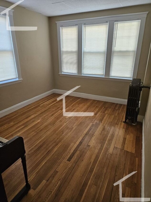
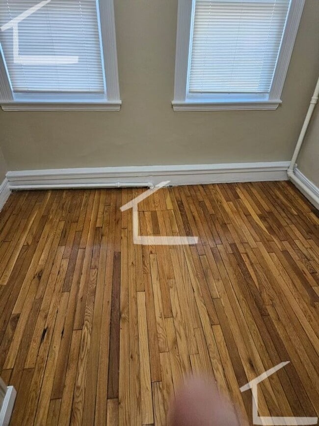
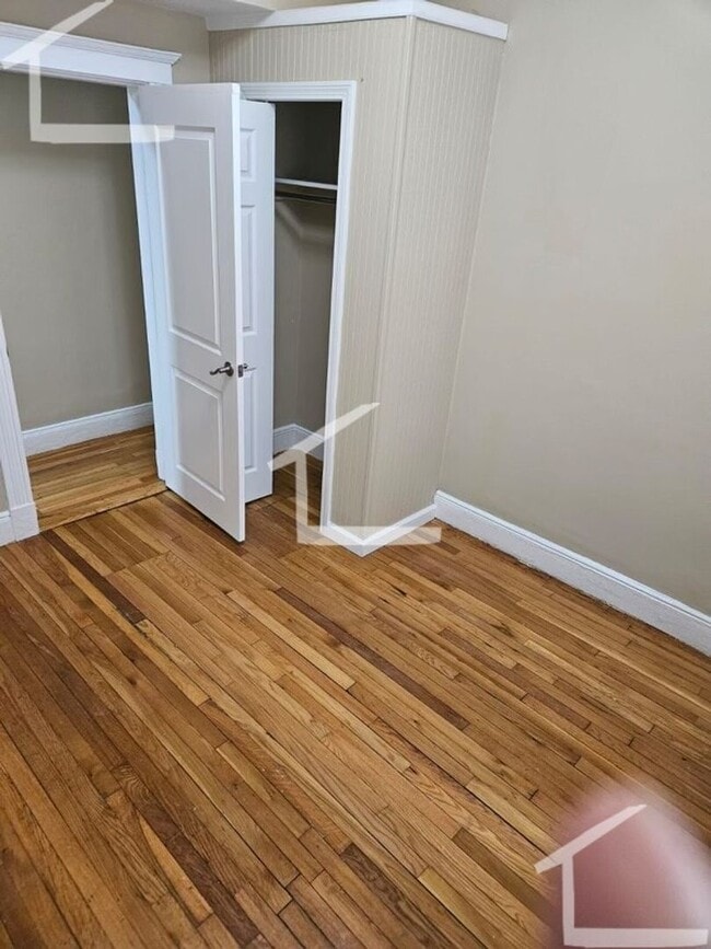
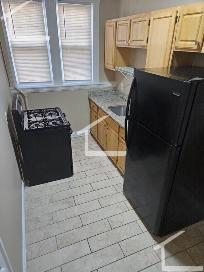
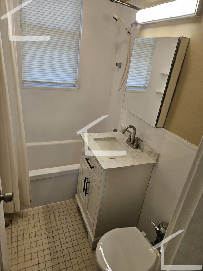
Bright, Spacious, 1st Floor, 613sf, 1.5BR/1BA steps from the Chiswick Rd Green Line T stop! This sun-filled offering features high ceilings, an open floor plan, hardwood floors throughout, a spacious living room, a large bedroom, a second office/den space, a modern, fully applianced kitchen with granite countertops, a modern bath, laundry on site and H/HW included!
34 Sidlaw Rd is a condo located in Suffolk County and the 02135 ZIP Code. This area is served by the Boston Public Schools attendance zone.
* Price shown is total price based on community-supplied monthly required fees. Excludes user-selected optional fees and variable or usage-based fees and required charges due at or prior to move-in or at move-out. Price, availability, fees, and any applicable rent special are subject to change without notice.
* Square footage definitions vary. Displayed square footage is approximate.
Fees and Policies
The fees listed below are community-provided and may exclude utilities or add-ons. All payments are made directly to the property and are non-refundable unless otherwise specified. Use the Cost Calculator to determine costs based on your needs.
-
One-Time Basics
-
Due at Move-In
-
Security Deposit - RefundableCharged per unit.$2,400
-
-
Due at Move-In
-
Cats
-
Allowed
-
Property Fee Disclaimer: Based on community-supplied data and independent market research. Subject to change without notice. May exclude fees for mandatory or optional services and usage-based utilities.
Contact
- Listed by Gateway Real Estate (AD) | Gateway Real Estate (AD)
- Phone Number
- Contact
Location
Get Directions
Saint Elizabeth’s is a Brighton neighborhood situated about 10 miles away from Boston. Thanks to Saint Elizabeth’s top border sitting on Highway 20, commuting in and out of Brighton is easy. Some residents travel by car, but buses and railways make commuting via public transportation a breeze.
The neighborhood’s best amenities are two world-renowned hospitals, Saint Elizabeth’s Medical Center and Franciscan Children’s, that sit on the edge of town. Other great amenities of Saint Elizabeth’s include many local parks like Ringer Playground and Chestnut Hill Reservoir, which has great trails and greenspace. This neighborhood is also equipped with cozy coffee shops, restaurants serving international and American classics, and shopping plazas with grocers and convenience stores.
Saint Elizabeth’s has several rental options ranging from apartments to single-family homes.
Learn more about living in St Elizabeth's
Education
| Colleges & Universities | Distance | ||
|---|---|---|---|
| Colleges & Universities | Distance | ||
| Walk: | 15 min | 0.8 mi | |
| Drive: | 2 min | 1.1 mi | |
| Drive: | 5 min | 2.8 mi | |
| Drive: | 7 min | 3.4 mi |
34 Sidlaw Rd is within 15 minutes or 0.8 mile from Boston College, Brighton. It is also near Boston College and Boston University.
Schools


Public Elementary School
Grades PK-5
349 Students
Attendance Zone
Public Elementary & Middle School
Grades PK-8
455 Students
Attendance Zone
Public Middle & High School
Grades 6-12
609 Students
Attendance Zone
Public Middle & High School
Grades 6-12
2,382 Students
Attendance Zone
Public Middle & High School
Grades 6-12
450 Students
Attendance Zone
Public High School
Grades 9-12
27 Students
Attendance Zone
Private Elementary & Middle School
Grades PK-8
263 Students
Nearby
Private Elementary School
Grades PK-5
103 Students
Nearby
Private High School
Grades 9-12
34 Students
Nearby
School data provided by
 The GreatSchools Rating helps parents compare schools within a state based on a variety of school quality indicators and provides a helpful picture of how effectively each school serves all of its students. Ratings are on a scale of 1 (below average) to 10 (above average) and can include test scores, college readiness, academic progress, advanced courses, equity, discipline and attendance data. We also advise parents to visit schools, consider other information on school performance and programs, and consider family needs as part of the school selection process.
View GreatSchools Rating Methodology
Data provided by GreatSchools.org © 2026. All rights reserved.
View GreatSchools Rating Methodology
Data provided by GreatSchools.org © 2026. All rights reserved.
Transportation options available in Boston include Chiswick Road Station, located 0.1 mile from 34 Sidlaw Rd. 34 Sidlaw Rd is near General Edward Lawrence Logan International, located 9.9 miles or 18 minutes away.
| Transit / Subway | Distance | ||
|---|---|---|---|
| Transit / Subway | Distance | ||
|
|
Walk: | 2 min | 0.1 mi |
|
|
Walk: | 3 min | 0.2 mi |
|
|
Walk: | 6 min | 0.4 mi |
|
|
Walk: | 7 min | 0.4 mi |
|
|
Walk: | 9 min | 0.5 mi |
| Commuter Rail | Distance | ||
|---|---|---|---|
| Commuter Rail | Distance | ||
|
|
Drive: | 9 min | 3.9 mi |
|
|
Drive: | 7 min | 4.1 mi |
|
|
Drive: | 8 min | 4.2 mi |
| Drive: | 10 min | 4.8 mi | |
|
|
Drive: | 9 min | 4.8 mi |
| Airports | Distance | ||
|---|---|---|---|
| Airports | Distance | ||
|
General Edward Lawrence Logan International
|
Drive: | 18 min | 9.9 mi |
Getting Around
 What do Walkability, Transit, Drivability, and Bikeability mean?
Walkability measures the walking distance to day-to-day needs.
Transit measures access to public transportation.
Drivability measures congestion, parking availability, and access to major roads.
Bikeability measures the suitability for cycling.
How It Works
What do Walkability, Transit, Drivability, and Bikeability mean?
Walkability measures the walking distance to day-to-day needs.
Transit measures access to public transportation.
Drivability measures congestion, parking availability, and access to major roads.
Bikeability measures the suitability for cycling.
How It Works
Very Walkable
Walkability
80
/ 100
Strong Public Transit
Transit
80
/ 100
Fairly Drivable
Drivability
40
/ 100
Moderately Bikeable
Bikeability
60
/ 100
Scores provided by
Active
Soundscore™
69
/ 100
Traffic
BusyAirport
CalmBusinesses
ActiveScores provided by
HowLoud What is a Sound Score Rating? A Sound Score Rating aggregates noise caused by vehicle traffic, airplane traffic and local sources. How It WorksTime and distance from 34 Sidlaw Rd.
| Shopping Centers | Distance | ||
|---|---|---|---|
| Shopping Centers | Distance | ||
| Walk: | 14 min | 0.7 mi | |
| Drive: | 2 min | 1.2 mi | |
| Drive: | 5 min | 2.0 mi |
34 Sidlaw Rd has 3 shopping centers within 2.0 miles, which is about a 5-minute drive. The miles and minutes will be for the farthest away property.
| Parks and Recreation | Distance | ||
|---|---|---|---|
| Parks and Recreation | Distance | ||
|
Chestnut Hill Reservation
|
Walk: | 7 min | 0.4 mi |
|
Frederick Law Olmsted National Historic Site
|
Drive: | 4 min | 2.0 mi |
|
Hammond Pond Reservation
|
Drive: | 4 min | 2.2 mi |
|
John Fitzgerald Kennedy National Historic Site
|
Drive: | 4 min | 2.2 mi |
|
Coit Observatory
|
Drive: | 6 min | 3.3 mi |
34 Sidlaw Rd has 5 parks within 3.3 miles, including Chestnut Hill Reservation, John Fitzgerald Kennedy National Historic Site, and Frederick Law Olmsted National Historic Site.
| Hospitals | Distance | ||
|---|---|---|---|
| Hospitals | Distance | ||
| Drive: | 3 min | 1.4 mi | |
| Drive: | 3 min | 1.6 mi | |
| Drive: | 4 min | 2.3 mi |
34 Sidlaw Rd has 3 hospitals within 2.3 miles, the nearest is Franciscan Children's Hospital & Rehab Center which is 1.4 miles away and a 3 minute drive.
| Military Bases | Distance | ||
|---|---|---|---|
| Military Bases | Distance | ||
| Drive: | 22 min | 12.9 mi | |
| Drive: | 27 min | 15.6 mi | |
| Drive: | 41 min | 23.7 mi |
34 Sidlaw Rd has 3 military bases within 23.7 miles, the nearest is US Military Reservation which is 12.9 miles away and a 22 minute drive.
You May Also Like
Similar Rentals Nearby


What Are Walk Score®, Transit Score®, and Bike Score® Ratings?
Walk Score® measures the walkability of any address. Transit Score® measures access to public transit. Bike Score® measures the bikeability of any address.
What is a Sound Score Rating?
A Sound Score Rating aggregates noise caused by vehicle traffic, airplane traffic and local sources.

34 Sidlaw Rd
Boston, MA 02135