
Adara
888 N 4th St,
Phoenix, AZ 85004
$740 - $3,000
Studio - 4 Beds


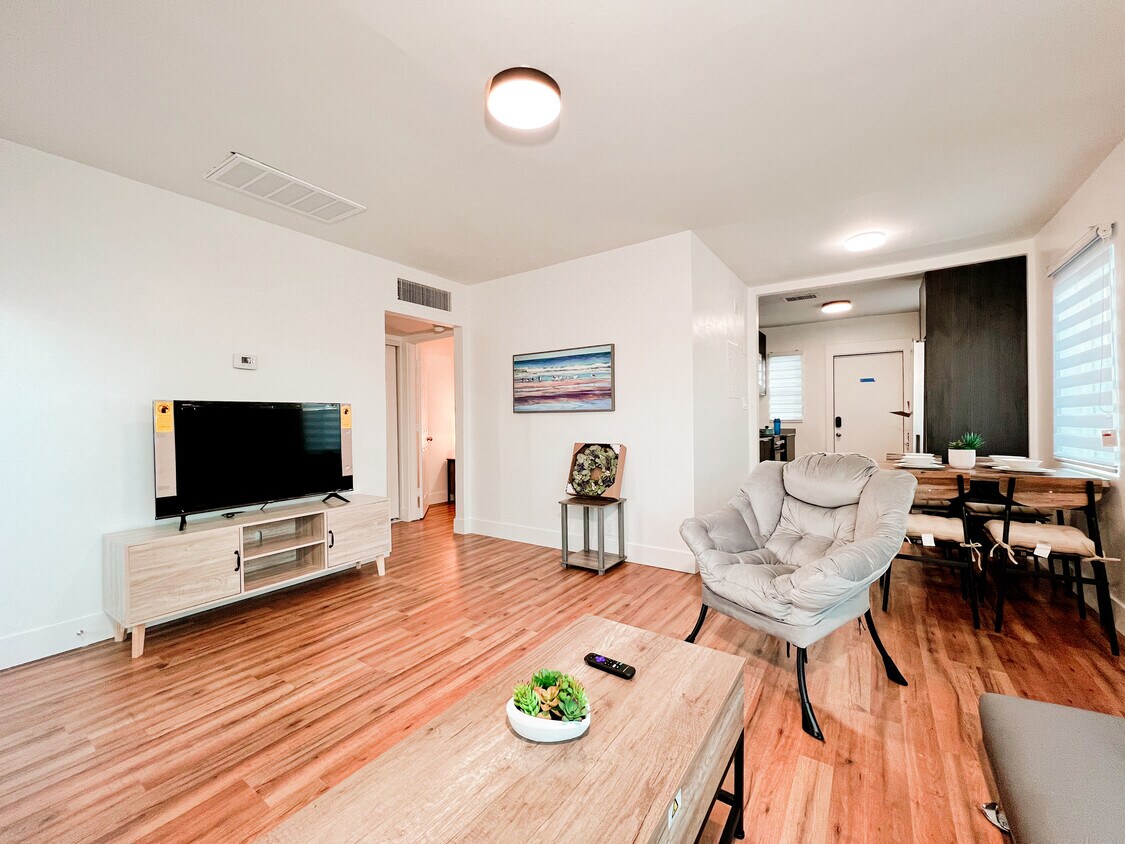
Complete New Remodel 1BR-1BA with full amenities and a cozy private front yard, Secure gated facility ideal for travel nurses, utilities, WiFi, TV included. Located in a quiet corner in the heart of downtown Phoenix Roosevelt Arts district with convenient walking access to transportation, vibrant restaurants, pubs, shops and 1st Friday-of-the-Month night market. Within 1 mile to major medical centers and teaching hospitals. Pets welcomed.
338 E Portland St is an apartment community located in Maricopa County and the 85004 ZIP Code. This area is served by the Arizona School For The Arts attendance zone.
Laundry Facilities
Gated
Community-Wide WiFi
Key Fob Entry
Air Conditioning
Dishwasher
High Speed Internet Access
Hardwood Floors
A major art hub in Phoenix, Roosevelt is alive with revitalized parks, distinct shops and local small businesses, topnotch restaurants, and Craftsman-style architecture.
Roosevelt Row, or “RoRo”, is a very walkable arts district filled with impressive sculptures, colorful murals, and art exhibits. During the first Friday of every month, locals are given the opportunity to immerse themselves in culture and art with the First Friday Art Walk.
Residents are encouraged to stroll through the studios and view the newest collections, sip cocktails, and mingle with the community artists.
When it comes to food on RoRo, the locals rave about the Dressing Room and its international street fare. The Japanese Friendship Garden is a serene, park-like setting that includes a koi pond, cascading waterfall, and tea garden – it’s the ideal place for meditation. The Valley Metro Rail connects residents to the airport’s sky train, zoo, and Desert Botanical Garden.
Learn more about living in Roosevelt Row| Colleges & Universities | Distance | ||
|---|---|---|---|
| Colleges & Universities | Distance | ||
| Walk: | 13 min | 0.7 mi | |
| Walk: | 13 min | 0.7 mi | |
| Drive: | 8 min | 2.9 mi | |
| Drive: | 8 min | 5.1 mi |


Transportation options available in Phoenix include Roosevelt/Central Ave, located 0.5 mile from 338 E Portland St. 338 E Portland St is near Phoenix Sky Harbor International, located 5.9 miles or 11 minutes away, and Phoenix-Mesa Gateway, located 32.7 miles or 43 minutes away.
| Transit / Subway | Distance | ||
|---|---|---|---|
| Transit / Subway | Distance | ||
|
|
Walk: | 8 min | 0.5 mi |
|
|
Walk: | 12 min | 0.6 mi |
|
|
Walk: | 19 min | 1.0 mi |
|
|
Drive: | 3 min | 1.2 mi |
|
|
Drive: | 3 min | 1.3 mi |
| Commuter Rail | Distance | ||
|---|---|---|---|
| Commuter Rail | Distance | ||
|
|
Drive: | 43 min | 33.8 mi |
| Airports | Distance | ||
|---|---|---|---|
| Airports | Distance | ||
|
Phoenix Sky Harbor International
|
Drive: | 11 min | 5.9 mi |
|
Phoenix-Mesa Gateway
|
Drive: | 43 min | 32.7 mi |
Time and distance from 338 E Portland St.
| Shopping Centers | Distance | ||
|---|---|---|---|
| Shopping Centers | Distance | ||
| Walk: | 2 min | 0.1 mi | |
| Walk: | 11 min | 0.6 mi | |
| Walk: | 11 min | 0.6 mi |
| Parks and Recreation | Distance | ||
|---|---|---|---|
| Parks and Recreation | Distance | ||
|
Margaret T. Hance Park
|
Walk: | 10 min | 0.6 mi |
|
Japanese Friendship Garden
|
Walk: | 13 min | 0.7 mi |
|
Civic Space Park
|
Walk: | 16 min | 0.9 mi |
|
Children's Museum of Phoenix
|
Walk: | 16 min | 0.9 mi |
|
Arizona Science Center
|
Walk: | 19 min | 1.0 mi |
| Hospitals | Distance | ||
|---|---|---|---|
| Hospitals | Distance | ||
| Walk: | 19 min | 1.0 mi | |
| Drive: | 5 min | 2.1 mi | |
| Drive: | 5 min | 2.1 mi |
| Military Bases | Distance | ||
|---|---|---|---|
| Military Bases | Distance | ||
| Drive: | 11 min | 5.8 mi | |
| Drive: | 30 min | 22.0 mi | |
| Drive: | 98 min | 74.5 mi |
What Are Walk Score®, Transit Score®, and Bike Score® Ratings?
Walk Score® measures the walkability of any address. Transit Score® measures access to public transit. Bike Score® measures the bikeability of any address.
What is a Sound Score Rating?
A Sound Score Rating aggregates noise caused by vehicle traffic, airplane traffic and local sources
338 E Portland St
Phoenix, AZ 85004


