$2,875 / Month
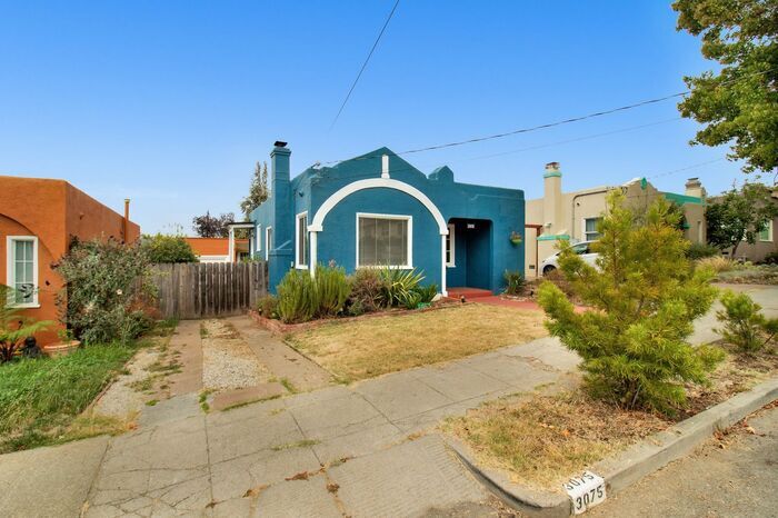
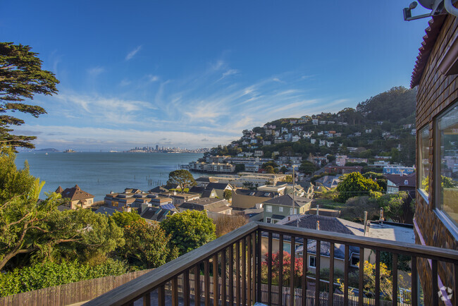
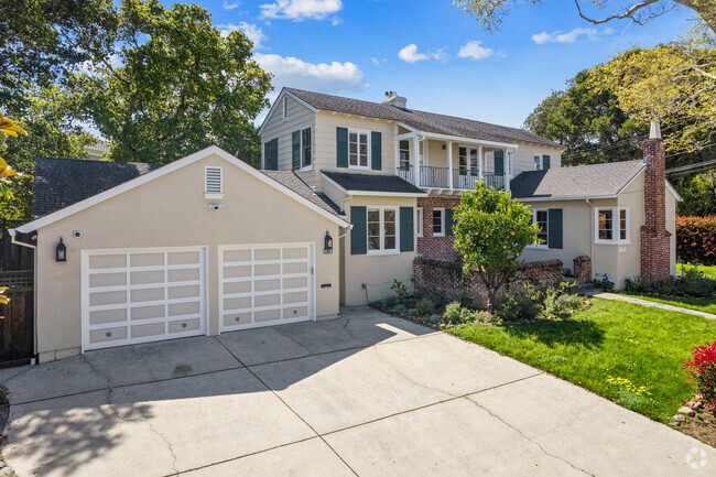
3075 California St
Oakland, CA 94602
2 Weeks Ago
Favorites
3075 California St

Favorites
Check Back Soon for Upcoming Availability
| Beds | Baths | Average SF |
|---|---|---|
| 2 Bedrooms 2 Bedrooms 2 Br | 1 Bath 1 Bath 1 Ba | 906 SF |
About This Property
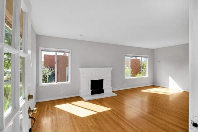
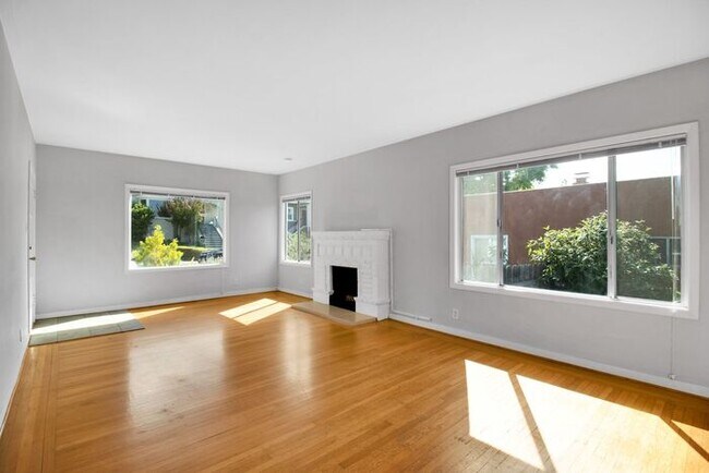
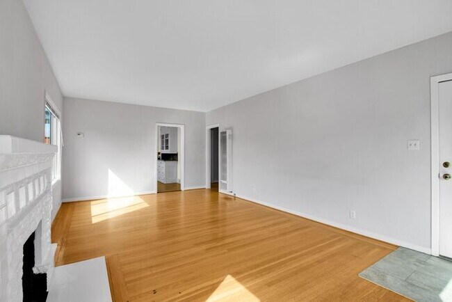
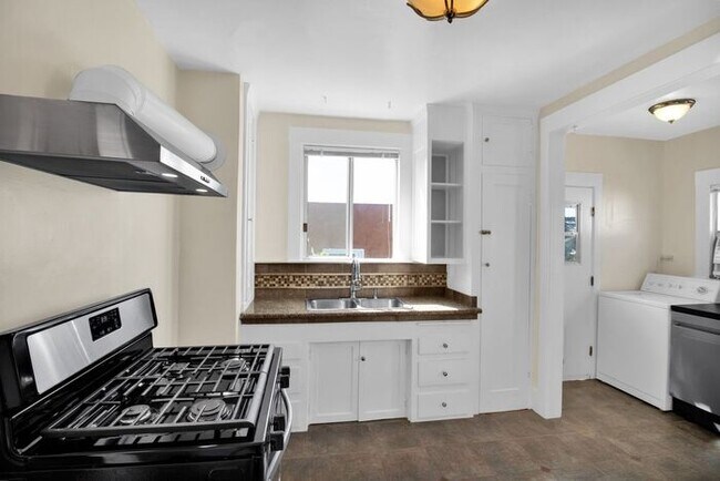
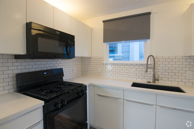
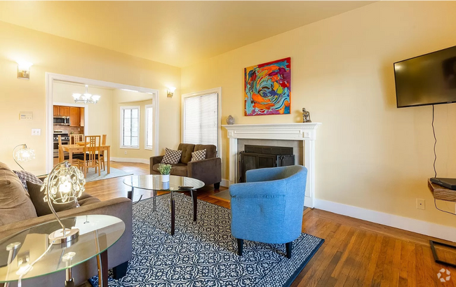
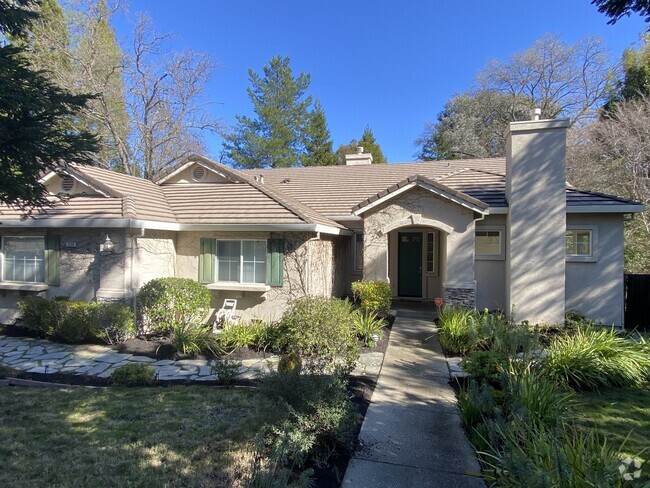
Updated two bedroom bugalow home in Oakland's Upper Dimond neighborhood. Freshly painted, hardwood flooring, spacious living room with fireplace, lots of cabinet space in kitchen, stainless steel appliances, gas range, dishwasher and refrigerator included, in-unit laundry with washer and dryer, rear patio and yard, detached garage with workshop. Tenant pays all utilities plus $30/mo Resident Benefits Package which includes renter's insurance, tenant liability insurance, our utility concierge service, resident portal, maintenance hotline and more. Near public transportation, shopping, restaurants and more. Sec8 ok. Professionally managed. No warranty on washer and dryer. Virtual Tour Rental Terms: Rent: $2,875, Application Fee: $40, Security Deposit: $3,000, Available Now Pet Policy: Cats not allowed, Dogs not allowed Contact us to schedule a showing.
3075 California St is a house located in Alameda County and the 94602 ZIP Code. This area is served by the Oakland Unified attendance zone.
Location
Get Directions
The Lower Hills District of Oakland is made up of several small neighborhoods, including Piedmont, Crocker Heights, Oakmont, and Redwood Heights. Situated just seven miles to the east of Downtown Oakland on the north side of Interstate 580, the Lower Hills District maintains a small town feel despite its location among one of the Bay Area’s biggest communities. Windy, tree-lined streets house both new apartments and homes dating back to the '30s and '40s. Residents don’t have to travel far for everyday needs thanks to Oakland’s fast-growing economy. There is a plethora of shopping and dining options scattered around this sprawling community. You’ll find most of the amenities close to the MacArthur Freeway (Interstate 580) or near Park Boulevard. Access to the freeway and Bay Area Rapid Transit make getting around the rest of the Bay Area a breeze.
Learn more about living in Lower Hills DistrictBelow are rent ranges for similar nearby apartments
Education
| Colleges & Universities | Distance | ||
|---|---|---|---|
| Colleges & Universities | Distance | ||
| Drive: | 7 min | 2.1 mi | |
| Drive: | 8 min | 4.0 mi | |
| Drive: | 10 min | 4.4 mi | |
| Drive: | 9 min | 4.6 mi |
3075 California St is within 7 minutes or 2.1 miles from Mills College. It is also near Laney College and Lincoln University, Oakland.
Schools


Public Elementary & Middle School
Grades K-8
656 Students
Nearby
Public Elementary School
Grades K-5
424 Students
Attendance Zone
Public Middle School
Grades 6-9
446 Students
Attendance Zone
Public High School
Grades 9-12
1,590 Students
Attendance Zone
Private Elementary, Middle & High School
Grades PK-10
16 Students
Nearby
Private Elementary, Middle & High School
Grades K-10
7 Students
Nearby
Private Middle & High School
Grades 6-11
15 Students
Nearby
Private Middle & High School
Grades 6-11
15 Students
Nearby
School data provided by
 The GreatSchools Rating helps parents compare schools within a state based on a variety of school quality indicators and provides a helpful picture of how effectively each school serves all of its students. Ratings are on a scale of 1 (below average) to 10 (above average) and can include test scores, college readiness, academic progress, advanced courses, equity, discipline and attendance data. We also advise parents to visit schools, consider other information on school performance and programs, and consider family needs as part of the school selection process.
View GreatSchools Rating Methodology
View GreatSchools Rating Methodology
Transportation options available in Oakland include Fruitvale Station, located 2.4 miles from 3075 California St. 3075 California St is near Metro Oakland International, located 8.2 miles or 14 minutes away, and San Francisco International, located 26.3 miles or 39 minutes away.
| Transit / Subway | Distance | ||
|---|---|---|---|
| Transit / Subway | Distance | ||
|
|
Drive: | 5 min | 2.4 mi |
|
|
Drive: | 9 min | 4.4 mi |
|
|
Drive: | 9 min | 4.4 mi |
|
|
Drive: | 9 min | 4.6 mi |
|
|
Drive: | 9 min | 4.8 mi |
| Commuter Rail | Distance | ||
|---|---|---|---|
| Commuter Rail | Distance | ||
|
|
Drive: | 10 min | 4.7 mi |
|
|
Drive: | 11 min | 7.3 mi |
|
|
Drive: | 14 min | 9.3 mi |
|
|
Drive: | 20 min | 13.5 mi |
| Drive: | 21 min | 13.8 mi |
| Airports | Distance | ||
|---|---|---|---|
| Airports | Distance | ||
|
Metro Oakland International
|
Drive: | 14 min | 8.2 mi |
|
San Francisco International
|
Drive: | 39 min | 26.3 mi |
Time and distance from 3075 California St.
| Shopping Centers | Distance | ||
|---|---|---|---|
| Shopping Centers | Distance | ||
| Walk: | 20 min | 1.0 mi | |
| Drive: | 3 min | 1.3 mi | |
| Drive: | 7 min | 3.4 mi |
3075 California St has 3 shopping centers within 3.4 miles, which is about a 7-minute walk. The miles and minutes will be for the farthest away property.
| Parks and Recreation | Distance | ||
|---|---|---|---|
| Parks and Recreation | Distance | ||
|
Lakeside Park
|
Drive: | 6 min | 3.6 mi |
|
Roberts Regional Recreation Area
|
Drive: | 9 min | 3.9 mi |
|
Redwood Regional Park
|
Drive: | 9 min | 4.1 mi |
|
Chabot Space & Science Center
|
Drive: | 12 min | 4.6 mi |
|
Joaquin Miller Park
|
Drive: | 11 min | 4.7 mi |
3075 California St has 5 parks within 4.7 miles, including Joaquin Miller Park, Roberts Regional Recreation Area, and Chabot Space & Science Center.
| Hospitals | Distance | ||
|---|---|---|---|
| Hospitals | Distance | ||
| Drive: | 4 min | 1.8 mi | |
| Drive: | 4 min | 1.9 mi | |
| Drive: | 7 min | 4.3 mi |
3075 California St has 3 hospitals within 4.3 miles, the nearest is Telecare Heritage Psychiatric Health Facility which is 1.8 miles away and a 4 minute drive.
| Military Bases | Distance | ||
|---|---|---|---|
| Military Bases | Distance | ||
| Drive: | 18 min | 7.8 mi | |
| Drive: | 18 min | 9.7 mi |
3075 California St is 7.8 miles from Alameda/US Naval Air Station Alameda, and is convenient to other military bases, including Oakland Army Base.
You May Also Like
Similar Rentals Nearby

What Are Walk Score®, Transit Score®, and Bike Score® Ratings?
Walk Score® measures the walkability of any address. Transit Score® measures access to public transit. Bike Score® measures the bikeability of any address.
What is a Sound Score Rating?
A Sound Score Rating aggregates noise caused by vehicle traffic, airplane traffic and local sources

3075 California St
Oakland, CA 94602