$2,875 - $3,850
Total Monthly Price
12 Month Lease
29 Peterborough St
Boston, MA 02215
Favorites
-
Bedrooms
1 - 2
-
Bathrooms
1
-
Square Feet
500 - 999 sq ft
-
Available
Available Sep 1
Highlight
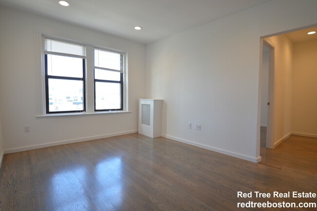
- Hardwood Floors
29 Peterborough St

Favorites
2 Available Units
11-6
$2,875
Total Monthly Price
1 bed,
1 bath,
500 sq ft
12 Month Lease, $2,600 deposit,
Sep 1
11-10
$3,850
Total Monthly Price
2 beds,
1 bath,
999 sq ft
12 Month Lease, $3,850 deposit,
Sep 1
* Price shown is base rent. Excludes user-selected optional fees and variable or usage-based fees and required charges due at or prior to move-in or at move-out.
Price, availability, fees, and any applicable rent special are subject to change without notice.
* Square footage definitions vary. Displayed square footage is approximate.
About 29 Peterborough St Boston, MA 02215
12 Month Lease,
$2,600 deposit,
Available Sep 1
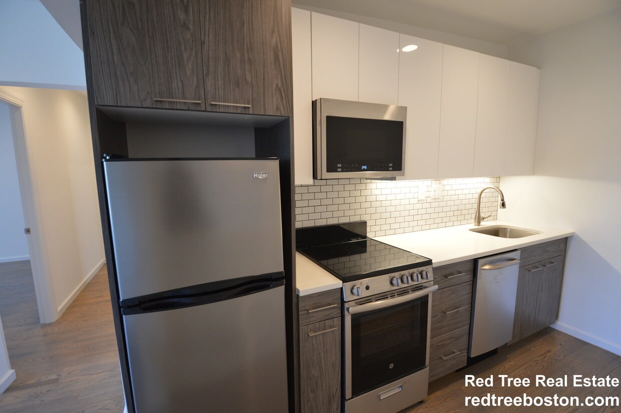
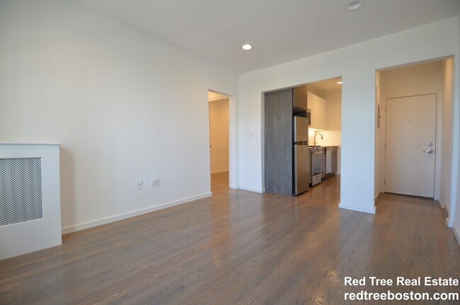
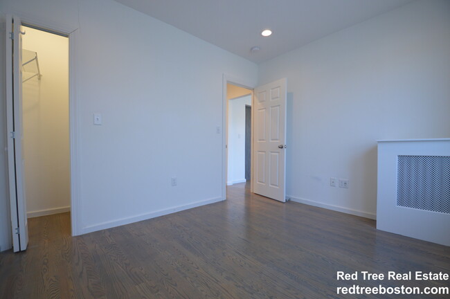
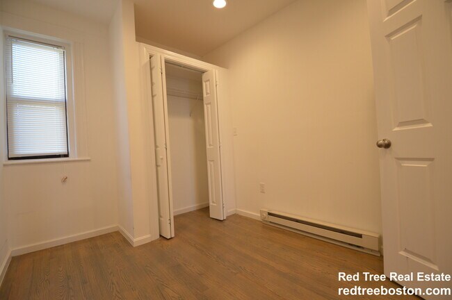
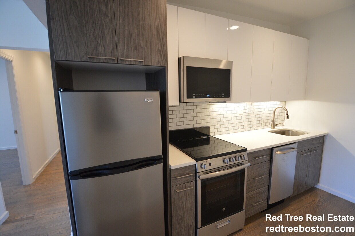
NO FEE- MULTIPLE OPTIONS AVAILABLE- Steps from Fenway Park, museums, and the gardens. Walking proximity to the latest restaurants, MGM music hall, and universities. This incredibly charming one bed is in an unbeatable Boston location. With hardwood floors throughout and a generous foyer utilized as an office or for dining, this home is equipped with a modern kitchen with granite counter tops and a spacious living room.
29 Peterborough St is an apartment community located in Suffolk County and the 02215 ZIP Code. This area is served by the Boston Public Schools attendance zone.
* Price shown is total price based on community-supplied monthly required fees. Excludes user-selected optional fees and variable or usage-based fees and required charges due at or prior to move-in or at move-out. Price, availability, fees, and any applicable rent special are subject to change without notice.
* Square footage definitions vary. Displayed square footage is approximate.
Apartment Features
Hardwood Floors
Granite Countertops
Office
Kitchen
- Granite Countertops
- Kitchen
- Hardwood Floors
- Office
- Laundry Facilities
Fees and Policies
The fees listed below are community-provided and may exclude utilities or add-ons. All payments are made directly to the property and are non-refundable unless otherwise specified.
- One-Time Move-In Fees
-
Broker Fee$0
Details
Utilities Included
-
Water
Contact
- Contact
Location
Get Directions
Tree-filled, historic, and packed with educational opportunity, there's no other neighborhood quite like Fenway. The neighborhood may be most well-known for its titular attraction, Fenway Park, home of the Boston Red Sox. However, the area is also renowned for its sprawling greenspace. The name "Fenway" refers to the neighborhood’s lush parkway and tree-filled paths that wind lazily through the area, forming part of Frederick Law Olmsted’s “Emerald Necklace Plan” (a chain of parks throughout Boston). The Fenway opened in 1876, and its route includes the Museum of Fine Arts and the Isabella Steward Gardner Museum.
Learn more about living in Fenway
Education
| Colleges & Universities | Distance | ||
|---|---|---|---|
| Colleges & Universities | Distance | ||
| Walk: | 10 min | 0.6 mi | |
| Walk: | 11 min | 0.6 mi | |
| Walk: | 11 min | 0.6 mi | |
| Drive: | 3 min | 1.3 mi |
29 Peterborough St is within 10 minutes or 0.6 mile from Lesley Univ., Art Institute. It is also near Simmons College and Emmanuel College.
Schools


Public Elementary & Middle School
Grades PK-8
355 Students
Attendance Zone
Public Elementary & Middle School
Grades PK-8
337 Students
Attendance Zone
Public Middle & High School
Grades 6-12
2,382 Students
Attendance Zone
Public Middle & High School
Grades 6-12
50 Students
Attendance Zone
Public High School
Grades 9-12
424 Students
Attendance Zone
Private Elementary, Middle & High School
Grades K-12
478 Students
Nearby
Private Elementary & Middle School
Grades PK-8
78 Students
Nearby
School data provided by
 The GreatSchools Rating helps parents compare schools within a state based on a variety of school quality indicators and provides a helpful picture of how effectively each school serves all of its students. Ratings are on a scale of 1 (below average) to 10 (above average) and can include test scores, college readiness, academic progress, advanced courses, equity, discipline and attendance data. We also advise parents to visit schools, consider other information on school performance and programs, and consider family needs as part of the school selection process.
View GreatSchools Rating Methodology
Data provided by GreatSchools.org © 2026. All rights reserved.
View GreatSchools Rating Methodology
Data provided by GreatSchools.org © 2026. All rights reserved.
Transportation options available in Boston include Kenmore Station, located 0.5 mile from 29 Peterborough St. 29 Peterborough St is near General Edward Lawrence Logan International, located 6.1 miles or 14 minutes away.
| Transit / Subway | Distance | ||
|---|---|---|---|
| Transit / Subway | Distance | ||
|
|
Walk: | 10 min | 0.5 mi |
|
|
Walk: | 11 min | 0.6 mi |
|
|
Walk: | 11 min | 0.6 mi |
|
|
Drive: | 3 min | 1.2 mi |
|
|
Drive: | 3 min | 1.2 mi |
| Commuter Rail | Distance | ||
|---|---|---|---|
| Commuter Rail | Distance | ||
|
|
Drive: | 3 min | 1.1 mi |
|
|
Drive: | 7 min | 1.6 mi |
| Drive: | 6 min | 2.4 mi | |
|
|
Drive: | 7 min | 2.4 mi |
|
|
Drive: | 7 min | 3.9 mi |
| Airports | Distance | ||
|---|---|---|---|
| Airports | Distance | ||
|
General Edward Lawrence Logan International
|
Drive: | 14 min | 6.1 mi |
Getting Around
 What do Walkability, Transit, Drivability, and Bikeability mean?
Walkability measures the walking distance to day-to-day needs.
Transit measures access to public transportation.
Drivability measures congestion, parking availability, and access to major roads.
Bikeability measures the suitability for cycling.
How It Works
What do Walkability, Transit, Drivability, and Bikeability mean?
Walkability measures the walking distance to day-to-day needs.
Transit measures access to public transportation.
Drivability measures congestion, parking availability, and access to major roads.
Bikeability measures the suitability for cycling.
How It Works
Exceptionally Walkable
Walkability
100
/ 100
Exceptional Public Transit
Transit
90
/ 100
Fairly Drivable
Drivability
40
/ 100
Exceptionally Bikeable
Bikeability
100
/ 100
Scores provided by
-
Soundscore™
-
/ 100
Traffic
-Airport
-Businesses
-Scores provided by
HowLoud What is a Sound Score Rating? A Sound Score Rating aggregates noise caused by vehicle traffic, airplane traffic and local sources. How It WorksTime and distance from 29 Peterborough St.
| Shopping Centers | Distance | ||
|---|---|---|---|
| Shopping Centers | Distance | ||
| Walk: | 15 min | 0.8 mi | |
| Drive: | 9 min | 4.8 mi | |
| Drive: | 9 min | 5.0 mi |
29 Peterborough St has 3 shopping centers within 5.0 miles, which is about a 9-minute drive. The miles and minutes will be for the farthest away property.
| Parks and Recreation | Distance | ||
|---|---|---|---|
| Parks and Recreation | Distance | ||
|
Charles River Reservation
|
Walk: | 15 min | 0.8 mi |
|
Coit Observatory
|
Drive: | 3 min | 1.5 mi |
|
Boston Public Garden
|
Drive: | 6 min | 1.8 mi |
|
John Fitzgerald Kennedy National Historic Site
|
Drive: | 4 min | 1.9 mi |
|
Roxbury Heritage State Park
|
Drive: | 5 min | 2.3 mi |
29 Peterborough St has 5 parks within 2.3 miles, including Charles River Reservation, Coit Observatory, and Roxbury Heritage State Park.
| Hospitals | Distance | ||
|---|---|---|---|
| Hospitals | Distance | ||
| Walk: | 11 min | 0.6 mi | |
| Walk: | 15 min | 0.8 mi | |
| Drive: | 3 min | 1.3 mi |
29 Peterborough St has 3 hospitals within 1.3 miles, the nearest is Beth Israel Deaconess Medical Center which is 0.6 mile away and a 11 minute walk.
| Military Bases | Distance | ||
|---|---|---|---|
| Military Bases | Distance | ||
| Drive: | 29 min | 14.7 mi | |
| Drive: | 28 min | 15.8 mi | |
| Drive: | 36 min | 20.9 mi |
29 Peterborough St has 3 military bases within 20.9 miles, the nearest is Hanscom Air Force Base which is 14.7 miles away and a 29 minute drive.
Amenities
- Granite Countertops
- Kitchen
- Hardwood Floors
- Office
- Laundry Facilities
29 Peterborough St Photos
What Are Walk Score®, Transit Score®, and Bike Score® Ratings?
Walk Score® measures the walkability of any address. Transit Score® measures access to public transit. Bike Score® measures the bikeability of any address.
What is a Sound Score Rating?
A Sound Score Rating aggregates noise caused by vehicle traffic, airplane traffic and local sources.
29 Peterborough St
Boston, MA 02215