
$2,000
/ Month
29 High St
West Orange, NJ 07052
Today
|
Edit
Favorites
973-985-8637
-
Bedrooms
2
-
Bathrooms
1
-
Square Feet
--
-
Available
Available Now
29 High St

Favorites
About This Home
Available Now
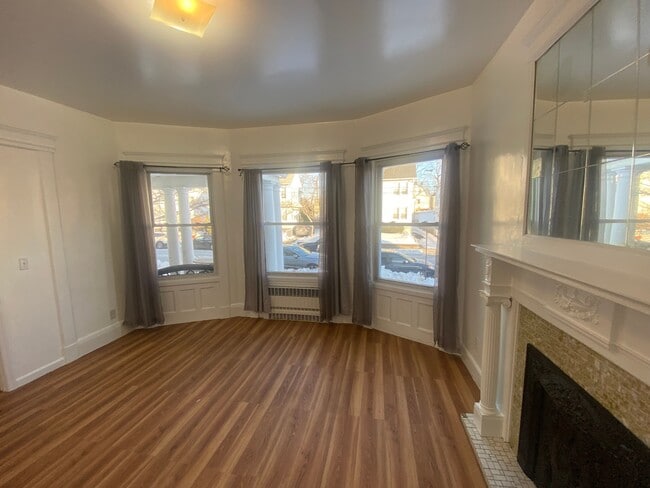
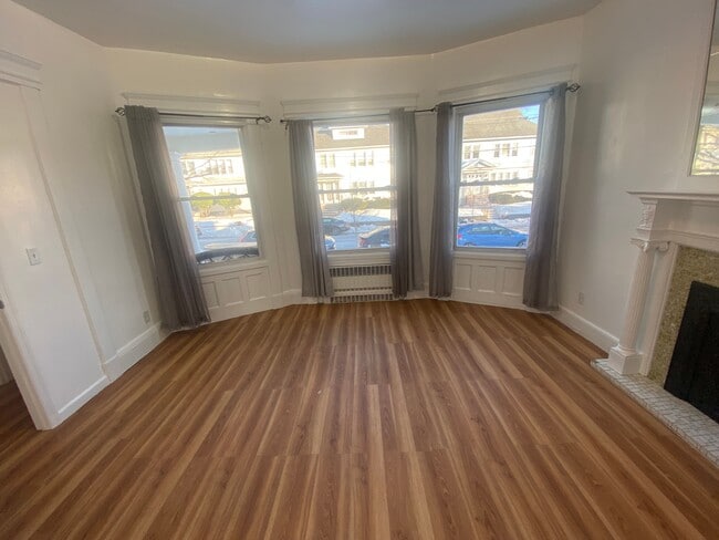
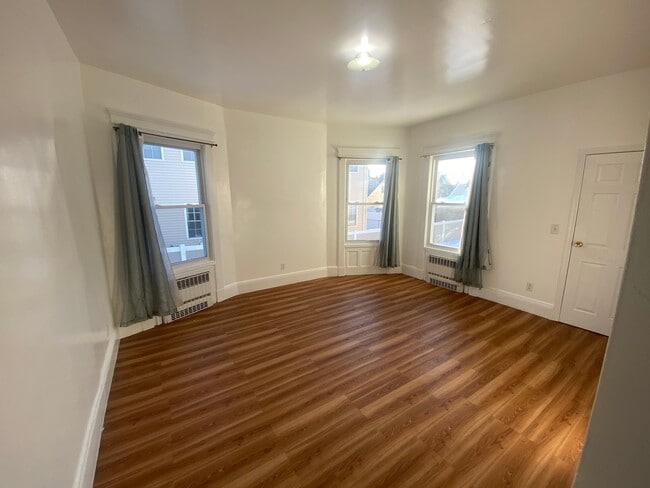
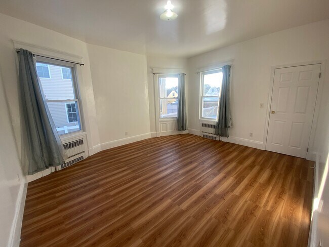
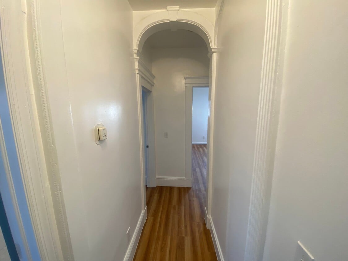
This is a beautiful 2 bedroom unit with tall ceilings and generous sized rooms and is on the first floor. The primary bedroom has a small walk in closet. This space pours in tons of sunlight. This unit also has a great living room to hang out in the basement. Tenant pays utilities and snow removal. The lawncare is maintained by the landlord. Off street parking is an additional $25 each spot per month. Please call if you have pets for details. Laundromat around the corner of Chestnut Street and Watson Ave. This unit also includes a private back desk only available to this unit. Closet to public transportation, Churches, Stores & Parks.
29 High St is an apartment community located in Essex County and the 07052 ZIP Code.
* Price shown is base rent. Excludes user-selected optional fees and variable or usage-based fees and required charges due at or prior to move-in or at move-out. Price, availability, fees, and any applicable rent special are subject to change without notice.
* Square footage definitions vary. Displayed square footage is approximate.
Features
- Air Conditioning
- Hardwood Floors
- Tile Floors
- Package Service
- Laundry Facilities
- Controlled Access
Contact
- Listed by Laurena White
- Phone Number
- Contact
Location
Get Directions
West Orange is an upscale suburban community located about thirty miles west of Manhattan. The township is best known for its historic Llewellyn Park neighborhood, filled with Victorian homes that once belonged to such prominent citizens as Thomas Edison (Edison’s factory is one of the city’s distinctive landmarks as well). Most of the landscape in West Orange is covered by residential neighborhoods, with the popular Essex Green Shopping Center in the middle of town serving as the hub for shopping, dining, and entertainment.
When the weather is nice, locals love to hit the links at the nearby golf courses or explore the trails of South Mountain and Eagle Rock reservations. Seton Hall University sits just a few blocks southeast of town, making West Orange a great place for students, faculty, and staff members to live.
Learn more about living in West Orange
Amenities
- Air Conditioning
- Hardwood Floors
- Tile Floors
- Package Service
- Laundry Facilities
- Controlled Access
Education
| Colleges & Universities | Distance | ||
|---|---|---|---|
| Colleges & Universities | Distance | ||
| Drive: | 7 min | 2.6 mi | |
| Drive: | 11 min | 4.2 mi | |
| Drive: | 11 min | 4.9 mi | |
| Drive: | 12 min | 5.2 mi |
29 High St is within 7 minutes or 2.6 miles from Bloomfield College. It is also near Seton Hall University and N.J. Inst. of Technology.
Transportation options available in West Orange include Grove Street, located 2.9 miles from 29 High St. 29 High St is near Newark Liberty International, located 10.5 miles or 20 minutes away, and LaGuardia, located 31.3 miles or 50 minutes away.
| Transit / Subway | Distance | ||
|---|---|---|---|
| Transit / Subway | Distance | ||
|
|
Drive: | 8 min | 2.9 mi |
|
|
Drive: | 10 min | 3.6 mi |
|
|
Drive: | 10 min | 3.6 mi |
|
|
Drive: | 10 min | 3.7 mi |
|
|
Drive: | 9 min | 4.4 mi |
| Commuter Rail | Distance | ||
|---|---|---|---|
| Commuter Rail | Distance | ||
|
|
Drive: | 5 min | 1.6 mi |
|
|
Drive: | 6 min | 1.9 mi |
|
|
Drive: | 6 min | 1.9 mi |
|
|
Drive: | 7 min | 2.1 mi |
|
|
Drive: | 6 min | 2.2 mi |
| Airports | Distance | ||
|---|---|---|---|
| Airports | Distance | ||
|
Newark Liberty International
|
Drive: | 20 min | 10.5 mi |
|
LaGuardia
|
Drive: | 50 min | 31.3 mi |
Time and distance from 29 High St.
| Shopping Centers | Distance | ||
|---|---|---|---|
| Shopping Centers | Distance | ||
| Drive: | 5 min | 1.7 mi | |
| Drive: | 5 min | 2.0 mi | |
| Drive: | 7 min | 2.8 mi |
29 High St has 3 shopping centers within 2.8 miles, which is about a 7-minute drive. The miles and minutes will be for the farthest away property.
| Parks and Recreation | Distance | ||
|---|---|---|---|
| Parks and Recreation | Distance | ||
|
Edison National Historic Site
|
Drive: | 5 min | 1.4 mi |
|
Van Vleck House & Gardens
|
Drive: | 6 min | 2.5 mi |
|
Turtle Back Zoo
|
Drive: | 11 min | 4.0 mi |
|
Presby Memorial Iris Gardens
|
Drive: | 10 min | 4.7 mi |
|
Branch Brook Park
|
Drive: | 11 min | 4.7 mi |
29 High St has 5 parks within 4.7 miles, including Edison National Historic Site, Van Vleck House & Gardens, and Turtle Back Zoo.
| Hospitals | Distance | ||
|---|---|---|---|
| Hospitals | Distance | ||
| Drive: | 7 min | 3.2 mi | |
| Drive: | 9 min | 4.6 mi | |
| Drive: | 10 min | 4.7 mi |
29 High St has 3 hospitals within 4.7 miles, the nearest is East Orange General Hospital which is 3.2 miles away and a 7 minute drive.
| Military Bases | Distance | ||
|---|---|---|---|
| Military Bases | Distance | ||
| Drive: | 25 min | 14.3 mi | |
| Drive: | 31 min | 16.7 mi | |
| Drive: | 35 min | 16.9 mi |
29 High St has 3 military bases within 16.9 miles, the nearest is Military Ocean Terminal which is 14.3 miles away and a 25 minute drive.
You May Also Like
How do I access Social Services in New Jersey?
Statewide service is free, confidential, multilingual and always open. Three easy ways to reach Social Services in NJ: Dial 2-1-1; text your zip code to 898-211; or chat at https://www.nj211.org
Similar Rentals Nearby


What Are Walk Score®, Transit Score®, and Bike Score® Ratings?
Walk Score® measures the walkability of any address. Transit Score® measures access to public transit. Bike Score® measures the bikeability of any address.
What is a Sound Score Rating?
A Sound Score Rating aggregates noise caused by vehicle traffic, airplane traffic and local sources
29 High St
West Orange, NJ 07052