Median Age
44 Years
Largest Age Group
50-59 Years
Approximately 14% of Residents
Under 20
23%
Over 65
22%

Avg Rent
$2,203
Population
48,842
Renter Mix
30% Rent
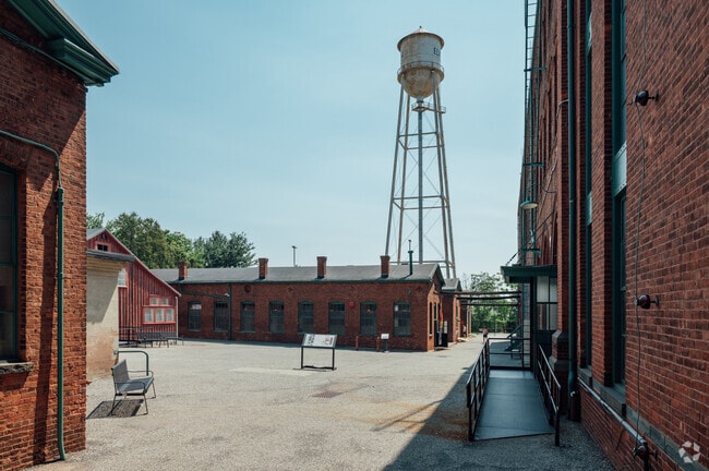
West Orange, NJ, carries the kind of name recognition that most towns never earn, thanks to one of history's greatest inventors calling it home. Thomas Edison built his famed laboratory complex here in the late 1800s, and today the Thomas Edison National Historical Park preserves that legacy for anyone curious enough to explore it. The township spans about 13 square miles in Essex County, striking a balance between a relaxed suburban atmosphere and easy access to New York City.
Neighborhoods range from the storied Llewellyn Park, thought to be one of the country's earliest planned residential communities, to newer developments closer to the commercial corridors along Pleasant Valley Way. Seton Hall University is just minutes away to the southeast, adding an educational anchor to the broader area. The housing mix reflects that variety well, with classic Victorian and Colonial-style single-family homes sharing the landscape alongside townhome communities and well-appointed apartment communities offering everything from cozy studios to spacious multi-bedroom layouts.
Life in West Orange rewards those who want breathing room without sacrificing access to a major metro. The township's tree-lined streets and distinct neighborhoods each carry their own character, making it one of Essex County's most compelling places to put down roots.
The Edison Historical Park preserves the remaining factories operated by Thomas Edison.
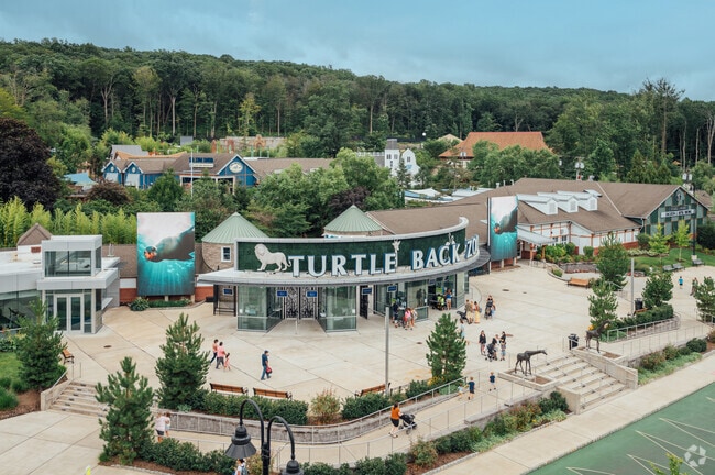
The Turtle Back Zoo is repeatedly ranked the #1 zoo in New Jersey.
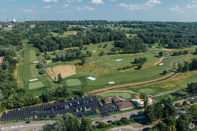
West Orange is home to 5 golf courses, both public and private.
Opened in 2014, The Waterfront is a 1.8 mile loop around the Orange Reservoir.
Regatta Playground in West Orange offers an adventure escape for all ages.
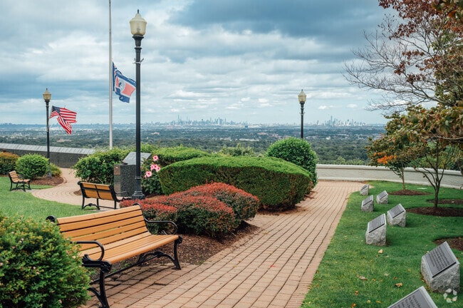
The South Mountain Reservation contains Orange Reservoir and over 2000 acres of green space.
Median Household Income
$120,837
Average: $150,753
Education
20,417
Residents Have a Degree
Job Market
26,183
Workers Employed
Median Age
44 Years
Largest Age Group
50-59 Years
Approximately 14% of Residents
Under 20
23%
Over 65
22%
Housing Distribution
West Orange has more homeowners than renters.

Education Distribution
Review this city's overall education levels.

As of July 2026, the average apartment rent in West Orange, NJ is $2,385 for a studio, $2,224 for one bedroom, $3,011 for two bedrooms, and $3,138 for three bedrooms. Apartment rent in West Orange has decreased by -2.8% in the past year.
Explore how walkable, bikeable, drivable, and transit-friendly West Orange, NJ is for everyday living.
Fairly Walkable
Walkability
Limited Public Transit
Transit
Exceptionally Drivable
Drivability
Fairly Bikeable
Bikeability
Public
Grades K-5
436 Students

Public
Grades K-5
484 Students

Public
Grades K-5
446 Students
Mount Pleasant Elementary School
Public
Grades K-5
349 Students
Hazel Avenue Elementary School
Public
Grades K-5
328 Students
Public
Grades 6-8
559 Students

Public
Grades 6-8
499 Students
Public
Grades 9-12
2,151 Students
† Our analysis of utilities, groceries, transportation, healthcare, home prices, and other goods and services is sourced from the Cost of Living Index, a respected benchmark published by the Council for Community and Economic Research (C2ER) that provides a thorough overview of living expenses across different regions.
Rent data is provided by CoStar Group’s Market Trend reports. As the industry leader in commercial real estate information, analytics, and news, CoStar conducts extensive research to produce and maintain a comprehensive database of commercial real estate information. We combine this data with public record to provide the most up-to-date rental information available.
Consumer goods, services, and home prices are sourced from the Cost of Living Index published by the Council for Community and Economic Research (C2ER). The data on this page is updated quarterly. It was last published in June 2026.
Demographic information comes from Neustar and combines detailed address data with U.S. Census and American Community Survey statistics to produce reliable local estimates.


