
100 Van Ness
100 Van Ness Ave,
San Francisco, CA 94102
Studio - 2 Beds $3,232 - $6,713
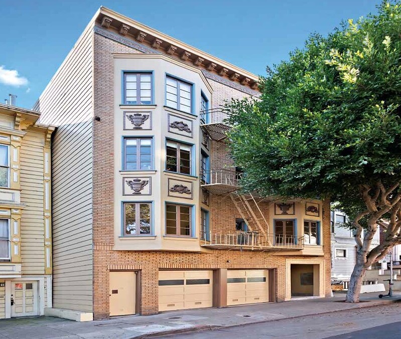
Nicely updated, modern where it needs to be, classic where you want it to be, 1 bedroom flat in a quintessentially classic San Francisco building. Meticulously cared for over the years, the property features newer plumbing with solar heating for the ecologically aware tenant, shared laundry, a common garden, and bike racks for most residents. The units have natural light and SOME units feature refinished hardwood floors, remodeled modern kitchens and plenty of closet space. And then there is the location...hard to beat. Located on a quaint tree-lined section of Pine St. within walking distance of the world-class dining and shopping of the Fillmore district, the convenience of the Divisadero Corridor, and just three blocks to the jewel of San Francisco outdoor space, Alta Plaza Park. Rent: $2,500 Trash and water are included Tenant pays PG&E and internet Security deposit: $2,500 No pets. TO APPLY: Call Prince Hall Apartments and let them know you are interested in the PINE STREET RENTAL and they will get you an application and work directly with you.
2655 Pine St is an apartment community located in San Francisco County and the 94115 ZIP Code. This area is served by the San Francisco Unified attendance zone.
Laundry Facilities
Controlled Access
Bicycle Storage
Security System
Lower Pacific Heights is a vibrant San Francisco neighborhood situated between Pacific Heights, Japantown, the Fillmore District, and Laurel Heights. Formerly known as Upper Fillmore, Lower Pacific Heights offers residents a wide variety of apartments, condos, and houses available for rent, many of which boast scenic views due to the neighborhood’s hilly environment.
Lower Pacific Heights is regarded for its walkable layout, with many rentals situated within easy walking distance of the diverse restaurants, shops, coffeehouses, and bars that line Fillmore Street, the community’s main commercial thoroughfare. The neighborhood’s central locale is a major part of its allure, providing quick access to Union Square, the University of San Francisco, the Financial District, several prominent medical centers, tech employers, landmarks, and more.
Learn more about living in Lower Pacific Heights| Colleges & Universities | Distance | ||
|---|---|---|---|
| Colleges & Universities | Distance | ||
| Walk: | 5 min | 0.3 mi | |
| Drive: | 4 min | 1.2 mi | |
| Drive: | 6 min | 2.1 mi | |
| Drive: | 9 min | 3.2 mi |


Transportation options available in San Francisco include Van Ness And California, located 1.1 miles from 2655 Pine St. 2655 Pine St is near San Francisco International, located 15.3 miles or 25 minutes away, and Metro Oakland International, located 21.2 miles or 35 minutes away.
| Transit / Subway | Distance | ||
|---|---|---|---|
| Transit / Subway | Distance | ||
|
|
Drive: | 3 min | 1.1 mi |
|
|
Drive: | 3 min | 1.3 mi |
|
|
Drive: | 3 min | 1.4 mi |
|
|
Drive: | 5 min | 1.4 mi |
|
|
Drive: | 4 min | 1.6 mi |
| Commuter Rail | Distance | ||
|---|---|---|---|
| Commuter Rail | Distance | ||
| Drive: | 9 min | 4.4 mi | |
| Drive: | 9 min | 4.4 mi | |
| Drive: | 11 min | 5.2 mi | |
| Drive: | 11 min | 5.2 mi | |
| Drive: | 14 min | 7.4 mi |
| Airports | Distance | ||
|---|---|---|---|
| Airports | Distance | ||
|
San Francisco International
|
Drive: | 25 min | 15.3 mi |
|
Metro Oakland International
|
Drive: | 35 min | 21.2 mi |
Time and distance from 2655 Pine St.
| Shopping Centers | Distance | ||
|---|---|---|---|
| Shopping Centers | Distance | ||
| Walk: | 14 min | 0.7 mi | |
| Walk: | 15 min | 0.8 mi | |
| Drive: | 4 min | 1.5 mi |
| Parks and Recreation | Distance | ||
|---|---|---|---|
| Parks and Recreation | Distance | ||
|
Buena Vista Park
|
Drive: | 6 min | 1.5 mi |
|
Exploratorium
|
Drive: | 4 min | 1.7 mi |
|
Conservatory of Flowers
|
Drive: | 5 min | 2.0 mi |
|
Randall Museum
|
Drive: | 7 min | 2.3 mi |
|
San Francisco Maritime National Historical Park
|
Drive: | 6 min | 2.6 mi |
| Hospitals | Distance | ||
|---|---|---|---|
| Hospitals | Distance | ||
| Walk: | 10 min | 0.5 mi | |
| Drive: | 4 min | 1.5 mi | |
| Drive: | 4 min | 1.6 mi |
| Military Bases | Distance | ||
|---|---|---|---|
| Military Bases | Distance | ||
| Drive: | 11 min | 3.7 mi | |
| Drive: | 12 min | 4.1 mi | |
| Drive: | 17 min | 7.4 mi |
What Are Walk Score®, Transit Score®, and Bike Score® Ratings?
Walk Score® measures the walkability of any address. Transit Score® measures access to public transit. Bike Score® measures the bikeability of any address.
What is a Sound Score Rating?
A Sound Score Rating aggregates noise caused by vehicle traffic, airplane traffic and local sources

2655 Pine St
San Francisco, CA 94115


