$1,415
/ Month
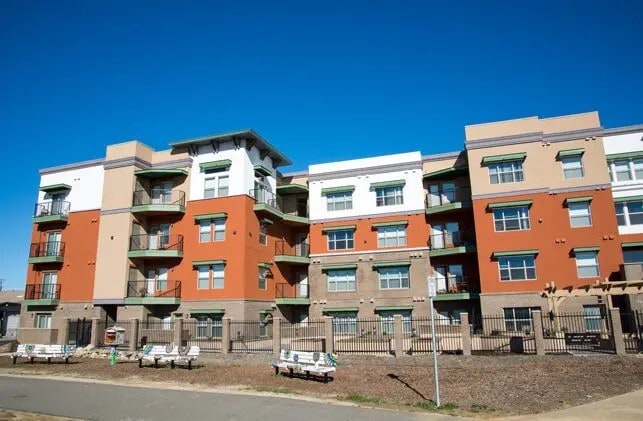
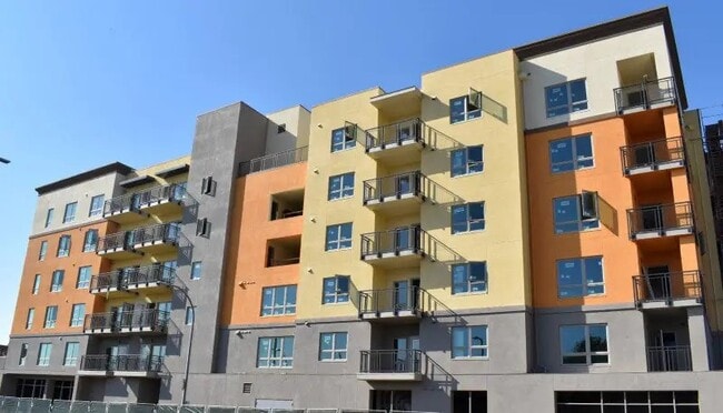
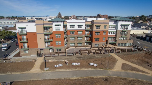
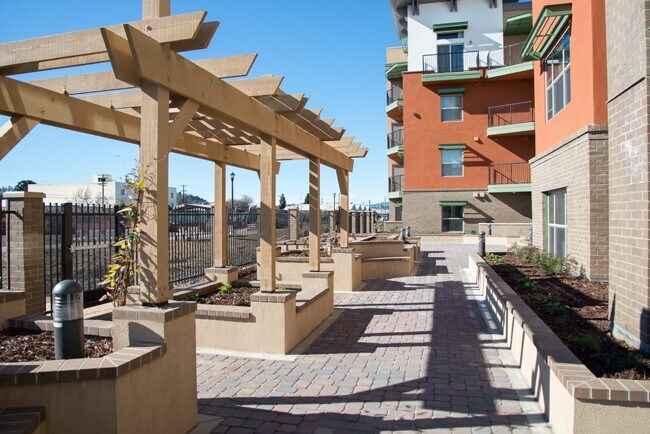
25 Harbour Way
Richmond, CA 94801
Today
|
Edit
Favorites
626-281-8301
-
Bedrooms
1
-
Bathrooms
1
-
Square Feet
--
-
Available
Available Now
Highlight
- Active Adult
25 Harbour Way

Favorites
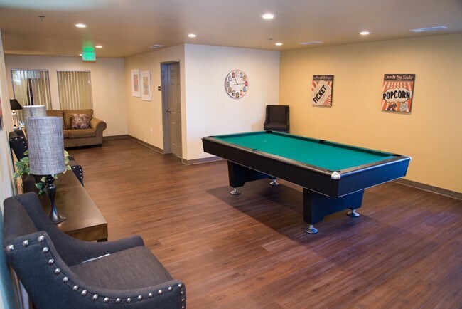
About This Home
Available Now
MLS# 47849611
25 Harbour Way is an apartment community located in Contra Costa County and the 94801 ZIP Code.
* Price shown is base rent. Excludes user-selected optional fees and variable or usage-based fees and required charges due at or prior to move-in or at move-out. Price, availability, fees, and any applicable rent special are subject to change without notice.
* Square footage definitions vary. Displayed square footage is approximate.
Home Details
Year Built
Built in 2014
Bedrooms and Bathrooms
1 Full Bathroom
1 Bedroom
Home Design
Apartment
Listing and Financial Details
Property Available on 3/29/26
12 Month Lease Term
Community Details
Overview
Active Adult
Aperto Property Management Inc Association
Pet Policy
Pets Allowed
Pet Deposit Required
Fees and Policies
The fees listed below are community-provided and may exclude utilities or add-ons. All payments are made directly to the property and are non-refundable unless otherwise specified.
-
Dogs
-
Allowed
-
-
Cats
-
Allowed
-
Property Fee Disclaimer: Based on community-supplied data and independent market research. Subject to change without notice. May exclude fees for mandatory or optional services and usage-based utilities.
Contact
- Listed by Rick Rivera | Rental Housing Deals
- Phone Number
- Contact
-
Source
 Houston Association of REALTORS®
Copyright © 2026 Houston Association of Realtors. All rights reserved. All information provided by the listing agent/broker is deemed reliable but is not guaranteed and should be independently verified.
Location
Get Directions
The Iron Triangle neighborhood sits in the heart of Central Richmond, California. With the area being largely residential, most rentals reside in the upper part of the triangle and an easy three-mile commute north to Point Richmond, a major shipping and industrial area. To the south, Berkeley and Oakland lie roughly 10 miles away via Interstate 580.
Locals often head for the Miller/Knox Regional Shoreline for a bit of jogging or cycling, or to cast a line off the fishing pier. Wade into the waters of San Francisco Bay at Keller Beach on the northern end of the park, or enjoy a show at the Masquers Playhouse, also just outside the Iron Triangle's southern border. Most eateries sit along Interstate 580, including several fast food chains. The MacDonald 80 Shopping Center lies roughly three miles east of the neighborhood. Drive another three miles and find Wildcat Canyon Regional Park and the Tilden Nature Area.
Learn more about living in Iron Triangle
Education
| Colleges & Universities | Distance | ||
|---|---|---|---|
| Colleges & Universities | Distance | ||
| Drive: | 8 min | 3.6 mi | |
| Drive: | 15 min | 8.8 mi | |
| Drive: | 19 min | 9.8 mi | |
| Drive: | 18 min | 11.4 mi |
25 Harbour Way is within 8 minutes or 3.6 miles from Contra Costa College. It is also near Berkeley City College and UC Berkeley.
Transportation options available in Richmond include Richmond Station, located 1.1 miles from 25 Harbour Way. 25 Harbour Way is near Metro Oakland International, located 21.8 miles or 30 minutes away, and San Francisco International, located 29.4 miles or 42 minutes away.
| Transit / Subway | Distance | ||
|---|---|---|---|
| Transit / Subway | Distance | ||
|
|
Drive: | 2 min | 1.1 mi |
|
|
Drive: | 7 min | 3.3 mi |
|
|
Drive: | 9 min | 5.5 mi |
|
|
Drive: | 13 min | 8.2 mi |
|
|
Drive: | 15 min | 8.9 mi |
| Commuter Rail | Distance | ||
|---|---|---|---|
| Commuter Rail | Distance | ||
| Walk: | 13 min | 0.7 mi | |
|
|
Drive: | 9 min | 6.9 mi |
| Drive: | 13 min | 9.2 mi | |
| Drive: | 16 min | 9.6 mi | |
| Drive: | 16 min | 10.6 mi |
| Airports | Distance | ||
|---|---|---|---|
| Airports | Distance | ||
|
Metro Oakland International
|
Drive: | 30 min | 21.8 mi |
|
San Francisco International
|
Drive: | 42 min | 29.4 mi |
Getting Around
 What do Walkability, Transit, Drivability, and Bikeability mean?
Walkability measures the walking distance to day-to-day needs.
Transit measures access to public transportation.
Drivability measures congestion, parking availability, and access to major roads.
Bikeability measures the suitability for cycling.
How It Works
What do Walkability, Transit, Drivability, and Bikeability mean?
Walkability measures the walking distance to day-to-day needs.
Transit measures access to public transportation.
Drivability measures congestion, parking availability, and access to major roads.
Bikeability measures the suitability for cycling.
How It Works
Fairly Walkable
Walkability
50
/ 100
Some Public Transit
Transit
50
/ 100
Very Drivable
Drivability
80
/ 100
Moderately Bikeable
Bikeability
60
/ 100
Scores provided by
Active
Soundscore™
68
/ 100
Traffic
BusyAirport
CalmBusinesses
BusyScores provided by
HowLoud What is a Sound Score Rating? A Sound Score Rating aggregates noise caused by vehicle traffic, airplane traffic and local sources. How It WorksTime and distance from 25 Harbour Way.
| Shopping Centers | Distance | ||
|---|---|---|---|
| Shopping Centers | Distance | ||
| Walk: | 7 min | 0.4 mi | |
| Drive: | 3 min | 1.6 mi | |
| Drive: | 6 min | 2.3 mi |
25 Harbour Way has 3 shopping centers within 2.3 miles, which is about a 6-minute drive. The miles and minutes will be for the farthest away property.
| Parks and Recreation | Distance | ||
|---|---|---|---|
| Parks and Recreation | Distance | ||
|
Rosie the Riveter WWII Home Front National Historical Park
|
Drive: | 4 min | 1.7 mi |
|
Marina Park & Green
|
Drive: | 4 min | 1.9 mi |
|
Shimada Friendship Park
|
Drive: | 6 min | 2.6 mi |
|
Miller/Knox Regional Shoreline
|
Drive: | 5 min | 2.8 mi |
|
Brooks Island Regional Preserve
|
Drive: | 9 min | 4.2 mi |
25 Harbour Way has 5 parks within 4.2 miles, including Rosie the Riveter WWII Home Front National Historical Park, Marina Park & Green, and Shimada Friendship Park.
| Hospitals | Distance | ||
|---|---|---|---|
| Hospitals | Distance | ||
| Drive: | 18 min | 10.4 mi | |
| Drive: | 15 min | 11.3 mi | |
| Drive: | 15 min | 11.4 mi |
25 Harbour Way has 3 hospitals within 11.4 miles, the nearest is Alta Bates Summit Medical Center - Alta Bates Campus which is 10.4 miles away and a 18 minute drive.
| Military Bases | Distance | ||
|---|---|---|---|
| Military Bases | Distance | ||
| Drive: | 7 min | 3.6 mi | |
| Drive: | 13 min | 5.7 mi | |
| Drive: | 24 min | 15.4 mi |
25 Harbour Way has 3 military bases within 15.4 miles, the nearest is Armory West Contra Costa which is 3.6 miles away and a 7 minute drive.
You May Also Like
-
Isle House
39 Bruton St
San Francisco, CA 94130
$3,637 - $7,642 Total Monthly Price
1-3 Br 7.8 mi
-
Lakewood Apartments At Lake Merced
515 John Muir Dr
San Francisco, CA 94132
$2,878 - $4,378
1-2 Br 16.7 mi
-
Stoneridge Luxury Apartments
101 Hogan Ct
Walnut Creek, CA 94598
$2,372 - $3,360
1-2 Br 17.0 mi
Similar Rentals Nearby
-
-
-
-
1 Bed$2,434+2 Beds$4,511+Total Monthly PriceTotal Monthly Price NewPrices include base rent and required monthly fees of $5. Variable costs based on usage may apply.Base Rent:1 Bed$2,429+2 Beds$4,506+2 Months Free
Pets Allowed Fitness Center In Unit Washer & Dryer Walk-In Closets Stainless Steel Appliances Hardwood Floors EV Charging
-
-
-
-
-
-


What Are Walk Score®, Transit Score®, and Bike Score® Ratings?
Walk Score® measures the walkability of any address. Transit Score® measures access to public transit. Bike Score® measures the bikeability of any address.
What is a Sound Score Rating?
A Sound Score Rating aggregates noise caused by vehicle traffic, airplane traffic and local sources.

25 Harbour Way
Richmond, CA 94801