
Hanover Soma West
1140 Harrison St,
San Francisco, CA 94103
$3,475 - $8,729 Total Monthly Price
Studio - 3 Beds

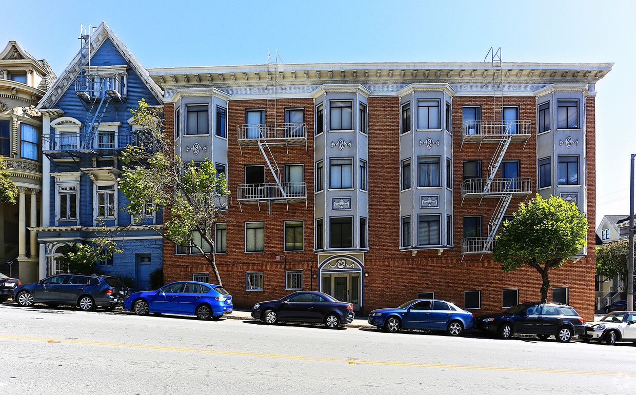
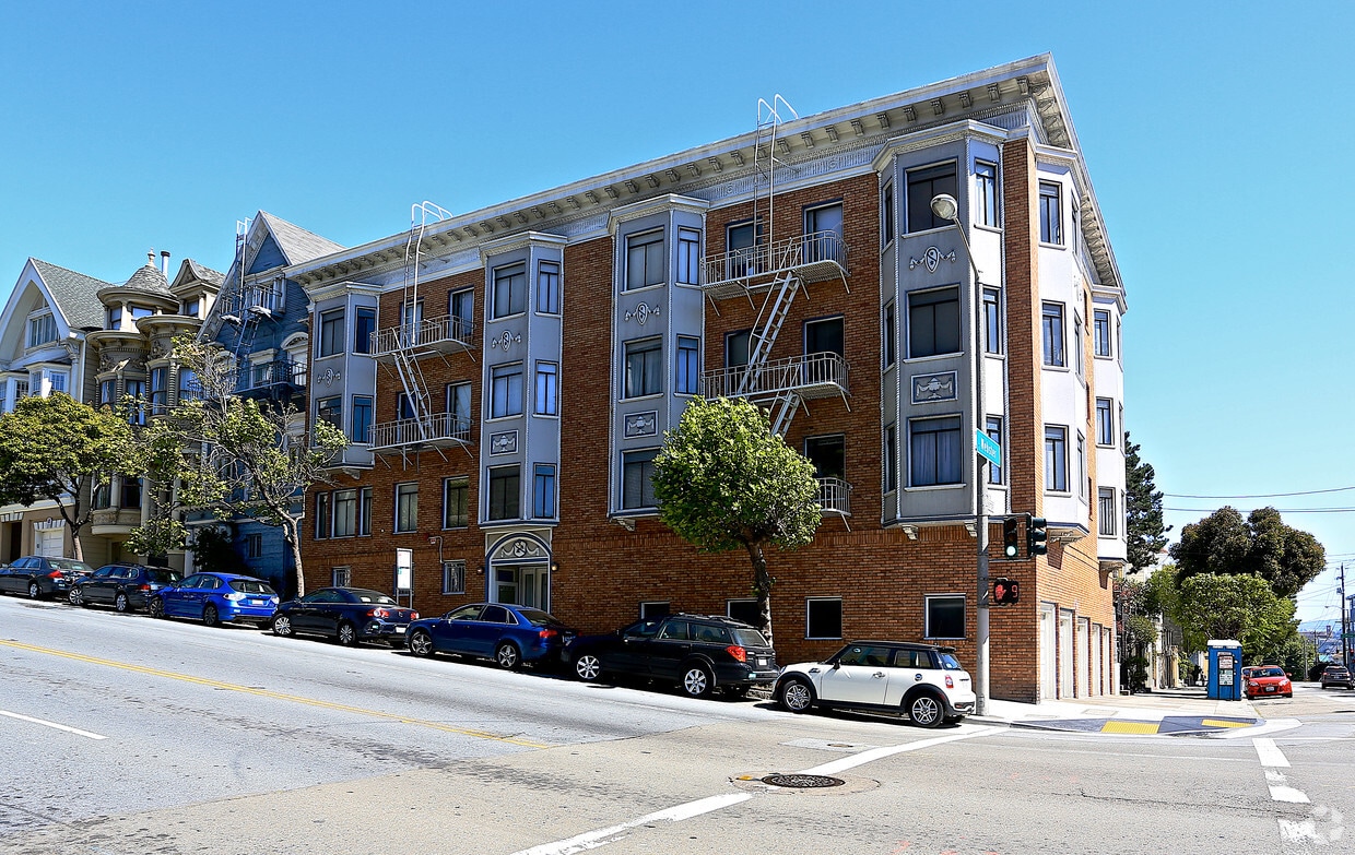

Find true San Francisco living at 2295 California St. The premium California St. location in the 94115 Zip code of San Francisco is a great place to move to. Make a visit to see the current floorplan options. Here at this community, the leasing staff is excited to help you find the perfect new home. At 2295 California St you're right at home.
2295 California St is an apartment community located in San Francisco County and the 94115 ZIP Code. This area is served by the San Francisco Unified School District attendance zone.
Lower Pacific Heights is a vibrant San Francisco neighborhood situated between Pacific Heights, Japantown, the Fillmore District, and Laurel Heights. Formerly known as Upper Fillmore, Lower Pacific Heights offers residents a wide variety of apartments, condos, and houses available for rent, many of which boast scenic views due to the neighborhood’s hilly environment.
Lower Pacific Heights is regarded for its walkable layout, with many rentals situated within easy walking distance of the diverse restaurants, shops, coffeehouses, and bars that line Fillmore Street, the community’s main commercial thoroughfare. The neighborhood’s central locale is a major part of its allure, providing quick access to Union Square, the University of San Francisco, the Financial District, several prominent medical centers, tech employers, landmarks, and more.
Learn more about living in Lower Pacific HeightsCompare neighborhood and city base rent averages by bedroom.
| Lower Pacific Heights | San Francisco, CA | |
|---|---|---|
| Studio | $2,658 | $2,590 |
| 1 Bedroom | $3,040 | $3,419 |
| 2 Bedrooms | $4,476 | $4,674 |
| 3 Bedrooms | $5,619 | $5,875 |
| Colleges & Universities | Distance | ||
|---|---|---|---|
| Colleges & Universities | Distance | ||
| Walk: | 12 min | 0.7 mi | |
| Drive: | 4 min | 1.5 mi | |
| Drive: | 5 min | 1.7 mi | |
| Drive: | 6 min | 2.2 mi |


Transportation options available in San Francisco include Van Ness And California, located 0.6 mile from 2295 California St. 2295 California St is near San Francisco International, located 14.9 miles or 24 minutes away, and Metro Oakland International, located 20.7 miles or 33 minutes away.
| Transit / Subway | Distance | ||
|---|---|---|---|
| Transit / Subway | Distance | ||
|
|
Walk: | 10 min | 0.6 mi |
|
|
Walk: | 14 min | 0.7 mi |
|
|
Walk: | 15 min | 0.8 mi |
|
|
Walk: | 17 min | 0.9 mi |
| Walk: | 19 min | 1.0 mi |
| Commuter Rail | Distance | ||
|---|---|---|---|
| Commuter Rail | Distance | ||
| Drive: | 7 min | 2.8 mi | |
| Drive: | 14 min | 7.1 mi | |
| Drive: | 19 min | 10.2 mi | |
|
|
Drive: | 20 min | 11.8 mi |
|
|
Drive: | 22 min | 12.3 mi |
| Airports | Distance | ||
|---|---|---|---|
| Airports | Distance | ||
|
San Francisco International
|
Drive: | 24 min | 14.9 mi |
|
Metro Oakland International
|
Drive: | 33 min | 20.7 mi |
Scores provided by
Traffic
-Airport
-Businesses
-Scores provided by
HowLoud What is a Sound Score Rating? A Sound Score Rating aggregates noise caused by vehicle traffic, airplane traffic and local sources. How It WorksTime and distance from 2295 California St.
| Shopping Centers | Distance | ||
|---|---|---|---|
| Shopping Centers | Distance | ||
| Walk: | 7 min | 0.4 mi | |
| Walk: | 13 min | 0.7 mi |
| Parks and Recreation | Distance | ||
|---|---|---|---|
| Parks and Recreation | Distance | ||
|
Exploratorium
|
Drive: | 5 min | 2.0 mi |
|
San Francisco Maritime National Historical Park
|
Drive: | 5 min | 2.0 mi |
|
Children's Creativity Museum
|
Drive: | 6 min | 2.1 mi |
|
Buena Vista Park
|
Drive: | 6 min | 2.2 mi |
|
Randall Museum
|
Drive: | 8 min | 2.7 mi |
| Hospitals | Distance | ||
|---|---|---|---|
| Hospitals | Distance | ||
| Walk: | 16 min | 0.8 mi | |
| Walk: | 17 min | 0.9 mi | |
| Drive: | 3 min | 1.3 mi |
| Military Bases | Distance | ||
|---|---|---|---|
| Military Bases | Distance | ||
| Drive: | 11 min | 4.1 mi | |
| Drive: | 12 min | 4.4 mi | |
| Drive: | 16 min | 6.8 mi |
What Are Walk Score®, Transit Score®, and Bike Score® Ratings?
Walk Score® measures the walkability of any address. Transit Score® measures access to public transit. Bike Score® measures the bikeability of any address.
What is a Sound Score Rating?
A Sound Score Rating aggregates noise caused by vehicle traffic, airplane traffic and local sources.
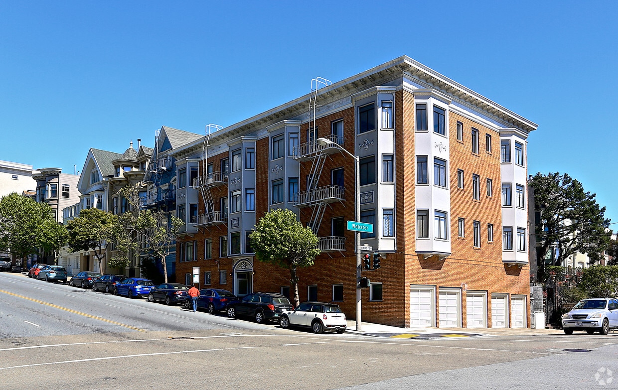
2295 California St
San Francisco, CA 94115


