
Summerwood
21701 Foothill Blvd,
Hayward, CA 94541
$2,199 - $2,695
1-3 Beds

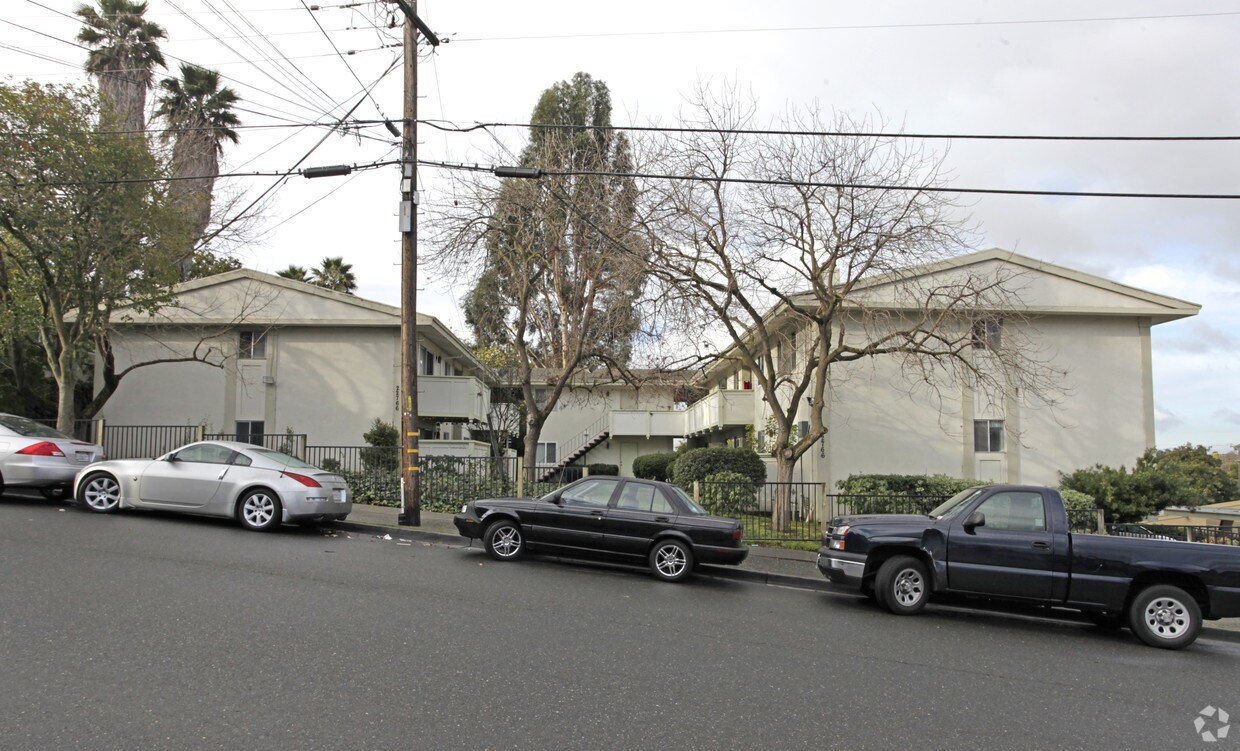
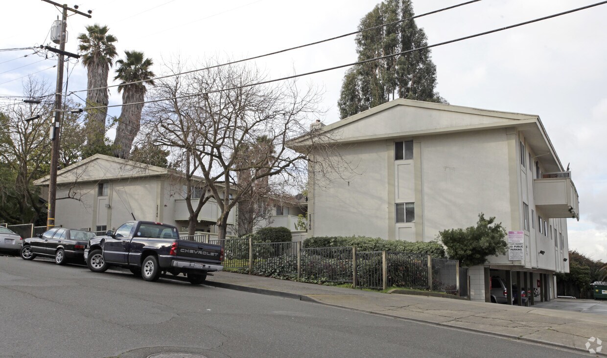
Find your new home at 22766 Vermont St in Hayward, CA. You'll find this community in the Upper B Street area of Hayward. The professional leasing staff is ready for you to come see our property. Stop by the leasing office to see everything we have to offer.
22766 Vermont St is an apartment community located in Alameda County and the 94541 ZIP Code. This area is served by the Hayward Unified School District attendance zone.
Situated in the northeastern-most part of Hayward, Upper B Street offers plenty of affordable rental options and convenient amenities along with easy access to several nearby highways and BART stations. Aside from its remarkable accessibility, Upper B Street’s quiet boulevards lined with charming bungalows and mature trees make the neighborhood stand out.
Located about one mile northeast of Downtown Hayward, Upper B Street is surrounded by a host of lush green spaces for residents to enjoy as well as numerous urban amenities. Hayward Japanese Gardens, Sulphur Creek Nature Center, Don Castro Regional Recreation Area, and Lake Chabot Regional Park are all situated within close proximity to the neighborhood.
The many metropolitan delights of San Francisco are about 27 miles northwest of Upper B Street. Southland Mall offers a bevy of shopping and dining opportunities a little closer to home, sitting just three miles southwest of the neighborhood.
Learn more about living in Upper B StreetCompare neighborhood and city base rent averages by bedroom.
| Upper B Street | Hayward, CA | |
|---|---|---|
| Studio | - | $1,993 |
| 1 Bedroom | $1,831 | $2,115 |
| 2 Bedrooms | $1,978 | $2,390 |
| 3 Bedrooms | $2,664 | $2,796 |
| Colleges & Universities | Distance | ||
|---|---|---|---|
| Colleges & Universities | Distance | ||
| Drive: | 9 min | 3.6 mi | |
| Drive: | 12 min | 5.2 mi | |
| Drive: | 20 min | 12.5 mi | |
| Drive: | 22 min | 13.8 mi |


Transportation options available in Hayward include Hayward Station, located 1.8 miles from 22766 Vermont St. 22766 Vermont St is near Metro Oakland International, located 11.5 miles or 18 minutes away, and San Francisco International, located 24.5 miles or 34 minutes away.
| Transit / Subway | Distance | ||
|---|---|---|---|
| Transit / Subway | Distance | ||
|
|
Drive: | 5 min | 1.8 mi |
|
|
Drive: | 5 min | 2.5 mi |
|
|
Drive: | 12 min | 4.7 mi |
|
|
Drive: | 10 min | 5.3 mi |
|
|
Drive: | 14 min | 8.8 mi |
| Commuter Rail | Distance | ||
|---|---|---|---|
| Commuter Rail | Distance | ||
|
|
Drive: | 7 min | 2.5 mi |
| Drive: | 7 min | 2.5 mi | |
| Drive: | 20 min | 11.5 mi | |
| Drive: | 21 min | 11.7 mi | |
| Drive: | 19 min | 13.2 mi |
| Airports | Distance | ||
|---|---|---|---|
| Airports | Distance | ||
|
Metro Oakland International
|
Drive: | 18 min | 11.5 mi |
|
San Francisco International
|
Drive: | 34 min | 24.5 mi |
Scores provided by
Traffic
-Airport
-Businesses
-Scores provided by
HowLoud What is a Sound Score Rating? A Sound Score Rating aggregates noise caused by vehicle traffic, airplane traffic and local sources. How It WorksTime and distance from 22766 Vermont St.
| Shopping Centers | Distance | ||
|---|---|---|---|
| Shopping Centers | Distance | ||
| Walk: | 2 min | 0.1 mi | |
| Walk: | 4 min | 0.2 mi | |
| Drive: | 4 min | 1.4 mi |
| Parks and Recreation | Distance | ||
|---|---|---|---|
| Parks and Recreation | Distance | ||
|
Don Castro Regional Recreation Area
|
Walk: | 18 min | 0.9 mi |
|
Sulphur Creek Nature Center
|
Drive: | 5 min | 1.7 mi |
|
Cull Canyon Regional Recreation Area
|
Drive: | 7 min | 2.5 mi |
|
Lake Chabot Regional Park
|
Drive: | 9 min | 4.1 mi |
|
Hayward Regional Shoreline
|
Drive: | 17 min | 8.1 mi |
| Hospitals | Distance | ||
|---|---|---|---|
| Hospitals | Distance | ||
| Drive: | 11 min | 5.0 mi | |
| Drive: | 9 min | 5.0 mi | |
| Drive: | 13 min | 7.8 mi |
| Military Bases | Distance | ||
|---|---|---|---|
| Military Bases | Distance | ||
| Drive: | 30 min | 18.9 mi | |
| Drive: | 30 min | 19.1 mi | |
| Drive: | 30 min | 19.2 mi |
Pets Allowed Fitness Center In Unit Washer & Dryer Stainless Steel Appliances Business Center Package Service Elevator
What Are Walk Score®, Transit Score®, and Bike Score® Ratings?
Walk Score® measures the walkability of any address. Transit Score® measures access to public transit. Bike Score® measures the bikeability of any address.
What is a Sound Score Rating?
A Sound Score Rating aggregates noise caused by vehicle traffic, airplane traffic and local sources.
22766 Vermont St
Hayward, CA 94541


