The Village at Town Center
6410 Schmidt Ln,
El Cerrito, CA 94530
Studio - 2 Beds $2,100 - $3,060


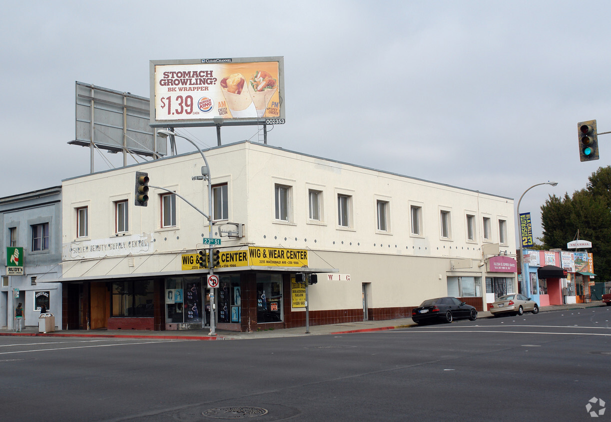
Find your new apartment at 2229-2235 Macdonald Ave. This property is situated in the Belding Woods area of Richmond. The professional leasing team will assist you in finding the best floor plan for your lifestyle. It's time to love where you live. Stop by for a visit today.
2229-2235 Macdonald Ave is an apartment community located in Contra Costa County and the 94801 ZIP Code. This area is served by the West Contra Costa Unified attendance zone.
Belding Woods is a low-key suburban community right in the heart of Richmond. The neighborhood is almost entirely residential, with small corner grocery stores and locally-owned restaurants along 23rd Street and scattered among the blocks of houses. The cost of living is relatively low for the location, and rent tends to be quite affordable as well.
The NIAD Art Center, Richmond Art Center, and Richmond Auditorium are nearby, helping feed the community’s cultural appetites. Kaiser Permanente Richmond Medical Center is just a few blocks away, making Belding Woods a great location for healthcare professionals. Amtrak and BART rail service are both available from Richmond Station at the southwest corner of the neighborhood, putting the entire Bay Area (and beyond) at your fingertips, even without the use of a personal vehicle.
Learn more about living in Belding Woods| Colleges & Universities | Distance | ||
|---|---|---|---|
| Colleges & Universities | Distance | ||
| Drive: | 6 min | 2.8 mi | |
| Drive: | 15 min | 8.6 mi | |
| Drive: | 19 min | 9.6 mi | |
| Drive: | 15 min | 11.2 mi |
 The GreatSchools Rating helps parents compare schools within a state based on a variety of school quality indicators and provides a helpful picture of how effectively each school serves all of its students. Ratings are on a scale of 1 (below average) to 10 (above average) and can include test scores, college readiness, academic progress, advanced courses, equity, discipline and attendance data. We also advise parents to visit schools, consider other information on school performance and programs, and consider family needs as part of the school selection process.
Transportation options available in Richmond include Richmond Station, located 0.4 mile from 2229-2235 Macdonald Ave. 2229-2235 Macdonald Ave is near Metro Oakland International, located 21.6 miles or 30 minutes away, and San Francisco International, located 29.2 miles or 42 minutes away.
| Transit / Subway | Distance | ||
|---|---|---|---|
| Transit / Subway | Distance | ||
|
|
Walk: | 7 min | 0.4 mi |
|
|
Drive: | 5 min | 2.3 mi |
|
|
Drive: | 5 min | 2.3 mi |
|
|
Drive: | 8 min | 4.4 mi |
|
|
Drive: | 13 min | 8.0 mi |
| Commuter Rail | Distance | ||
|---|---|---|---|
| Commuter Rail | Distance | ||
| Walk: | 8 min | 0.4 mi | |
|
|
Drive: | 10 min | 7.2 mi |
|
|
Drive: | 13 min | 9.0 mi |
| Drive: | 18 min | 10.7 mi | |
| Drive: | 18 min | 11.6 mi |
| Airports | Distance | ||
|---|---|---|---|
| Airports | Distance | ||
|
Metro Oakland International
|
Drive: | 30 min | 21.6 mi |
|
San Francisco International
|
Drive: | 42 min | 29.2 mi |
Time and distance from 2229-2235 Macdonald Ave.
| Shopping Centers | Distance | ||
|---|---|---|---|
| Shopping Centers | Distance | ||
| Walk: | 11 min | 0.6 mi | |
| Drive: | 4 min | 1.7 mi | |
| Drive: | 5 min | 2.6 mi |
| Parks and Recreation | Distance | ||
|---|---|---|---|
| Parks and Recreation | Distance | ||
|
Marina Park & Green
|
Drive: | 4 min | 1.8 mi |
|
Rosie the Riveter WWII Home Front National Historical Park
|
Drive: | 5 min | 2.3 mi |
|
Shimada Friendship Park
|
Drive: | 5 min | 2.3 mi |
|
Miller/Knox Regional Shoreline
|
Drive: | 7 min | 3.5 mi |
|
Brooks Island Regional Preserve
|
Drive: | 11 min | 5.2 mi |
| Hospitals | Distance | ||
|---|---|---|---|
| Hospitals | Distance | ||
| Drive: | 18 min | 10.2 mi | |
| Drive: | 16 min | 11.1 mi | |
| Drive: | 15 min | 11.1 mi |
| Military Bases | Distance | ||
|---|---|---|---|
| Military Bases | Distance | ||
| Drive: | 5 min | 2.7 mi | |
| Drive: | 10 min | 5.1 mi | |
| Drive: | 24 min | 15.2 mi |
What Are Walk Score®, Transit Score®, and Bike Score® Ratings?
Walk Score® measures the walkability of any address. Transit Score® measures access to public transit. Bike Score® measures the bikeability of any address.
What is a Sound Score Rating?
A Sound Score Rating aggregates noise caused by vehicle traffic, airplane traffic and local sources