
The Franklin at Hancock Village
201 Sherman Rd,
Brookline, MA 02445
$3,240 - $7,465 Plus Fees
1-3 Beds 12 Month Lease
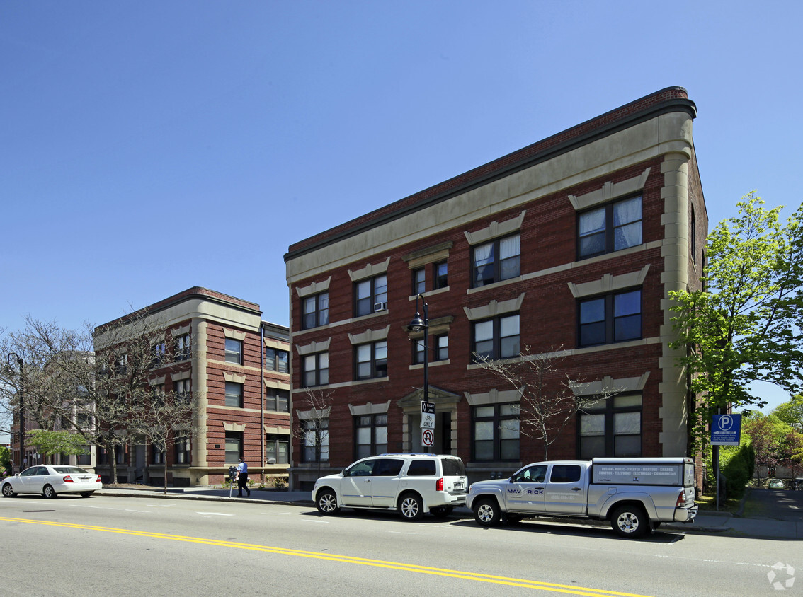
Find your new home at 219 Harvard St. This community is located at 217-221 Harvard St in the Coolidge Corner area of Brookline. The professional leasing staff is ready to show you our community. It's time to love where you live. Stop by for a visit today.
219 Harvard St is an apartment community located in Norfolk County and the 02446 ZIP Code. This area is served by the Brookline attendance zone.
Refrigerator
Heating
Oven
Range
Located just four miles west of Downtown Boston, Coolidge Corner is a vibrant commercial hub brimming with activity and gorgeous historical buildings. Residents enjoy a large selection of shops, bookstores, restaurants, and coffee houses in Coolidge Corner as well as access to the landmark Coolidge Theatre, an Art Deco-inspired venue showcasing the best of contemporary art house and independent film.
Coolidge Corner exudes a nostalgic charm, and has attracted shoppers for more than 150 years. There’s a healthy mix of local businesses and familiar chains in Coolidge Corner, offering residents the best of both worlds. Home to its own T stop, Coolidge Corner is an ideal spot for commuters and college students alike.
Learn more about living in Coolidge Corner| Colleges & Universities | Distance | ||
|---|---|---|---|
| Colleges & Universities | Distance | ||
| Drive: | 3 min | 1.1 mi | |
| Drive: | 3 min | 1.5 mi | |
| Drive: | 3 min | 1.5 mi | |
| Drive: | 3 min | 1.6 mi |


Transportation options available in Brookline include Coolidge Corner Station, located 0.1 mile from 219 Harvard St. 219 Harvard St is near General Edward Lawrence Logan International, located 7.3 miles or 16 minutes away.
| Transit / Subway | Distance | ||
|---|---|---|---|
| Transit / Subway | Distance | ||
|
|
Walk: | 2 min | 0.1 mi |
|
|
Walk: | 6 min | 0.3 mi |
|
|
Walk: | 6 min | 0.3 mi |
|
|
Walk: | 9 min | 0.5 mi |
|
|
Walk: | 9 min | 0.5 mi |
| Commuter Rail | Distance | ||
|---|---|---|---|
| Commuter Rail | Distance | ||
|
|
Drive: | 5 min | 2.3 mi |
|
|
Drive: | 9 min | 3.0 mi |
|
|
Drive: | 6 min | 3.3 mi |
|
|
Drive: | 8 min | 3.6 mi |
| Drive: | 12 min | 5.9 mi |
| Airports | Distance | ||
|---|---|---|---|
| Airports | Distance | ||
|
General Edward Lawrence Logan International
|
Drive: | 16 min | 7.3 mi |
Time and distance from 219 Harvard St.
| Shopping Centers | Distance | ||
|---|---|---|---|
| Shopping Centers | Distance | ||
| Walk: | 15 min | 0.8 mi | |
| Walk: | 15 min | 0.8 mi | |
| Walk: | 19 min | 1.0 mi |
| Parks and Recreation | Distance | ||
|---|---|---|---|
| Parks and Recreation | Distance | ||
|
John Fitzgerald Kennedy National Historic Site
|
Walk: | 10 min | 0.6 mi |
|
Frederick Law Olmsted National Historic Site
|
Drive: | 3 min | 1.4 mi |
|
Chestnut Hill Reservation
|
Drive: | 3 min | 1.7 mi |
|
Coit Observatory
|
Drive: | 4 min | 2.0 mi |
|
Charles River Reservation
|
Drive: | 5 min | 2.4 mi |
| Hospitals | Distance | ||
|---|---|---|---|
| Hospitals | Distance | ||
| Walk: | 15 min | 0.8 mi | |
| Walk: | 17 min | 0.9 mi | |
| Walk: | 18 min | 0.9 mi |
| Military Bases | Distance | ||
|---|---|---|---|
| Military Bases | Distance | ||
| Drive: | 25 min | 14.3 mi | |
| Drive: | 28 min | 14.5 mi |
What Are Walk Score®, Transit Score®, and Bike Score® Ratings?
Walk Score® measures the walkability of any address. Transit Score® measures access to public transit. Bike Score® measures the bikeability of any address.
What is a Sound Score Rating?
A Sound Score Rating aggregates noise caused by vehicle traffic, airplane traffic and local sources


