

$2,100
/ Month
2156 N 9th St Unit 2
Philadelphia, PA 19122
Today
|
Edit
Favorites
267-774-6886
-
Bedrooms
3
-
Bathrooms
3
-
Square Feet
--
-
Available
Available Now
Highlights
- Built in 2024 | New Construction
- Open Floorplan
- Contemporary Architecture
- Main Floor Bedroom
- Combination Kitchen and Living
- Stainless Steel Appliances
2156 N 9th St Unit 2

Favorites
About This Home
Available Now
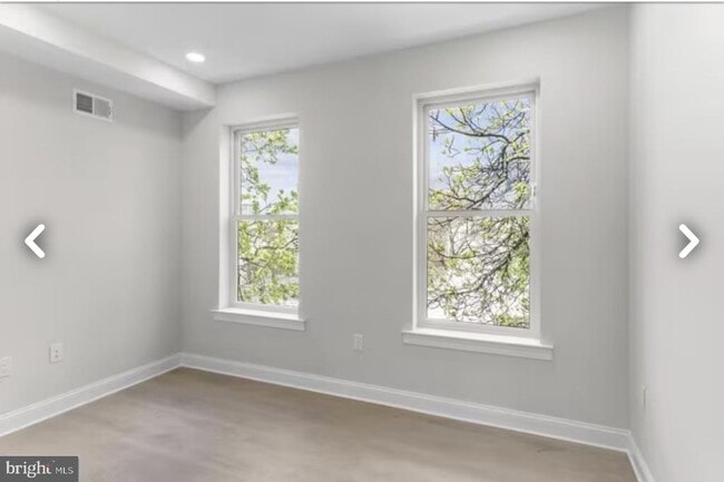
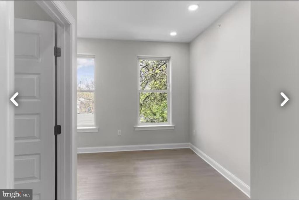
This spacious bi-level unit offers an open-concept living area with high ceilings, oversized windows, and great natural light. The kitchen features contemporary cabinets, stainless-steel appliances, and plenty of counter space—perfect for cooking and entertaining. Each bedroom is generously sized and designed with privacy in mind, with every room having its own full bathroom, making this ideal for families, roommates, or anyone wanting extra comfort. The unit also includes in-unit laundry for added convenience. Upstairs, enjoy private rooftop access—perfect for relaxing, hosting, or taking in city views. Located near Temple University, public transit, and local shops, this unit offers both comfort and convenience in a growing neighborhood. Schedule your showing today!
Unique Features
- NewConstruction
2156 N 9th St is an apartment community located in Philadelphia County and the 19122 ZIP Code.
* Price shown is base rent. Excludes user-selected optional fees and variable or usage-based fees and required charges due at or prior to move-in or at move-out. Price, availability, fees, and any applicable rent special are subject to change without notice.
* Square footage definitions vary. Displayed square footage is approximate.
Home Details
Home Type
Condominium
Year Built
Built in 2024 | New Construction
Bedrooms and Bathrooms
3 Bedrooms | 1 Main Level Bedroom
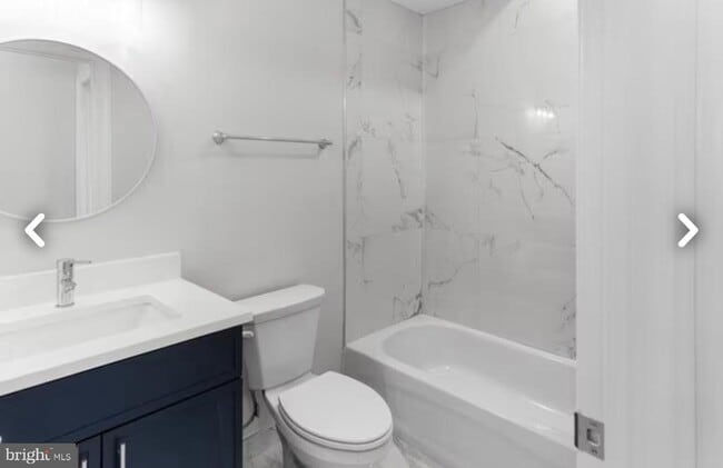
3 Full Bathrooms
Home Design
Contemporary Architecture
Brick Exterior Construction
Entry on the 1st floor
Interior Spaces
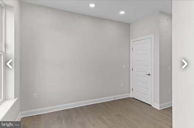
Open Floorplan
Combination Kitchen and Living
1,250 Sq Ft Home
Property has 2 Levels
Kitchen
Stainless Steel Appliances
ENERGY STAR Qualified Dishwasher
ENERGY STAR Qualified Refrigerator
Electric Oven or Range
Microwave
Laundry
Stacked Washer and Dryer
Listing and Financial Details
Security Deposit $2,100
12-Month Lease Term
Available 11/19/25
Assessor Parcel Number 202168600
Residential Lease
Lot Details
798 Sq Ft Lot
Property is in excellent condition
Lot Dimensions are 14.00 x 56.00
Parking
On-Street Parking
Utilities
90% Forced Air Heating and Cooling System
60 Gallon+ Water Heater
Community Details
Overview
4 Units
Low-Rise Condominium
Norris Square Subdivision
Pet Policy
Pets allowed on a case-by-case basis
Contact
- Listed by Gazi Ataseven | HomeSmart First Advantage Realty
- Phone Number
- Contact
-
Source
 Bright MLS, Inc.
Copyright © 2025 Bright MLS, Inc.
Location
Get Directions
Amenities
- Basement
- NewConstruction
Not to be confused with Northeast Philadelphia, North Philadelphia East encompasses the smaller subsets of Ludlow, Yorktown, West Kensington, Poplar, and Callowhill. This composite area runs from the Vine Street Expressway, stretching north to Erie Avenue. Broad Street acts as its eastern border, and the western edge runs a jagged line separating North Philadelphia East from the nearby Kensington, Port Richmond, and Fishtown neighborhoods. With such a long stretch of city, the neighborhood offers a diverse blend of important city landmarks, such as renowned musical venues the Electric Factory and Union Transfer, and Temple University, North Philadelphia's premiere site of higher learning.
Learn more about living in North Philadelphia East
Education
| Colleges & Universities | Distance | ||
|---|---|---|---|
| Colleges & Universities | Distance | ||
| Walk: | 12 min | 0.7 mi | |
| Drive: | 4 min | 1.5 mi | |
| Drive: | 7 min | 2.6 mi | |
| Drive: | 8 min | 2.6 mi |
2156 N 9th St Unit 2 is within 12 minutes or 0.7 mile from Temple University, Main Campus. It is also near Temple Univ., Health Center and C.C. of Philadelphia.
Transportation options available in Philadelphia include Susquehanna-Dauphin, located 0.5 mile from 2156 N 9th St Unit 2. 2156 N 9th St Unit 2 is near Philadelphia International, located 14.7 miles or 26 minutes away, and Trenton Mercer, located 33.1 miles or 51 minutes away.
| Transit / Subway | Distance | ||
|---|---|---|---|
| Transit / Subway | Distance | ||
|
|
Walk: | 10 min | 0.5 mi |
|
|
Walk: | 18 min | 0.9 mi |
|
|
Drive: | 3 min | 1.3 mi |
|
|
Drive: | 4 min | 1.4 mi |
| Drive: | 4 min | 1.6 mi |
| Commuter Rail | Distance | ||
|---|---|---|---|
| Commuter Rail | Distance | ||
|
|
Walk: | 7 min | 0.4 mi |
|
|
Walk: | 20 min | 1.0 mi |
|
|
Drive: | 3 min | 1.1 mi |
|
|
Drive: | 5 min | 1.5 mi |
|
|
Drive: | 5 min | 2.1 mi |
| Airports | Distance | ||
|---|---|---|---|
| Airports | Distance | ||
|
Philadelphia International
|
Drive: | 26 min | 14.7 mi |
|
Trenton Mercer
|
Drive: | 51 min | 33.1 mi |
Time and distance from 2156 N 9th St Unit 2.
| Shopping Centers | Distance | ||
|---|---|---|---|
| Shopping Centers | Distance | ||
| Walk: | 13 min | 0.7 mi | |
| Drive: | 4 min | 1.2 mi | |
| Drive: | 4 min | 1.2 mi |
2156 N 9th St Unit 2 has 3 shopping centers within 1.2 miles, which is about a 4-minute walk. The miles and minutes will be for the farthest away property.
| Parks and Recreation | Distance | ||
|---|---|---|---|
| Parks and Recreation | Distance | ||
|
Wagner Free Institute of Science
|
Drive: | 4 min | 1.2 mi |
|
Edgar Allan Poe Nat'l Historic Site
|
Drive: | 6 min | 2.2 mi |
|
The Academy of Natural Sciences
|
Drive: | 8 min | 3.1 mi |
|
Franklin Institute
|
Drive: | 9 min | 3.3 mi |
|
Fels Planetarium
|
Drive: | 9 min | 3.3 mi |
2156 N 9th St Unit 2 has 5 parks within 3.3 miles, including Wagner Free Institute of Science, Edgar Allan Poe Nat'l Historic Site, and The Academy of Natural Sciences.
| Hospitals | Distance | ||
|---|---|---|---|
| Hospitals | Distance | ||
| Drive: | 4 min | 1.6 mi | |
| Drive: | 5 min | 1.8 mi | |
| Drive: | 6 min | 2.4 mi |
2156 N 9th St Unit 2 has 3 hospitals within 2.4 miles, the nearest is Temple University Hospital which is 1.6 miles away and a 4 minute drive.
| Military Bases | Distance | ||
|---|---|---|---|
| Military Bases | Distance | ||
| Drive: | 17 min | 9.0 mi |
2156 N 9th St Unit 2 is 9.0 miles and a 17 minute drive from Philadelphia Naval Busi Center.
You May Also Like
Similar Rentals Nearby


What Are Walk Score®, Transit Score®, and Bike Score® Ratings?
Walk Score® measures the walkability of any address. Transit Score® measures access to public transit. Bike Score® measures the bikeability of any address.
What is a Sound Score Rating?
A Sound Score Rating aggregates noise caused by vehicle traffic, airplane traffic and local sources
2156 N 9th St
Philadelphia, PA 19122