$2,050
/ Month
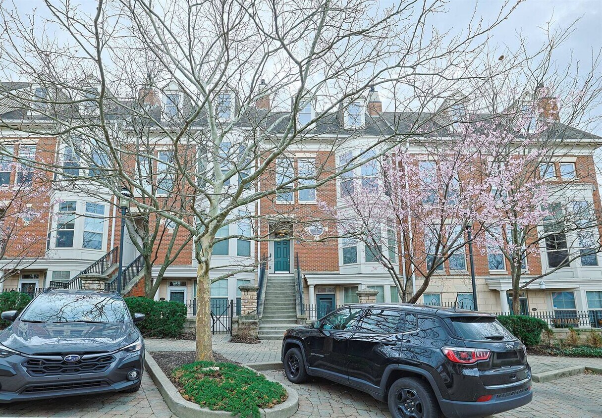
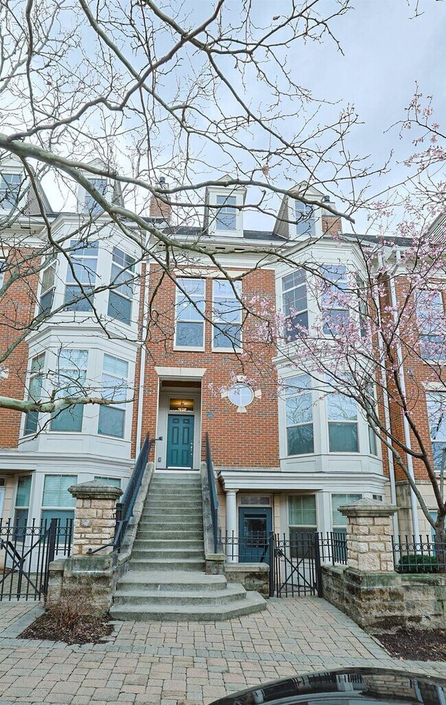
215 Stetson St
Cincinnati, OH 45219
Favorites
513-880-8708
-
Bedrooms
2
-
Bathrooms
1
-
Square Feet
1,109 sq ft
-
Available
Available Now
215 Stetson St

Favorites
About This Home
Available Now
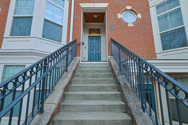
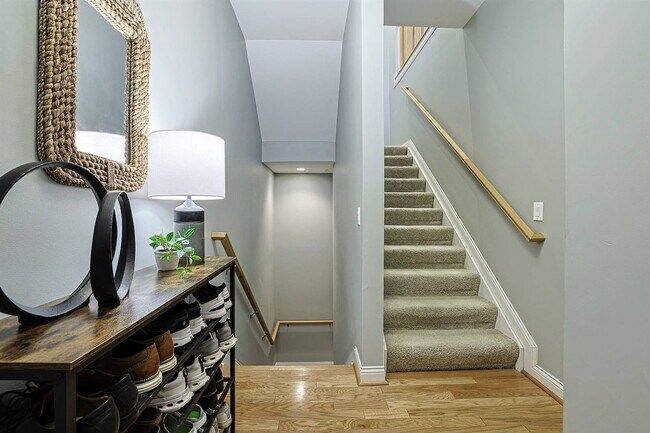
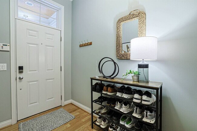
Experience the perfect blend of comfort and convenience within the highly sought-after Village at Stetson community. This professionally maintained 2-bedroom garden-style apartment offers generous living space, premium parking accommodations, and access to exceptional community amenities—all just minutes from the University of Cincinnati, major hospitals, downtown Cincinnati, dining, shopping, and entertainment. Whether you're a professional, student, medical resident, or anyone seeking a low-maintenance lifestyle in a prime location, this home provides everything you need to feel right at home. Enjoy the convenience of city living while returning to a peaceful, amenity-rich residential community with the following property highlights: Spacious 2-Bedroom Garden-Style Apartment Private 1-Car Attached Garage Two Reserved Parking Spaces Directly Outside the Unit (Permits Included) Access to HOA Community Amenities, including: Fitness Center, Swimming Pool, Resident Lobby Utilities Included in Rent: Water, Sewer, Landscaping, Snow Removal In-Unit Washer/Dryer Tenant is responsible for Electricity and Gas. No pets and no smoking allowed. Background Check Required. Minimum Credit Score of 600+ or Qualified Co-Signer with 700+ Credit Score Call or text today to schedule your tour and make 215 Stetson your next home! By submitting your information on this page you consent to being contacted by the Property Manager and RentEngine via SMS, phone, or email.
215 Stetson St is an apartment community located in Hamilton County and the 45219 ZIP Code.
* Price shown is base rent. Excludes user-selected optional fees and variable or usage-based fees and required charges due at or prior to move-in or at move-out. Price, availability, fees, and any applicable rent special are subject to change without notice.
* Square footage definitions vary. Displayed square footage is approximate.
Contact
- Listed by Keller
- Phone Number
- Contact
Location
Get Directions
Corryville is an up-and-coming community just four miles from Cincinnati’s Central Business District. The neighborhood is next to the University of Cincinnati campus, containing the school’s College of Medicine classrooms.
Because of its proximity to the university, Corryville has experienced rapid growth in the construction of new student apartments and trendy restaurants. Even with such development, the Mecklenburg Gardens restaurant continues to be a popular dining spot for locals since its opening in 1870.
Residents and students alike enjoy the many happy hour options on Short Vine Street. The Bogart’s theater is a cool landmark, known for its metal band concerts. Locals adore the walkability of Corryville, direct access to Interstate 71, and the nearby scenic landscapes of Burnet Woods.
Learn more about living in Corryville
Education
| Colleges & Universities | Distance | ||
|---|---|---|---|
| Colleges & Universities | Distance | ||
| Walk: | 8 min | 0.4 mi | |
| Walk: | 10 min | 0.5 mi | |
| Drive: | 7 min | 2.3 mi | |
| Drive: | 10 min | 3.3 mi |
215 Stetson St is within 8 minutes or 0.4 mile from Univ. of Cincinnati, Medical. It is also near University of Cincinnati and Xavier University.
Transportation options available in Cincinnati include Findlay Market-Race Station - Race & Elder, located 1.9 miles from 215 Stetson St. 215 Stetson St is near Cincinnati/Northern Kentucky International, located 16.9 miles or 32 minutes away.
| Transit / Subway | Distance | ||
|---|---|---|---|
| Transit / Subway | Distance | ||
| Drive: | 5 min | 1.9 mi | |
| Drive: | 6 min | 2.0 mi | |
| Drive: | 6 min | 2.0 mi | |
| Drive: | 6 min | 2.1 mi | |
| Drive: | 7 min | 2.4 mi |
| Commuter Rail | Distance | ||
|---|---|---|---|
| Commuter Rail | Distance | ||
|
|
Drive: | 10 min | 4.6 mi |
| Airports | Distance | ||
|---|---|---|---|
| Airports | Distance | ||
|
Cincinnati/Northern Kentucky International
|
Drive: | 32 min | 16.9 mi |
Getting Around
 What do Walkability, Transit, Drivability, and Bikeability mean?
Walkability measures the walking distance to day-to-day needs.
Transit measures access to public transportation.
Drivability measures congestion, parking availability, and access to major roads.
Bikeability measures the suitability for cycling.
How It Works
What do Walkability, Transit, Drivability, and Bikeability mean?
Walkability measures the walking distance to day-to-day needs.
Transit measures access to public transportation.
Drivability measures congestion, parking availability, and access to major roads.
Bikeability measures the suitability for cycling.
How It Works
Very Walkable
Walkability
80
/ 100
Good Public Transit
Transit
60
/ 100
Moderately Drivable
Drivability
60
/ 100
Fairly Bikeable
Bikeability
50
/ 100
Scores provided by
Active
Soundscore™
73
/ 100
Traffic
BusyAirport
CalmBusinesses
ActiveScores provided by
HowLoud What is a Sound Score Rating? A Sound Score Rating aggregates noise caused by vehicle traffic, airplane traffic and local sources. How It WorksTime and distance from 215 Stetson St.
| Shopping Centers | Distance | ||
|---|---|---|---|
| Shopping Centers | Distance | ||
| Walk: | 9 min | 0.5 mi | |
| Walk: | 9 min | 0.5 mi | |
| Walk: | 19 min | 1.0 mi |
215 Stetson St has 3 shopping centers within 1.0 miles, which is about a 19-minute walk. The miles and minutes will be for the farthest away property.
| Parks and Recreation | Distance | ||
|---|---|---|---|
| Parks and Recreation | Distance | ||
|
Cincinnati Zoo and Botanical Garden
|
Walk: | 16 min | 0.8 mi |
|
Trailside Nature Center
|
Walk: | 18 min | 1.0 mi |
|
Burnet Woods
|
Drive: | 4 min | 1.1 mi |
|
William H. Taft National Historic Site
|
Drive: | 4 min | 1.3 mi |
|
Eden Park
|
Drive: | 6 min | 2.3 mi |
215 Stetson St has 5 parks within 2.3 miles, including Cincinnati Zoo and Botanical Garden, Trailside Nature Center, and Burnet Woods.
| Hospitals | Distance | ||
|---|---|---|---|
| Hospitals | Distance | ||
| Walk: | 5 min | 0.3 mi | |
| Walk: | 12 min | 0.6 mi | |
| Drive: | 3 min | 1.1 mi |
215 Stetson St has 3 hospitals within 1.1 miles, the nearest is University of Cincinnati Medical Center which is 0.3 mile away and a 5 minute walk.
| Military Bases | Distance | ||
|---|---|---|---|
| Military Bases | Distance | ||
| Drive: | 69 min | 51.7 mi | |
| Drive: | 75 min | 56.7 mi | |
| Drive: | 78 min | 60.0 mi |
215 Stetson St has 3 military bases within 60.0 miles, the nearest is Gentile Air Force Station which is 51.7 miles away and a 69 minute drive.
You May Also Like
Similar Rentals Nearby


215 Stetson St
Cincinnati, OH 45219