$2,800
Total Monthly Price
2041 Laurel Ave Unit 2
Saint Paul, MN 55104
Favorites
-
Bedrooms
3
-
Bathrooms
2
-
Square Feet
1,000 sq ft
2041 Laurel Ave Unit 2

Favorites
About This Home
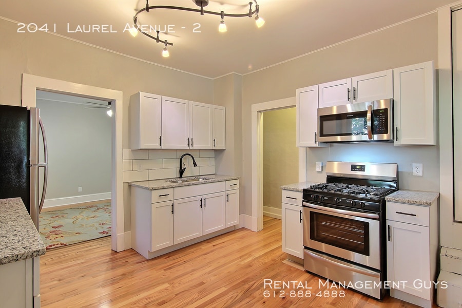
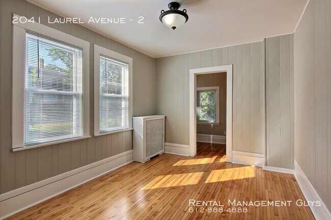
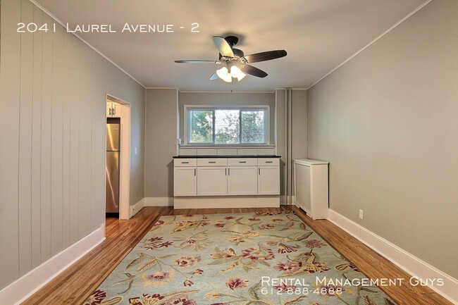
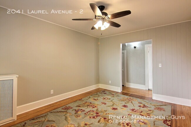
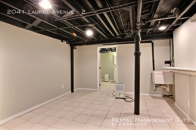
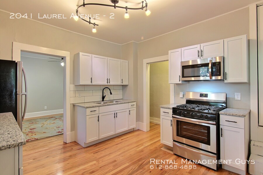
---- SCHEDULE A SHOWING ONLINE AT: ---- NOW AVAILABLE TO LEASE FOR SCHOOL YEAR! Email for showings. This updated home is 100 yards from St. Thomas Campus. Has been fully renovated with new carpet, 2nd bathroom, paint, tile, and refinished hardwoods. One bedroom is very large and will generally accommodate 2 beds. Heat, gas, electric, water and sewer included in rent!!!! No pets or smoking. Must have stable income and rental history. All adults to complete rental application and screening. See rental criteria here: Leasing agent is Licensed MN Real Estate Agent.
2041 Laurel Ave is an apartment community located in Ramsey County and the 55104 ZIP Code.
* Price shown is total price based on community-supplied monthly required fees. Excludes user-selected optional fees and variable or usage-based fees and required charges due at or prior to move-in or at move-out. Price, availability, fees, and any applicable rent special are subject to change without notice.
* Square footage definitions vary. Displayed square footage is approximate.
Features
- Washer/Dryer
- Cable Ready
Contact
- Listed by Leasing Agent
Location
Get Directions
Along the shore of the Mississippi River, Merriam Park West offers riverfront parks, a large golf course, and quaint local restaurants just minutes from downtown Saint Paul, Minnesota. Stop on in at Izzy’s Ice Cream Café, or grab a treat at Black Coffee and Waffle Bar. Local businesses thrive alongside riverfront community spaces like Shadow Falls Park, a picturesque nature preserve.
The University of Saint Thomas resides on the south end of town, and the neighborhood offers a blend of private and public schools, churches, and every day conveniences. Situated just five miles southeast of Minneapolis and seven miles northeast of the Minneapolis-Saint Paul International Airport, this neighborhood is in a premier location for commuting, shopping, dining, and entertainment.
Learn more about living in Merriam Park West
Amenities
- Washer/Dryer
- Cable Ready
Education
| Colleges & Universities | Distance | ||
|---|---|---|---|
| Colleges & Universities | Distance | ||
| Walk: | 9 min | 0.5 mi | |
| Drive: | 4 min | 1.8 mi | |
| Drive: | 6 min | 1.9 mi | |
| Drive: | 3 min | 2.0 mi |
2041 Laurel Ave Unit 2 is within 9 minutes or 0.5 mile from Univ. of St Thomas, St. Paul. It is also near Macalester College and St. Catherine University.
Transportation options available in Saint Paul include Fairview Ave Station, located 1.4 miles from 2041 Laurel Ave Unit 2. 2041 Laurel Ave Unit 2 is near Minneapolis-St Paul International/Wold-Chamberlain, located 6.6 miles or 15 minutes away.
| Transit / Subway | Distance | ||
|---|---|---|---|
| Transit / Subway | Distance | ||
| Drive: | 3 min | 1.4 mi | |
| Drive: | 4 min | 1.8 mi | |
| Drive: | 4 min | 1.8 mi | |
| Drive: | 4 min | 2.2 mi | |
| Drive: | 5 min | 2.3 mi |
| Commuter Rail | Distance | ||
|---|---|---|---|
| Commuter Rail | Distance | ||
|
|
Drive: | 10 min | 5.9 mi |
|
|
Drive: | 14 min | 6.3 mi |
|
|
Drive: | 22 min | 14.9 mi |
|
|
Drive: | 32 min | 23.7 mi |
|
|
Drive: | 33 min | 25.3 mi |
| Airports | Distance | ||
|---|---|---|---|
| Airports | Distance | ||
|
Minneapolis-St Paul International/Wold-Chamberlain
|
Drive: | 15 min | 6.6 mi |
Getting Around
 What do Walkability, Transit, Drivability, and Bikeability mean?
Walkability measures the walking distance to day-to-day needs.
Transit measures access to public transportation.
Drivability measures congestion, parking availability, and access to major roads.
Bikeability measures the suitability for cycling.
How It Works
What do Walkability, Transit, Drivability, and Bikeability mean?
Walkability measures the walking distance to day-to-day needs.
Transit measures access to public transportation.
Drivability measures congestion, parking availability, and access to major roads.
Bikeability measures the suitability for cycling.
How It Works
Moderately Walkable
Walkability
60
/ 100
Some Public Transit
Transit
50
/ 100
Very Drivable
Drivability
80
/ 100
Very Bikeable
Bikeability
80
/ 100
Scores provided by
-
Soundscore™
-
/ 100
Traffic
-Airport
-Businesses
-Scores provided by
HowLoud What is a Sound Score Rating? A Sound Score Rating aggregates noise caused by vehicle traffic, airplane traffic and local sources. How It WorksTime and distance from 2041 Laurel Ave Unit 2.
| Shopping Centers | Distance | ||
|---|---|---|---|
| Shopping Centers | Distance | ||
| Drive: | 4 min | 2.0 mi | |
| Drive: | 5 min | 2.1 mi |
2041 Laurel Ave Unit 2 has 2 shopping centers within 2.1 miles, which is about a 5-minute drive. The miles and minutes will be for the farthest away property.
| Parks and Recreation | Distance | ||
|---|---|---|---|
| Parks and Recreation | Distance | ||
|
Macalester College Observatory
|
Drive: | 3 min | 2.0 mi |
|
Brackett Park
|
Drive: | 5 min | 2.0 mi |
|
Newell Park
|
Drive: | 4 min | 2.1 mi |
|
Longfellow Park
|
Drive: | 6 min | 2.4 mi |
|
Hiawatha School Park
|
Drive: | 8 min | 3.1 mi |
2041 Laurel Ave Unit 2 has 5 parks within 3.1 miles, including Macalester College Observatory, Brackett Park, and Newell Park.
| Hospitals | Distance | ||
|---|---|---|---|
| Hospitals | Distance | ||
| Drive: | 8 min | 3.5 mi | |
| Drive: | 7 min | 3.7 mi | |
| Drive: | 7 min | 3.7 mi |
2041 Laurel Ave Unit 2 has 3 hospitals within 3.7 miles, the nearest is M Health Fairview University of Minnesota Medical Center - East Bank which is 3.5 miles away and a 8 minute drive.
| Military Bases | Distance | ||
|---|---|---|---|
| Military Bases | Distance | ||
| Drive: | 14 min | 5.4 mi |
2041 Laurel Ave Unit 2 is 5.4 miles and a 14 minute drive from Fort Snelling Military Reservation.
You May Also Like
Similar Rentals Nearby
-
-
3 Beds$6,031Total Monthly PriceTotal Monthly Price NewPrices include required monthly fees of $4.Base Rent:3 Beds$6,027+1 Month Free
Pets Allowed Fitness Center Pool Dishwasher Refrigerator Clubhouse Maintenance on site
-
3 Beds$3,201+Total Monthly PriceTotal Monthly Price NewPrices include all required monthly fees.Specials
Pets Allowed Fitness Center Pool In Unit Washer & Dryer Maintenance on site Stainless Steel Appliances
-
-
3 Beds$1,707+Total Monthly PriceTotal Monthly Price NewPrices include required monthly fees of $25 - $50.Base Rent:3 Beds$1,682+
Pets Allowed Fitness Center Dishwasher Refrigerator Kitchen In Unit Washer & Dryer
-
3 Beds$1,921Total Monthly PriceTotal Monthly Price NewPrices include required monthly fees of $22.Base Rent:3 Beds$1,899
Pool
-
-
3 Beds$3,450+Total Monthly Price12 Month LeaseTotal Monthly Price NewPrices include required monthly fees of $80.Base Rent:3 Beds$3,370+1 Month Free
Pets Allowed Fitness Center Pool Dishwasher Refrigerator Kitchen
-
-
3 Beds$3,779+Total Monthly Price12 Month LeaseTotal Monthly Price NewPrices include base rent and required monthly fees of $23. Variable costs based on usage may apply.Base Rent:3 Beds$3,756+Discounts
Fitness Center Pool Maintenance on site Stainless Steel Appliances Business Center


What Are Walk Score®, Transit Score®, and Bike Score® Ratings?
Walk Score® measures the walkability of any address. Transit Score® measures access to public transit. Bike Score® measures the bikeability of any address.
What is a Sound Score Rating?
A Sound Score Rating aggregates noise caused by vehicle traffic, airplane traffic and local sources.
2041 Laurel Ave
Saint Paul, MN 55104