
Baker Chocolate Factory
1200-1220 Adams St,
Dorchester, MA 02124
$2,740 - $3,595 Plus Fees
1-2 Beds 12 Month Lease
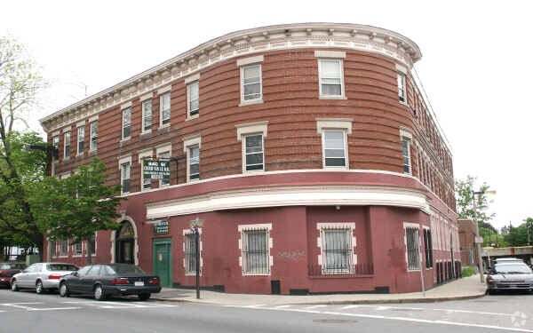
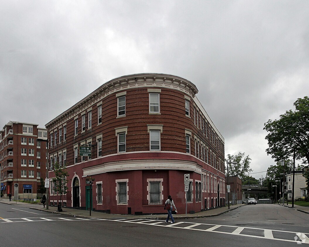
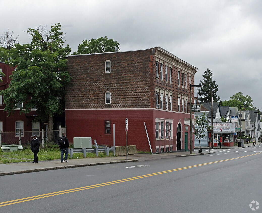

Find your new home at 1980 Dorchester Ave. You'll find this community in the Ashmont area of Dorchester. From pricing to features, the professional leasing staff is excited to help you find the best floor plan for your lifestyle. Stop looking and get moving. Contact or stop by the 1980 Dorchester Ave leasing office to see available floor plans.
1980-1984A Dorchester Ave is an apartment community located in Suffolk County and the 02124 ZIP Code. This area is served by the Conservatory Lab Charter (District) attendance zone.
Ashmont is a charming suburban district on the southern end of Boston’s Dorchester area. Several public parks are easily accessible from anywhere in the neighborhood, including the huge Dorchester Park to the south and Roberts Playground on the west side.
Walking to the numerous schools and libraries is a breeze, and the rows of shops, cafes, and pubs along Adams Street and Dorchester Avenue can be quickly reached on foot as well. With Carney Hospital nearby, Ashmont is an excellent location for healthcare professionals.
Downtown Boston is only about twenty minutes away by car, and MBTA Red Line service puts the whole city at your fingertips even without the use of a personal vehicle.
Learn more about living in Ashmont| Colleges & Universities | Distance | ||
|---|---|---|---|
| Colleges & Universities | Distance | ||
| Drive: | 8 min | 3.5 mi | |
| Drive: | 12 min | 5.3 mi | |
| Drive: | 10 min | 5.9 mi | |
| Drive: | 12 min | 6.7 mi |


Transportation options available in Dorchester include Ashmont Station, located 0.1 mile from 1980-1984A Dorchester Ave. 1980-1984A Dorchester Ave is near General Edward Lawrence Logan International, located 9.6 miles or 16 minutes away.
| Transit / Subway | Distance | ||
|---|---|---|---|
| Transit / Subway | Distance | ||
|
|
Walk: | 2 min | 0.1 mi |
|
|
Walk: | 10 min | 0.5 mi |
|
|
Walk: | 14 min | 0.8 mi |
|
|
Walk: | 18 min | 1.0 mi |
|
|
Drive: | 2 min | 1.1 mi |
| Commuter Rail | Distance | ||
|---|---|---|---|
| Commuter Rail | Distance | ||
| Drive: | 2 min | 1.1 mi | |
|
|
Drive: | 2 min | 1.3 mi |
| Drive: | 5 min | 2.1 mi | |
| Drive: | 5 min | 2.4 mi | |
|
|
Drive: | 6 min | 2.9 mi |
| Airports | Distance | ||
|---|---|---|---|
| Airports | Distance | ||
|
General Edward Lawrence Logan International
|
Drive: | 16 min | 9.6 mi |
Time and distance from 1980-1984A Dorchester Ave.
| Shopping Centers | Distance | ||
|---|---|---|---|
| Shopping Centers | Distance | ||
| Drive: | 3 min | 1.2 mi | |
| Drive: | 3 min | 1.4 mi | |
| Drive: | 4 min | 2.1 mi |
| Parks and Recreation | Distance | ||
|---|---|---|---|
| Parks and Recreation | Distance | ||
|
Mass Audubon's Boston Nature Center and Wildlife Sanctuary
|
Drive: | 5 min | 2.5 mi |
|
Dorchester Shores Reservation
|
Drive: | 7 min | 3.1 mi |
|
Franklin Park Zoo
|
Drive: | 5 min | 3.2 mi |
|
Lower Neponset River Trail
|
Drive: | 5 min | 3.3 mi |
|
Squantum Point Park
|
Drive: | 8 min | 3.5 mi |
| Hospitals | Distance | ||
|---|---|---|---|
| Hospitals | Distance | ||
| Walk: | 7 min | 0.4 mi | |
| Drive: | 5 min | 2.5 mi | |
| Drive: | 9 min | 5.7 mi |
$4,290 - $9,340
Total Monthly Price1-3 Beds
Pets Allowed Fitness Center Dishwasher Refrigerator Kitchen In Unit Washer & Dryer
What Are Walk Score®, Transit Score®, and Bike Score® Ratings?
Walk Score® measures the walkability of any address. Transit Score® measures access to public transit. Bike Score® measures the bikeability of any address.
What is a Sound Score Rating?
A Sound Score Rating aggregates noise caused by vehicle traffic, airplane traffic and local sources

1980-1984A Dorchester Ave
Dorchester, MA 02124


