$2,100
/ Month
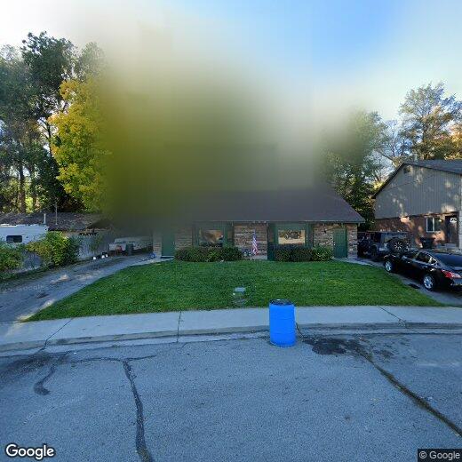
1939 N 700 W Unit 1939 N 700 W
Provo, UT 84604
Favorites
617-606-3680
-
Bedrooms
4
-
Bathrooms
2
-
Square Feet
--
-
Available
Available Aug 1
1939 N 700 W Unit 1939 N 700 W

Favorites
Contact
- Listed by CFI Realty LLC | CFI Realty LLC
- Phone Number
- Contact
Location
Get Directions
With the rugged Wasatch Mountains dominating the landscape, Carterville locals never tire of the scenery. Relatively flat terrain magnifies this spectacular view and tree-lined streets add freshness to the district. Most of the area's apartments sit in the shared residential and commercial properties in the southern half of the neighborhood. Carterville Park provides residents with ball courts, playing fields, and five acres of idyllic green space.
Although downtown Provo and its urban delights sit just two miles southeast of Carterville, this amenity-rich neighborhood has much to offer its residents. Brassa's Mexican Grill serves authentic south-of-the-border eats, and Molly's comes through with comfort food done right. University Place acts as a one-stop hub for shopping, dining, and movie-going.
Learn more about living in Carterville
Education
| Colleges & Universities | Distance | ||
|---|---|---|---|
| Colleges & Universities | Distance | ||
| Drive: | 4 min | 1.8 mi | |
| Drive: | 8 min | 3.8 mi | |
| Drive: | 8 min | 4.4 mi | |
| Drive: | 12 min | 7.8 mi |
1939 N 700 W Unit 1939 N 700 W is within 4 minutes or 1.8 miles from Brigham Young University. It is also near Utah Valley University and Rocky Mountain University.
Getting Around
 What do Walkability, Transit, Drivability, and Bikeability mean?
Walkability measures the walking distance to day-to-day needs.
Transit measures access to public transportation.
Drivability measures congestion, parking availability, and access to major roads.
Bikeability measures the suitability for cycling.
How It Works
What do Walkability, Transit, Drivability, and Bikeability mean?
Walkability measures the walking distance to day-to-day needs.
Transit measures access to public transportation.
Drivability measures congestion, parking availability, and access to major roads.
Bikeability measures the suitability for cycling.
How It Works
Moderately Walkable
Walkability
60
/ 100
Limited Public Transit
Transit
30
/ 100
Moderately Drivable
Drivability
70
/ 100
Moderately Bikeable
Bikeability
60
/ 100
Scores provided by
-
Soundscore™
-
/ 100
Traffic
-Airport
-Businesses
-Scores provided by
HowLoud What is a Sound Score Rating? A Sound Score Rating aggregates noise caused by vehicle traffic, airplane traffic and local sources. How It WorksYou May Also Like
Similar Rentals Nearby
-
-
-
-
-
-
1 / 45
 4 Beds$2,839+5 Beds$3,688+6 Beds$3,989+Total Monthly PriceTotal Monthly Price NewPrices include base rent and required monthly fees of $188. Variable costs based on usage may apply.Base Rent:4 Beds$2,650+5 Beds$3,499+6 Beds$3,800+2 Months Free
Pets Allowed Fitness Center Pool Dishwasher Refrigerator Kitchen
-
1 / 10
 4 Beds$3,664+Total Monthly PriceTotal Monthly Price NewPrices include base rent and required monthly fees of $144. Variable costs based on usage may apply.Base Rent:4 Beds$3,519+2 Months Free
Pets Allowed Fitness Center Pool Dishwasher In Unit Washer & Dryer Balcony Disposal
-
4 Beds$2,717+Total Monthly PriceTotal Monthly Price NewPrices include base rent and required monthly fees of $148. Variable costs based on usage may apply.Base Rent:4 Beds$2,569+Specials
Pets Allowed Fitness Center Pool In Unit Washer & Dryer Clubhouse Stainless Steel Appliances Basement
-
4 Beds$2,605+Total Monthly Price16 Month LeaseTotal Monthly Price NewPrices include base rent and required monthly fees of $154. Variable costs based on usage may apply.Base Rent:4 Beds$2,450+2 Months Free
Pets Allowed Fitness Center Pool In Unit Washer & Dryer Walk-In Closets Clubhouse
-
4 Beds$2,978Total Monthly PriceTotal Monthly Price NewPrices include base rent and required monthly fees of $124. Variable costs based on usage may apply.Base Rent:4 Beds$2,853+Specials
Pets Allowed Fitness Center Pool Dishwasher Refrigerator Kitchen


What Are Walk Score®, Transit Score®, and Bike Score® Ratings?
Walk Score® measures the walkability of any address. Transit Score® measures access to public transit. Bike Score® measures the bikeability of any address.
What is a Sound Score Rating?
A Sound Score Rating aggregates noise caused by vehicle traffic, airplane traffic and local sources.

1939 N 700 W
Provo, UT 84604