
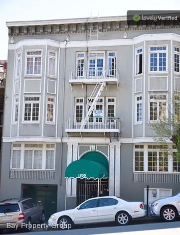
$2,595 / Month
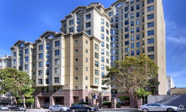
1855 California St
San Francisco, CA 94109
2 Weeks Ago
Favorites
1855 California St

Favorites
Check Back Soon for Upcoming Availability
| Beds | Baths | Average SF |
|---|---|---|
| 1 Bedroom 1 Bedroom 1 Br | 1 Bath 1 Bath 1 Ba | 700 SF |
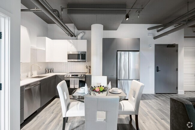
About This Property
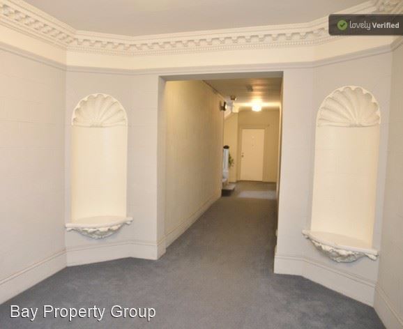
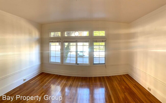
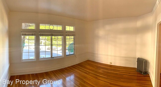
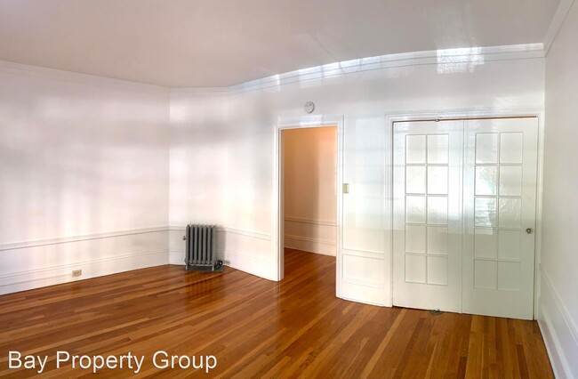
(415) 649-7685 - BRIGHT UPDATED Pacific Heights/Lafayette Park1BR/1BA Pac Apt AVAILABLE NOW - **PLEASE CONTACT US TO SCHEDULE A VIEWING** This BRIGHT 1BR/1BA apartment, is 2 blocks from Polk Gulch and 5 blocks from Fillmore district, with refinished hardwood floors,, has a new home look and feel with classic molding and trim throughout and is AVAILABLE NOW. Refinished hardwood floors Original molding/trim throughout - classic 1920's look and feel New paint throughout New Appliances New fixtures Radiator heat throughout Plenty of storage Backyard patio access Laundry in building available 1 car garage parking available for additional fee MUNI BUS 1 California 1 block 47 Van Ness 1 block 49 MIssion-Van Ness 1 block 10 Townsend 2 blocks 19 Polk 2 blocks 2 Clement 5 blocks 3 Jackson 5 blocks 22 Fillmore 5 blocks Walking distance to shops, restaurants, cafe's, nightlife, parks: Van Ness Ave -1 block Whole Foods Market - 1 block Polk Gulch -2 blocks Lafayette Park -1 blocks Fillmore St -5 blocks Lower Nob Hill -5 blocks WalkScore 97!! https://www.walkscore.com/score/1855-california-st-san-francisco-ca-94109 Owner pays water/trash. Tenant pays all other utilities Address: 1855 California St. San Francisco, CA 94109 Cross Streets: California/Franklin Please view our additional listings at: http://baypropertygroup.com/vacancies (RLNE2481481)
1855 California St is an apartment community located in San Francisco County and the 94109 ZIP Code.
Location
Get Directions
Lower Pacific Heights is a vibrant San Francisco neighborhood situated between Pacific Heights, Japantown, the Fillmore District, and Laurel Heights. Formerly known as Upper Fillmore, Lower Pacific Heights offers residents a wide variety of apartments, condos, and houses available for rent, many of which boast scenic views due to the neighborhood’s hilly environment.
Lower Pacific Heights is regarded for its walkable layout, with many rentals situated within easy walking distance of the diverse restaurants, shops, coffeehouses, and bars that line Fillmore Street, the community’s main commercial thoroughfare. The neighborhood’s central locale is a major part of its allure, providing quick access to Union Square, the University of San Francisco, the Financial District, several prominent medical centers, tech employers, landmarks, and more.
Learn more about living in Lower Pacific HeightsBelow are rent ranges for similar nearby apartments
Education
| Colleges & Universities | Distance | ||
|---|---|---|---|
| Colleges & Universities | Distance | ||
| Walk: | 20 min | 1.1 mi | |
| Drive: | 3 min | 1.1 mi | |
| Drive: | 5 min | 1.8 mi | |
| Drive: | 6 min | 2.1 mi |
1855 California St is within 3 minutes or 1.1 miles from Academy of Art University. It is also near UC San Francisco, Mount Zion and Golden Gate Univ., San Fran..
Transportation options available in San Francisco include Van Ness And California, located 0.2 mile from 1855 California St. 1855 California St is near San Francisco International, located 14.6 miles or 25 minutes away, and Metro Oakland International, located 20.3 miles or 32 minutes away.
| Transit / Subway | Distance | ||
|---|---|---|---|
| Transit / Subway | Distance | ||
|
|
Walk: | 3 min | 0.2 mi |
|
|
Walk: | 6 min | 0.3 mi |
|
|
Walk: | 7 min | 0.4 mi |
|
|
Walk: | 11 min | 0.6 mi |
|
|
Walk: | 12 min | 0.7 mi |
| Commuter Rail | Distance | ||
|---|---|---|---|
| Commuter Rail | Distance | ||
| Drive: | 6 min | 2.3 mi | |
| Drive: | 8 min | 3.9 mi | |
| Drive: | 13 min | 6.7 mi | |
|
|
Drive: | 18 min | 9.8 mi |
|
|
Drive: | 21 min | 11.9 mi |
| Airports | Distance | ||
|---|---|---|---|
| Airports | Distance | ||
|
San Francisco International
|
Drive: | 25 min | 14.6 mi |
|
Metro Oakland International
|
Drive: | 32 min | 20.3 mi |
Time and distance from 1855 California St.
| Shopping Centers | Distance | ||
|---|---|---|---|
| Shopping Centers | Distance | ||
| Walk: | 5 min | 0.3 mi | |
| Walk: | 10 min | 0.5 mi | |
| Walk: | 12 min | 0.6 mi |
1855 California St has 3 shopping centers within 0.6 mile, which is about a 12-minute walk. The miles and minutes will be for the farthest away property.
| Parks and Recreation | Distance | ||
|---|---|---|---|
| Parks and Recreation | Distance | ||
|
San Francisco Maritime National Historical Park
|
Drive: | 4 min | 1.6 mi |
|
Children's Creativity Museum
|
Drive: | 5 min | 1.7 mi |
|
Aquarium of The Bay
|
Drive: | 6 min | 2.2 mi |
|
Exploratorium
|
Drive: | 6 min | 2.4 mi |
|
Buena Vista Park
|
Drive: | 7 min | 2.4 mi |
1855 California St has 5 parks within 2.4 miles, including San Francisco Maritime National Historical Park, Children's Creativity Museum, and Exploratorium.
| Hospitals | Distance | ||
|---|---|---|---|
| Hospitals | Distance | ||
| Walk: | 8 min | 0.4 mi | |
| Walk: | 9 min | 0.5 mi | |
| Drive: | 3 min | 1.2 mi |
1855 California St has 3 hospitals within 1.2 miles, the nearest is California Pacific Medical Center - Van Ness Campus which is 0.4 mile away and a 8 minute walk.
| Military Bases | Distance | ||
|---|---|---|---|
| Military Bases | Distance | ||
| Drive: | 12 min | 4.4 mi | |
| Drive: | 14 min | 4.8 mi | |
| Drive: | 15 min | 6.4 mi |
1855 California St has 3 military bases within 6.4 miles, the nearest is East Fort Miley which is 4.4 miles away and a 12 minute drive.
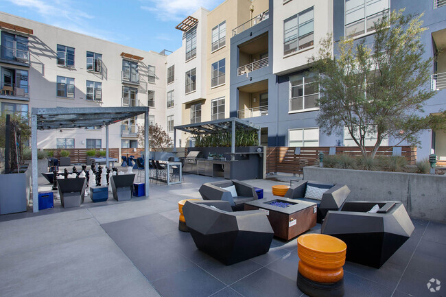
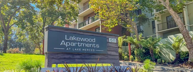
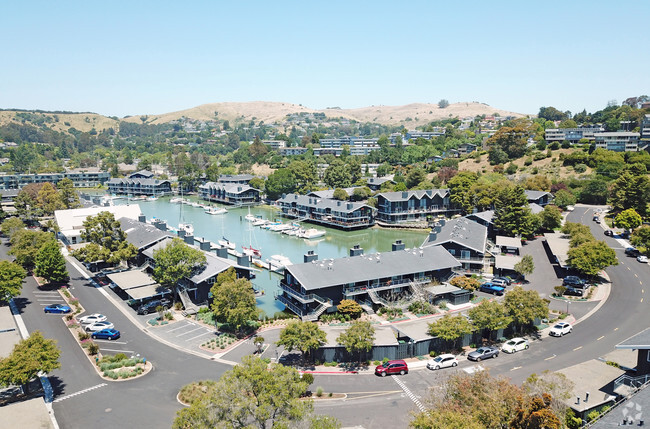
You May Also Like
Similar Rentals Nearby


What Are Walk Score®, Transit Score®, and Bike Score® Ratings?
Walk Score® measures the walkability of any address. Transit Score® measures access to public transit. Bike Score® measures the bikeability of any address.
What is a Sound Score Rating?
A Sound Score Rating aggregates noise caused by vehicle traffic, airplane traffic and local sources
1855 California St
San Francisco, CA 94109