
Hanover Soma West
1140 Harrison St,
San Francisco, CA 94103
$3,475 - $8,729 Total Monthly Price
Studio - 3 Beds

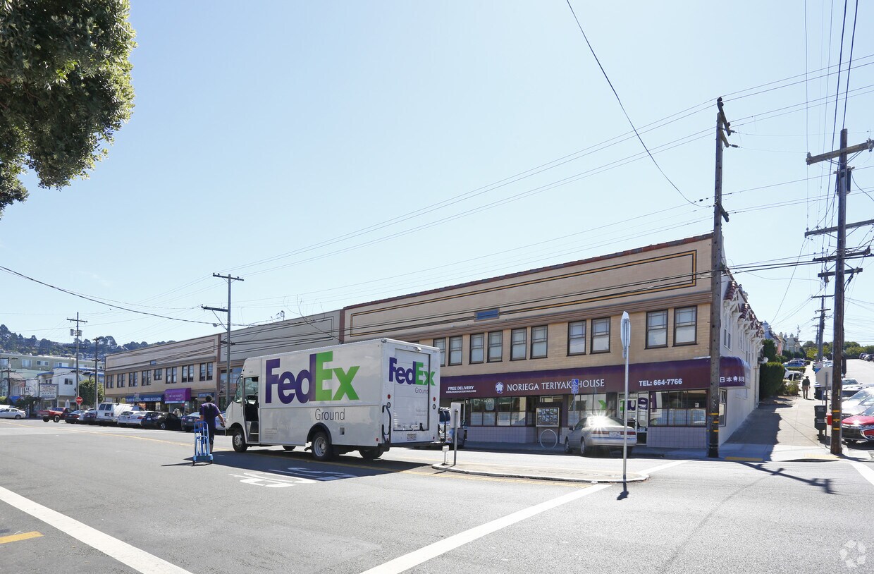
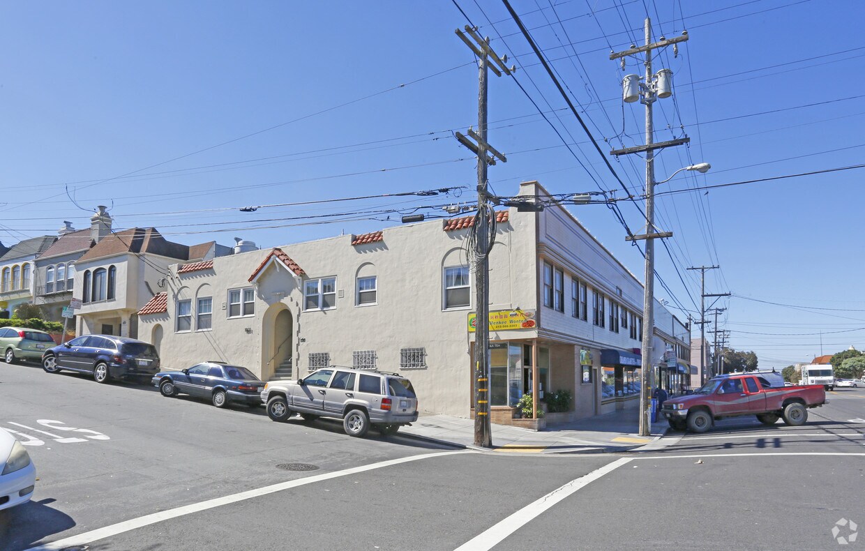

1701-1799 Noriega St is an apartment community located in San Francisco County and the 94122 ZIP Code.
Refrigerator
Tub/Shower
Freezer
Heating
Central Sunset is a densely populated area about one mile east of the beach and five miles west of the heart of San Francisco. Renters have a large selection of apartments, single-family homes, and condos to choose from. Central Sunset’s residential neighborhoods are paired with parks like Stern Grove Park and McCoppin Square. For in-town shopping and dining, residents head to Taraval Street, Irving Street, and Noriega Street. A variety of eateries serving everything from seafood and barbecue can be found along these roads. This Bay Area suburb is also in proximity to the world-renowned dining, shopping, and entertainment offered by Downtown San Francisco and its neighboring cities.
Learn more about living in Central SunsetCompare neighborhood and city base rent averages by bedroom.
| Central Sunset | San Francisco, CA | |
|---|---|---|
| Studio | $1,424 | $2,623 |
| 1 Bedroom | $3,131 | $3,463 |
| 2 Bedrooms | $2,914 | $4,788 |
| 3 Bedrooms | - | $5,972 |
| Colleges & Universities | Distance | ||
|---|---|---|---|
| Colleges & Universities | Distance | ||
| Drive: | 6 min | 2.1 mi | |
| Drive: | 8 min | 2.6 mi | |
| Drive: | 11 min | 3.5 mi | |
| Drive: | 8 min | 3.5 mi |
Transportation options available in San Francisco include Judah And 25Th Avenue, located 0.5 mile from 1701-1799 Noriega St. 1701-1799 Noriega St is near San Francisco International, located 13.8 miles or 24 minutes away, and Metro Oakland International, located 25.1 miles or 42 minutes away.
| Transit / Subway | Distance | ||
|---|---|---|---|
| Transit / Subway | Distance | ||
|
|
Walk: | 10 min | 0.5 mi |
| Walk: | 10 min | 0.5 mi | |
| Walk: | 11 min | 0.6 mi | |
| Walk: | 13 min | 0.7 mi | |
|
|
Walk: | 13 min | 0.7 mi |
| Commuter Rail | Distance | ||
|---|---|---|---|
| Commuter Rail | Distance | ||
| Drive: | 15 min | 6.3 mi | |
| Drive: | 17 min | 7.5 mi | |
| Drive: | 21 min | 10.8 mi | |
| Drive: | 19 min | 11.3 mi | |
|
|
Drive: | 32 min | 16.7 mi |
| Airports | Distance | ||
|---|---|---|---|
| Airports | Distance | ||
|
San Francisco International
|
Drive: | 24 min | 13.8 mi |
|
Metro Oakland International
|
Drive: | 42 min | 25.1 mi |
Scores provided by
Traffic
-Airport
-Businesses
-Scores provided by
HowLoud What is a Sound Score Rating? A Sound Score Rating aggregates noise caused by vehicle traffic, airplane traffic and local sources. How It WorksTime and distance from 1701-1799 Noriega St.
| Shopping Centers | Distance | ||
|---|---|---|---|
| Shopping Centers | Distance | ||
| Drive: | 7 min | 2.0 mi | |
| Drive: | 7 min | 2.5 mi |
| Parks and Recreation | Distance | ||
|---|---|---|---|
| Parks and Recreation | Distance | ||
|
Golden Gate Park
|
Drive: | 4 min | 1.4 mi |
|
San Francisco Botanical Garden
|
Drive: | 4 min | 1.4 mi |
|
Japanese Tea Garden
|
Drive: | 7 min | 2.2 mi |
|
California Academy of Sciences
|
Drive: | 7 min | 2.5 mi |
|
Steinhart Aquarium
|
Drive: | 8 min | 2.5 mi |
| Hospitals | Distance | ||
|---|---|---|---|
| Hospitals | Distance | ||
| Drive: | 5 min | 2.0 mi | |
| Drive: | 5 min | 2.0 mi | |
| Drive: | 7 min | 2.2 mi |
| Military Bases | Distance | ||
|---|---|---|---|
| Military Bases | Distance | ||
| Drive: | 11 min | 3.5 mi | |
| Drive: | 10 min | 3.5 mi | |
| Drive: | 25 min | 11.2 mi |
What Are Walk Score®, Transit Score®, and Bike Score® Ratings?
Walk Score® measures the walkability of any address. Transit Score® measures access to public transit. Bike Score® measures the bikeability of any address.
What is a Sound Score Rating?
A Sound Score Rating aggregates noise caused by vehicle traffic, airplane traffic and local sources.
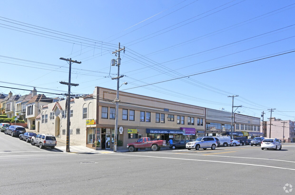
1701-1799 Noriega St
San Francisco, CA 94122


