
$3,000
/ Month
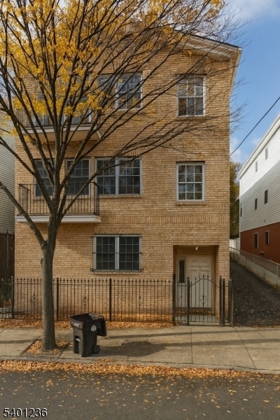
17 Norfolk St
Newark, NJ 07103
Today
|
Edit
Favorites
347-803-0504
-
Bedrooms
3
-
Bathrooms
2
-
Square Feet
--
-
Available
Available Now
Highlights
- Central Air
- Dogs and Cats Allowed
17 Norfolk St

Favorites
About This Home
Available Now
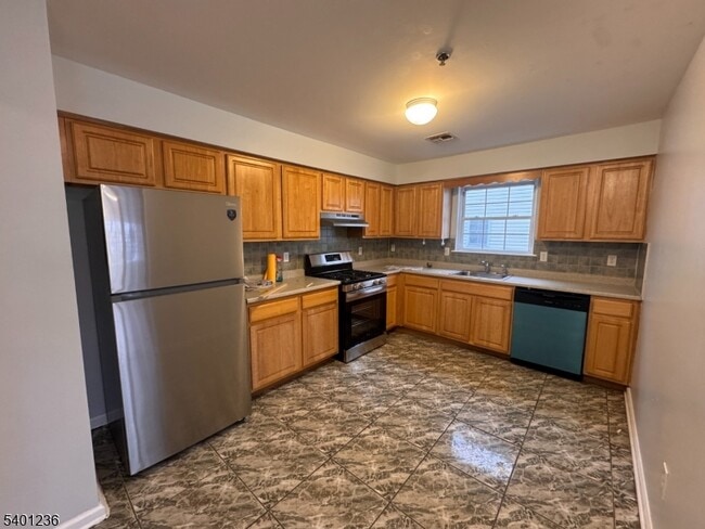
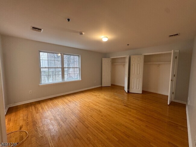
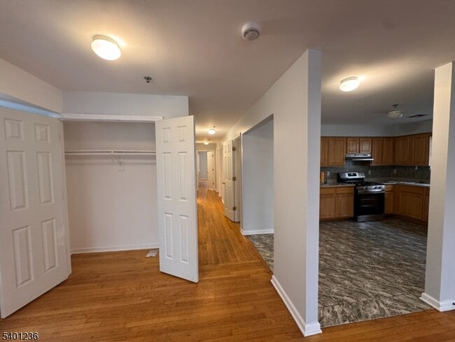
Spacious and well-maintained 3BR/2BA apartment located on the second floor of a newer three-family home. This unit offers a comfortable layout with an updated kitchen (including dishwasher), a primary bedroom with a private en-suite bath, hardwood flooring, central air, and in-unit laundry hookup. Enjoy the convenience of an exclusive two-car garage with a private rear entrance directly into the unit.Excellent location just one block from I-280 and only minutes to Downtown Newark, University Heights, and Branch Brook Park. Pets are allowed.
17 Norfolk St is an apartment community located in Essex County and the 07103 ZIP Code.
* Price shown is base rent. Excludes user-selected optional fees and variable or usage-based fees and required charges due at or prior to move-in or at move-out. Price, availability, fees, and any applicable rent special are subject to change without notice.
* Square footage definitions vary. Displayed square footage is approximate.
Home Details
Year Built
Built in 2007
Bedrooms and Bathrooms
2 Full Bathrooms
3 Bedrooms
Home Design
Apartment
Interior Spaces
3-Story Property
Laundry
Washer and Dryer Hookup
Listing and Financial Details
Assessor Parcel Number 1614-02851-0000-00001-0004-
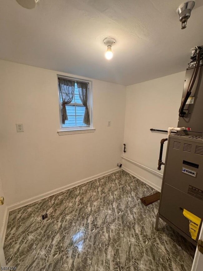
Tenant pays for electric, gas, heat, hot water, trash removal
Lot Details
4,200 Sq Ft Lot
Parking
Parking Garage Space
2 Car Garage
Utilities
Central Air
Community Details
Pet Policy
Dogs and Cats Allowed
Fees and Policies
The fees listed below are community-provided and may exclude utilities or add-ons. All payments are made directly to the property and are non-refundable unless otherwise specified.
-
Garage Lot
Property Fee Disclaimer: Based on community-supplied data and independent market research. Subject to change without notice. May exclude fees for mandatory or optional services and usage-based utilities.
Contact
- Listed by ROI VANA | GardenStateMLS#NJ
- Phone Number
- Contact
-
Source
Garden State Multiple Listing Service, LLC
Copyright © 2026 Garden State MLS, LLC. All rights reserved. All information provided by the listing agent/broker is deemed reliable but is not guaranteed and should be independently verified.
Location
Get Directions
As its name implies, University Heights houses several academic institutions. University Heights is home to Essex County College, the New Jersey Institute of Technology, and Rutgers University-Newark Campus. Sprawling campuses, along with several medical facilities like Saint Michael's Medical Center and Rutger’s University Hospital, dominate the neighborhood but there still plenty of rentals to choose from. Ideal for all renters, University Heights has affordable to upscale rentals available.
This urban neighborhood is nestled beside Downtown Newark, giving easy access to some of the city’s best dining, shopping, and entertainment options. Bike lanes and a light rail system provide transportation options that make it easy to get around, although you may opt to simply lace up your shoes in this walkable neighborhood. Locals enjoy being able to stroll downtown entertainment hubs like the New Jersey Performing Arts Center and Prudential Center.
Learn more about living in University Heights
Amenities
- Air Conditioning
Education
| Colleges & Universities | Distance | ||
|---|---|---|---|
| Colleges & Universities | Distance | ||
| Walk: | 11 min | 0.6 mi | |
| Walk: | 13 min | 0.7 mi | |
| Walk: | 17 min | 0.9 mi | |
| Drive: | 6 min | 3.7 mi |
17 Norfolk St is within 11 minutes or 0.6 mile from N.J. Inst. of Technology. It is also near Rutgers, Newark Campus and Essex County College.
Transportation options available in Newark include Norfolk Street, located 0.3 mile from 17 Norfolk St. 17 Norfolk St is near Newark Liberty International, located 6.5 miles or 11 minutes away, and LaGuardia, located 27.1 miles or 40 minutes away.
| Transit / Subway | Distance | ||
|---|---|---|---|
| Transit / Subway | Distance | ||
|
|
Walk: | 4 min | 0.3 mi |
|
|
Walk: | 5 min | 0.3 mi |
|
|
Walk: | 10 min | 0.5 mi |
|
|
Walk: | 12 min | 0.6 mi |
|
|
Drive: | 2 min | 1.2 mi |
| Commuter Rail | Distance | ||
|---|---|---|---|
| Commuter Rail | Distance | ||
|
|
Walk: | 13 min | 0.7 mi |
|
|
Drive: | 3 min | 1.8 mi |
|
|
Drive: | 3 min | 1.8 mi |
|
|
Drive: | 3 min | 2.0 mi |
|
|
Drive: | 4 min | 2.4 mi |
| Airports | Distance | ||
|---|---|---|---|
| Airports | Distance | ||
|
Newark Liberty International
|
Drive: | 11 min | 6.5 mi |
|
LaGuardia
|
Drive: | 40 min | 27.1 mi |
Time and distance from 17 Norfolk St.
| Shopping Centers | Distance | ||
|---|---|---|---|
| Shopping Centers | Distance | ||
| Walk: | 13 min | 0.7 mi | |
| Walk: | 18 min | 1.0 mi | |
| Drive: | 2 min | 1.1 mi |
17 Norfolk St has 3 shopping centers within 1.1 miles, which is about a 2-minute drive. The miles and minutes will be for the farthest away property.
| Parks and Recreation | Distance | ||
|---|---|---|---|
| Parks and Recreation | Distance | ||
|
Newark Museum and Dreyfuss Planetarium
|
Walk: | 15 min | 0.8 mi |
|
Branch Brook Park
|
Drive: | 3 min | 1.7 mi |
|
Kearny Marsh
|
Drive: | 7 min | 3.6 mi |
|
Edison National Historic Site
|
Drive: | 9 min | 4.4 mi |
|
Richard W. DeKorte Park
|
Drive: | 12 min | 6.1 mi |
17 Norfolk St has 5 parks within 6.1 miles, including Newark Museum and Dreyfuss Planetarium, Branch Brook Park, and Kearny Marsh.
| Hospitals | Distance | ||
|---|---|---|---|
| Hospitals | Distance | ||
| Walk: | 11 min | 0.6 mi | |
| Walk: | 19 min | 1.0 mi | |
| Drive: | 3 min | 1.9 mi |
17 Norfolk St has 3 hospitals within 1.9 miles, the nearest is Saint Michael's Medical Center which is 0.6 mile away and a 11 minute walk.
| Military Bases | Distance | ||
|---|---|---|---|
| Military Bases | Distance | ||
| Drive: | 16 min | 10.3 mi | |
| Drive: | 26 min | 12.7 mi | |
| Drive: | 32 min | 18.4 mi |
17 Norfolk St has 3 military bases within 18.4 miles, the nearest is Military Ocean Terminal which is 10.3 miles away and a 16 minute drive.
You May Also Like
How do I access Social Services in New Jersey?
Statewide service is free, confidential, multilingual and always open. Three easy ways to reach Social Services in NJ: Dial 2-1-1; text your zip code to 898-211; or chat at https://www.nj211.org
Similar Rentals Nearby
-
-
-
-
-
-
-
1 / 25
 3 Beds$5,140Total Monthly PriceTotal Monthly Price NewPrices include base rent and required monthly fees of $70. Variable costs based on usage may apply.Base Rent:3 Beds$5,0702 Months Free
Pets Allowed Fitness Center In Unit Washer & Dryer Maintenance on site Courtyard Granite Countertops
-
-
-


What Are Walk Score®, Transit Score®, and Bike Score® Ratings?
Walk Score® measures the walkability of any address. Transit Score® measures access to public transit. Bike Score® measures the bikeability of any address.
What is a Sound Score Rating?
A Sound Score Rating aggregates noise caused by vehicle traffic, airplane traffic and local sources.
17 Norfolk St
Newark, NJ 07103