$1,800
/ Month
168 Daimler Dr
Capitol Heights, MD 20743
2 Weeks Ago
Favorites
168 Daimler Dr

Favorites
Check Back Soon for Upcoming Availability
| Beds | Baths | Average SF |
|---|---|---|
| 3 Bedrooms 3 Bedrooms 3 Br | 1.5 Baths 1.5 Baths 1.5 Ba | — |
About This Property
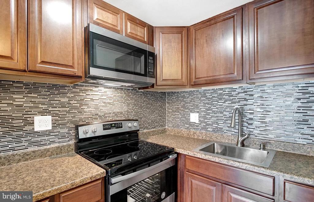
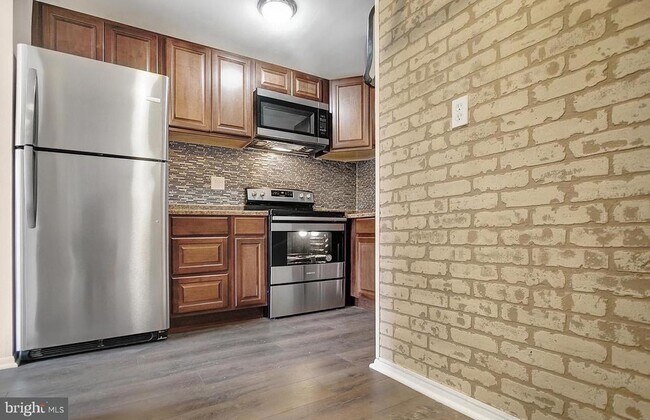
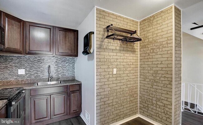
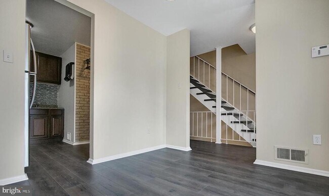
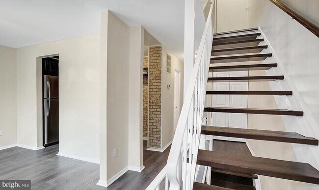
Three bedroom 1 & half bath town house available for rent. Walking distance to Metro station. Quiet neighborhood. Assigned parking spot plus plenty space for visitors plus street parking available. No Carpet in the house. You can bring your own agent or contact the listing agent directly. Property is walk-in ready. The house is 3 floors. The lowest floor which is the basement is occupied by the owner. It has its own entrance from the back and is completely separated from the top floor. Only the top two floors are rented.
168 Daimler Dr is a townhome located in Prince George's County and the 20743 ZIP Code. This area is served by the Prince George's County Public Schools attendance zone.
Townhome Features
- Basement
Location
Get Directions
Capitol Heights -- named for its location near Washington, DC -- provides the perfect location: near DC, near the Capital Beltway, and minutes away from FedEx Field, home of the NFL's Washington Football Team. It is also close to the Anacostia River, the United States National Arboretum, and Joint Base Anacostia-Bolling. Nearby Fort Circle Park provides Capitol Heights residents with 10 miles of hiking trails -- it is also a popular concert venue and is home to Fort Dupont Ice Rink.
Capitol Heights is a terrific location for your DC-area apartment, only about seven miles southeast of downtown. Hop on the Metro at the Capitol Heights Metro Station for a fast, car-free commute. Despite being so close to the historic sites of DC, Capitol Heights was a rural area with no paved roads or streetlights. In 1910, the 200 residents in the area named their town "Capitol Heights," but it wasn't until 1980 and the arrival of the Metro Blue Line that the town began to grow.
Learn more about living in Capitol HeightsBelow are rent ranges for similar nearby apartments
Amenities
- Basement
Education
| Colleges & Universities | Distance | ||
|---|---|---|---|
| Colleges & Universities | Distance | ||
| Drive: | 9 min | 4.6 mi | |
| Drive: | 10 min | 5.4 mi | |
| Drive: | 14 min | 6.7 mi | |
| Drive: | 16 min | 8.9 mi |
168 Daimler Dr is within 10 minutes or 5.4 miles from Univ. of Md. Univ. Coll.. It is also near Prince George's Comm. Coll. and Gallaudet University.
Schools


Public Elementary School
Grades PK-5
443 Students
Attendance Zone
Public Middle School
Grades 6-8
867 Students
Attendance Zone
Public High School
Grades 9-12
877 Students
Attendance Zone
Private Elementary & Middle School
Grades PK-8
Nearby
Private Elementary & Middle School
Grades K-8
23 Students
Nearby
Private High School
Grades 9-12
40 Students
Nearby
School data provided by
 The GreatSchools Rating helps parents compare schools within a state based on a variety of school quality indicators and provides a helpful picture of how effectively each school serves all of its students. Ratings are on a scale of 1 (below average) to 10 (above average) and can include test scores, college readiness, academic progress, advanced courses, equity, discipline and attendance data. We also advise parents to visit schools, consider other information on school performance and programs, and consider family needs as part of the school selection process.
View GreatSchools Rating Methodology
Data provided by GreatSchools.org © 2025. All rights reserved.
View GreatSchools Rating Methodology
Data provided by GreatSchools.org © 2025. All rights reserved.
Transportation options available in Capitol Heights include Addison Road-Seat Pleasant, located 0.9 mile from 168 Daimler Dr. 168 Daimler Dr is near Ronald Reagan Washington Ntl, located 13.2 miles or 24 minutes away, and Baltimore/Washington International Thurgood Marshall, located 30.4 miles or 45 minutes away.
| Transit / Subway | Distance | ||
|---|---|---|---|
| Transit / Subway | Distance | ||
|
|
Walk: | 16 min | 0.9 mi |
|
Capitol Heights, Blue/Silver Line Center Platform
|
Drive: | 4 min | 1.6 mi |
|
|
Drive: | 6 min | 2.7 mi |
|
|
Drive: | 10 min | 4.0 mi |
|
|
Drive: | 9 min | 4.5 mi |
| Commuter Rail | Distance | ||
|---|---|---|---|
| Commuter Rail | Distance | ||
|
|
Drive: | 13 min | 7.0 mi |
|
|
Drive: | 15 min | 7.8 mi |
| Drive: | 15 min | 9.2 mi | |
|
|
Drive: | 15 min | 9.2 mi |
|
|
Drive: | 16 min | 9.5 mi |
| Airports | Distance | ||
|---|---|---|---|
| Airports | Distance | ||
|
Ronald Reagan Washington Ntl
|
Drive: | 24 min | 13.2 mi |
|
Baltimore/Washington International Thurgood Marshall
|
Drive: | 45 min | 30.4 mi |
Time and distance from 168 Daimler Dr.
| Shopping Centers | Distance | ||
|---|---|---|---|
| Shopping Centers | Distance | ||
| Walk: | 19 min | 1.0 mi | |
| Drive: | 2 min | 1.1 mi | |
| Drive: | 3 min | 1.6 mi |
168 Daimler Dr has 3 shopping centers within 1.6 miles, which is about a 3-minute walk. The miles and minutes will be for the farthest away property.
| Parks and Recreation | Distance | ||
|---|---|---|---|
| Parks and Recreation | Distance | ||
|
Walker Mill Regional Park
|
Drive: | 6 min | 2.8 mi |
|
Fort Dupont Park
|
Drive: | 10 min | 4.2 mi |
|
Suitland Bog
|
Drive: | 11 min | 5.7 mi |
|
Bladensburg Waterfront Park
|
Drive: | 10 min | 5.9 mi |
|
National Arboretum
|
Drive: | 14 min | 7.4 mi |
168 Daimler Dr has 5 parks within 7.4 miles, including Walker Mill Regional Park, Fort Dupont Park, and Suitland Bog.
| Hospitals | Distance | ||
|---|---|---|---|
| Hospitals | Distance | ||
| Drive: | 10 min | 5.2 mi | |
| Drive: | 18 min | 7.3 mi | |
| Drive: | 17 min | 7.5 mi |
168 Daimler Dr has 3 hospitals within 7.5 miles, the nearest is University of Maryland Prince George's Hospital Center which is 5.2 miles away and a 10 minute drive.
| Military Bases | Distance | ||
|---|---|---|---|
| Military Bases | Distance | ||
| Drive: | 15 min | 7.3 mi | |
| Drive: | 16 min | 7.7 mi |
168 Daimler Dr is 7.3 miles from Washington Navy Yard, and is convenient to other military bases, including Andrews Airforce Base.
You May Also Like
Similar Rentals Nearby


What Are Walk Score®, Transit Score®, and Bike Score® Ratings?
Walk Score® measures the walkability of any address. Transit Score® measures access to public transit. Bike Score® measures the bikeability of any address.
What is a Sound Score Rating?
A Sound Score Rating aggregates noise caused by vehicle traffic, airplane traffic and local sources

168 Daimler Dr
Capitol Heights, MD 20743