$2,500 / Month
1678 Westwind Way
McLean, VA 22102
2 Weeks Ago
Favorites
1678 Westwind Way

Favorites
Check Back Soon for Upcoming Availability
| Beds | Baths | Average SF |
|---|---|---|
| 2 Bedrooms 2 Bedrooms 2 Br | 1.5 Baths 1.5 Baths 1.5 Ba | — |
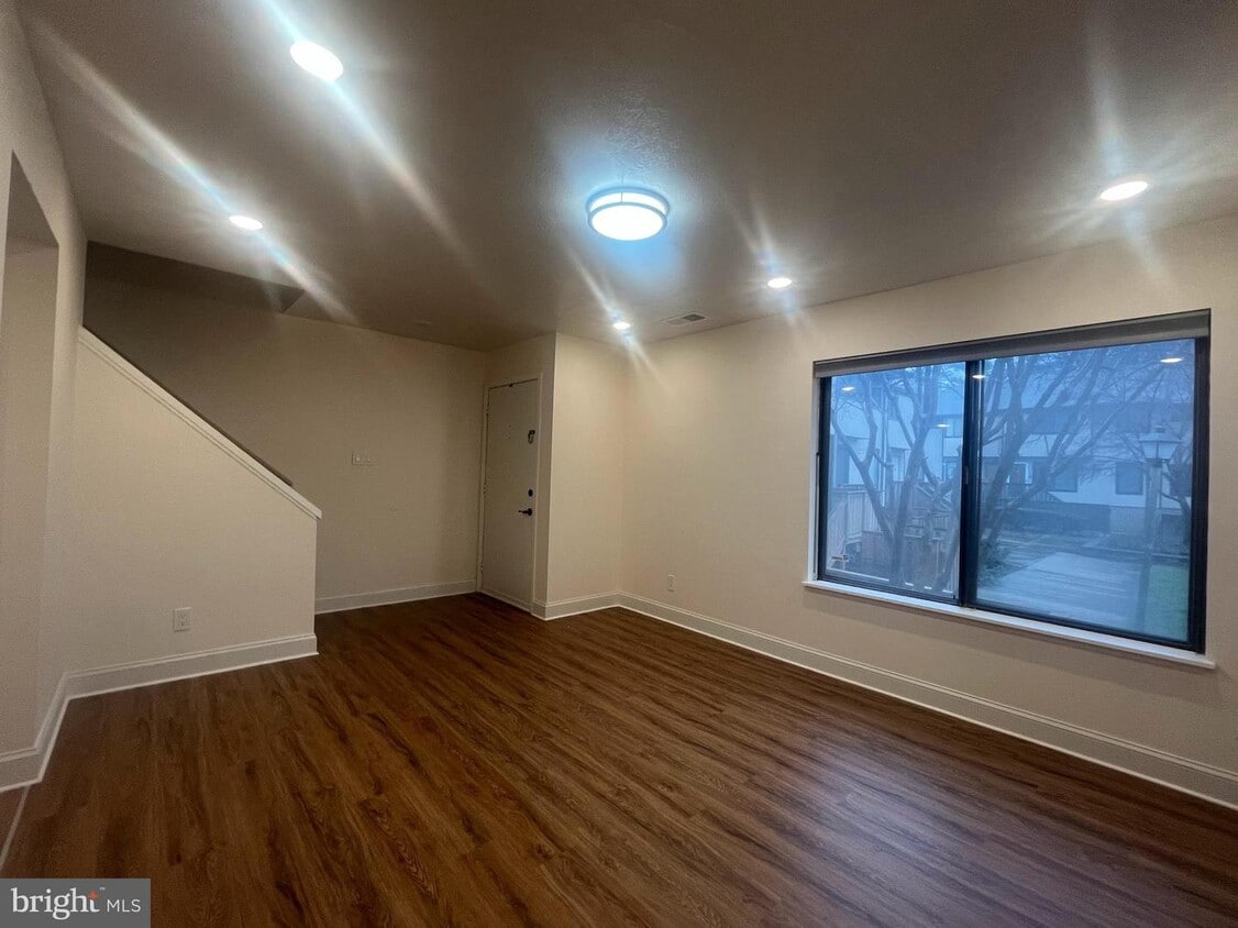
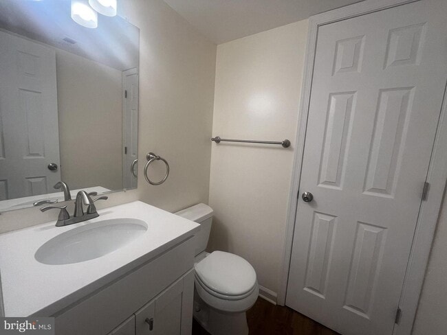
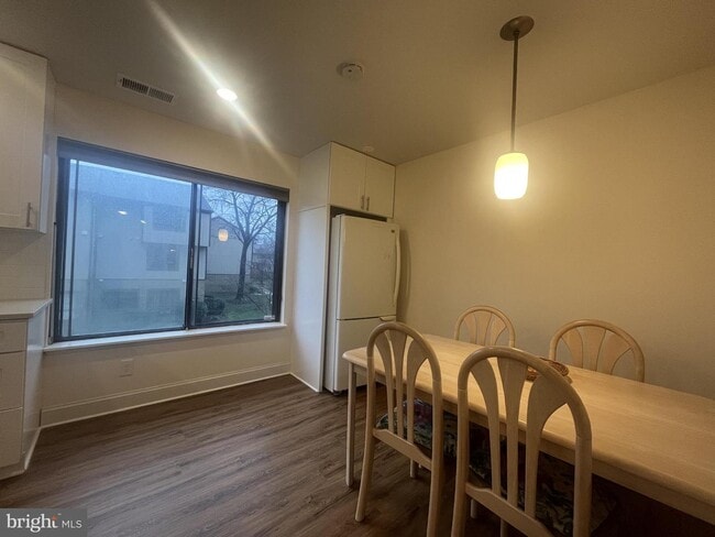
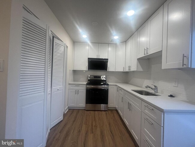
About This Property
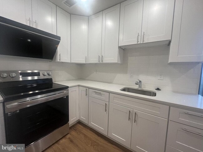
Welcome to this two story townhome style condo with two bedrooms and one-half baths which offers both style and functionality. The kitchen and baths have been renovated, flooring replaced and the home has been freshly painted. The Westerlies location is just across the street from Safeway and Lost Dog. Located a short distance to the McLean Silver Line metro station, Capital One Hall, Wegman’s, The Perch and Starr Hill Brewery. Conveniently inside the Capital Beltway in Tysons, easy access to I66 and Dulles Tollroad. The Westerlies communities amenities includes a tot lot and outdoor pool in the summer months.
1678 Westwind Way is a townhome located in Fairfax County and the 22102 ZIP Code. This area is served by the Fairfax County Public Schools attendance zone.
Location
Get Directions
True to its name, Tysons East is located in the eastern portion of Tysons Corner, one of the largest commercial hubs in the Washington, DC metro area and the nation. Living in Tysons East will place you just a few steps away from Tysons Corner Center, Tysons Galleria, and Tysons Square, providing easy access to a plethora of restaurants, high-end retailers, big-box stores, entertainment options, and more. Tysons Corner is also home to several business parks, making it a great option for employees looking for a short commute. This amenity-laden neighborhood has luxury condos and apartments available for rent. Since Tysons East is about 12 miles away from Washington, DC, it’s also an ideal choice for commuters. Hop onto one of the many roadways nearby, like Interstate 66, or take the train at the McLean Metro station to travel into the nation’s capital.
Learn more about living in Tysons EastBelow are rent ranges for similar nearby apartments
| Beds | Average Size | Lowest | Typical | Premium |
|---|---|---|---|---|
| Studio Studio Studio | 580 Sq Ft | $2,472 | $2,515 | $2,541 |
| 1 Bed 1 Bed 1 Bed | 765-766 Sq Ft | $1,850 | $3,108 | $6,941 |
| 2 Beds 2 Beds 2 Beds | 1159-1160 Sq Ft | $2,215 | $4,373 | $8,269 |
| 3 Beds 3 Beds 3 Beds | 1984 Sq Ft | $4,200 | $5,678 | $7,408 |
| 4 Beds 4 Beds 4 Beds | 2843 Sq Ft | $3,995 | $4,449 | $4,650 |
Education
| Colleges & Universities | Distance | ||
|---|---|---|---|
| Colleges & Universities | Distance | ||
| Drive: | 13 min | 5.5 mi | |
| Drive: | 17 min | 7.9 mi | |
| Drive: | 14 min | 8.3 mi | |
| Drive: | 18 min | 8.4 mi |
1678 Westwind Way is within 13 minutes or 5.5 miles from Marymount University. It is also near George Mason Univ., Arlington and GWU, Mount Vernon.
Schools


Public Elementary School
Grades PK-6
584 Students
Attendance Zone
Public Middle School
Grades 7-8
1,225 Students
Attendance Zone
Public High School
Grades 9-12
2,441 Students
Attendance Zone
Private Elementary, Middle & High School
Grades PK-12
Nearby
Private Elementary & Middle School
Grades PK-8
481 Students
Nearby
School data provided by
 The GreatSchools Rating helps parents compare schools within a state based on a variety of school quality indicators and provides a helpful picture of how effectively each school serves all of its students. Ratings are on a scale of 1 (below average) to 10 (above average) and can include test scores, college readiness, academic progress, advanced courses, equity, discipline and attendance data. We also advise parents to visit schools, consider other information on school performance and programs, and consider family needs as part of the school selection process.
View GreatSchools Rating Methodology
Data provided by GreatSchools.org © 2025. All rights reserved.
View GreatSchools Rating Methodology
Data provided by GreatSchools.org © 2025. All rights reserved.
Transportation options available in McLean include Mclean, located 0.8 mile from 1678 Westwind Way. 1678 Westwind Way is near Ronald Reagan Washington Ntl, located 14.9 miles or 24 minutes away, and Washington Dulles International, located 16.3 miles or 28 minutes away.
| Transit / Subway | Distance | ||
|---|---|---|---|
| Transit / Subway | Distance | ||
|
|
Walk: | 15 min | 0.8 mi |
|
|
Drive: | 4 min | 1.7 mi |
|
|
Drive: | 6 min | 2.7 mi |
|
|
Drive: | 7 min | 3.1 mi |
|
|
Drive: | 17 min | 9.8 mi |
| Commuter Rail | Distance | ||
|---|---|---|---|
| Commuter Rail | Distance | ||
|
|
Drive: | 21 min | 12.7 mi |
|
|
Drive: | 22 min | 12.9 mi |
|
|
Drive: | 24 min | 13.5 mi |
|
|
Drive: | 21 min | 13.6 mi |
|
|
Drive: | 23 min | 14.8 mi |
| Airports | Distance | ||
|---|---|---|---|
| Airports | Distance | ||
|
Ronald Reagan Washington Ntl
|
Drive: | 24 min | 14.9 mi |
|
Washington Dulles International
|
Drive: | 28 min | 16.3 mi |
Time and distance from 1678 Westwind Way.
| Shopping Centers | Distance | ||
|---|---|---|---|
| Shopping Centers | Distance | ||
| Walk: | 5 min | 0.3 mi | |
| Drive: | 4 min | 1.6 mi | |
| Drive: | 4 min | 1.6 mi |
1678 Westwind Way has 3 shopping centers within 1.6 miles, which is about a 4-minute walk. The miles and minutes will be for the farthest away property.
| Parks and Recreation | Distance | ||
|---|---|---|---|
| Parks and Recreation | Distance | ||
|
Clemyjontri Park
|
Drive: | 8 min | 4.0 mi |
|
Claude Moore Colonial Farm
|
Drive: | 11 min | 4.4 mi |
|
W&OD Trail
|
Drive: | 8 min | 4.6 mi |
|
Rock Spring Park
|
Drive: | 11 min | 4.9 mi |
|
Benjamin Banneker Park
|
Drive: | 9 min | 5.0 mi |
1678 Westwind Way has 5 parks within 5.0 miles, including Clemyjontri Park, W&OD Trail, and Benjamin Banneker Park.
| Hospitals | Distance | ||
|---|---|---|---|
| Hospitals | Distance | ||
| Drive: | 11 min | 4.9 mi | |
| Drive: | 11 min | 6.6 mi | |
| Drive: | 13 min | 6.9 mi |
1678 Westwind Way has 3 hospitals within 6.9 miles, the nearest is Dominion Hospital which is 4.9 miles away and a 11 minute drive.
You May Also Like
Similar Rentals Nearby


What Are Walk Score®, Transit Score®, and Bike Score® Ratings?
Walk Score® measures the walkability of any address. Transit Score® measures access to public transit. Bike Score® measures the bikeability of any address.
What is a Sound Score Rating?
A Sound Score Rating aggregates noise caused by vehicle traffic, airplane traffic and local sources

1678 Westwind Way
McLean, VA 22102