
$3,000
/ Month
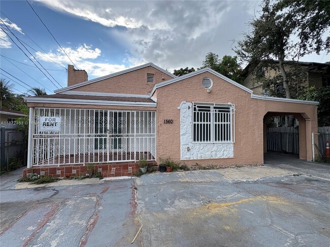
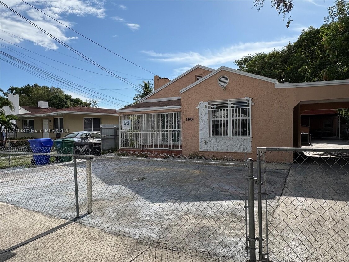
1560 NW 25th Ave
Miami, FL 33125
2 Weeks Ago
|
Edit
Favorites
786-304-2991
-
Bedrooms
3
-
Bathrooms
1
-
Square Feet
2,117 sq ft
-
Available
Available Now
1560 NW 25th Ave

Favorites
About This Home
12 Month Lease,
$3,000 deposit,
Available Now
ONLY 2 MONTH TO ENTER THE LEASE!! Take advantage of this remodeled home with impact windows, parking space for 3+ cars, just pay 1st month and security deposit. In the heart of Miami, close to everything.
1560 NW 25th Ave is an apartment community located in Miami/Dade County and the 33125 ZIP Code. This area is served by the Miami-Dade County Public Schools attendance zone.
* Price shown is base rent. Excludes user-selected optional fees and variable or usage-based fees and required charges due at or prior to move-in or at move-out. Price, availability, fees, and any applicable rent special are subject to change without notice.
* Square footage definitions vary. Displayed square footage is approximate.
Contact
- Listed by Julio Laborde
- Phone Number
- Contact
Location
Get Directions
Located just west of Downtown Miami, Little Havana is the epicenter of Cuban culture in Miami. Little Havana, named after Cuba’s capital city, is best known for Calle Ocho, the neighborhood’s main commercial thoroughfare brimming with restaurants, specialty shops, art galleries, and dance halls in colorful buildings in addition to a Latin Walk of Fame.
The Little Havana community comes together for an array of annual events, including the popular Calle Ocho Festival, Viernes Culturales/Cultural Fridays, Salsero Sundays, and the Miami Beer Festival at Marlins Park. Marlins Park, home of the MLB Miami Marlins, is also located in the eastern portion of the neighborhood.
Outside of Calle Ocho and Marlins Park, Little Havana is largely residential, boasting a variety of apartments and houses available for rent. The neighborhood is an attractive option for many commuters, offering close proximity to Downtown Miami, Brickell, Coconut Grove, Coral Gables, Wynwood, and Miami Beach.
Learn more about living in Little Havana
Education
| Colleges & Universities | Distance | ||
|---|---|---|---|
| Colleges & Universities | Distance | ||
| Drive: | 4 min | 2.2 mi | |
| Drive: | 5 min | 2.3 mi | |
| Drive: | 6 min | 2.4 mi | |
| Drive: | 6 min | 3.1 mi |
1560 NW 25th Ave is within 4 minutes or 2.2 miles from Miami Dade Coll., InterAm.. It is also near Univ. of Miami, Uhealth and Miami Dade College, Medical.
Schools


Public Elementary School
Grades PK-5
573 Students
Attendance Zone
Public Middle School
Grades 6-8
781 Students
Attendance Zone
Public High School
Grades 9-12
1,305 Students
Attendance Zone
Private Elementary, Middle & High School
Grades PK-12
697 Students
Nearby
School data provided by
 The GreatSchools Rating helps parents compare schools within a state based on a variety of school quality indicators and provides a helpful picture of how effectively each school serves all of its students. Ratings are on a scale of 1 (below average) to 10 (above average) and can include test scores, college readiness, academic progress, advanced courses, equity, discipline and attendance data. We also advise parents to visit schools, consider other information on school performance and programs, and consider family needs as part of the school selection process.
View GreatSchools Rating Methodology
Data provided by GreatSchools.org © 2025. All rights reserved.
View GreatSchools Rating Methodology
Data provided by GreatSchools.org © 2025. All rights reserved.
Transportation options available in Miami include Airport Station, located 2.9 miles from 1560 NW 25th Ave. 1560 NW 25th Ave is near Miami International, located 8.2 miles or 17 minutes away, and Fort Lauderdale/Hollywood International, located 24.7 miles or 35 minutes away.
| Transit / Subway | Distance | ||
|---|---|---|---|
| Transit / Subway | Distance | ||
|
Airport Station
|
Drive: | 10 min | 2.9 mi |
|
Miami Intl Airport Ground Level
|
Drive: | 8 min | 3.5 mi |
|
|
Drive: | 7 min | 3.7 mi |
|
|
Drive: | 7 min | 4.0 mi |
|
|
Drive: | 8 min | 4.5 mi |
| Commuter Rail | Distance | ||
|---|---|---|---|
| Commuter Rail | Distance | ||
|
|
Drive: | 5 min | 2.1 mi |
|
|
Drive: | 5 min | 2.2 mi |
|
|
Drive: | 6 min | 2.4 mi |
|
|
Drive: | 7 min | 2.9 mi |
|
|
Drive: | 9 min | 5.9 mi |
| Airports | Distance | ||
|---|---|---|---|
| Airports | Distance | ||
|
Miami International
|
Drive: | 17 min | 8.2 mi |
|
Fort Lauderdale/Hollywood International
|
Drive: | 35 min | 24.7 mi |
Time and distance from 1560 NW 25th Ave.
| Shopping Centers | Distance | ||
|---|---|---|---|
| Shopping Centers | Distance | ||
| Walk: | 4 min | 0.2 mi | |
| Walk: | 11 min | 0.6 mi | |
| Walk: | 14 min | 0.8 mi |
1560 NW 25th Ave has 3 shopping centers within 0.8 mile, which is about a 14-minute walk. The miles and minutes will be for the farthest away property.
| Parks and Recreation | Distance | ||
|---|---|---|---|
| Parks and Recreation | Distance | ||
|
The Barnacle Historic State Park
|
Drive: | 10 min | 4.7 mi |
|
Miami Children's Museum
|
Drive: | 9 min | 5.2 mi |
|
Jungle Island
|
Drive: | 9 min | 5.5 mi |
|
Miami Science Museum - Closed
|
Drive: | 10 min | 6.1 mi |
|
Vizcaya Museum and Gardens
|
Drive: | 12 min | 6.3 mi |
1560 NW 25th Ave has 5 parks within 6.3 miles, including Miami Children's Museum, Miami Science Museum - Closed, and Jungle Island.
| Hospitals | Distance | ||
|---|---|---|---|
| Hospitals | Distance | ||
| Drive: | 6 min | 2.4 mi | |
| Drive: | 10 min | 5.1 mi | |
| Drive: | 11 min | 5.9 mi |
1560 NW 25th Ave has 3 hospitals within 5.9 miles, the nearest is Jackson Health System which is 2.4 miles away and a 6 minute drive.
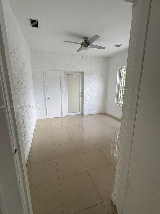
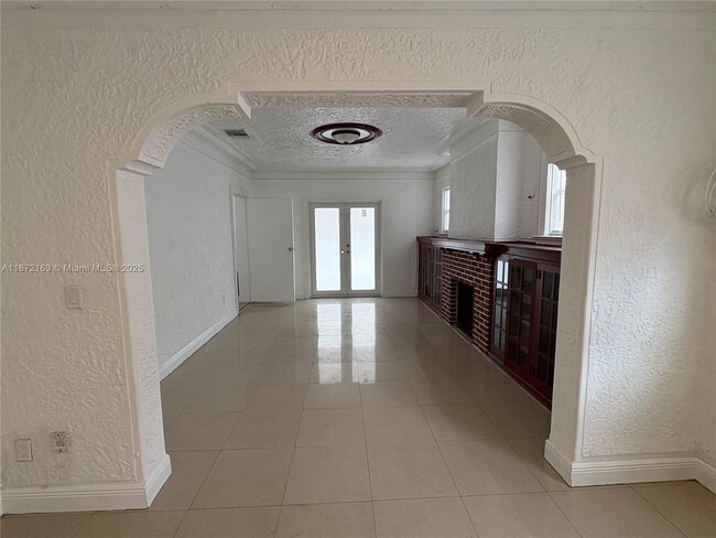
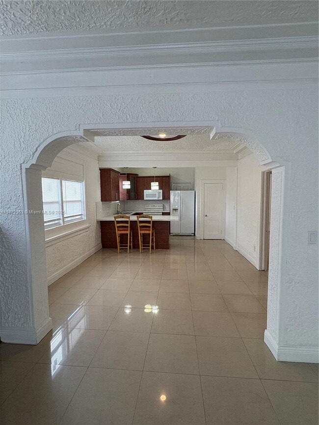
1560 NW 25th Ave Photos
What Are Walk Score®, Transit Score®, and Bike Score® Ratings?
Walk Score® measures the walkability of any address. Transit Score® measures access to public transit. Bike Score® measures the bikeability of any address.
What is a Sound Score Rating?
A Sound Score Rating aggregates noise caused by vehicle traffic, airplane traffic and local sources
1560 NW 25th Ave
Miami, FL 33125