
$1,785
/ Month
1389 W Galbraith Rd
Cincinnati, OH 45231
Favorites
513-880-8708
-
Bedrooms
3
-
Bathrooms
1.5
-
Square Feet
1,100 sq ft
-
Available
Available Now
1389 W Galbraith Rd

Favorites
About This Home
Available Now
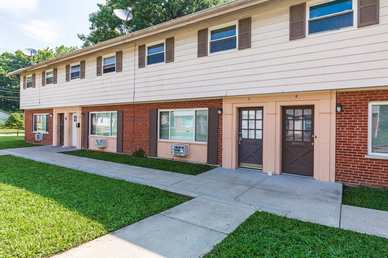
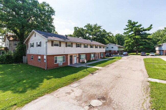
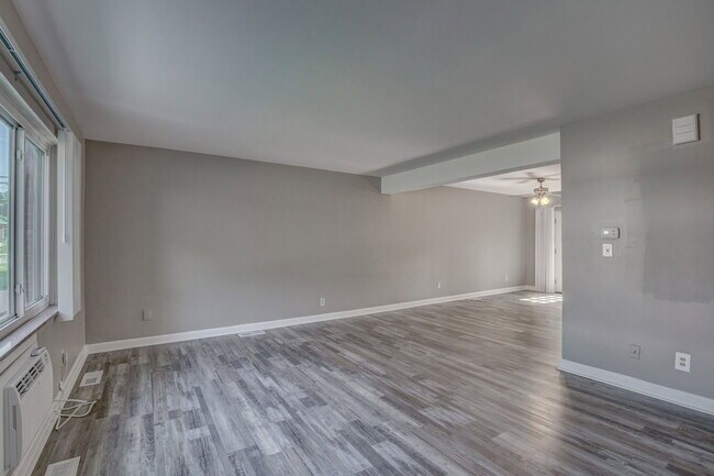
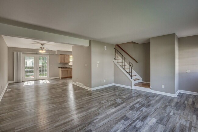
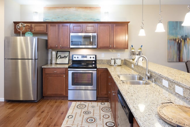
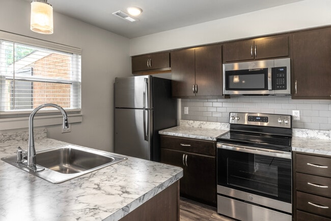
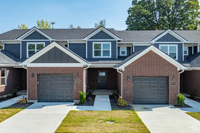
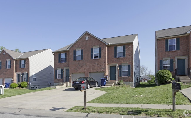
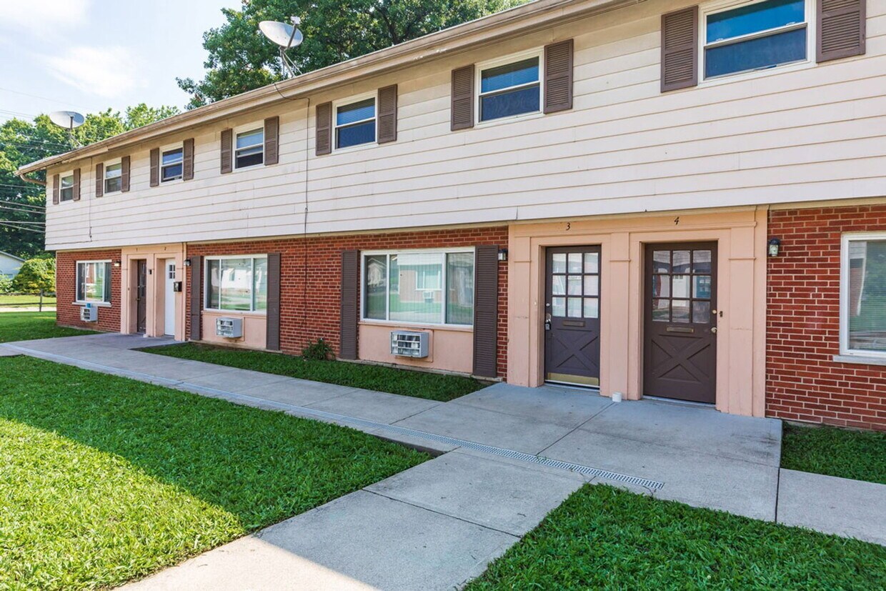
Welcome home to this spacious 3-bedroom, 1.5-bath townhouse in a pet-friendly community on West Galbraith Road. Featuring a large multi-level floor plan, this home offers plenty of space for families, roommates, or anyone needing extra room for a home office or flexible living. Conveniently located in North College Hill, you'll enjoy quick access to shopping, restaurants, schools, and I-275, making commuting and everyday errands a breeze. Pets are welcome with applicable pet rent. Tenants are responsible for electric, gas, and heat. Section 8 approved. Background checks are required. A credit score of 600+ or a co-signer with 700+ is required. Published rent includes water, sewer, and trash, as well as Resident Benefits Package (RBP)* and Group Rate Internet (GRI)** fees. *RBP (APT) — $25.00/month: Credit Building, Resident Rewards, Identity Theft Protection, Utility Concierge **GRI — $65.00/month: 1 Gig internet connection with no data caps, professional installation, all necessary equipment, and ongoing technical support — included as an amenity of the home. By submitting your information on this page you consent to being contacted by the Property Manager and RentEngine via SMS, phone, or email.
1389 W Galbraith Rd is a townhome located in Hamilton County and the 45231 ZIP Code. This area is served by the North College Hill City attendance zone.
* Price shown is base rent. Excludes user-selected optional fees and variable or usage-based fees and required charges due at or prior to move-in or at move-out. Price, availability, fees, and any applicable rent special are subject to change without notice.
* Square footage definitions vary. Displayed square footage is approximate.
Townhome Features
- Microwave
- Range
Contact
- Listed by Keller
- Phone Number
- Contact
Location
Get Directions
Cincinnati sits on the northern bank of the Ohio River, where rolling hills meet a city that helped establish the Midwest long before other major metros existed. Settled in 1788, the Queen City sits west of the Appalachian Mountains and combines historic culture with urban living.
Today, neighborhoods like Over-the-Rhine, Hyde Park, and Mount Adams each bring a distinct character to city life. Over-the-Rhine is packed with restored 19th-century architecture, Findlay Market, and Music Hall. Mount Adams perches beside Eden Park with stunning river views, while Hyde Park Square draws locals and tourists alike with local cafes and walkable streets.
Renters will find a wide range of housing options across the city, from converted lofts and townhouses in Over-the-Rhine to sleek high-rise apartment communities along the riverfront at The Banks. Clifton and Oakley offer everything from charming older buildings to newer developments with modern amenities.
Learn more about living in Cincinnati
Amenities
- Microwave
- Range
Education
| Colleges & Universities | Distance | ||
|---|---|---|---|
| Colleges & Universities | Distance | ||
| Drive: | 17 min | 7.0 mi | |
| Drive: | 16 min | 7.6 mi | |
| Drive: | 17 min | 7.7 mi | |
| Drive: | 17 min | 9.2 mi |
1389 W Galbraith Rd is within 17 minutes or 7.0 miles from Cincinnati State. It is also near University of Cincinnati and Univ. of Cincinnati, Medical.
Schools


Public Elementary School
Grades PK-5
459 Students
Attendance Zone
Public Elementary & Middle School
Grades K-8
445 Students
Attendance Zone
Public High School
Grades 9-12
310 Students
Attendance Zone
Private Elementary & Middle School
Grades PK-8
105 Students
Nearby
Private High School
Grades 9-12
420 Students
Nearby
School data provided by
 The GreatSchools Rating helps parents compare schools within a state based on a variety of school quality indicators and provides a helpful picture of how effectively each school serves all of its students. Ratings are on a scale of 1 (below average) to 10 (above average) and can include test scores, college readiness, academic progress, advanced courses, equity, discipline and attendance data. We also advise parents to visit schools, consider other information on school performance and programs, and consider family needs as part of the school selection process.
View GreatSchools Rating Methodology
Data provided by GreatSchools.org © 2026. All rights reserved.
The GreatSchools Rating helps parents compare schools within a state based on a variety of school quality indicators and provides a helpful picture of how effectively each school serves all of its students. Ratings are on a scale of 1 (below average) to 10 (above average) and can include test scores, college readiness, academic progress, advanced courses, equity, discipline and attendance data. We also advise parents to visit schools, consider other information on school performance and programs, and consider family needs as part of the school selection process.
View GreatSchools Rating Methodology
Data provided by GreatSchools.org © 2026. All rights reserved.
Transportation options available in Cincinnati include Findlay Market-Race Station - Race & Elder, located 8.6 miles from 1389 W Galbraith Rd. 1389 W Galbraith Rd is near Cincinnati/Northern Kentucky International, located 22.9 miles or 44 minutes away.
| Transit / Subway | Distance | ||
|---|---|---|---|
| Transit / Subway | Distance | ||
| Drive: | 19 min | 8.6 mi | |
| Drive: | 20 min | 8.8 mi | |
| Drive: | 20 min | 8.8 mi | |
| Drive: | 20 min | 8.9 mi | |
| Drive: | 21 min | 9.3 mi |
| Commuter Rail | Distance | ||
|---|---|---|---|
| Commuter Rail | Distance | ||
|
|
Drive: | 20 min | 8.9 mi |
| Airports | Distance | ||
|---|---|---|---|
| Airports | Distance | ||
|
Cincinnati/Northern Kentucky International
|
Drive: | 44 min | 22.9 mi |
Getting Around
 What do Walkability, Transit, Drivability, and Bikeability mean?
Walkability measures the walking distance to day-to-day needs.
Transit measures access to public transportation.
Drivability measures congestion, parking availability, and access to major roads.
Bikeability measures the suitability for cycling.
How It Works
What do Walkability, Transit, Drivability, and Bikeability mean?
Walkability measures the walking distance to day-to-day needs.
Transit measures access to public transportation.
Drivability measures congestion, parking availability, and access to major roads.
Bikeability measures the suitability for cycling.
How It Works
Fairly Walkable
Walkability
50
/ 100
Minimal Public Transit
Transit
10
/ 100
Exceptionally Drivable
Drivability
100
/ 100
Fairly Bikeable
Bikeability
40
/ 100
Scores provided by
What do Walkability, Transit, Drivability, and Bikeability mean?
Walkability measures the walking distance to day-to-day needs.
Transit measures access to public transportation.
Drivability measures congestion, parking availability, and access to major roads.
Bikeability measures the suitability for cycling.
How It Works
Active
Soundscore™
74
/ 100
Traffic
BusyAirport
CalmBusinesses
CalmScores provided by
HowLoud What is a Sound Score Rating? A Sound Score Rating aggregates noise caused by vehicle traffic, airplane traffic and local sources. How It WorksTime and distance from 1389 W Galbraith Rd.
| Shopping Centers | Distance | ||
|---|---|---|---|
| Shopping Centers | Distance | ||
| Walk: | 7 min | 0.4 mi | |
| Walk: | 7 min | 0.4 mi | |
| Walk: | 9 min | 0.5 mi |
1389 W Galbraith Rd has 3 shopping centers within 0.5 mile, which is about a 9-minute walk. The miles and minutes will be for the farthest away property.
| Parks and Recreation | Distance | ||
|---|---|---|---|
| Parks and Recreation | Distance | ||
|
LaBoiteaux Woods
|
Drive: | 8 min | 2.7 mi |
|
Buttercup Valley
|
Drive: | 10 min | 3.8 mi |
|
Caldwell Preserve
|
Drive: | 9 min | 4.0 mi |
|
Farbach-Werner Nature Preserve
|
Drive: | 9 min | 4.2 mi |
|
Winton Woods Park
|
Drive: | 10 min | 4.3 mi |
1389 W Galbraith Rd has 5 parks within 4.3 miles, including LaBoiteaux Woods, Buttercup Valley, and Farbach-Werner Nature Preserve.
| Hospitals | Distance | ||
|---|---|---|---|
| Hospitals | Distance | ||
| Drive: | 9 min | 5.2 mi | |
| Drive: | 15 min | 6.2 mi | |
| Drive: | 14 min | 6.8 mi |
1389 W Galbraith Rd has 3 hospitals within 6.8 miles, the nearest is Summit Behavioral Healthcare which is 5.2 miles away and a 9 minute drive.
| Military Bases | Distance | ||
|---|---|---|---|
| Military Bases | Distance | ||
| Drive: | 64 min | 49.5 mi | |
| Drive: | 70 min | 54.5 mi | |
| Drive: | 73 min | 57.8 mi |
1389 W Galbraith Rd has 3 military bases within 57.8 miles, the nearest is Gentile Air Force Station which is 49.5 miles away and a 64 minute drive.
You May Also Like
Similar Rentals Nearby
-
-
-
-
-
-
1 / 45
-
-
-
3 Beds$2,312+Total Monthly PriceTotal Monthly Price NewPrices include required monthly fees of $11.Base Rent:3 Beds$2,300+
-

1389 W Galbraith Rd
Cincinnati, OH 45231