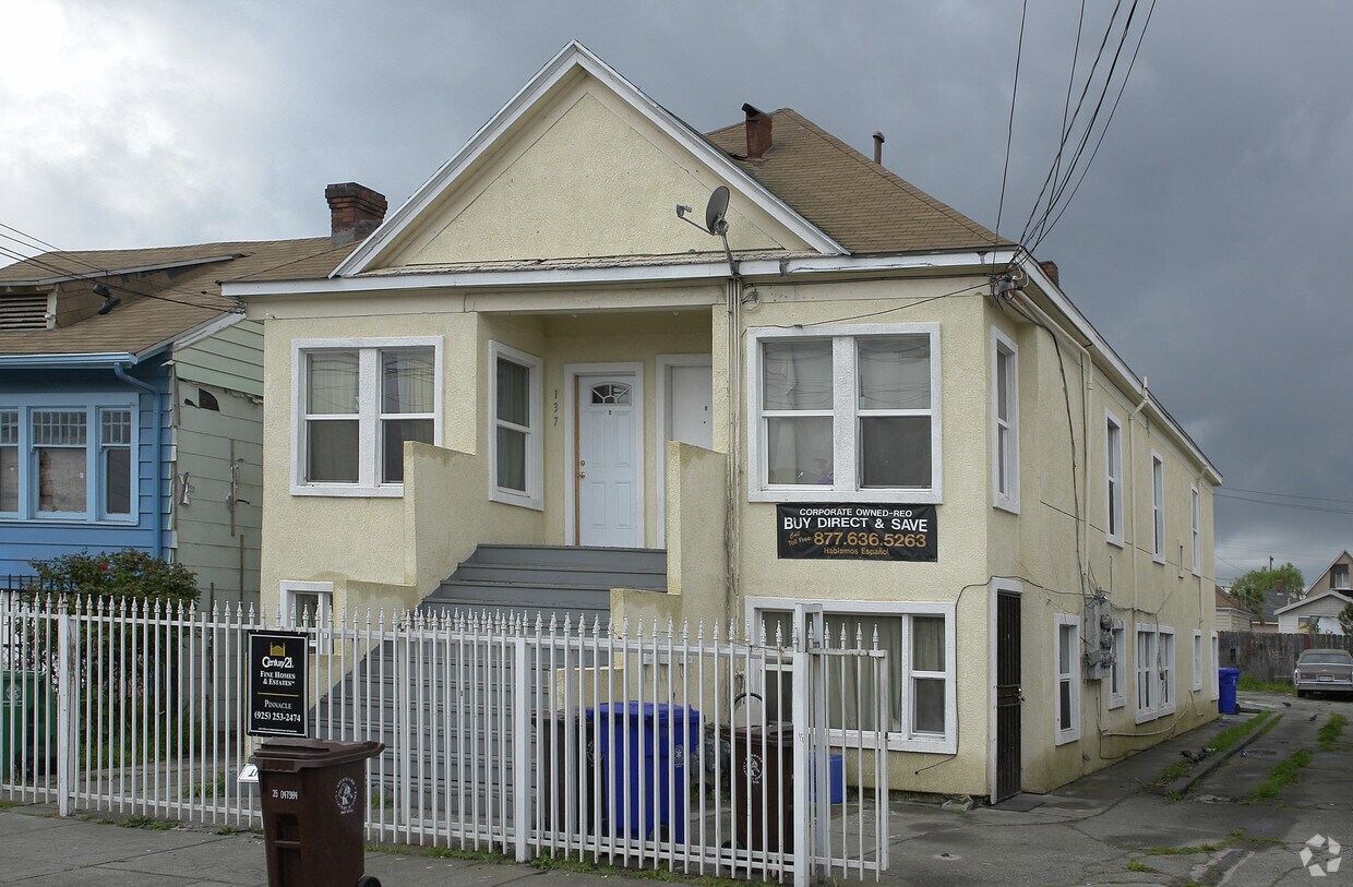
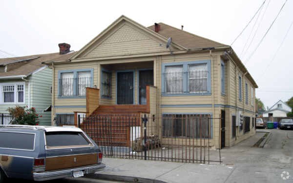
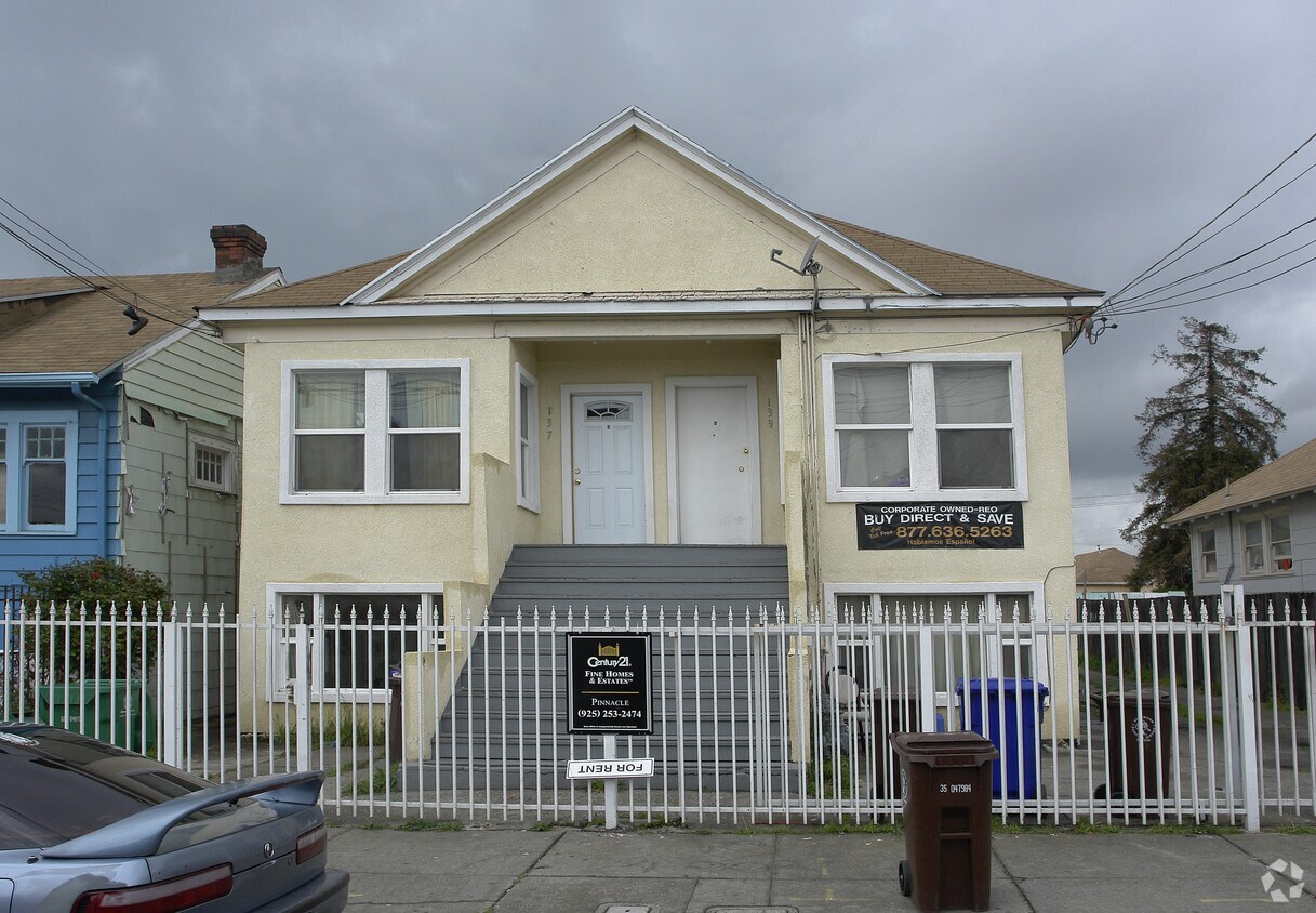
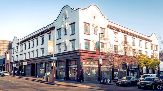
137 4th St
137 4th St,
Richmond,
CA
94801
2 Weeks Ago
Favorites
137 4th St

Favorites
Check Back Soon for Upcoming Availability
| Beds | Baths | Average SF | Availability |
|---|---|---|---|
| 1 Bedroom 1 Bedroom 1 Br | 1 Bath 1 Bath 1 Ba | 550 SF | Not Available |
| 2 Bedrooms 2 Bedrooms 2 Br | 1 Bath 1 Bath 1 Ba | 600 SF | Not Available |
Fees and Policies
Details
Property Information
-
Built in 1915
-
6 units/2 stories
About 137 4th St Richmond, CA 94801
Come enjoy Richmond living at 137 4th St. This community is located in the Iron Triangle area of Richmond. This community provides 1 to 2 bedroom apartments. The leasing staff will assist you in finding the perfect apartment. Contact us or stop by today.
137 4th St is an apartment community located in Contra Costa County and the 94801 ZIP Code. This area is served by the West Contra Costa Unified attendance zone.
Location
Get Directions
The Iron Triangle neighborhood sits in the heart of Central Richmond, California. With the area being largely residential, most rentals reside in the upper part of the triangle and an easy three-mile commute north to Point Richmond, a major shipping and industrial area. To the south, Berkeley and Oakland lie roughly 10 miles away via Interstate 580.
Locals often head for the Miller/Knox Regional Shoreline for a bit of jogging or cycling, or to cast a line off the fishing pier. Wade into the waters of San Francisco Bay at Keller Beach on the northern end of the park, or enjoy a show at the Masquers Playhouse, also just outside the Iron Triangle's southern border. Most eateries sit along Interstate 580, including several fast food chains. The MacDonald 80 Shopping Center lies roughly three miles east of the neighborhood. Drive another three miles and find Wildcat Canyon Regional Park and the Tilden Nature Area.
Learn more about living in Iron TriangleBelow are rent ranges for similar nearby apartments
Education
| Colleges & Universities | Distance | ||
|---|---|---|---|
| Colleges & Universities | Distance | ||
| Drive: | 8 min | 3.7 mi | |
| Drive: | 16 min | 9.1 mi | |
| Drive: | 20 min | 10.1 mi | |
| Drive: | 19 min | 10.8 mi |
137 4th St is within 8 minutes or 3.7 miles from Contra Costa College. It is also near Berkeley City College and UC Berkeley.
Schools


Public Elementary School
Grades K-6
316 Students
Attendance Zone
Public Elementary School
Grades K-5
270 Students
Nearby
Public Middle School
Grades 7-8
404 Students
Attendance Zone
Public High School
Grades 9-12
823 Students
Attendance Zone
Private Elementary, Middle & High School
Grades K-12
18 Students
Nearby
Private Elementary, Middle & High School
Grades PK-12
Nearby
School data provided by
 The GreatSchools Rating helps parents compare schools within a state based on a variety of school quality indicators and provides a helpful picture of how effectively each school serves all of its students. Ratings are on a scale of 1 (below average) to 10 (above average) and can include test scores, college readiness, academic progress, advanced courses, equity, discipline and attendance data. We also advise parents to visit schools, consider other information on school performance and programs, and consider family needs as part of the school selection process.
View GreatSchools Rating Methodology
View GreatSchools Rating Methodology
Transportation options available in Richmond include Richmond, located 1.3 miles from 137 4th St. 137 4th St is near Metro Oakland International, located 22.1 miles or 31 minutes away, and San Francisco International, located 29.7 miles or 43 minutes away.
| Transit / Subway | Distance | ||
|---|---|---|---|
| Transit / Subway | Distance | ||
|
|
Drive: | 3 min | 1.3 mi |
|
|
Drive: | 8 min | 3.5 mi |
|
|
Drive: | 8 min | 3.5 mi |
|
|
Drive: | 10 min | 5.8 mi |
|
|
Drive: | 14 min | 8.5 mi |
| Commuter Rail | Distance | ||
|---|---|---|---|
| Commuter Rail | Distance | ||
| Walk: | 16 min | 0.9 mi | |
|
|
Drive: | 11 min | 7.7 mi |
| Drive: | 16 min | 9.1 mi | |
|
|
Drive: | 14 min | 9.5 mi |
| Drive: | 16 min | 10.0 mi |
| Airports | Distance | ||
|---|---|---|---|
| Airports | Distance | ||
|
Metro Oakland International
|
Drive: | 31 min | 22.1 mi |
|
San Francisco International
|
Drive: | 43 min | 29.7 mi |
Time and distance from 137 4th St.
| Shopping Centers | Distance | ||
|---|---|---|---|
| Shopping Centers | Distance | ||
| Walk: | 10 min | 0.6 mi | |
| Drive: | 4 min | 1.9 mi | |
| Drive: | 5 min | 2.3 mi |
137 4th St has 3 shopping centers within 2.3 miles, which is about a 5-minute walk. The miles and minutes will be for the farthest away property.
| Parks and Recreation | Distance | ||
|---|---|---|---|
| Parks and Recreation | Distance | ||
|
Rosie the Riveter WWII Home Front National Historical Park
|
Drive: | 5 min | 2.0 mi |
|
Miller/Knox Regional Shoreline
|
Drive: | 5 min | 2.2 mi |
|
Marina Park & Green
|
Drive: | 5 min | 2.2 mi |
|
Shimada Friendship Park
|
Drive: | 7 min | 2.9 mi |
|
Brooks Island Regional Preserve
|
Drive: | 9 min | 3.9 mi |
137 4th St has 5 parks within 3.9 miles, including Rosie the Riveter WWII Home Front National Historical Park, Marina Park & Green, and Miller/Knox Regional Shoreline.
| Hospitals | Distance | ||
|---|---|---|---|
| Hospitals | Distance | ||
| Drive: | 19 min | 10.7 mi | |
| Drive: | 16 min | 11.6 mi | |
| Drive: | 16 min | 11.6 mi |
137 4th St has 3 hospitals within 11.6 miles, the nearest is Alta Bates Summit Medical Center - Alta Bates Campus which is 10.7 miles away and a 19 minute drive.
| Military Bases | Distance | ||
|---|---|---|---|
| Military Bases | Distance | ||
| Drive: | 8 min | 3.8 mi | |
| Drive: | 13 min | 6.2 mi | |
| Drive: | 25 min | 15.7 mi |
137 4th St has 3 military bases within 15.7 miles, the nearest is Armory West Contra Costa which is 3.8 miles away and a 8 minute drive.
You May Also Like
What neighborhood is the property located in?
137 4th St Richmond, CA 94801 is in Iron Triangle in the city of Richmond. Here you’ll find three shopping centers within 2.3 miles of the property. Five parks are within 3.9 miles, including Rosie the Riveter WWII Home Front National Historical Park, Marina Park & Green, and Miller/Knox Regional Shoreline.
Similar Rentals Nearby


What Are Walk Score®, Transit Score®, and Bike Score® Ratings?
Walk Score® measures the walkability of any address. Transit Score® measures access to public transit. Bike Score® measures the bikeability of any address.
What is a Sound Score Rating?
A Sound Score Rating aggregates noise caused by vehicle traffic, airplane traffic and local sources

137 4th St
Richmond, CA 94801
Responded To This Review