

$1,500
Total Monthly Price
12 Month Lease
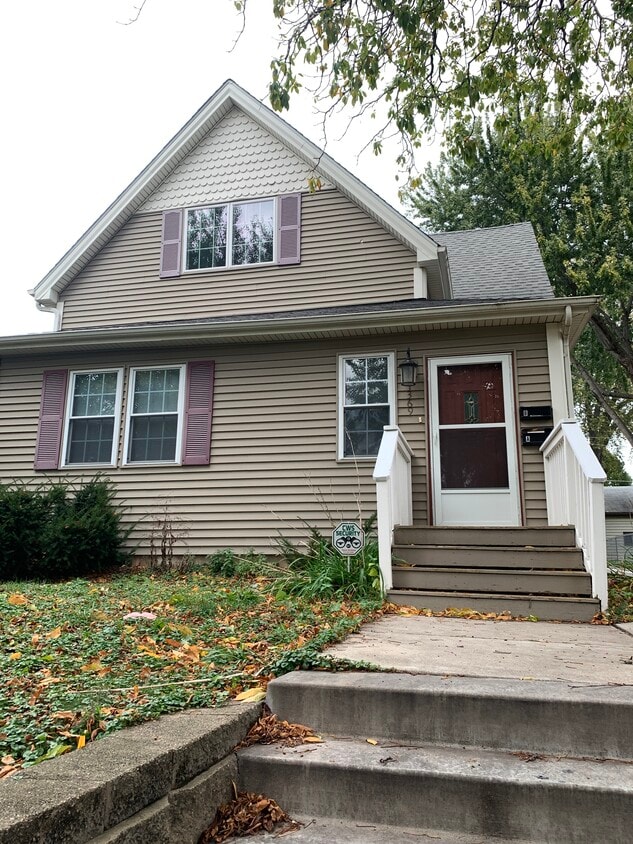
1369 Saint Clair Ave Unit Upper
Saint Paul, MN 55105
Favorites
1369 Saint Clair Ave Unit Upper

Favorites
Check Back Soon for Upcoming Availability
| Beds | Baths | Average SF |
|---|---|---|
| 2 Bedrooms 2 Bedrooms 2 Br | 1 Bath 1 Bath 1 Ba | 890 SF |
Fees and Policies
The fees listed below are community-provided and may exclude utilities or add-ons. All payments are made directly to the property and are non-refundable unless otherwise specified.
- Dogs Allowed
-
Fees not specified
- Cats Allowed
-
Fees not specified
- Parking
-
Garage--
Details
Utilities Included
-
Gas
-
Water
-
Heat
-
Trash Removal
-
Sewer
Property Information
-
2 units
About This Property
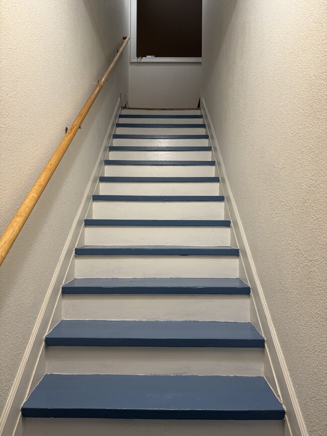
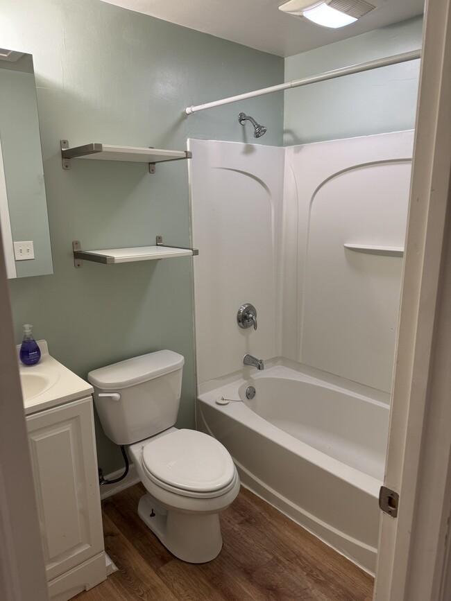
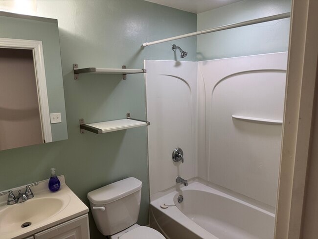
This upper level of the property at 1369 Saint Clair Ave features 2 bedrooms and 1 bathroom within a total living space of 890 square feet. The living room provides a comfortable area for relaxation and socializing, while the bedrooms offer adequate space for furnishings. The bathroom is equipped with standard fixtures and provides essential amenities. Heat and single garage space included in the rental prices. The property includes air conditioning for climate control. The exterior is maintained to ensure a welcoming appearance. This listing presents a practical option for those seeking a manageable living space with essential amenities.
1369 Saint Clair Ave is an apartment community located in Ramsey County and the 55105 ZIP Code.
Apartment Features
Air Conditioning
Refrigerator
Double Pane Windows
Oven
- Air Conditioning
- Kitchen
- Oven
- Refrigerator
- Carpet
- Double Pane Windows
- Yard
1369 Saint Clair Ave,
Saint Paul,
MN
55105
Macalester-Groveland, sometimes shortened to Mac-Grove, stretches from the eastern banks of the Mississippi River to Summit Hill. Mac-Grove is a largely residential neighborhood, touting an array of apartments and single-family homes available for rent.
The neighborhood contains the picturesque Summit Avenue Historic District, which boasts an impressive collection of Victorian-era homes between dense canopies of lush trees. One block south of Summit Avenue is the vibrant Grand Avenue, which is teeming with specialty shops, independent coffeehouses, and eclectic eateries.
Mac-Grove is famously convenient to multiple private colleges, including the University of Saint Thomas, Saint Catherine University, and Macalester College, making the neighborhood a top choice for many students, faculty, and staff. The community celebrates the start of the summer season every year with the annual Grand Old Day Festival.
Learn more about living in Macalester-GrovelandBelow are rent ranges for similar nearby apartments
Amenities
- Air Conditioning
- Kitchen
- Oven
- Refrigerator
- Carpet
- Double Pane Windows
- Yard
Expenses
Utilities Included
Gas, Water, Heat, Trash Removal, Sewer
Included
Education
| Colleges & Universities | Distance | ||
|---|---|---|---|
| Colleges & Universities | Distance | ||
| Walk: | 15 min | 0.8 mi | |
| Walk: | 21 min | 1.1 mi | |
| Drive: | 5 min | 1.9 mi | |
| Drive: | 5 min | 2.2 mi |
1369 Saint Clair Ave Unit Upper is within 15 minutes or 0.8 mile from Macalester College. It is also near Concordia Univ.-Saint Paul and St. Catherine University.
Transportation options available in Saint Paul include Snelling Ave Station, located 2.0 miles from 1369 Saint Clair Ave Unit Upper. 1369 Saint Clair Ave Unit Upper is near Minneapolis-St Paul International/Wold-Chamberlain, located 7.1 miles or 13 minutes away.
| Transit / Subway | Distance | ||
|---|---|---|---|
| Transit / Subway | Distance | ||
| Drive: | 4 min | 2.0 mi | |
| Drive: | 4 min | 2.0 mi | |
| Drive: | 4 min | 2.0 mi | |
| Drive: | 5 min | 2.5 mi | |
| Drive: | 5 min | 2.5 mi |
| Commuter Rail | Distance | ||
|---|---|---|---|
| Commuter Rail | Distance | ||
|
|
Drive: | 9 min | 4.4 mi |
|
|
Drive: | 16 min | 8.2 mi |
|
|
Drive: | 24 min | 16.8 mi |
|
|
Drive: | 34 min | 25.6 mi |
|
|
Drive: | 36 min | 27.2 mi |
| Airports | Distance | ||
|---|---|---|---|
| Airports | Distance | ||
|
Minneapolis-St Paul International/Wold-Chamberlain
|
Drive: | 13 min | 7.1 mi |
Walkability Near 1369 Saint Clair Ave Saint Paul, MN 55105
Getting Around
 What do Walkability, Transit, Drivability, and Bikeability mean?
Walkability measures the walking distance to day-to-day needs.
Transit measures access to public transportation.
Drivability measures congestion, parking availability, and access to major roads.
Bikeability measures the suitability for cycling.
How It Works
What do Walkability, Transit, Drivability, and Bikeability mean?
Walkability measures the walking distance to day-to-day needs.
Transit measures access to public transportation.
Drivability measures congestion, parking availability, and access to major roads.
Bikeability measures the suitability for cycling.
How It Works
Moderately Walkable
Walkability
60
/ 100
Some Public Transit
Transit
40
/ 100
Very Drivable
Drivability
80
/ 100
Moderately Bikeable
Bikeability
70
/ 100
Scores provided by
-
Soundscore™
-
/ 100
Traffic
-Airport
-Businesses
-Scores provided by
HowLoud What is a Sound Score Rating? A Sound Score Rating aggregates noise caused by vehicle traffic, airplane traffic and local sources. How It WorksTime and distance from 1369 Saint Clair Ave Unit Upper.
| Shopping Centers | Distance | ||
|---|---|---|---|
| Shopping Centers | Distance | ||
| Walk: | 14 min | 0.8 mi |
1369 Saint Clair Ave Unit Upper has 1 shopping centers within 0.8 mile, which is about a 14-minute walk. The miles and minutes will be for the farthest away property.
| Parks and Recreation | Distance | ||
|---|---|---|---|
| Parks and Recreation | Distance | ||
|
Macalester College Observatory
|
Walk: | 12 min | 0.7 mi |
|
Highland Park and Golf Course
|
Drive: | 4 min | 2.2 mi |
|
Newell Park
|
Drive: | 7 min | 3.3 mi |
|
Hidden Falls Park
|
Drive: | 10 min | 3.8 mi |
|
Crosby Farm Regional Park
|
Drive: | 8 min | 4.3 mi |
1369 Saint Clair Ave Unit Upper has 5 parks within 4.3 miles, including Macalester College Observatory, Highland Park and Golf Course, and Newell Park.
| Hospitals | Distance | ||
|---|---|---|---|
| Hospitals | Distance | ||
| Drive: | 5 min | 3.0 mi | |
| Drive: | 7 min | 3.4 mi | |
| Drive: | 8 min | 3.8 mi |
1369 Saint Clair Ave Unit Upper has 3 hospitals within 3.8 miles, the nearest is Allina United Hospital which is 3.0 miles away and a 5 minute drive.
| Military Bases | Distance | ||
|---|---|---|---|
| Military Bases | Distance | ||
| Drive: | 12 min | 5.8 mi |
1369 Saint Clair Ave Unit Upper is 5.8 miles and a 12 minute drive from Fort Snelling Military Reservation.
You May Also Like
-
Paragon Apartments
10670 Brunswick Rd
Bloomington, MN 55438
$1,620 - $1,935 Total Monthly Price
2 Br 13.2 mi
-
Bristol Village Apartments
7301 Bristol Village Dr
Bloomington, MN 55438
$1,992 - $2,022 Total Monthly Price
2 Br 12 Month Lease 13.5 mi
-
Lake Place
11445-11447 Anderson Lakes Pky
Eden Prairie, MN 55344
$1,900 - $1,905 Plus Fees
2 Br 14.4 mi
Similar Rentals Nearby
-
-
2 Beds$3,004+3 Beds$6,054Total Monthly PriceTotal Monthly Price NewPrices include required monthly fees of $4.Base Rent:2 Beds$3,000+3 Beds$6,050+1 Month Free
Pets Allowed Fitness Center Pool Dishwasher Refrigerator Clubhouse Maintenance on site
-
-
-
2 Beds$2,598+Total Monthly Price12 Month LeaseTotal Monthly Price NewPrices include required monthly fees of $68.Base Rent:2 Beds$2,380+Discounts
Pets Allowed Fitness Center Pool Dishwasher Refrigerator Kitchen In Unit Washer & Dryer
-
-
-
2 Beds$3,0303 Beds$3,350+Total Monthly Price12 Month LeaseTotal Monthly Price NewPrices include required monthly fees of $80.Base Rent:2 Beds$2,9503 Beds$3,270+1 Month Free
Pets Allowed Fitness Center Pool Dishwasher Refrigerator Kitchen
-
2 Beds$1,469Total Monthly PriceTotal Monthly Price NewPrices include base rent and required monthly fees. Variable costs based on usage may apply.Discounts
Pets Allowed Pool Dishwasher Microwave Granite Countertops
-


What Are Walk Score®, Transit Score®, and Bike Score® Ratings?
Walk Score® measures the walkability of any address. Transit Score® measures access to public transit. Bike Score® measures the bikeability of any address.
What is a Sound Score Rating?
A Sound Score Rating aggregates noise caused by vehicle traffic, airplane traffic and local sources.
1369 Saint Clair Ave
Saint Paul, MN 55105