
$1,100 - $1,200
Total Monthly Price
12 Month Lease
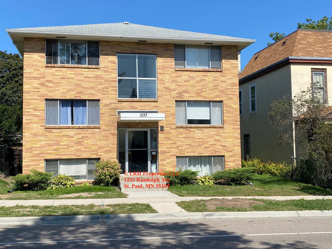
1233 Randolph ave
Saint paul, MN 55105
Favorites
1233 Randolph ave

Favorites
Check Back Soon for Upcoming Availability
| Beds | Baths | Average SF |
|---|---|---|
| 1 Bedroom 1 Bedroom 1 Br | 1 Bath 1 Bath 1 Ba | 855 SF |
| 2 Bedrooms 2 Bedrooms 2 Br | 1 Bath 1 Bath 1 Ba | 855 SF |
Fees and Policies
The fees listed below are community-provided and may exclude utilities or add-ons. All payments are made directly to the property and are non-refundable unless otherwise specified.
- Cats Allowed
-
Fees not specified
-
Weight limit--
-
Pet Limit--
- Parking
-
Surface Lot--
Details
Utilities Included
-
Gas
-
Water
-
Heat
-
Trash Removal
-
Sewer
Property Information
-
8 units
About 1233 Randolph ave Saint paul, MN 55105
Great neighborhood. Trader Joe's, restaurants and retail all within a block's walk. Quick access to 35E, Randolph and Lexington Parkway. Bus stop block away.
1233 Randolph Ave is an apartment community located in Ramsey County and the 55105 ZIP Code.
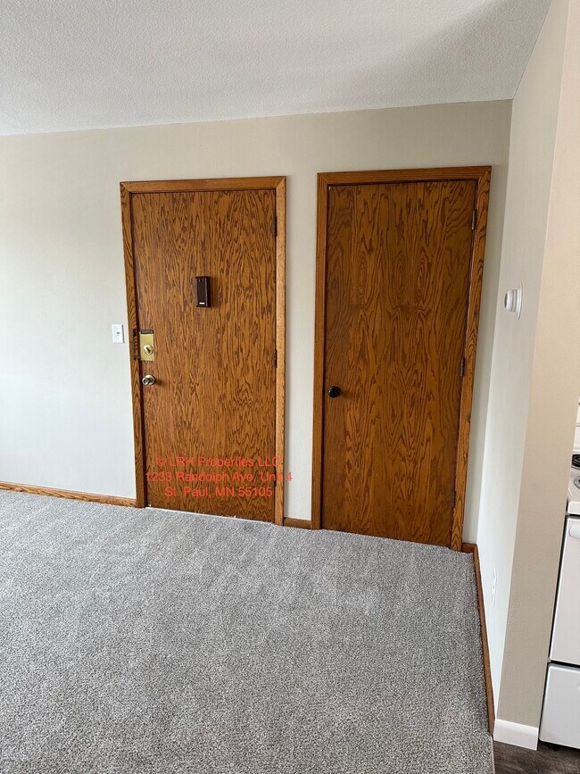
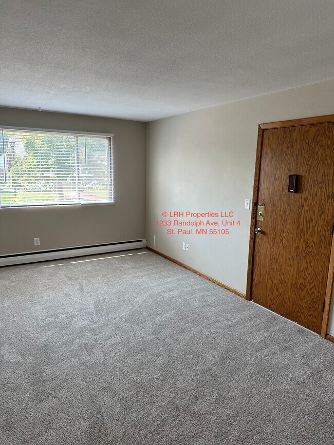
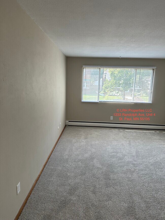
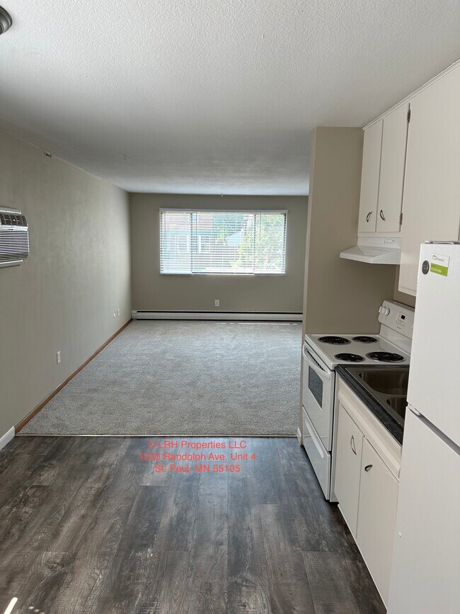
Apartment Features
Air Conditioning
Refrigerator
Tub/Shower
Smoke Free
- Air Conditioning
- Heating
- Smoke Free
- Cable Ready
- Tub/Shower
- Oven
- Range
- Refrigerator
- Carpet
- Vinyl Flooring
- Laundry Facilities
1233 Randolph ave,
Saint paul,
MN
55105
Macalester-Groveland, sometimes shortened to Mac-Grove, stretches from the eastern banks of the Mississippi River to Summit Hill. Mac-Grove is a largely residential neighborhood, touting an array of apartments and single-family homes available for rent.
The neighborhood contains the picturesque Summit Avenue Historic District, which boasts an impressive collection of Victorian-era homes between dense canopies of lush trees. One block south of Summit Avenue is the vibrant Grand Avenue, which is teeming with specialty shops, independent coffeehouses, and eclectic eateries.
Mac-Grove is famously convenient to multiple private colleges, including the University of Saint Thomas, Saint Catherine University, and Macalester College, making the neighborhood a top choice for many students, faculty, and staff. The community celebrates the start of the summer season every year with the annual Grand Old Day Festival.
Learn more about living in Macalester-GrovelandBelow are rent ranges for similar nearby apartments
| Beds | Average Size | Lowest | Typical | Premium |
|---|---|---|---|---|
| Studio Studio Studio | 495-502 Sq Ft | $640 | $1,039 | $1,500 |
| 1 Bed 1 Bed 1 Bed | 616-620 Sq Ft | $600 | $1,208 | $1,600 |
| 2 Beds 2 Beds 2 Beds | 904-905 Sq Ft | $700 | $1,553 | $2,315 |
| 3 Beds 3 Beds 3 Beds | 1032 Sq Ft | $675 | $1,698 | $2,340 |
| 4 Beds 4 Beds 4 Beds | 1598 Sq Ft | $845 | $1,525 | $6,000 |
Amenities
- Air Conditioning
- Heating
- Smoke Free
- Cable Ready
- Tub/Shower
- Oven
- Range
- Refrigerator
- Carpet
- Vinyl Flooring
- Laundry Facilities
Expenses
Utilities Included
Gas, Water, Heat, Trash Removal, Sewer
Included
Education
| Colleges & Universities | Distance | ||
|---|---|---|---|
| Colleges & Universities | Distance | ||
| Drive: | 4 min | 1.6 mi | |
| Drive: | 6 min | 1.8 mi | |
| Drive: | 4 min | 1.8 mi | |
| Drive: | 7 min | 3.1 mi |
1233 Randolph ave is within 4 minutes or 1.6 miles from Macalester College. It is also near St. Catherine University and Concordia Univ.-Saint Paul.
Transportation options available in Saint paul include Lexington Pkwy Station, located 2.4 miles from 1233 Randolph ave. 1233 Randolph ave is near Minneapolis-St Paul International/Wold-Chamberlain, located 6.4 miles or 13 minutes away.
| Transit / Subway | Distance | ||
|---|---|---|---|
| Transit / Subway | Distance | ||
| Drive: | 6 min | 2.4 mi | |
| Drive: | 6 min | 2.7 mi | |
| Drive: | 6 min | 2.7 mi | |
| Drive: | 6 min | 2.9 mi | |
| Drive: | 7 min | 3.2 mi |
| Commuter Rail | Distance | ||
|---|---|---|---|
| Commuter Rail | Distance | ||
|
|
Drive: | 8 min | 4.1 mi |
|
|
Drive: | 19 min | 9.1 mi |
|
|
Drive: | 27 min | 17.7 mi |
|
|
Drive: | 37 min | 26.5 mi |
|
|
Drive: | 38 min | 28.1 mi |
| Airports | Distance | ||
|---|---|---|---|
| Airports | Distance | ||
|
Minneapolis-St Paul International/Wold-Chamberlain
|
Drive: | 13 min | 6.4 mi |
Walkability Near 1233 Randolph ave Saint paul, MN 55105
Getting Around
 What do Walkability, Transit, Drivability, and Bikeability mean?
Walkability measures the walking distance to day-to-day needs.
Transit measures access to public transportation.
Drivability measures congestion, parking availability, and access to major roads.
Bikeability measures the suitability for cycling.
How It Works
What do Walkability, Transit, Drivability, and Bikeability mean?
Walkability measures the walking distance to day-to-day needs.
Transit measures access to public transportation.
Drivability measures congestion, parking availability, and access to major roads.
Bikeability measures the suitability for cycling.
How It Works
Moderately Walkable
Walkability
60
/ 100
Some Public Transit
Transit
50
/ 100
Exceptionally Drivable
Drivability
100
/ 100
Moderately Bikeable
Bikeability
60
/ 100
Scores provided by
-
Soundscore™
-
/ 100
Traffic
-Airport
-Businesses
-Scores provided by
HowLoud What is a Sound Score Rating? A Sound Score Rating aggregates noise caused by vehicle traffic, airplane traffic and local sources. How It WorksTime and distance from 1233 Randolph ave.
| Shopping Centers | Distance | ||
|---|---|---|---|
| Shopping Centers | Distance | ||
| Drive: | 4 min | 1.7 mi | |
| Drive: | 4 min | 1.7 mi |
1233 Randolph ave has 2 shopping centers within 1.7 miles, which is about a 4-minute drive. The miles and minutes will be for the farthest away property.
| Parks and Recreation | Distance | ||
|---|---|---|---|
| Parks and Recreation | Distance | ||
|
Highland Park and Golf Course
|
Drive: | 3 min | 1.6 mi |
|
Macalester College Observatory
|
Drive: | 4 min | 1.6 mi |
|
Crosby Farm Regional Park
|
Drive: | 7 min | 3.6 mi |
|
Hidden Falls Park
|
Drive: | 10 min | 3.6 mi |
|
Cherokee Regional Park
|
Drive: | 9 min | 4.1 mi |
1233 Randolph ave has 5 parks within 4.1 miles, including Highland Park and Golf Course, Macalester College Observatory, and Crosby Farm Regional Park.
| Hospitals | Distance | ||
|---|---|---|---|
| Hospitals | Distance | ||
| Drive: | 5 min | 2.6 mi | |
| Drive: | 6 min | 3.3 mi | |
| Drive: | 7 min | 3.8 mi |
1233 Randolph ave has 3 hospitals within 3.8 miles, the nearest is Allina United Hospital which is 2.6 miles away and a 5 minute drive.
| Military Bases | Distance | ||
|---|---|---|---|
| Military Bases | Distance | ||
| Drive: | 11 min | 5.1 mi |
1233 Randolph ave is 5.1 miles and a 11 minute drive from Fort Snelling Military Reservation.
You May Also Like
-
Paragon Apartments
10670 Brunswick Rd
Bloomington, MN 55438
$1,240 - $1,935 Total Monthly Price
1-2 Br 13.1 mi
-
Cedar Hills
11050 Cedar Hills Blvd
Minnetonka, MN 55305
$1,395 - $1,825 Plus Fees
1-3 Br 12 Month Lease 13.2 mi
-
Bristol Village Apartments
7301 Bristol Village Dr
Bloomington, MN 55438
$1,812 - $1,842 Total Monthly Price
2 Br 12 Month Lease 13.4 mi
Similar Rentals Nearby
-
-
1 Bed$2,084+2 Beds$2,989+3 Beds$5,866Total Monthly PriceTotal Monthly Price NewPrices include required monthly fees of $4.Base Rent:1 Bed$2,080+2 Beds$2,985+3 Beds$5,862+1 Month Free
Pets Allowed Fitness Center Pool Dishwasher Refrigerator Clubhouse Maintenance on site
-
-
1 Bed$1,112Total Monthly PriceTotal Monthly Price NewPrices include required monthly fees of $67.Base Rent:1 Bed$1,045
High-Speed Internet Laundry Facilities
-
-
-
-
1 Bed$1,628+2 Beds$2,115+Total Monthly PriceTotal Monthly Price NewPrices include required monthly fees of $20.Base Rent:1 Bed$1,608+2 Beds$2,095+2 Months Free
Pets Allowed Fitness Center Pool In Unit Washer & Dryer Stainless Steel Appliances Hardwood Floors
-
-
1 Bed$1,169+2 Beds$1,469Total Monthly PriceTotal Monthly Price NewPrices include base rent and required monthly fees. Variable costs based on usage may apply.Discounts
Pets Allowed Pool Dishwasher Microwave Granite Countertops


What Are Walk Score®, Transit Score®, and Bike Score® Ratings?
Walk Score® measures the walkability of any address. Transit Score® measures access to public transit. Bike Score® measures the bikeability of any address.
What is a Sound Score Rating?
A Sound Score Rating aggregates noise caused by vehicle traffic, airplane traffic and local sources.
1233 Randolph ave
Saint paul, MN 55105