
Colette
2099 1st St SW,
Washington, DC 20024
$1,240 - $15,075
Studio - 6 Beds
- (RLNE3329938)
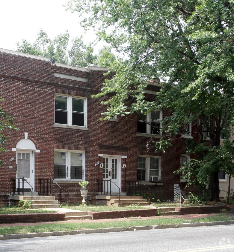
1219 Florida Ave NE is an apartment community located in District of Columbia County and the 20002 ZIP Code. This area is served by the District Of Columbia Public Schools attendance zone.
As its name would suggest, Near Northeast sits in Northeast Washington, DC and is bounded by North Capitol Street to the west, Florida Avenue to the north, F Street to the south, and 15th Street to the east. This quaint neighborhood sits just outside of downtown, offering easy access to the National Mall, the White House, and Union Market. Residents enjoy living near this warehouse-like food market that offers unique artisans. Union Station runs through Near Northeast, and either side of the neighborhood offers local restaurants, grocery stores, banks, convenience stores, and more like Fare Well, a vegan restaurant in a retro-chic diner.
Learn more about living in Near Northeast| Colleges & Universities | Distance | ||
|---|---|---|---|
| Colleges & Universities | Distance | ||
| Walk: | 13 min | 0.7 mi | |
| Drive: | 4 min | 2.0 mi | |
| Drive: | 4 min | 2.0 mi | |
| Drive: | 3 min | 2.1 mi |


Transportation options available in Washington include H St And 13Th St Ne, located 0.2 mile from 1219 Florida Ave NE. 1219 Florida Ave NE is near Ronald Reagan Washington Ntl, located 7.4 miles or 13 minutes away, and Washington Dulles International, located 30.0 miles or 48 minutes away.
| Transit / Subway | Distance | ||
|---|---|---|---|
| Transit / Subway | Distance | ||
| Walk: | 3 min | 0.2 mi | |
| Walk: | 7 min | 0.4 mi | |
| Walk: | 9 min | 0.5 mi | |
| Walk: | 14 min | 0.7 mi | |
| Walk: | 15 min | 0.8 mi |
| Commuter Rail | Distance | ||
|---|---|---|---|
| Commuter Rail | Distance | ||
|
|
Drive: | 2 min | 1.2 mi |
|
|
Drive: | 3 min | 1.3 mi |
|
|
Drive: | 6 min | 2.9 mi |
|
|
Drive: | 6 min | 2.9 mi |
|
|
Drive: | 10 min | 6.0 mi |
| Airports | Distance | ||
|---|---|---|---|
| Airports | Distance | ||
|
Ronald Reagan Washington Ntl
|
Drive: | 13 min | 7.4 mi |
|
Washington Dulles International
|
Drive: | 48 min | 30.0 mi |
Time and distance from 1219 Florida Ave NE.
| Shopping Centers | Distance | ||
|---|---|---|---|
| Shopping Centers | Distance | ||
| Walk: | 10 min | 0.6 mi | |
| Drive: | 3 min | 1.4 mi | |
| Drive: | 3 min | 1.7 mi |
| Parks and Recreation | Distance | ||
|---|---|---|---|
| Parks and Recreation | Distance | ||
|
Washington Youth Garden
|
Drive: | 2 min | 1.3 mi |
|
Kingman and Heritage Island Park
|
Drive: | 3 min | 1.4 mi |
|
National Arboretum
|
Drive: | 6 min | 2.1 mi |
|
Marian Koshland Science Museum
|
Drive: | 4 min | 2.3 mi |
|
U.S. Botanic Garden
|
Drive: | 5 min | 2.4 mi |
| Hospitals | Distance | ||
|---|---|---|---|
| Hospitals | Distance | ||
| Drive: | 5 min | 2.1 mi | |
| Drive: | 5 min | 2.7 mi | |
| Drive: | 7 min | 3.4 mi |
| Military Bases | Distance | ||
|---|---|---|---|
| Military Bases | Distance | ||
| Drive: | 5 min | 2.2 mi | |
| Drive: | 6 min | 3.3 mi |
What Are Walk Score®, Transit Score®, and Bike Score® Ratings?
Walk Score® measures the walkability of any address. Transit Score® measures access to public transit. Bike Score® measures the bikeability of any address.
What is a Sound Score Rating?
A Sound Score Rating aggregates noise caused by vehicle traffic, airplane traffic and local sources

1219 Florida Ave NE
Washington, DC 20002


