
sageLA - Brand New
200 N Vermont Ave,
Los Angeles, CA 90004
Studio - 2 Beds $2,416 - $5,017
Pets okay with one-time non-refundable pet fee Building Amenities: Hardwood floors, Elevator, Utilities: Water MANAGED BY: Century West Properties IT490723 - IT49CWmay116
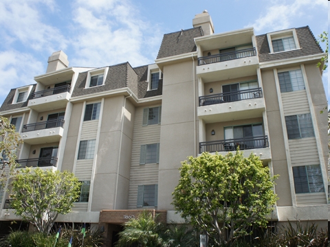
11660 Mayfield Ave is an apartment community located in Los Angeles County and the 90049 ZIP Code. This area is served by the Los Angeles Unified attendance zone.
Laundry Facilities
Elevator
Controlled Access
Recycling
High Speed Internet Access
Disposal
Freezer
Smoke Free
Perched on LA’s Westside, at the base of the Santa Monica Mountains, Brentwood is an upscale neighborhood teeming with high-end boutiques, fine dining, and luxurious gardens. The main thoroughfare in the community is San Vicente Boulevard, where eateries, cafes, and the historic Brentwood County Mart sit along tree-lined avenues.
Brentwood is also home to the famous Getty Center, which boasts extensive museums, scenic gardens, and stunning views that draw millions of visitors every year. Sprawling estates and luxury apartments comprise the bulk of the rental market in Brentwood, providing many options for a lavish lifestyle in the hills.
Learn more about living in Brentwood| Colleges & Universities | Distance | ||
|---|---|---|---|
| Colleges & Universities | Distance | ||
| Drive: | 5 min | 2.0 mi | |
| Drive: | 6 min | 2.1 mi | |
| Drive: | 8 min | 3.0 mi | |
| Drive: | 9 min | 3.4 mi |


Transportation options available in Los Angeles include Expo/Bundy, located 2.0 miles from 11660 Mayfield Ave. 11660 Mayfield Ave is near Los Angeles International, located 10.6 miles or 17 minutes away, and Bob Hope, located 17.4 miles or 27 minutes away.
| Transit / Subway | Distance | ||
|---|---|---|---|
| Transit / Subway | Distance | ||
|
|
Drive: | 5 min | 2.0 mi |
|
|
Drive: | 7 min | 2.8 mi |
| Drive: | 5 min | 2.9 mi | |
|
|
Drive: | 8 min | 2.9 mi |
|
|
Drive: | 8 min | 3.6 mi |
| Commuter Rail | Distance | ||
|---|---|---|---|
| Commuter Rail | Distance | ||
|
|
Drive: | 21 min | 13.7 mi |
|
|
Drive: | 27 min | 17.4 mi |
|
|
Drive: | 27 min | 18.2 mi |
| Drive: | 29 min | 18.3 mi | |
|
|
Drive: | 29 min | 18.9 mi |
| Airports | Distance | ||
|---|---|---|---|
| Airports | Distance | ||
|
Los Angeles International
|
Drive: | 17 min | 10.6 mi |
|
Bob Hope
|
Drive: | 27 min | 17.4 mi |
Time and distance from 11660 Mayfield Ave.
| Shopping Centers | Distance | ||
|---|---|---|---|
| Shopping Centers | Distance | ||
| Walk: | 3 min | 0.2 mi | |
| Walk: | 4 min | 0.2 mi | |
| Walk: | 6 min | 0.3 mi |
| Parks and Recreation | Distance | ||
|---|---|---|---|
| Parks and Recreation | Distance | ||
|
Mathias Botanical Garden
|
Drive: | 5 min | 1.9 mi |
|
Hannah Carter Japanese Garden
|
Drive: | 10 min | 3.5 mi |
|
Santa Monica Pier Aquarium
|
Drive: | 11 min | 4.5 mi |
|
Santa Monica State Beach
|
Drive: | 11 min | 4.9 mi |
|
Will Rogers State Historic Park
|
Drive: | 14 min | 5.1 mi |
| Hospitals | Distance | ||
|---|---|---|---|
| Hospitals | Distance | ||
| Drive: | 6 min | 2.0 mi | |
| Drive: | 6 min | 2.0 mi | |
| Drive: | 5 min | 2.1 mi |
| Military Bases | Distance | ||
|---|---|---|---|
| Military Bases | Distance | ||
| Drive: | 18 min | 13.2 mi |
What Are Walk Score®, Transit Score®, and Bike Score® Ratings?
Walk Score® measures the walkability of any address. Transit Score® measures access to public transit. Bike Score® measures the bikeability of any address.
What is a Sound Score Rating?
A Sound Score Rating aggregates noise caused by vehicle traffic, airplane traffic and local sources


 - AVA Burbank")
 - Violet on Virgil")
