
110 Roy Apartments
110 Roy St,
Seattle, WA 98109
$2,098 - $6,048 Total Monthly Price
Studio - 2 Beds

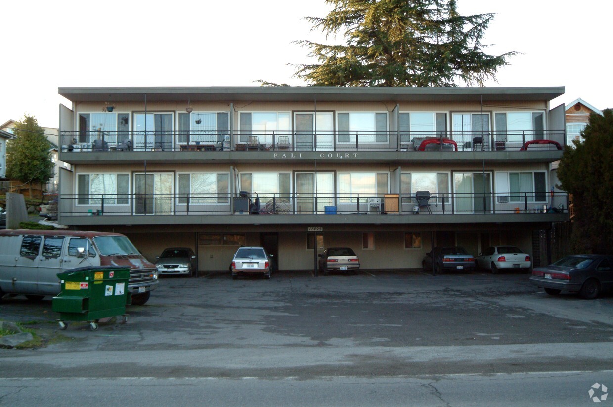
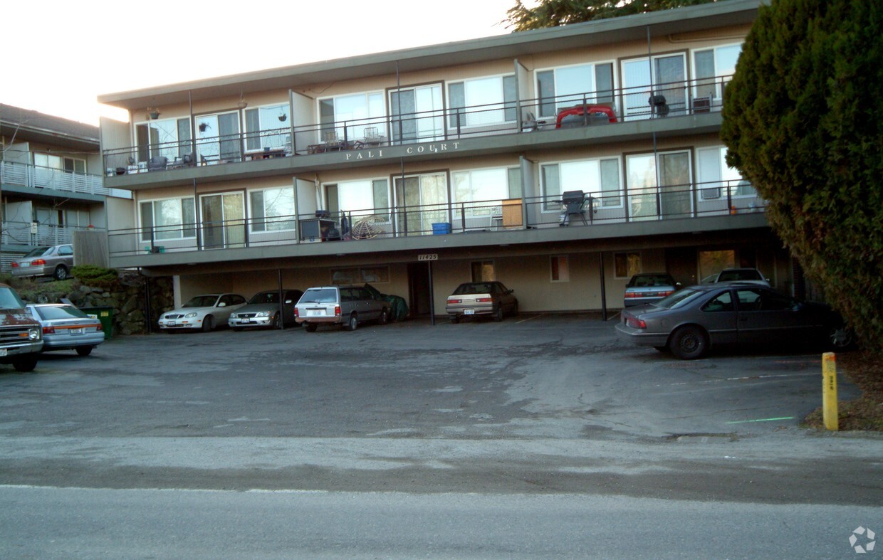

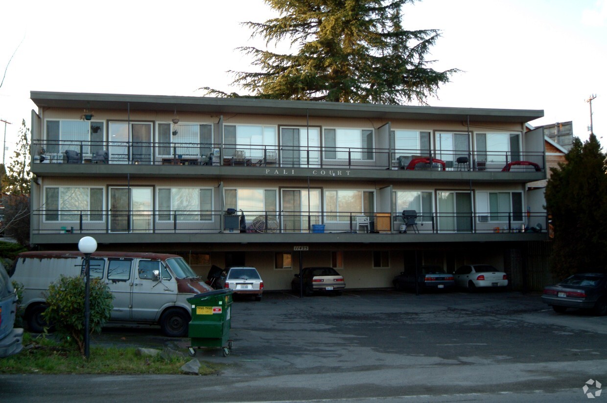
Thank you for visiting 11425 Military Rd S in Seattle, WA. The 98168 location in Seattle has much to offer its residents. Be sure to come for a visit to check out the apartment floorplan options. The professional leasing team is ready and waiting for you to come by for a visit. Contact us or stop by today.
11425 Military Rd S is an apartment community located in King County and the 98168 ZIP Code. This area is served by the Highline School District attendance zone.
Bounded by State Route 509 and 599, Southern Heights-Boulevard Park is a small community located approximately ten miles south of Downtown Seattle via Interstate 5. Along the way, you’ll pass King County International Airport, and just south of town is Seattle-Tacoma International Airport. This neighborhood is accessible and convenient, offering a central location for commuters and frequent flyers alike. Rainier Golf and Country Club and Glen Acres Golf and Country Club anchor the neighborhood. This active community also enjoys access to high-ranking public schools like Southern Heights Elementary School. Residents appreciate Southern Heights-Boulevard Park’s easy access to Seattle, while enjoying the laid-back environment that comes with living in a quaint community. Everything from luxury apartments to affordable single-family homes are available for rent in this centrally located neighborhood.
Learn more about living in Southern Heights-Boulevard ParkCompare neighborhood and city base rent averages by bedroom.
| Southern Heights-Boulevard Park | Seattle, WA | |
|---|---|---|
| Studio | $969 | $1,488 |
| 1 Bedroom | $1,169 | $2,082 |
| 2 Bedrooms | $1,822 | $2,805 |
| 3 Bedrooms | $2,192 | $3,830 |
| Colleges & Universities | Distance | ||
|---|---|---|---|
| Colleges & Universities | Distance | ||
| Drive: | 15 min | 6.0 mi | |
| Drive: | 17 min | 9.8 mi | |
| Drive: | 17 min | 10.2 mi | |
| Drive: | 16 min | 10.2 mi |

Transportation options available in Seattle include Rainier Beach, located 3.1 miles from 11425 Military Rd S. 11425 Military Rd S is near Seattle-Tacoma International, located 5.3 miles or 12 minutes away, and Seattle Paine Field International, located 33.2 miles or 47 minutes away.
| Transit / Subway | Distance | ||
|---|---|---|---|
| Transit / Subway | Distance | ||
| Drive: | 7 min | 3.1 mi | |
| Drive: | 11 min | 4.2 mi | |
| Drive: | 15 min | 7.1 mi | |
| Drive: | 14 min | 8.1 mi | |
| Drive: | 16 min | 9.6 mi |
| Commuter Rail | Distance | ||
|---|---|---|---|
| Commuter Rail | Distance | ||
|
|
Drive: | 15 min | 8.0 mi |
|
|
Drive: | 33 min | 24.8 mi |
|
|
Drive: | 40 min | 27.0 mi |
| Drive: | 38 min | 28.8 mi | |
| Drive: | 42 min | 32.0 mi |
| Airports | Distance | ||
|---|---|---|---|
| Airports | Distance | ||
|
Seattle-Tacoma International
|
Drive: | 12 min | 5.3 mi |
|
Seattle Paine Field International
|
Drive: | 47 min | 33.2 mi |
Scores provided by
Traffic
-Airport
-Businesses
-Scores provided by
HowLoud What is a Sound Score Rating? A Sound Score Rating aggregates noise caused by vehicle traffic, airplane traffic and local sources. How It WorksTime and distance from 11425 Military Rd S.
| Shopping Centers | Distance | ||
|---|---|---|---|
| Shopping Centers | Distance | ||
| Walk: | 9 min | 0.5 mi | |
| Drive: | 3 min | 1.4 mi | |
| Drive: | 3 min | 1.9 mi |
| Parks and Recreation | Distance | ||
|---|---|---|---|
| Parks and Recreation | Distance | ||
|
Highline SeaTac Botanical Garden
|
Drive: | 3 min | 1.4 mi |
|
Kubota Gardens
|
Drive: | 6 min | 3.0 mi |
|
Westcrest Park
|
Drive: | 9 min | 3.7 mi |
|
Pritchard Island Beach
|
Drive: | 9 min | 3.9 mi |
|
Lakeridge Park
|
Drive: | 11 min | 4.4 mi |
| Hospitals | Distance | ||
|---|---|---|---|
| Hospitals | Distance | ||
| Walk: | 18 min | 1.0 mi | |
| Drive: | 7 min | 4.4 mi | |
| Drive: | 12 min | 5.4 mi |
| Military Bases | Distance | ||
|---|---|---|---|
| Military Bases | Distance | ||
| Drive: | 33 min | 15.1 mi | |
| Drive: | 80 min | 59.1 mi |
Pets Allowed Fitness Center Pool Controlled Access Concierge EV Charging
Pets Allowed Fitness Center Maintenance on site Business Center Controlled Access EV Charging
Pets Allowed Fitness Center Dishwasher In Unit Washer & Dryer Patio Stainless Steel Appliances Controlled Access
Pets Allowed Fitness Center In Unit Washer & Dryer Walk-In Closets Patio Granite Countertops Elevator
What Are Walk Score®, Transit Score®, and Bike Score® Ratings?
Walk Score® measures the walkability of any address. Transit Score® measures access to public transit. Bike Score® measures the bikeability of any address.
What is a Sound Score Rating?
A Sound Score Rating aggregates noise caused by vehicle traffic, airplane traffic and local sources.
11425 Military Rd S
Seattle, WA 98168


