$1,650 / Month
11 Grove St
Cranford, NJ 07016
2 Weeks Ago
Favorites
11 Grove St

Favorites
Check Back Soon for Upcoming Availability
| Beds | Baths | Average SF |
|---|---|---|
| 1 Bedroom 1 Bedroom 1 Br | 1 Bath 1 Bath 1 Ba | — |
About This Property
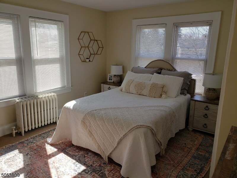
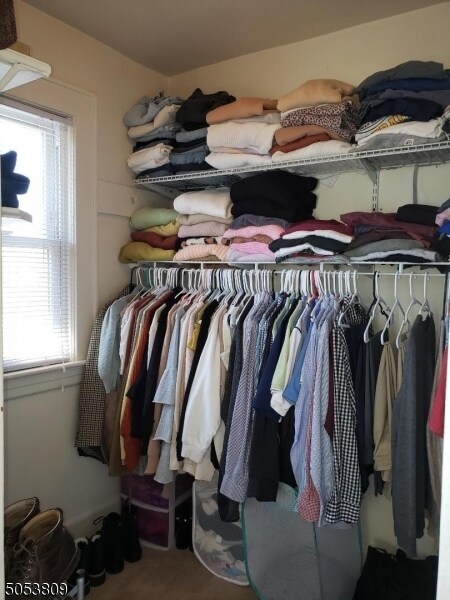
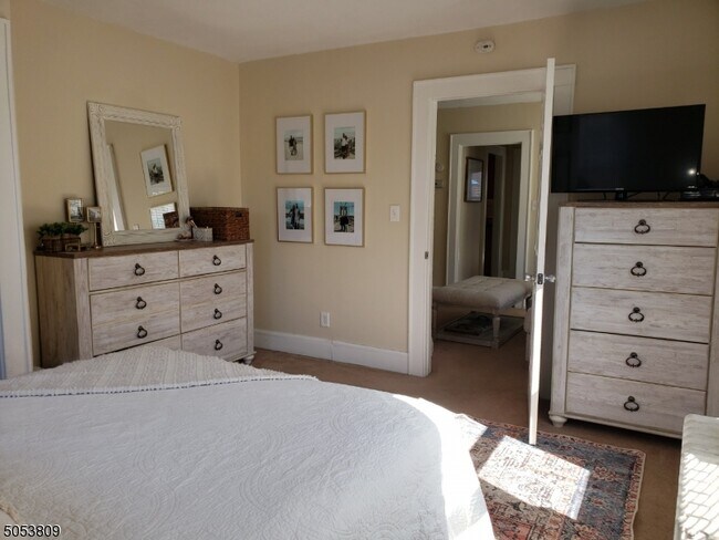
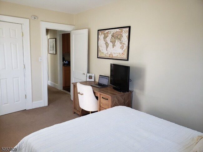
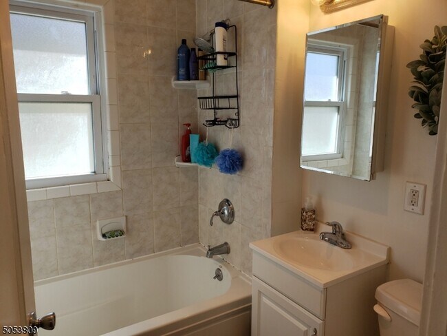
1 Block to Town & NYC Bus, 2 Blocks to NYC Train but on a VERY QUIET Street. Close To EVERYTHING! Beautiful 2nd floor apartment completely renovated in 2012 with newer Granite on Maple Kitchen w/Tile Floor, Refig, Microwave, Dishwasher - All Stainless Steel Appliances...really nice! New Full Bath with Tub. New Thermo Windows. 5th Rm is an Office. MBR w/ 8 x 6 walk in closet. Full basement with washer/dryer PROVIDED plus Plenty of storage space. New Tenant supplies their own window A/C's. Maximum 2 person occupancy, No smoking & No pets - no exceptions! Really nice apt with Private parking in rear so HURRY! Available for May 1st occupancy. Rear room can be used as office.
11 Grove St is an apartment community located in Union County and the 07016 ZIP Code.
Location
Get Directions
Cranford is a peaceful suburb situated in the heart of Union County. Lush with township and county parks as well as the Rahway River Parkway, Cranford offers ample opportunities to engage in outdoor recreation and connect with nature. Cranford is also home to the last working farm in Union County, Dreyer Farms, which provides fresh produce in addition to hosting a variety of special events.
Cranford’s vibrant downtown area contains a slew of restaurants, specialty shops, cafes, and art galleries in colorful buildings, serving as a gathering place for the close-knit community. Commuting and traveling from Cranford is easy with access to the NJ Transit bus, Raritan Valley train line, and the Garden State Parkway. New York City and its many dynamic amenities are less than an hour’s drive or train ride away from Cranford.
Learn more about living in Cranford
Education
| Colleges & Universities | Distance | ||
|---|---|---|---|
| Colleges & Universities | Distance | ||
| Drive: | 7 min | 2.0 mi | |
| Drive: | 12 min | 5.2 mi | |
| Drive: | 13 min | 6.5 mi | |
| Drive: | 18 min | 7.6 mi |
11 Grove St is within 7 minutes or 2.0 miles from Union County College, Cranford. It is also near Kean University and Union County Coll., Elizabeth.
Transportation options available in Cranford include Warren Street, located 10.3 miles from 11 Grove St. 11 Grove St is near Newark Liberty International, located 12.0 miles or 17 minutes away, and LaGuardia, located 31.3 miles or 52 minutes away.
| Transit / Subway | Distance | ||
|---|---|---|---|
| Transit / Subway | Distance | ||
|
|
Drive: | 17 min | 10.3 mi |
|
|
Drive: | 17 min | 10.4 mi |
|
|
Drive: | 17 min | 10.5 mi |
|
|
Drive: | 17 min | 10.8 mi |
| Drive: | 24 min | 13.3 mi |
| Commuter Rail | Distance | ||
|---|---|---|---|
| Commuter Rail | Distance | ||
|
|
Walk: | 6 min | 0.3 mi |
|
|
Drive: | 3 min | 1.2 mi |
|
|
Drive: | 6 min | 2.5 mi |
|
|
Drive: | 8 min | 3.0 mi |
|
|
Drive: | 9 min | 4.4 mi |
| Airports | Distance | ||
|---|---|---|---|
| Airports | Distance | ||
|
Newark Liberty International
|
Drive: | 17 min | 12.0 mi |
|
LaGuardia
|
Drive: | 52 min | 31.3 mi |
Time and distance from 11 Grove St.
| Shopping Centers | Distance | ||
|---|---|---|---|
| Shopping Centers | Distance | ||
| Walk: | 4 min | 0.2 mi | |
| Walk: | 13 min | 0.7 mi | |
| Walk: | 18 min | 1.0 mi |
11 Grove St has 3 shopping centers within 1.0 mile, which is about a 18-minute walk. The miles and minutes will be for the farthest away property.
| Parks and Recreation | Distance | ||
|---|---|---|---|
| Parks and Recreation | Distance | ||
|
William Miller Sperry Observatory
|
Drive: | 5 min | 1.8 mi |
|
Trailside Museum Watchung Reservation
|
Drive: | 14 min | 5.0 mi |
|
Hawk Rise Sanctuary
|
Drive: | 14 min | 5.5 mi |
|
Liberty State Park
|
Drive: | 17 min | 7.3 mi |
|
Merrill Park
|
Drive: | 15 min | 8.6 mi |
11 Grove St has 5 parks within 8.6 miles, including William Miller Sperry Observatory, Trailside Museum Watchung Reservation, and Hawk Rise Sanctuary.
| Hospitals | Distance | ||
|---|---|---|---|
| Hospitals | Distance | ||
| Drive: | 8 min | 3.2 mi | |
| Drive: | 14 min | 5.6 mi | |
| Drive: | 16 min | 7.3 mi |
11 Grove St has 3 hospitals within 7.3 miles, the nearest is Robert Wood Johnson University Hospital at Rahway which is 3.2 miles away and a 8 minute drive.
| Military Bases | Distance | ||
|---|---|---|---|
| Military Bases | Distance | ||
| Drive: | 13 min | 4.3 mi | |
| Drive: | 11 min | 4.7 mi | |
| Drive: | 23 min | 15.8 mi |
11 Grove St has 3 military bases within 15.8 miles, the nearest is Tamdques Reservation which is 4.3 miles away and a 13 minute drive.
You May Also Like
Similar Rentals Nearby


What Are Walk Score®, Transit Score®, and Bike Score® Ratings?
Walk Score® measures the walkability of any address. Transit Score® measures access to public transit. Bike Score® measures the bikeability of any address.
What is a Sound Score Rating?
A Sound Score Rating aggregates noise caused by vehicle traffic, airplane traffic and local sources

11 Grove St
Cranford, NJ 07016