
Isle House
39 Bruton St,
San Francisco, CA 94130
$3,395 - $7,635
Studio - 3 Beds


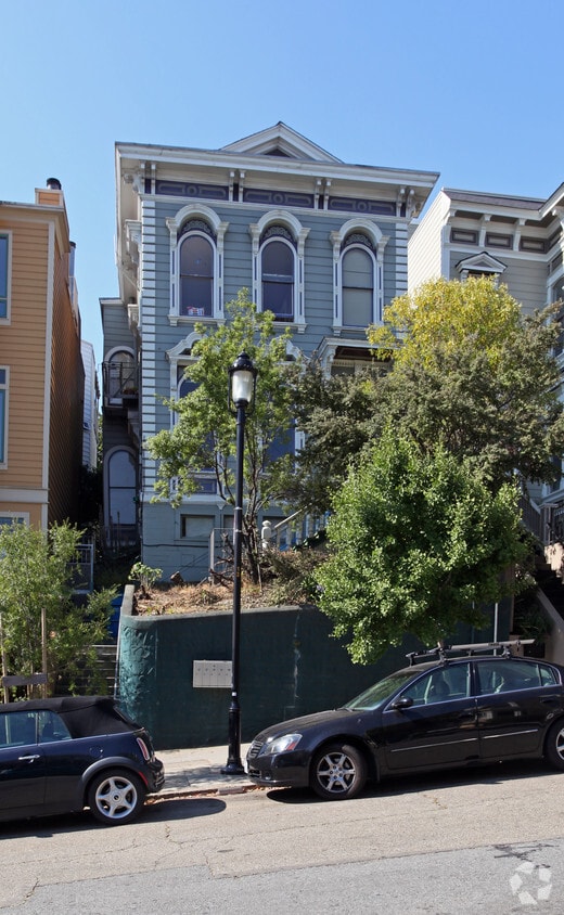
Thanks for your interest in 109 Liberty St in San Francisco, CA. You'll find this community in the Baja Noe area of San Francisco. The leasing staff is ready to help you find your perfect new place. Featuring 0 to 2 bedroom floor plans, your new place is waiting for you. So get a head start on your move. Contact or stop by 109 Liberty St to discuss your new apartment!
109 Liberty St is an apartment community located in San Francisco County and the 94110 ZIP Code. This area is served by the San Francisco Unified attendance zone.
Located between Noe Valley and Mission District, Baja Noe occupies the area between 20th and 24th Street and Church and Valencia in San Francisco's Mission District, right on the cusp of Noe Valley. Filled with colorful Victorian houses, Baja Noe features upscale houses, apartments, and condos available for rent. This vibrant urban neighborhood is diverse and known for its strong Latin American and Caribbean influences showcased by local eateries and nightlife hotspots. Baja Noe is a haven for hipsters, foodies, and artists. While living in this neighborhood, residents have access to a plethora of urban parks, artsy cafes, bohemian bars, art studios and galleries, and quirky boutiques found in Noe Valley and the Mission District. After you move in, be sure to check out Mission Dolores Park, a popular gathering spot for picnics and festivals. Baja Noe is also proximal to the city’s biggest destination including Golden Gate Park, SoMa, the Financial District, and more.
Learn more about living in Baja NoeCompare neighborhood and city base rent averages by bedroom.
| Baja Noe | San Francisco, CA | |
|---|---|---|
| Studio | $1,838 | $2,386 |
| 1 Bedroom | $2,050 | $3,161 |
| 2 Bedrooms | $2,255 | $4,307 |
| 3 Bedrooms | $3,724 | $5,641 |
| Colleges & Universities | Distance | ||
|---|---|---|---|
| Colleges & Universities | Distance | ||
| Drive: | 6 min | 2.2 mi | |
| Drive: | 6 min | 2.6 mi | |
| Drive: | 8 min | 3.0 mi | |
| Drive: | 8 min | 3.3 mi |


Transportation options available in San Francisco include Liberty Street, located 0.2 mile from 109 Liberty St. 109 Liberty St is near San Francisco International, located 12.4 miles or 22 minutes away, and Metro Oakland International, located 21.4 miles or 34 minutes away.
| Transit / Subway | Distance | ||
|---|---|---|---|
| Transit / Subway | Distance | ||
|
|
Walk: | 3 min | 0.2 mi |
|
|
Walk: | 4 min | 0.2 mi |
|
|
Walk: | 5 min | 0.3 mi |
|
|
Walk: | 7 min | 0.4 mi |
|
|
Walk: | 8 min | 0.5 mi |
| Commuter Rail | Distance | ||
|---|---|---|---|
| Commuter Rail | Distance | ||
| Drive: | 7 min | 2.9 mi | |
| Drive: | 7 min | 3.0 mi | |
| Drive: | 7 min | 3.0 mi | |
| Drive: | 7 min | 3.1 mi | |
| Drive: | 10 min | 4.5 mi |
| Airports | Distance | ||
|---|---|---|---|
| Airports | Distance | ||
|
San Francisco International
|
Drive: | 22 min | 12.4 mi |
|
Metro Oakland International
|
Drive: | 34 min | 21.4 mi |
Time and distance from 109 Liberty St.
| Shopping Centers | Distance | ||
|---|---|---|---|
| Shopping Centers | Distance | ||
| Walk: | 18 min | 0.9 mi | |
| Walk: | 18 min | 1.0 mi | |
| Drive: | 4 min | 1.6 mi |
| Parks and Recreation | Distance | ||
|---|---|---|---|
| Parks and Recreation | Distance | ||
|
Buena Vista Park
|
Drive: | 5 min | 1.7 mi |
|
Randall Museum
|
Drive: | 6 min | 1.9 mi |
|
Children's Creativity Museum
|
Drive: | 7 min | 2.8 mi |
|
Conservatory of Flowers
|
Drive: | 7 min | 3.1 mi |
|
California Academy of Sciences
|
Drive: | 10 min | 3.8 mi |
| Hospitals | Distance | ||
|---|---|---|---|
| Hospitals | Distance | ||
| Walk: | 15 min | 0.8 mi | |
| Drive: | 4 min | 1.1 mi | |
| Drive: | 4 min | 1.5 mi |
| Military Bases | Distance | ||
|---|---|---|---|
| Military Bases | Distance | ||
| Drive: | 16 min | 5.9 mi | |
| Drive: | 16 min | 6.5 mi |
What Are Walk Score®, Transit Score®, and Bike Score® Ratings?
Walk Score® measures the walkability of any address. Transit Score® measures access to public transit. Bike Score® measures the bikeability of any address.
What is a Sound Score Rating?
A Sound Score Rating aggregates noise caused by vehicle traffic, airplane traffic and local sources
109 Liberty St
San Francisco, CA 94110


