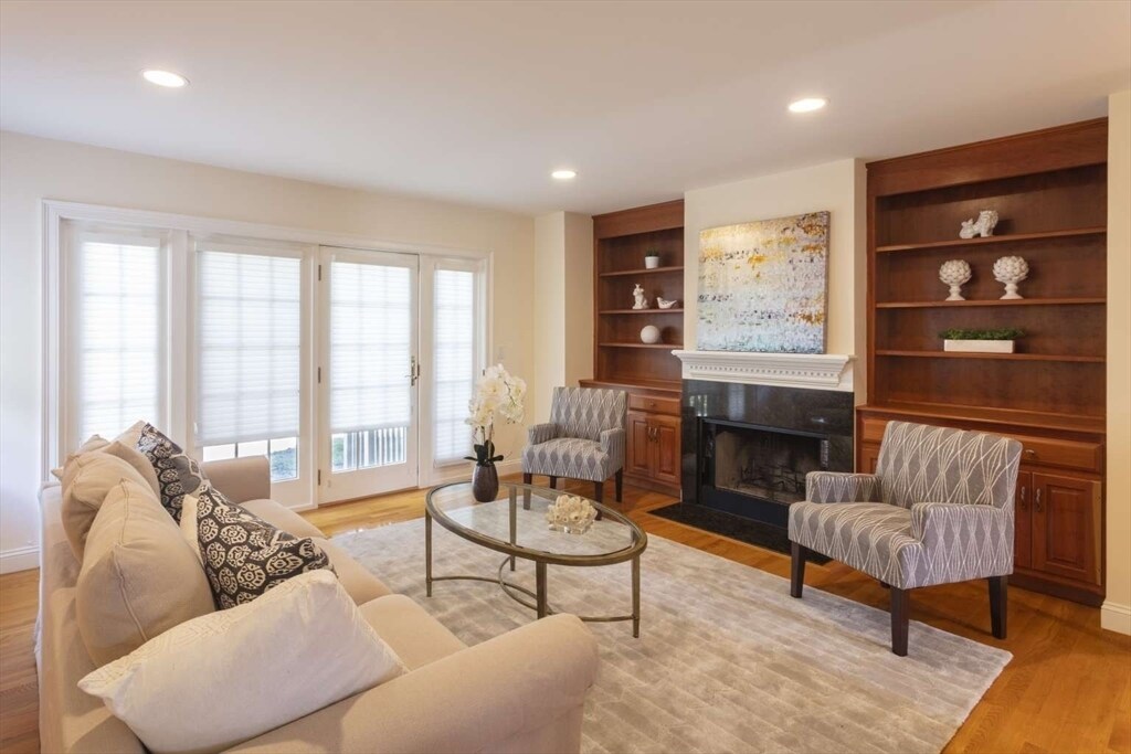
3 Beds, 1 Bath, 1,900 sq ft
1077 Boylston St
Newton, MA 02461

Check Back Soon for Upcoming Availability
| Beds | Baths | Average SF |
|---|---|---|
| 3 Bedrooms 3 Bedrooms 3 Br | 3.5 Baths 3.5 Baths 3.5 Ba | 2,400 SF |
About This Property
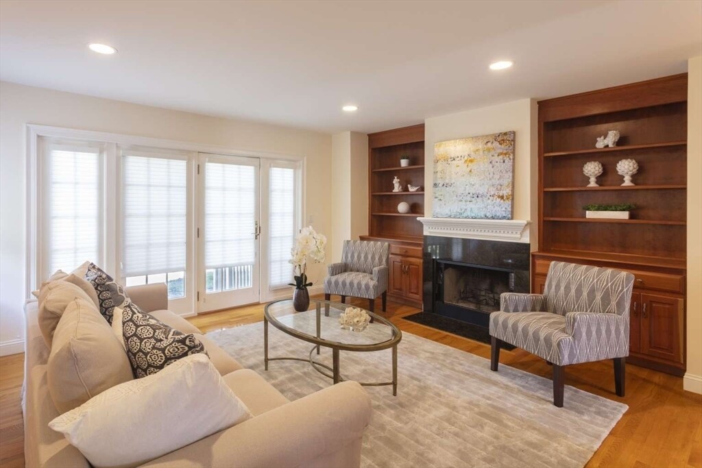
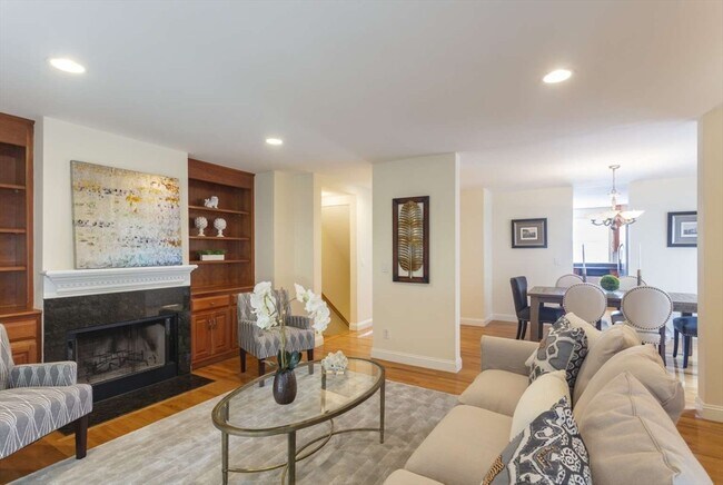
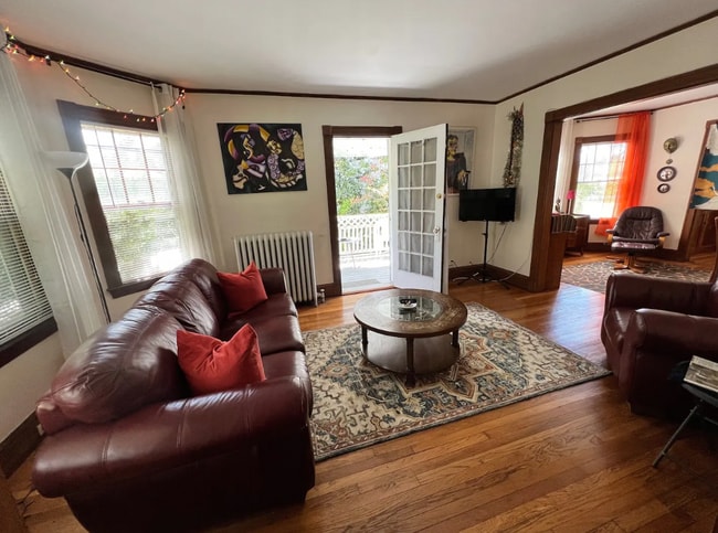
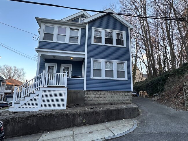
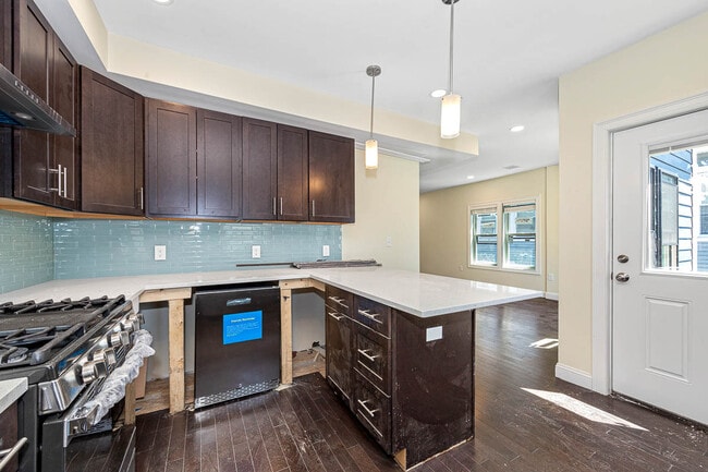
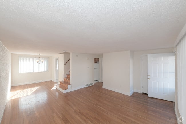
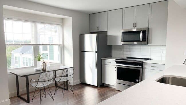
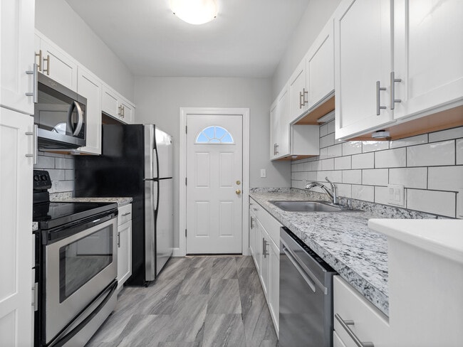
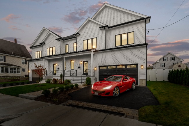
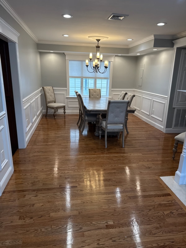
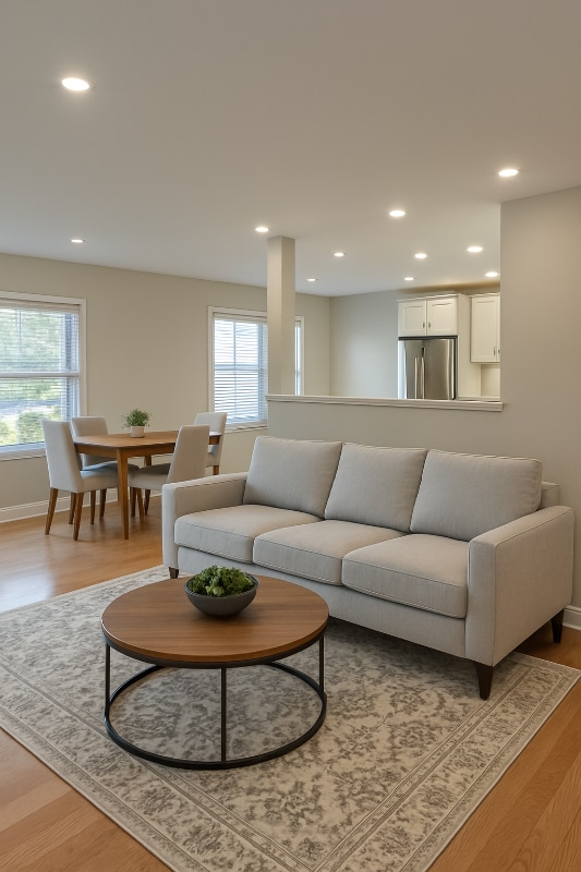
Must-see house in beautiful Newton Highlands. Three levels with TWO very private master suites,guest bedroom,3 full bathrooms and a jacuzzi! Bright & sunny,lovely home. Hardwood floors throughout,stunning fireplace in cozy living room overlooking the unique backyard area. Wonderful house for entertaining. 2 car,tandem garage! Perfect for those snowy winters. Located 30 seconds from the Eliot T Station. Easy commute into the city! Close to shops,restaurants,excellent Newton schools and public transportation. No smoking inside. No large pets. Pet fee.
1077 Boylston St is a townhome located in Middlesex County and the 02461 ZIP Code. This area is served by the Newton attendance zone.
An affluent suburb just 10 miles west of downtown Boston, Newton is a family-friendly area with plentiful amenities. Newton, Massachusetts houses part of Boston College, as well as a few private universities. Newton prides itself on its great public school district, Newton Public Schools, offering options like Newton South High School. Luxury apartment and condo rentals are spread throughout Newton, giving you a wide range of upscale options to choose from.
Residents appreciate access to the Massachusetts Bay Transportation Authority’s commuter rail, affording them easy commutes to neighboring areas. Enjoy shopping malls like the Shops at Chestnut Hill and Chestnut Hill Square for popular retailers and a variety of eateries. Get outdoors at Cold Spring Park, complete with nature trails and sports fields and courts.
Learn more about living in Newton| Colleges & Universities | Distance | ||
|---|---|---|---|
| Colleges & Universities | Distance | ||
| Drive: | 9 min | 5.0 mi | |
| Drive: | 10 min | 5.2 mi | |
| Drive: | 11 min | 5.3 mi | |
| Drive: | 11 min | 5.5 mi |
 The GreatSchools Rating helps parents compare schools within a state based on a variety of school quality indicators and provides a helpful picture of how effectively each school serves all of its students. Ratings are on a scale of 1 (below average) to 10 (above average) and can include test scores, college readiness, academic progress, advanced courses, equity, discipline and attendance data. We also advise parents to visit schools, consider other information on school performance and programs, and consider family needs as part of the school selection process.
View GreatSchools Rating Methodology
Data provided by GreatSchools.org © 2025. All rights reserved.
Transportation options available in Newton include Waban Station, located 1.3 miles from 1077 Boylston St. 1077 Boylston St is near General Edward Lawrence Logan International, located 16.2 miles or 26 minutes away, and Worcester Regional, located 40.9 miles or 58 minutes away.
| Transit / Subway | Distance | ||
|---|---|---|---|
| Transit / Subway | Distance | ||
|
|
Drive: | 3 min | 1.3 mi |
|
|
Drive: | 4 min | 1.6 mi |
|
|
Drive: | 4 min | 1.8 mi |
|
|
Drive: | 5 min | 2.9 mi |
|
|
Drive: | 6 min | 3.1 mi |
| Commuter Rail | Distance | ||
|---|---|---|---|
| Commuter Rail | Distance | ||
|
|
Drive: | 5 min | 3.0 mi |
|
|
Drive: | 7 min | 3.9 mi |
|
|
Drive: | 12 min | 6.0 mi |
|
|
Drive: | 14 min | 7.4 mi |
|
|
Drive: | 15 min | 8.2 mi |
| Airports | Distance | ||
|---|---|---|---|
| Airports | Distance | ||
|
General Edward Lawrence Logan International
|
Drive: | 26 min | 16.2 mi |
|
Worcester Regional
|
Drive: | 58 min | 40.9 mi |
Time and distance from 1077 Boylston St.
| Shopping Centers | Distance | ||
|---|---|---|---|
| Shopping Centers | Distance | ||
| Drive: | 3 min | 1.7 mi | |
| Drive: | 4 min | 1.7 mi | |
| Drive: | 4 min | 2.1 mi |
| Parks and Recreation | Distance | ||
|---|---|---|---|
| Parks and Recreation | Distance | ||
|
Hemlock Gorge Reservation
|
Drive: | 3 min | 1.4 mi |
|
Cutler Park Reservation
|
Drive: | 6 min | 3.3 mi |
|
Hammond Pond Reservation
|
Drive: | 7 min | 3.7 mi |
|
Brook Farm Historic Site
|
Drive: | 9 min | 4.9 mi |
|
Chestnut Hill Reservation
|
Drive: | 10 min | 5.2 mi |
| Hospitals | Distance | ||
|---|---|---|---|
| Hospitals | Distance | ||
| Drive: | 4 min | 2.6 mi | |
| Drive: | 7 min | 4.1 mi | |
| Drive: | 12 min | 6.0 mi |
| Military Bases | Distance | ||
|---|---|---|---|
| Military Bases | Distance | ||
| Drive: | 14 min | 8.7 mi | |
| Drive: | 21 min | 12.6 mi |
You May Also Like
Similar Rentals Nearby
-
Total Monthly Price New$3,600Total Monthly PricePrices include all required monthly fees.1 Month LeaseTownhome for Rent
-
Total Monthly Price New$3,100Total Monthly PricePrices include all required monthly fees.13 Month LeaseTownhome for Rent
4 Beds, 1 Bath, 1,300 sq ft
-
Total Monthly Price New$6,700Total Monthly PricePrices include all required monthly fees.12 Month LeaseTownhome for Rent
4 Beds, 4.5 Baths, 1,675 sq ft
-
-
Total Monthly Price New3 Beds$3,320+Total Monthly PricePrices include base rent and required monthly fees. Variable costs based on usage may apply.
-
-
-
-
-
What Are Walk Score®, Transit Score®, and Bike Score® Ratings?
Walk Score® measures the walkability of any address. Transit Score® measures access to public transit. Bike Score® measures the bikeability of any address.
What is a Sound Score Rating?
A Sound Score Rating aggregates noise caused by vehicle traffic, airplane traffic and local sources
