
$2,495 / Month
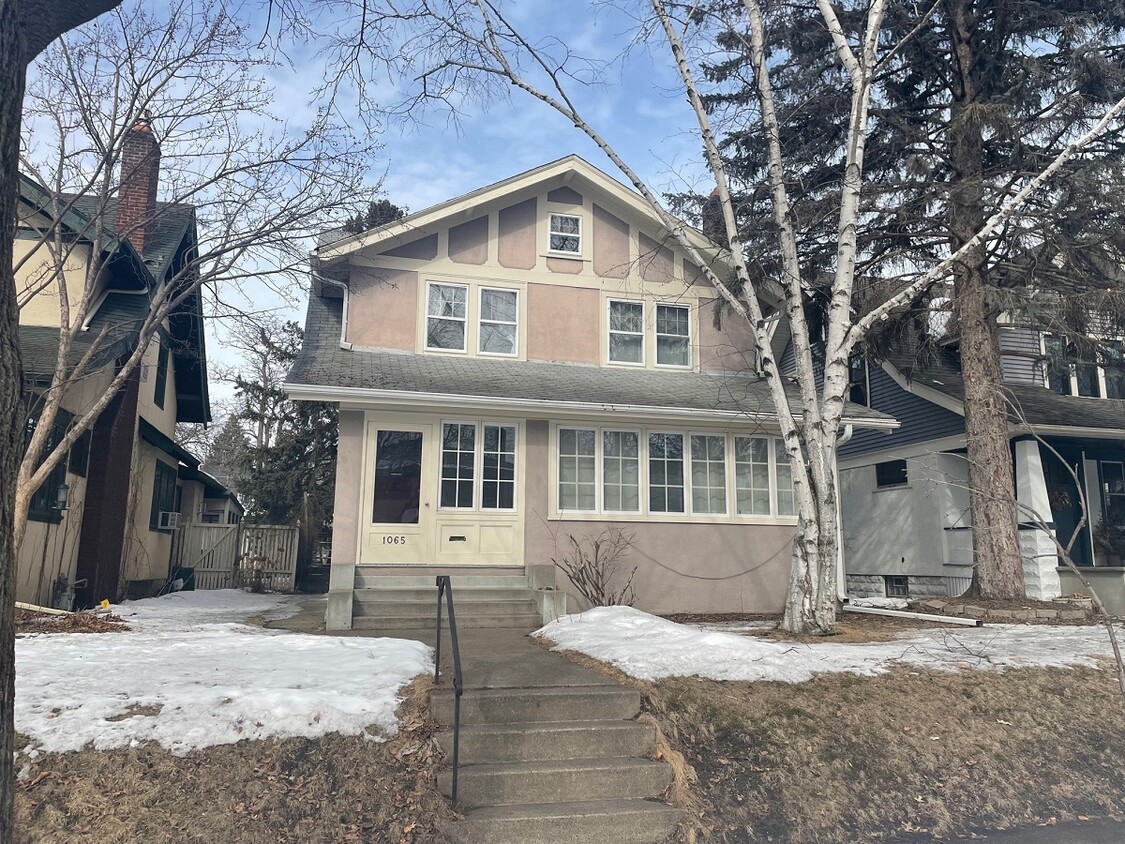
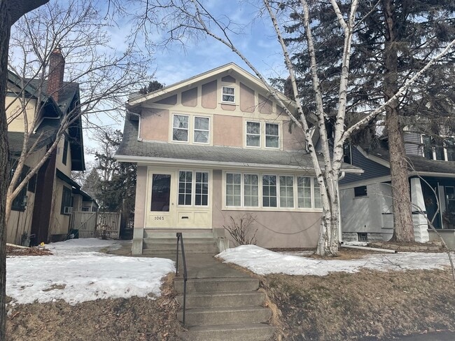
1065 Fairmount Ave
Saint Paul, MN 55105
2 Weeks Ago
Favorites
1065 Fairmount Ave

Favorites
Check Back Soon for Upcoming Availability
| Beds | Baths | Average SF |
|---|---|---|
| 4 Bedrooms 4 Bedrooms 4 Br | 2 Baths 2 Baths 2 Ba | 2,000 SF |
Fees and Policies
The fees below are based on community-supplied data and may exclude additional fees and utilities.
- Dogs Allowed
-
Fees not specified
-
Weight limit--
-
Pet Limit--
- Parking
-
Garage--
About This Property
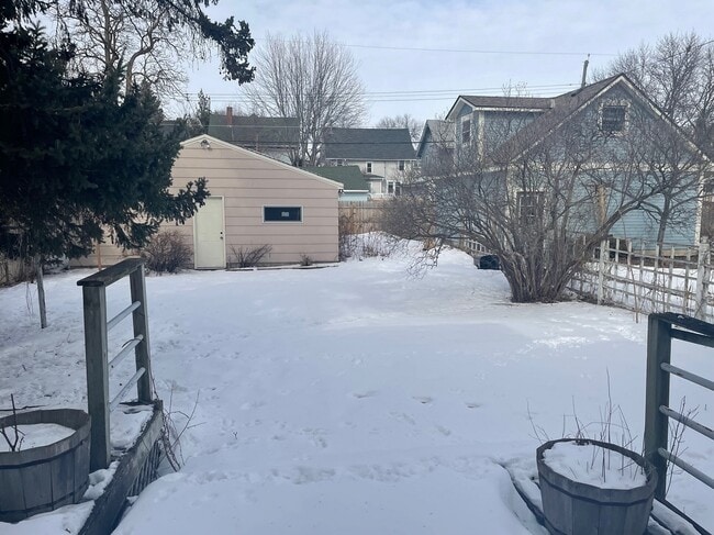
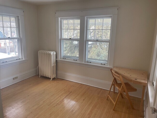
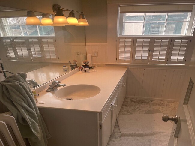
Property Description 1065 Fairmount Ave. St Paul, MN 55105 St. Paul Rental Property 4810, 4BR This beautiful four bedroom Victorian home located in the summit hill neighborhood a couple blocks from grand and summit Ave is a must see! Location: Walk to Summit for shopping or a coffee. Very convenient location for restaurants, shopping and easy freeway access to 35E and 94. Main level: large living room with wood burning fireplace and hardwood floors. 4 season sitting room or office space. Kitchen with ample cabinet space and stainless steel appliances. Lower level: large room great for an office space. Full bathroom. Laundry area with folding space. Extra storage. Upper level: all 4 bedrooms, 1 full bathroom and access to the attic offering great storage space. Yard is fully fenced. There is a deck that spans across the entire backside of home. There is also a 2 car detached garage that is accessible from the alleyway. Pets: Negotiable on a small dog with additional $40.00 a month pet rent + $500.00 refundable pet deposit. Utilities: Tenant pays gas, electric, trash and water. Extras: Oak Archways, Hardwood floors, Main floor office with oak french doors, Oak built ins and walkout to a double tiered deck. A place you will be proud to call “Home”. Application fee $60.00 per adult/ $65.00 out state
1065 Fairmount Ave is a house located in Ramsey County and the 55105 ZIP Code.
House Features
Washer/Dryer
Hardwood Floors
Fireplace
Stainless Steel Appliances
- Washer/Dryer
- Smoke Free
- Fireplace
- Stainless Steel Appliances
- Kitchen
- Hardwood Floors
- Office
- Attic
- Storage Space
- Deck
- Yard
Location
Get Directions
Situated in beautiful Saint Paul along the eastern border of Minneapolis, the Summit Hill neighborhood features oak-lined boulevards and historic Victorian mansions. Considering its location three miles west of downtown Saint Paul and eight miles east of downtown Minneapolis, this area an ideal neighborhood for commuters to either city. The centerpieces of the pedestrian-friendly neighborhood are its stately cathedral and its bustling commercial center along Grand Avenue. Summit Avenue was recently named one of America’s 10 Great Streets by the American Planning Association.
Home to locally and nationally owned restaurants, galleries and businesses, Summit Hill provides a safe, historic and vibrant community for both homeowners and renters.
Learn more about living in Summit HillBelow are rent ranges for similar nearby apartments
Amenities
- Washer/Dryer
- Smoke Free
- Fireplace
- Stainless Steel Appliances
- Kitchen
- Hardwood Floors
- Office
- Attic
- Storage Space
- Deck
- Yard
Education
| Colleges & Universities | Distance | ||
|---|---|---|---|
| Colleges & Universities | Distance | ||
| Drive: | 3 min | 1.4 mi | |
| Drive: | 3 min | 1.5 mi | |
| Drive: | 7 min | 2.7 mi | |
| Drive: | 8 min | 2.8 mi |
1065 Fairmount Ave is within 3 minutes or 1.4 miles from Concordia Univ.-Saint Paul. It is also near Macalester College and Saint Paul College.
Transportation options available in Saint Paul include Lexington Pkwy Station, located 1.5 miles from 1065 Fairmount Ave. 1065 Fairmount Ave is near Minneapolis-St Paul International/Wold-Chamberlain, located 6.8 miles or 14 minutes away.
| Transit / Subway | Distance | ||
|---|---|---|---|
| Transit / Subway | Distance | ||
| Drive: | 4 min | 1.5 mi | |
| Drive: | 4 min | 1.8 mi | |
| Drive: | 5 min | 2.3 mi | |
| Drive: | 5 min | 2.3 mi | |
| Drive: | 5 min | 2.4 mi |
| Commuter Rail | Distance | ||
|---|---|---|---|
| Commuter Rail | Distance | ||
|
|
Drive: | 8 min | 3.7 mi |
|
|
Drive: | 17 min | 8.7 mi |
|
|
Drive: | 25 min | 17.3 mi |
|
|
Drive: | 35 min | 26.1 mi |
|
|
Drive: | 36 min | 27.7 mi |
| Airports | Distance | ||
|---|---|---|---|
| Airports | Distance | ||
|
Minneapolis-St Paul International/Wold-Chamberlain
|
Drive: | 14 min | 6.8 mi |
Time and distance from 1065 Fairmount Ave.
| Shopping Centers | Distance | ||
|---|---|---|---|
| Shopping Centers | Distance | ||
| Walk: | 11 min | 0.6 mi | |
| Walk: | 12 min | 0.6 mi | |
| Walk: | 12 min | 0.7 mi |
1065 Fairmount Ave has 3 shopping centers within 0.7 mile, which is about a 12-minute walk. The miles and minutes will be for the farthest away property.
| Parks and Recreation | Distance | ||
|---|---|---|---|
| Parks and Recreation | Distance | ||
|
Macalester College Observatory
|
Drive: | 3 min | 1.5 mi |
|
Highland Park and Golf Course
|
Drive: | 4 min | 2.0 mi |
|
Irvine Park
|
Drive: | 5 min | 2.5 mi |
|
Western Park
|
Drive: | 6 min | 3.2 mi |
|
Cherokee Regional Park
|
Drive: | 8 min | 3.8 mi |
1065 Fairmount Ave has 5 parks within 3.8 miles, including Macalester College Observatory, Highland Park and Golf Course, and Irvine Park.
| Hospitals | Distance | ||
|---|---|---|---|
| Hospitals | Distance | ||
| Drive: | 4 min | 2.3 mi | |
| Drive: | 6 min | 2.9 mi | |
| Drive: | 7 min | 3.4 mi |
1065 Fairmount Ave has 3 hospitals within 3.4 miles, the nearest is Allina United Hospital which is 2.3 miles away and a 4 minute drive.
| Military Bases | Distance | ||
|---|---|---|---|
| Military Bases | Distance | ||
| Drive: | 12 min | 5.5 mi |
1065 Fairmount Ave is 5.5 miles and a 12 minute drive from Fort Snelling Military Reservation.
You May Also Like
Similar Rentals Nearby


What Are Walk Score®, Transit Score®, and Bike Score® Ratings?
Walk Score® measures the walkability of any address. Transit Score® measures access to public transit. Bike Score® measures the bikeability of any address.
What is a Sound Score Rating?
A Sound Score Rating aggregates noise caused by vehicle traffic, airplane traffic and local sources

1065 Fairmount Ave
Saint Paul, MN 55105