
150 Van Ness
150 Van Ness Ave,
San Francisco, CA 94102
Studio - 3 Beds $2,795 - $8,085
Built in 1906, this classic San Francisco apartment features gated entrances, hardwood floors, washer/dryers and is pet friendly. The top-notch amenities don't stop within the walls- it extends to the scenic, central location in which it lies. Take a cable car home then stroll past Grace Cathedral to picturesque Huntington Park for the best dog walking spot in town. You're just a short walk away from amazing dining and cocktail options like Del Popolo and Nob Hill Cafe. The Tonga Room and Top of Market are the perfect place for your late nights out. Your San Franciscan dream life is complete.One online application, hundreds of amazing apartments. At RentSFNow, it's about partnership, not paperwork. With a prime portfolio of buildings in San Francisco's most vibrant neighborhoods, RentSFNow is your key to the city. Our classic properties combine the best of both worlds - timeless character and contemporary comfort. Iconic charm. Modern living.This unit is a rental unit subject to the San Francisco Rent Ordinance, which limits evictions without just cause, and which states that any waiver by a tenant of their rights under the Rent Ordinance is void as contrary to public policy.
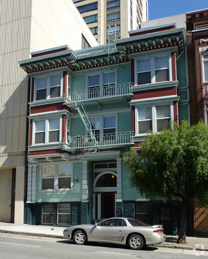
1060 Pine is an apartment community located in San Francisco County and the 94109 ZIP Code. This area is served by the San Francisco Unified attendance zone.
San Francisco’s Lower Nob Hill sits in the heart of Downtown, offering residents a premier location in one of California’s most popular cities. Situated between Union Square and US-101, locals can easily travel through the city, but why leave when there are so many conveniences right in this neighborhood? Union Square is San Francisco’s expansive and famous shopping plaza known for its upscale shops, restaurants, hotels, and nightlife spots.
Lower Nob’s light rail and bus stations are abundant, making commuting as easy as ever. This neighborhood is a great place for job opportunities due to the vast number of businesses in the area. Lower Nob is home to Saint Francis Memorial Hospital, the Masonic, and Dragon’s Gate, a landmark arch that’s the iconic gateway to Chinatown, Lower Nob’s neighbor. This neighborhood features an array of upscale apartments, houses, and condos that will fit any renter’s preferences and style.
Learn more about living in Lower Nob| Colleges & Universities | Distance | ||
|---|---|---|---|
| Colleges & Universities | Distance | ||
| Walk: | 4 min | 0.2 mi | |
| Drive: | 4 min | 1.2 mi | |
| Drive: | 5 min | 1.8 mi | |
| Drive: | 7 min | 2.3 mi |


Transportation options available in San Francisco include California And Jones, located 0.1 mile from 1060 Pine. 1060 Pine is near San Francisco International, located 14.7 miles or 24 minutes away, and Metro Oakland International, located 19.6 miles or 30 minutes away.
| Transit / Subway | Distance | ||
|---|---|---|---|
| Transit / Subway | Distance | ||
|
|
Walk: | 2 min | 0.1 mi |
| Walk: | 2 min | 0.1 mi | |
|
|
Walk: | 2 min | 0.1 mi |
|
|
Walk: | 3 min | 0.2 mi |
|
|
Walk: | 3 min | 0.2 mi |
| Commuter Rail | Distance | ||
|---|---|---|---|
| Commuter Rail | Distance | ||
| Drive: | 4 min | 1.7 mi | |
| Drive: | 5 min | 1.8 mi | |
| Drive: | 6 min | 3.2 mi | |
| Drive: | 7 min | 3.2 mi | |
| Drive: | 12 min | 6.8 mi |
| Airports | Distance | ||
|---|---|---|---|
| Airports | Distance | ||
|
San Francisco International
|
Drive: | 24 min | 14.7 mi |
|
Metro Oakland International
|
Drive: | 30 min | 19.6 mi |
Time and distance from 1060 Pine.
| Shopping Centers | Distance | ||
|---|---|---|---|
| Shopping Centers | Distance | ||
| Walk: | 10 min | 0.5 mi | |
| Walk: | 13 min | 0.7 mi | |
| Drive: | 4 min | 1.2 mi |
| Parks and Recreation | Distance | ||
|---|---|---|---|
| Parks and Recreation | Distance | ||
|
Children's Creativity Museum
|
Walk: | 19 min | 1.0 mi |
|
San Francisco Maritime National Historical Park
|
Drive: | 4 min | 1.5 mi |
|
Aquarium of The Bay
|
Drive: | 6 min | 2.0 mi |
|
Buena Vista Park
|
Drive: | 9 min | 3.0 mi |
|
Exploratorium
|
Drive: | 8 min | 3.1 mi |
| Hospitals | Distance | ||
|---|---|---|---|
| Hospitals | Distance | ||
| Walk: | 4 min | 0.3 mi | |
| Walk: | 11 min | 0.6 mi | |
| Walk: | 13 min | 0.7 mi |
| Military Bases | Distance | ||
|---|---|---|---|
| Military Bases | Distance | ||
| Drive: | 15 min | 5.1 mi | |
| Drive: | 13 min | 5.8 mi | |
| Drive: | 27 min | 14.2 mi |
What Are Walk Score®, Transit Score®, and Bike Score® Ratings?
Walk Score® measures the walkability of any address. Transit Score® measures access to public transit. Bike Score® measures the bikeability of any address.
What is a Sound Score Rating?
A Sound Score Rating aggregates noise caused by vehicle traffic, airplane traffic and local sources


