
Hartwood
401 Willow Ave,
Sunnyvale, CA 94086
$3,299 - $7,749
Studio - 2 Beds

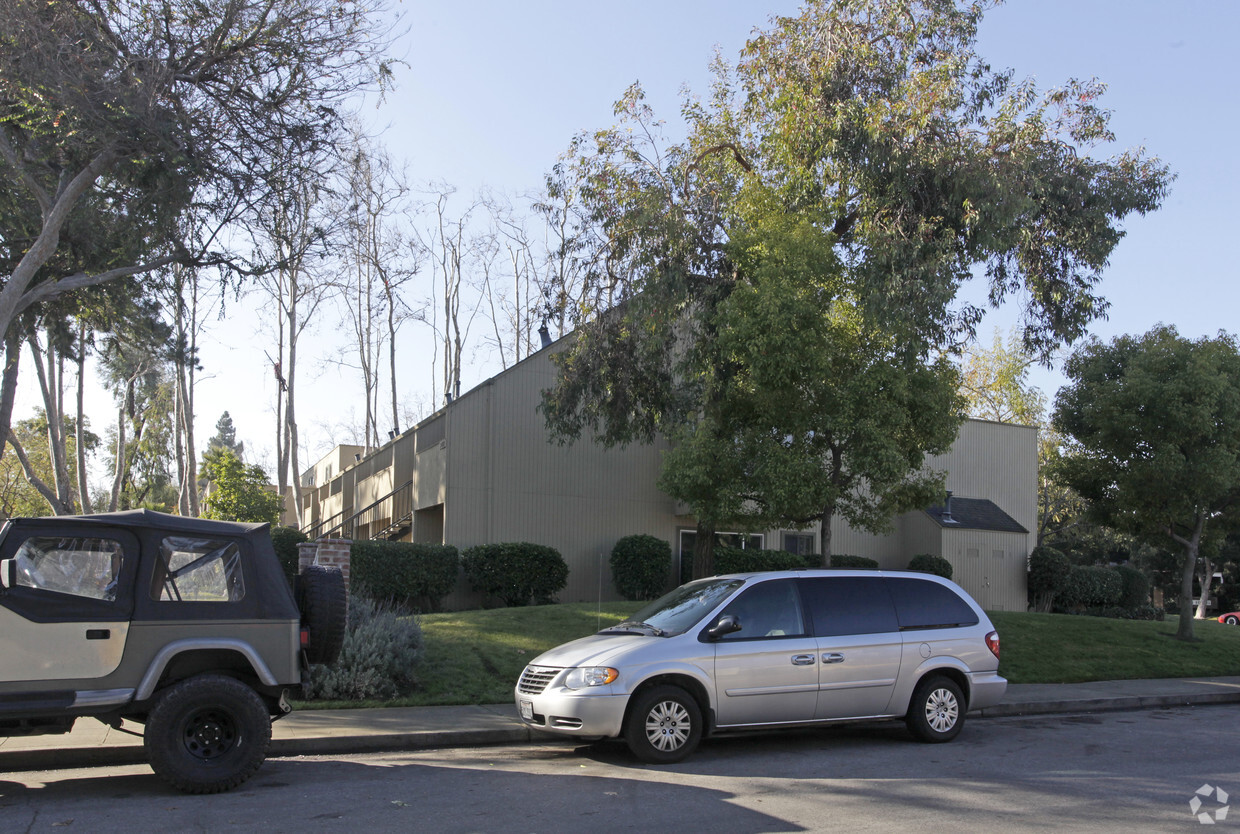

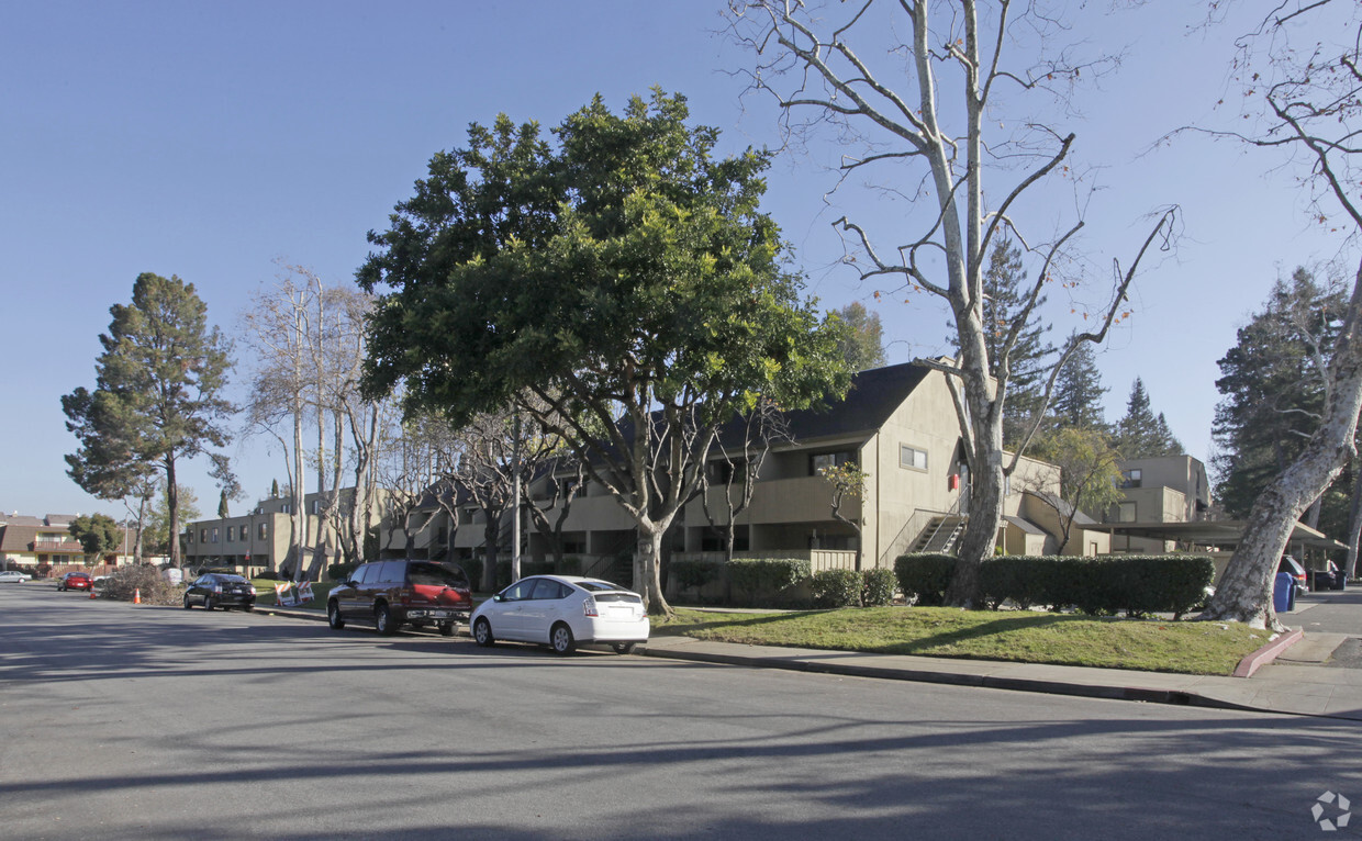
Meet your new home at Woodacre Apartments in Sunnyvale. Situated in the 94086 Zip code of Sunnyvale on Acalanes Dr., renters have convenient access to a mixture of attractions within a few miles. The team of leasing professionals is ready and waiting for you to visit. You'll experience a unique selection of features and amenities at this community including balconies, recycling, and high-speed internet access. It's time to get moving on finding your next place. Contact or stop by Woodacre Apartments to check the availability and schedule a tour today!
Woodacre Apartments is an apartment community located in Santa Clara County and the 94086 ZIP Code. This area is served by the Sunnyvale attendance zone.
Fitness Center
Laundry Facilities
Clubhouse
Recycling
Dishwasher
High Speed Internet Access
Disposal
Fireplace
Sunnyvale West is a sprawling community that makes up a large portion of the city. Surrounded by big businesses and job opportunities in Silicon Valley, Sunnyvale West is a residential haven. Known for its family-friendly atmosphere and walkable, bike-friendly streets, Sunnyvale West is a highly sought-after place to call home. Neighborhood parks are commonplace in this district, including Serra Park, Mango Park, Las Palmas Park, and Washington Park. Residents enjoy living near the heart of the city along El Camino Real, where you’ll find a variety of restaurants, grocers, car dealerships, department stores, service-based shops, and more. For more big-city amenities, locals travel roughly 40 miles north into San Francisco or 15 miles east into San Jose. There are abundant apartments, houses, condos, and townhomes available for rent in Sunnyvale West that range from mid-range to upscale.
Learn more about living in Sunnyvale West| Colleges & Universities | Distance | ||
|---|---|---|---|
| Colleges & Universities | Distance | ||
| Drive: | 14 min | 5.7 mi | |
| Drive: | 12 min | 6.1 mi | |
| Drive: | 12 min | 6.6 mi | |
| Drive: | 13 min | 8.4 mi |


Transportation options available in Sunnyvale include Whisman Station, located 1.6 miles from Woodacre Apartments. Woodacre Apartments is near Norman Y Mineta San Jose International, located 8.1 miles or 14 minutes away, and San Francisco International, located 28.0 miles or 36 minutes away.
| Transit / Subway | Distance | ||
|---|---|---|---|
| Transit / Subway | Distance | ||
|
|
Drive: | 4 min | 1.6 mi |
|
|
Drive: | 4 min | 1.9 mi |
| Drive: | 5 min | 2.0 mi | |
|
|
Drive: | 5 min | 2.0 mi |
|
|
Drive: | 6 min | 2.8 mi |
| Commuter Rail | Distance | ||
|---|---|---|---|
| Commuter Rail | Distance | ||
| Drive: | 5 min | 1.8 mi | |
| Drive: | 4 min | 1.8 mi | |
| Drive: | 5 min | 2.0 mi | |
| Drive: | 8 min | 4.2 mi | |
| Drive: | 10 min | 5.0 mi |
| Airports | Distance | ||
|---|---|---|---|
| Airports | Distance | ||
|
Norman Y Mineta San Jose International
|
Drive: | 14 min | 8.1 mi |
|
San Francisco International
|
Drive: | 36 min | 28.0 mi |
Time and distance from Woodacre Apartments.
| Shopping Centers | Distance | ||
|---|---|---|---|
| Shopping Centers | Distance | ||
| Walk: | 14 min | 0.8 mi | |
| Walk: | 16 min | 0.9 mi | |
| Drive: | 3 min | 1.3 mi |
| Parks and Recreation | Distance | ||
|---|---|---|---|
| Parks and Recreation | Distance | ||
|
Redwood Grove
|
Drive: | 13 min | 5.1 mi |
|
Sunnyvale Baylands Park
|
Drive: | 11 min | 5.5 mi |
|
Stevens Creek Shoreline Nature Study Area
|
Drive: | 12 min | 5.8 mi |
|
Deer Hollow Farm
|
Drive: | 14 min | 7.2 mi |
|
Rancho San Antonio County Park
|
Drive: | 14 min | 7.3 mi |
| Hospitals | Distance | ||
|---|---|---|---|
| Hospitals | Distance | ||
| Drive: | 6 min | 2.7 mi | |
| Drive: | 12 min | 5.6 mi | |
| Drive: | 11 min | 6.7 mi |
| Military Bases | Distance | ||
|---|---|---|---|
| Military Bases | Distance | ||
| Drive: | 11 min | 5.0 mi |
What Are Walk Score®, Transit Score®, and Bike Score® Ratings?
Walk Score® measures the walkability of any address. Transit Score® measures access to public transit. Bike Score® measures the bikeability of any address.
What is a Sound Score Rating?
A Sound Score Rating aggregates noise caused by vehicle traffic, airplane traffic and local sources
140-150 Acalanes Dr
Sunnyvale, CA 94086


