
Montclair Gardens
39-41 N Fullerton Ave,
Montclair, NJ 07042
$2,995
2 Beds

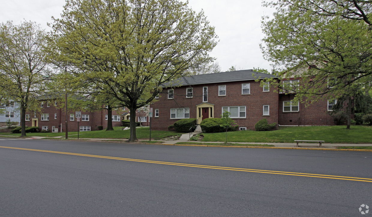
Visit Upper Montclair Gardens in Montclair, NJ. The 07043 location is an ideal place for residents. Make a visit to see the available floorplan options. Experience a great selection of amenities at this community. These include: smoke free options, high-speed internet access, and convenient on-site parking options. Stop by to find out the current floorplan availability.
Upper Montclair Gardens is an apartment community located in Essex County and the 07043 ZIP Code. This area is served by the Montclair Public attendance zone.
High Speed Internet Access
Refrigerator
Smoke Free
Oven
Located just 12 miles west of Manhattan, Montclair combines metropolitan convenience with tree-lined neighborhood charm. The township features diverse architecture, from historic Victorians to contemporary homes, spread across six commercial districts. Montclair Center and Upper Montclair offer an array of shops and restaurants. The community's parks provide outdoor recreation opportunities, including the 33-acre Mountainside Park and the seasonal displays at Presby Memorial Iris Gardens. Current rental trends show steady growth, with average one-bedroom apartments commanding $2,340 monthly, reflecting a 2.2% year-over-year increase, while two-bedroom units average $2,947 with a 4% annual increase.
Montclair State University anchors the township's educational landscape, while cultural attractions include the Montclair Art Museum, Wellmont Theater, and the annual Montclair Film Festival.
Learn more about living in Montclair| Colleges & Universities | Distance | ||
|---|---|---|---|
| Colleges & Universities | Distance | ||
| Drive: | 5 min | 1.8 mi | |
| Drive: | 8 min | 4.4 mi | |
| Drive: | 11 min | 5.0 mi | |
| Drive: | 11 min | 5.5 mi |


Transportation options available in Montclair include Grove Street, located 5.5 miles from Upper Montclair Gardens. Upper Montclair Gardens is near Newark Liberty International, located 17.8 miles or 24 minutes away, and LaGuardia, located 29.0 miles or 43 minutes away.
| Transit / Subway | Distance | ||
|---|---|---|---|
| Transit / Subway | Distance | ||
|
|
Drive: | 10 min | 5.5 mi |
|
|
Drive: | 12 min | 5.9 mi |
|
|
Drive: | 12 min | 6.1 mi |
|
|
Drive: | 12 min | 6.2 mi |
|
|
Drive: | 11 min | 6.5 mi |
| Commuter Rail | Distance | ||
|---|---|---|---|
| Commuter Rail | Distance | ||
|
|
Walk: | 7 min | 0.4 mi |
|
|
Walk: | 8 min | 0.4 mi |
|
|
Drive: | 2 min | 1.2 mi |
|
|
Drive: | 3 min | 1.3 mi |
|
|
Drive: | 5 min | 2.0 mi |
| Airports | Distance | ||
|---|---|---|---|
| Airports | Distance | ||
|
Newark Liberty International
|
Drive: | 24 min | 17.8 mi |
|
LaGuardia
|
Drive: | 43 min | 29.0 mi |
Time and distance from Upper Montclair Gardens.
| Shopping Centers | Distance | ||
|---|---|---|---|
| Shopping Centers | Distance | ||
| Drive: | 3 min | 1.4 mi | |
| Drive: | 4 min | 1.5 mi | |
| Drive: | 5 min | 1.8 mi |
| Parks and Recreation | Distance | ||
|---|---|---|---|
| Parks and Recreation | Distance | ||
|
Presby Memorial Iris Gardens
|
Walk: | 10 min | 0.5 mi |
|
Van Vleck House & Gardens
|
Drive: | 4 min | 1.9 mi |
|
Edison National Historic Site
|
Drive: | 13 min | 5.3 mi |
|
Branch Brook Park
|
Drive: | 13 min | 7.2 mi |
|
Fairfield Farm
|
Drive: | 17 min | 10.2 mi |
| Hospitals | Distance | ||
|---|---|---|---|
| Hospitals | Distance | ||
| Drive: | 5 min | 1.9 mi | |
| Drive: | 8 min | 4.6 mi | |
| Drive: | 10 min | 5.8 mi |
| Military Bases | Distance | ||
|---|---|---|---|
| Military Bases | Distance | ||
| Drive: | 29 min | 17.9 mi | |
| Drive: | 33 min | 20.0 mi |
What Are Walk Score®, Transit Score®, and Bike Score® Ratings?
Walk Score® measures the walkability of any address. Transit Score® measures access to public transit. Bike Score® measures the bikeability of any address.
What is a Sound Score Rating?
A Sound Score Rating aggregates noise caused by vehicle traffic, airplane traffic and local sources


