
Tessa Matthews Homes, Townhomes and Apartments
3110 Doe River Way,
Matthews, NC 28105
$1,390 - $3,609
Studio - 4 Beds
Located in Downtown Matthews, TOWN 324 offers 24 new, modern 1 bedroom apartments. Enjoy all the benefits and amenities of Matthews from a convenient address. Shops, restaurants, wine and craft beer establishments, a Farmers Market and library, all within walking distance. Ready for Occupancy.
Town324 is an apartment community located in Mecklenburg County and the 28105 ZIP Code. This area is served by the Charlotte-Mecklenburg School District attendance zone.
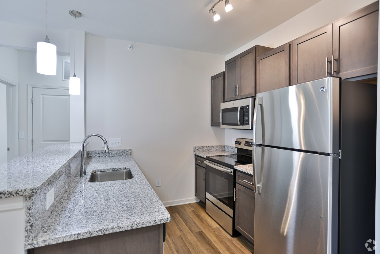
Washer/Dryer
Air Conditioning
Dishwasher
Hardwood Floors
Walk-In Closets
Island Kitchen
Granite Countertops
Microwave
Nestled along the South Carolina-North Carolina state line, South Charlotte is a sprawling sector of the city that offers a family-friendly atmosphere, quiet residential streets, and easy access to Uptown Charlotte and beyond. Charlotte’s city center is around 15 miles north of town, so residents can easily commute into the city for work or entertainment. Local breweries, restaurants, and boutiques can all be found within the heart of the city. Abundant apartments, houses, condos, and townhomes are available for rent in South Charlotte, ranging from cozy to upscale. The neighborhood is also only a few miles from the Charlotte Douglas International Airport, which can be easily accessed via Interstate 485.
Learn more about living in South CharlotteCompare neighborhood and city base rent averages by bedroom.
| South Charlotte | Matthews, NC | |
|---|---|---|
| Studio | $1,303 | $1,352 |
| 1 Bedroom | $1,353 | $1,390 |
| 2 Bedrooms | $1,673 | $1,673 |
| 3 Bedrooms | $2,274 | $2,106 |
| Colleges & Universities | Distance | ||
|---|---|---|---|
| Colleges & Universities | Distance | ||
| Drive: | 9 min | 4.0 mi | |
| Drive: | 16 min | 9.6 mi | |
| Drive: | 17 min | 10.8 mi | |
| Drive: | 21 min | 11.0 mi |


Transportation options available in Matthews include Hawthorne Ln & 8Th St Citylynx, located 11.0 miles from Town324. Town324 is near Charlotte/Douglas International, located 19.4 miles or 33 minutes away, and Concord-Padgett Regional, located 26.9 miles or 36 minutes away.
| Transit / Subway | Distance | ||
|---|---|---|---|
| Transit / Subway | Distance | ||
| Drive: | 17 min | 11.0 mi | |
| Drive: | 17 min | 11.1 mi | |
| Drive: | 18 min | 11.2 mi | |
| Drive: | 18 min | 11.3 mi | |
|
|
Drive: | 23 min | 16.7 mi |
| Commuter Rail | Distance | ||
|---|---|---|---|
| Commuter Rail | Distance | ||
|
|
Drive: | 20 min | 12.6 mi |
|
|
Drive: | 47 min | 33.0 mi |
| Drive: | 49 min | 37.5 mi |
| Airports | Distance | ||
|---|---|---|---|
| Airports | Distance | ||
|
Charlotte/Douglas International
|
Drive: | 33 min | 19.4 mi |
|
Concord-Padgett Regional
|
Drive: | 36 min | 26.9 mi |
Scores provided by
Traffic
-Airport
-Businesses
-Scores provided by
HowLoud What is a Sound Score Rating? A Sound Score Rating aggregates noise caused by vehicle traffic, airplane traffic and local sources. How It WorksTime and distance from Town324.
| Shopping Centers | Distance | ||
|---|---|---|---|
| Shopping Centers | Distance | ||
| Walk: | 0 min | 0.0 mi | |
| Walk: | 5 min | 0.3 mi | |
| Walk: | 7 min | 0.4 mi |
| Parks and Recreation | Distance | ||
|---|---|---|---|
| Parks and Recreation | Distance | ||
|
Stallings Municipal Park
|
Drive: | 7 min | 3.1 mi |
|
Campbell Creek Greenway
|
Drive: | 8 min | 4.2 mi |
|
Blair Mills Park
|
Drive: | 10 min | 5.0 mi |
|
Fred Kirby Park
|
Drive: | 11 min | 6.3 mi |
|
Mint Hill Veteran's Park
|
Drive: | 14 min | 7.9 mi |
| Hospitals | Distance | ||
|---|---|---|---|
| Hospitals | Distance | ||
| Drive: | 18 min | 11.1 mi | |
| Drive: | 18 min | 12.8 mi | |
| Drive: | 18 min | 13.6 mi |
| Military Bases | Distance | ||
|---|---|---|---|
| Military Bases | Distance | ||
| Drive: | 138 min | 102.0 mi |
What Are Walk Score®, Transit Score®, and Bike Score® Ratings?
Walk Score® measures the walkability of any address. Transit Score® measures access to public transit. Bike Score® measures the bikeability of any address.
What is a Sound Score Rating?
A Sound Score Rating aggregates noise caused by vehicle traffic, airplane traffic and local sources.

324 E Matthews St
Matthews, NC 28105


