
1213 Walnut
1213 Walnut St,
Philadelphia, PA 19107
$2,540 - $5,824
Studio - 2 Beds
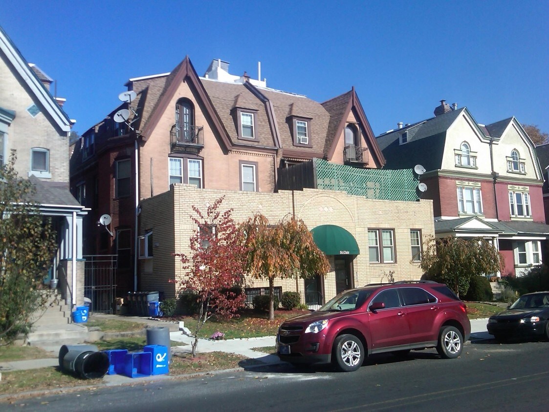
The Saint Claire Apartments in Philadelphia is ready for you to visit. The prime Cedar Ave address in the 19143 Zip code of Philadelphia is a popular place for you to live. The team of leasing professionals is available to assist you in finding the perfect new apartment. Be sure to check out the apartment floorplan options. Welcome to your new home at The Saint Claire Apartments. Contact or drop by to find out the availability today.
The Saint Claire Apartments is an apartment community located in Philadelphia County and the 19143 ZIP Code. This area is served by the The School District of Philadelphia attendance zone.
Located in West Philadelphia, Cedar Park is a historic neighborhood that has undergone revitalization in recent years. Known as a “streetcar” suburb, Cedar Park boasts stunning architecture and many historic homes. Today, this diverse neighborhood is known as a quirky, urban locale with a bohemian vibe and vibrant culture. Located along Baltimore Avenue, Cedar Park maintains its own distinctive identity with a unique collection of galleries, shops, independent music, international restaurants, and a microbrewery.
Although the neighborhood is perfect for urbanites, Cedar Park is filled with trees and residents have access to several city parks including Clark Park and Malcolm X Park. Like most urban communities, Cedar Park is walkable, but residents also use public transit to travel to other major destinations in the city including the University of Pennsylvania and Center City. Great for renters of all ages, Cedar Park offers affordable to upscale rentals in every style.
Learn more about living in Cedar Park| Colleges & Universities | Distance | ||
|---|---|---|---|
| Colleges & Universities | Distance | ||
| Walk: | 10 min | 0.6 mi | |
| Walk: | 14 min | 0.8 mi | |
| Drive: | 3 min | 1.3 mi | |
| Drive: | 5 min | 2.1 mi |


Transportation options available in Philadelphia include Baltimore Ave & 46Th St, located 0.0 mile from The Saint Claire Apartments. The Saint Claire Apartments is near Philadelphia International, located 7.5 miles or 18 minutes away, and Trenton Mercer, located 37.2 miles or 56 minutes away.
| Transit / Subway | Distance | ||
|---|---|---|---|
| Transit / Subway | Distance | ||
|
|
Walk: | 2 min | 0.0 mi |
|
|
Walk: | 2 min | 0.1 mi |
|
|
Walk: | 2 min | 0.1 mi |
|
|
Walk: | 4 min | 0.2 mi |
|
|
Walk: | 4 min | 0.2 mi |
| Commuter Rail | Distance | ||
|---|---|---|---|
| Commuter Rail | Distance | ||
|
|
Walk: | 11 min | 0.6 mi |
|
|
Drive: | 4 min | 1.7 mi |
| Drive: | 4 min | 1.7 mi | |
|
|
Drive: | 7 min | 2.8 mi |
|
|
Drive: | 6 min | 2.8 mi |
| Airports | Distance | ||
|---|---|---|---|
| Airports | Distance | ||
|
Philadelphia International
|
Drive: | 18 min | 7.5 mi |
|
Trenton Mercer
|
Drive: | 56 min | 37.2 mi |
Scores provided by
Traffic
-Airport
-Businesses
-Scores provided by
HowLoud What is a Sound Score Rating? A Sound Score Rating aggregates noise caused by vehicle traffic, airplane traffic and local sources. How It WorksTime and distance from The Saint Claire Apartments.
| Shopping Centers | Distance | ||
|---|---|---|---|
| Shopping Centers | Distance | ||
| Drive: | 4 min | 1.3 mi | |
| Drive: | 4 min | 1.6 mi | |
| Drive: | 5 min | 1.8 mi |
| Parks and Recreation | Distance | ||
|---|---|---|---|
| Parks and Recreation | Distance | ||
|
Penn Museum
|
Drive: | 4 min | 1.6 mi |
|
University of Pennsylvania Observatory
|
Drive: | 4 min | 1.7 mi |
|
Bartram's Garden
|
Drive: | 5 min | 1.7 mi |
|
Cobbs Creek Environmental Education Center
|
Drive: | 5 min | 1.9 mi |
|
Schuylkill River Park
|
Drive: | 7 min | 3.1 mi |
| Hospitals | Distance | ||
|---|---|---|---|
| Hospitals | Distance | ||
| Drive: | 4 min | 1.4 mi | |
| Drive: | 4 min | 1.8 mi | |
| Drive: | 10 min | 4.7 mi |
| Military Bases | Distance | ||
|---|---|---|---|
| Military Bases | Distance | ||
| Drive: | 13 min | 6.2 mi |
What Are Walk Score®, Transit Score®, and Bike Score® Ratings?
Walk Score® measures the walkability of any address. Transit Score® measures access to public transit. Bike Score® measures the bikeability of any address.
What is a Sound Score Rating?
A Sound Score Rating aggregates noise caused by vehicle traffic, airplane traffic and local sources.

4607-4609 Cedar Ave
Philadelphia, PA 19143


